Sears-Kay Ruins
Short hike past rocky outcrops and scattered saguaro cacti to the fragmentary remains of an 11th century Hohokam settlement, on a grassy hill a few miles northeast of Camp Creek
Length: 1 mile, loop
Elevation change: 220 feet
Difficulty: Easy
Type: Loop, maintained trail
Usage: Medium
Season: All year
Trailhead: Parking area off Seven Springs Road
Rating (1-5): ★★★★★
Elevation change: 220 feet
Difficulty: Easy
Type: Loop, maintained trail
Usage: Medium
Season: All year
Trailhead: Parking area off Seven Springs Road
Rating (1-5): ★★★★★

Sears-Kay Ruin is an ancient Hohokam pueblo, or fortification, built around 1050 and inhabited for 150 years, located on a small hill near the village of Camp Creek, 30 miles northeast of Phoenix. The site lies just within the boundaries of the Tonto National Forest, along the paved Cave Creek Road/Seven Springs Road, which forks north off the road to Bartlett Reservoir. The ruin is a developed USFS site, toured by a one mile loop trail, accompanied by interpretative notices about the history of this place, which was rediscovered in 1867 by soldiers from the nearby Fort McDowell.
The ruins are so-named as they are on land that was subsequently part of the Sears-Kay Ranch, founded by two settlers of this name, in 1867. The ranch site survives, half a mile east, surrounded by a little parcel of private land - along Camp Creek, which provides a reliable water source, essential to the establishment of the settlement.
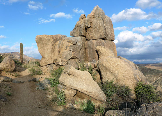
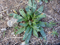
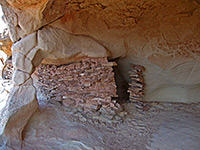
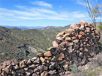
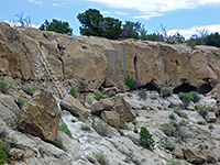
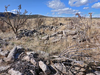
The surviving structures are only low foundations, some partially reconstructed, so not especially exciting to look at, but hike is also notable for the long-distance views across the surrounding mountains and south towards Phoenix, and also for a few large saguaro cacti, and an assortment of photogenic rock formations. All the bedrock is diorite, coarse-grained, dark grey brown in color. Wildflowers are also quite plentiful.
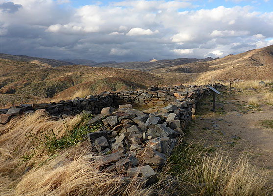
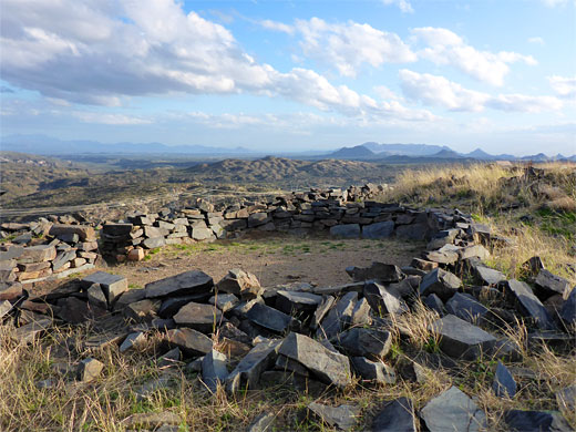
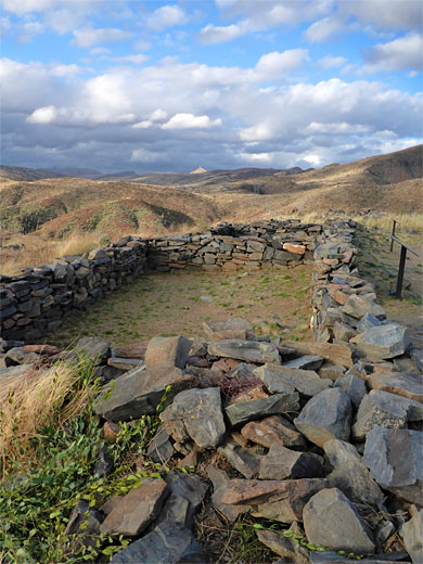
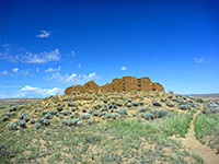
The Sears-Kay site is signposted from some distance away, along Cave Creek Road. A short side road climbs to the base of the hill, to the parking lot, with restrooms. The trail is a partial loop; the left branch ascends a ridge, climbing 150 feet to a junction, then continues to the summit of the hill, and the ruins site, 300 by 100 feet in extent. Visible structures include a row of three rectangular rooms, an oval-shaped enclosure, and a longer rectangular room, while all around are lines and piles of stones, from other buildings. There were once around 40 rooms here, housing up to 100 people. The place is thought to have be abandoned due to the surrounding ground proving to be too infertile, and the population moved to more well-irrigated terrain in the Seven Springs area.
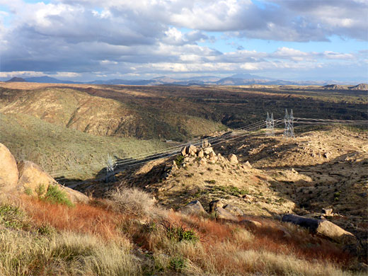
Back at the junction, the alternative path traverses the hillside to the southeast, overlooking a tributary of Camp Creek, usually dry, and the buildings of Sears-Kay Ranch, a short distance south of which is a picturesque waterfall, visited on a separate hike. A double set of powerlines also crosses the slopes. Along the trail are a number of large saguaro, here at an elevation of 3,500 feet, close to the upper limit of their range. Nearby are a few shapely rock formations, of the diorite; overall this is a good, varied, short hike.
The ruins are so-named as they are on land that was subsequently part of the Sears-Kay Ranch, founded by two settlers of this name, in 1867. The ranch site survives, half a mile east, surrounded by a little parcel of private land - along Camp Creek, which provides a reliable water source, essential to the establishment of the settlement.
The surviving structures are only low foundations, some partially reconstructed, so not especially exciting to look at, but hike is also notable for the long-distance views across the surrounding mountains and south towards Phoenix, and also for a few large saguaro cacti, and an assortment of photogenic rock formations. All the bedrock is diorite, coarse-grained, dark grey brown in color. Wildflowers are also quite plentiful.

The Ruins
The Sears-Kay site is signposted from some distance away, along Cave Creek Road. A short side road climbs to the base of the hill, to the parking lot, with restrooms. The trail is a partial loop; the left branch ascends a ridge, climbing 150 feet to a junction, then continues to the summit of the hill, and the ruins site, 300 by 100 feet in extent. Visible structures include a row of three rectangular rooms, an oval-shaped enclosure, and a longer rectangular room, while all around are lines and piles of stones, from other buildings. There were once around 40 rooms here, housing up to 100 people. The place is thought to have be abandoned due to the surrounding ground proving to be too infertile, and the population moved to more well-irrigated terrain in the Seven Springs area.
Cacti and Rocks
Back at the junction, the alternative path traverses the hillside to the southeast, overlooking a tributary of Camp Creek, usually dry, and the buildings of Sears-Kay Ranch, a short distance south of which is a picturesque waterfall, visited on a separate hike. A double set of powerlines also crosses the slopes. Along the trail are a number of large saguaro, here at an elevation of 3,500 feet, close to the upper limit of their range. Nearby are a few shapely rock formations, of the diorite; overall this is a good, varied, short hike.

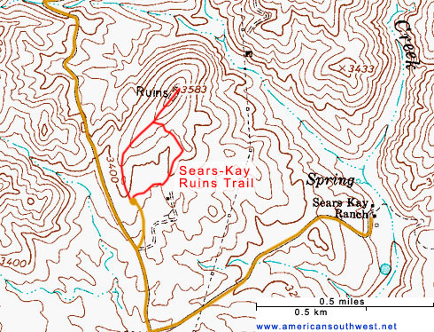
Topo Map of the Sears-Kay Ruins


Sears-Kay Ruins - Similar Hikes
All Contents © Copyright The American Southwest | Comments and Questions | Contribute | Affiliate Marketing Disclosure | Site Map