Loop Hike, Spur Cross Ranch Conservation Area
Arizona > Spur Cross Ranch Conservation Area > Loop Hike
Loop Hike
Circuit of the desert slopes and plains of Spur Cross Ranch, along the Dragonfly, Spur Cross, Elephant Mountain and Tortuga trails. Passes some petroglyphs and ancient ruins
Length: 8 miles (round trip)
Elevation change: 1,100 feet
Difficulty: Moderate to strenuous
Type: Loop
Usage: Low
Season: Fall to spring
Trailhead: Spur Cross Road
Rating (1-5): ★★★★★
Elevation change: 1,100 feet
Difficulty: Moderate to strenuous
Type: Loop
Usage: Low
Season: Fall to spring
Trailhead: Spur Cross Road
Rating (1-5): ★★★★★

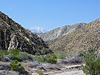
The best way to fully appreciate the beautiful desert scenery of Spur Cross Ranch Conservation Area, from the riparian corridor along Cave Creek to the rugged mountain slopes, is by an 8 mile loop hike, incorporating parts of four trails - Dragonfly, Elephant Mountain, Tortuga and Spur Cross.
There are several shorter loops in the preserve, across the lower elevation regions, but Elephant Mountain is the only path into the high country. The full loop, which climbs 1,100 feet, is relatively long and strenuous, though all parts are well enough maintained and easy to follow, even the Elephant Mountain section which is described by the park as 'very difficult, primitive route, not maintained'. The round trip takes four hours or more.
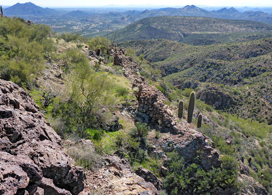
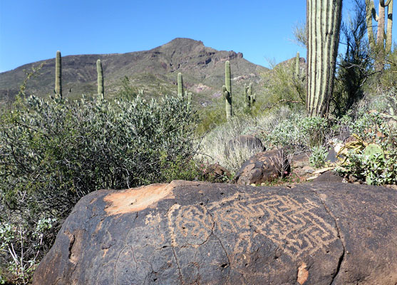
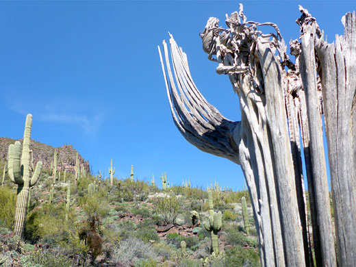
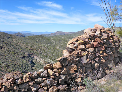
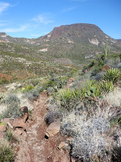
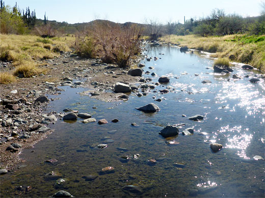
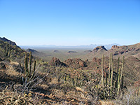
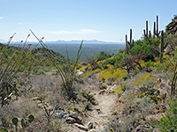
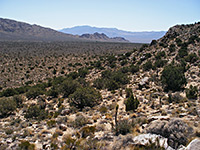
Besides the spectacular scenery, and the abundant desert plants, other attractions of the hike include the year around waters of Cave Creek, a number of boulders with petroglyphs, and the remains of ancient structures including a spectacular fortress on the eastern summit of Elephant Mountain. Views along the higher reaches offer a striking contrast between the extensive, residential suburbs to the south and the undeveloped, mostly trailless terrain to the north.
34 views along the loop.
Parking for all hikes in Spur Cross Ranch is at a large lot at the north end of Spur Cross Road, next to a corral where horseriding trips can be arranged, since all trails are open to stock use as well as hiking, though the Elephant Mountain segment is not recommended for novice riders. A track continues a short distance north into the park, past the fee booth and ranger building, but the loop is described in the opposite, clockwise direction, starting by walking back down the road for 800 feet, into the adjacent, smaller Jewel of the Creek Preserve, and taking a path, and the Dragonfly Trail, which parallels the road a little further then descends to Cave Creek, crossing it on a bridge then heading further west through a beguiling mix of cottonwood trees and saguaro. It soon exits the preserve, back into the conservation area, and on to a junction, at the lower end of a usually dry tributary drainage, Boca Grande Wash.
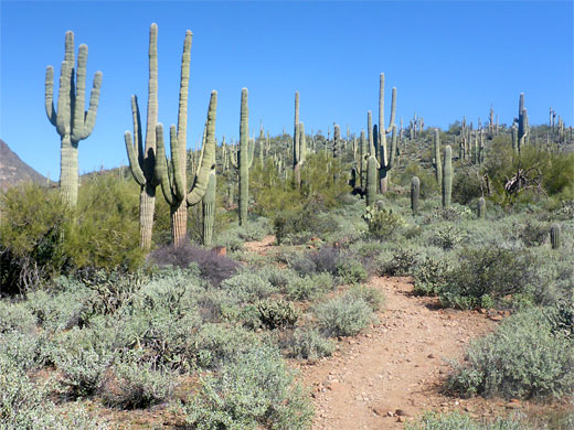
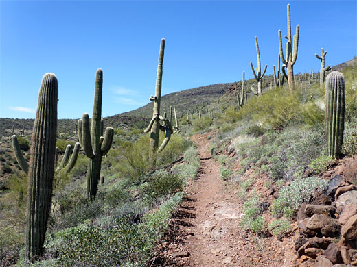
The trail stays at wash level a little way then climbs the slopes to the east, up to a ridgeline, now well away from the cool, moist corridor of Cave Creek, instead crossing the dry, unshaded desert that persists for the remainder of the hike. The surroundings are still well vegetated, however, with a healthy mix of cacti including many huge saguaro. The path rises through a V-shaped bend, just after which are several petroglyph panels, on brown basalt boulders, rather incongruous amongst the cacti. After cresting a saddle, the trail traverses a grassy flat, now with far fewer cacti, and on the far side arrives at a four-way junction; left and right is the Spur Cross Trail, while straight on is the Tortuga Trail. Turning left, the Spur Cross route stays level for a while before descending to Boca Grande Wash, up the far side and over more flats with expansive views. It crosses a second, similarly-sized dry wash then climbs some more, now with views of the suburbs to the south.br>
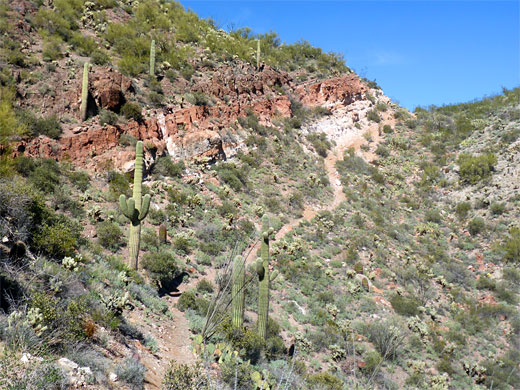
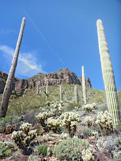
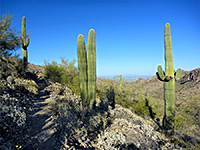
The path passes a memorial bench on an exposed corner, and winds in and out of several small ravines to a junction, beside a second bench. Here the Spur Cross/Maricopa Trail continues southwest, exiting the conservation area after 0.9 miles, while the Elephant Mountain Trail branches off to the north, a somewhat narrower and less-used route. This has a steady climb, up 500 feet, to a saddle on Elephant Mountain, between the main summit to the west and a detached high point to the east. The path rises first to an intermediate ridge, affording increasingly grand views, before reaching the main divide, around which are banded rocks of red and white, volcanic in origin. A short spur climbs to the eastern summit (3,342 feet), along the eastern rim of which is a crumbling rock wall from some ancient dwelling, or fortress.
From the saddle the path descends steeply down the north side of the mountain, soon reaching the next junction, very close to the north edge of the conservation area, with a path (Limestone Trail) into the adjacent Tonto National Forest. A seasonal spring is close by. The Elephant Mountain route now heads east, down a bit more to a wash, moving in and out of the streambed a few times, followed by a short but steep ascent via steps over red stones, to a junction on a ridge. Turning south, another junction is reached after 0.2 miles, with the two portions of the Tortuga Trail. The left (east) branch provides the shortest way back - this path drops down to another wash, rises on the far side, rounds a little hill to the next junction, with the Spur Cross Trail once more. This descends, and in 0.4 miles crosses Cave Creek, after an area of particularly large saguaro. On the far side it rises slightly and meets the track from the car park.
There are several shorter loops in the preserve, across the lower elevation regions, but Elephant Mountain is the only path into the high country. The full loop, which climbs 1,100 feet, is relatively long and strenuous, though all parts are well enough maintained and easy to follow, even the Elephant Mountain section which is described by the park as 'very difficult, primitive route, not maintained'. The round trip takes four hours or more.
Besides the spectacular scenery, and the abundant desert plants, other attractions of the hike include the year around waters of Cave Creek, a number of boulders with petroglyphs, and the remains of ancient structures including a spectacular fortress on the eastern summit of Elephant Mountain. Views along the higher reaches offer a striking contrast between the extensive, residential suburbs to the south and the undeveloped, mostly trailless terrain to the north.
Photographs
34 views along the loop.
Dragonfly Trail
Parking for all hikes in Spur Cross Ranch is at a large lot at the north end of Spur Cross Road, next to a corral where horseriding trips can be arranged, since all trails are open to stock use as well as hiking, though the Elephant Mountain segment is not recommended for novice riders. A track continues a short distance north into the park, past the fee booth and ranger building, but the loop is described in the opposite, clockwise direction, starting by walking back down the road for 800 feet, into the adjacent, smaller Jewel of the Creek Preserve, and taking a path, and the Dragonfly Trail, which parallels the road a little further then descends to Cave Creek, crossing it on a bridge then heading further west through a beguiling mix of cottonwood trees and saguaro. It soon exits the preserve, back into the conservation area, and on to a junction, at the lower end of a usually dry tributary drainage, Boca Grande Wash.
Spur Cross Trail
The trail stays at wash level a little way then climbs the slopes to the east, up to a ridgeline, now well away from the cool, moist corridor of Cave Creek, instead crossing the dry, unshaded desert that persists for the remainder of the hike. The surroundings are still well vegetated, however, with a healthy mix of cacti including many huge saguaro. The path rises through a V-shaped bend, just after which are several petroglyph panels, on brown basalt boulders, rather incongruous amongst the cacti. After cresting a saddle, the trail traverses a grassy flat, now with far fewer cacti, and on the far side arrives at a four-way junction; left and right is the Spur Cross Trail, while straight on is the Tortuga Trail. Turning left, the Spur Cross route stays level for a while before descending to Boca Grande Wash, up the far side and over more flats with expansive views. It crosses a second, similarly-sized dry wash then climbs some more, now with views of the suburbs to the south.br>
Elephant Mountain Trail
The path passes a memorial bench on an exposed corner, and winds in and out of several small ravines to a junction, beside a second bench. Here the Spur Cross/Maricopa Trail continues southwest, exiting the conservation area after 0.9 miles, while the Elephant Mountain Trail branches off to the north, a somewhat narrower and less-used route. This has a steady climb, up 500 feet, to a saddle on Elephant Mountain, between the main summit to the west and a detached high point to the east. The path rises first to an intermediate ridge, affording increasingly grand views, before reaching the main divide, around which are banded rocks of red and white, volcanic in origin. A short spur climbs to the eastern summit (3,342 feet), along the eastern rim of which is a crumbling rock wall from some ancient dwelling, or fortress.
Tortuga Trail
From the saddle the path descends steeply down the north side of the mountain, soon reaching the next junction, very close to the north edge of the conservation area, with a path (Limestone Trail) into the adjacent Tonto National Forest. A seasonal spring is close by. The Elephant Mountain route now heads east, down a bit more to a wash, moving in and out of the streambed a few times, followed by a short but steep ascent via steps over red stones, to a junction on a ridge. Turning south, another junction is reached after 0.2 miles, with the two portions of the Tortuga Trail. The left (east) branch provides the shortest way back - this path drops down to another wash, rises on the far side, rounds a little hill to the next junction, with the Spur Cross Trail once more. This descends, and in 0.4 miles crosses Cave Creek, after an area of particularly large saguaro. On the far side it rises slightly and meets the track from the car park.
Spur Cross Ranch Wildflowers
More flowers along the trail
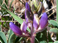 Arroyo lupine |
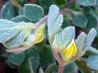 Foothill deerweed |
 Turpentine bloom |
More flowers along the trail
Spur Cross Ranch - Similar Hikes
All Contents © Copyright The American Southwest | Comments and Questions | Contribute | Affiliate Marketing Disclosure | Site Map