Highlights:
Large area of Sonoran Desert plains and rocky slopes bordering the permanent stream of Cave Creek, north of Phoenix. Centered on Elephant Mountain, a rugged peak, and crossed by a network of trails. Park also contains ancient ruins and rock art
Nearby town:
Carefree, 6 miles
Management:
Location:
Seasons:
All year, though very hot in summer
Rating (1-5):
★★★★★

Featured Hotel
Hampton Inn Carefree
 The first chain hotel in Carefree, open summer 2022, part of a group of shops and restaurants. Upper floor rooms have fine views of the mountains to the north
Check Rates
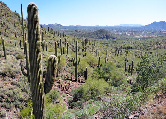
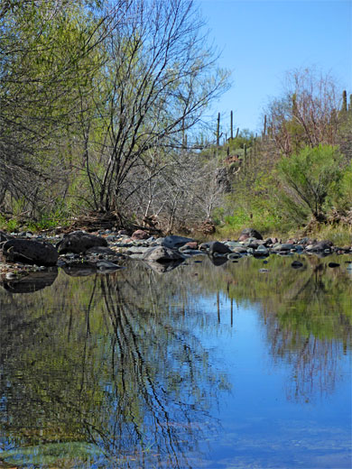
Spur Cross Ranch Conservation Area, one of the Maricopa County regional Parks, covers 2,154 acres of Sonoran Desert land north of the town of Cave Creek, 30 miles north of Phoenix; from the riparian corridor of Cave Creek itself, a year round stream, elevation 2,200 feet, to the rocky slopes of Elephant Mountain, the high point 3,926 feet. The park represents a transition from the mostly developed land to the south, with housing estates now creeping right up to the mountain foothills, to the rugged terrain further north, mostly lacking even any trails.
The preserve contains a number of ancient sites - petroglyph panels and remains of structures, plus relics from the more recent activities of ranching and mining. The cattle and guest ranch after which the park is named was in operation until 1953, when, following the death of owner Warren Beaubien, it was sold, to investors who demolished all the buildings to reduce their tax liability. The ranch was located on the west side of Cave Creek, just north of the current Spur Cross Trail.
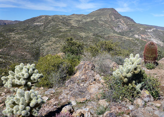
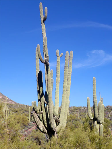
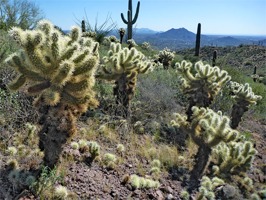
The Cave Creek corridor is frequented by many birds and other wildlife, while the dry slopes above harbor various cactus species including numerous, large multi-branched saguaro. Like all the regional parks, Spur Cross is well-managed; it has various facilities including restrooms, information booth and ranger station, and all trails are well signposted. There is no campsite, however. The park is situated at the north end of Spur Cross Road, which leads through the northern suburbs of Cave Creek, past the adjacent Jewel of the Creek Preserve, ending at a parking lot.
The preserve contains a number of ancient sites - petroglyph panels and remains of structures, plus relics from the more recent activities of ranching and mining. The cattle and guest ranch after which the park is named was in operation until 1953, when, following the death of owner Warren Beaubien, it was sold, to investors who demolished all the buildings to reduce their tax liability. The ranch was located on the west side of Cave Creek, just north of the current Spur Cross Trail.
The Cave Creek corridor is frequented by many birds and other wildlife, while the dry slopes above harbor various cactus species including numerous, large multi-branched saguaro. Like all the regional parks, Spur Cross is well-managed; it has various facilities including restrooms, information booth and ranger station, and all trails are well signposted. There is no campsite, however. The park is situated at the north end of Spur Cross Road, which leads through the northern suburbs of Cave Creek, past the adjacent Jewel of the Creek Preserve, ending at a parking lot.
Spur Cross Ranch Table of Contents
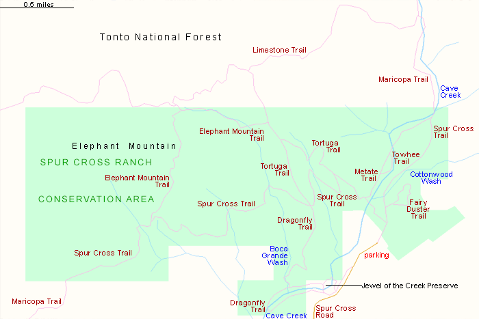
- Map of Spur Cross Ranch Conservation Area
- Photographs
- Trails of the conservation area
- Loop hike - 8 miles
- Nearby places
- Similar places
Spur Cross Ranch Conservation Area
Just beyond the fee station, the 0.6 mile Fairy Duster Loop rises to a terrace overlooking a Cave Creek tributary, Cottonwood Wash, giving good views of the surroundings. This branches off the Spur Cross Trail, which is the longest route in the conservation area, crossing the whole preserve from west to east, 5.3 miles, and forming a small part of the 315 mile Maricopa Trail that loops all around Phoenix. Within the conservation area this can be used to form part of several loop hikes, and one is with the 0.8 mile Metate Trail, that follows the upstream section of Cave Creek, through mesquite and cottonwoods. The very short (0.2 mile) Towhee Trail forks off here, for closer views of the creek. The Tortuga Trail is a 1.2 mile route that climbs to a mesa, overlooking the central portion of the park. The Dragonfly Trail, 2 miles, explores the downstream section of Cave Creek, partly through the Jewel of the Creek Preserve, and one section of it heads north over open slopes to link with the Spur Cross Trail. The most rugged hike in the conservation area is along the Elephant Mountain Trail, 2.1 miles; described as primitive and unmaintained, this climbs to a saddle high on the mountain, and links to two paths that exit the preserve to the north, into the Tonto National Forest.
Loop Hike
Perhaps the best way to explore Spur Cross Ranch is via an 8 mile loop that incorporates four of these trails; all of Elephant Mountain, and parts of Dragonfly, Spur Cross and Tortuga.

Spur Cross Ranch - Nearby Places
- Jewel of the Creek (adjacent) - small preserve along Cave Creek
- Lake Pleasant (32 miles) - popular lake in the Sonoran Desert
Spur Cross Ranch - Similar Places
- Estrella Mountain Regional Park - desert flats, rocky hills and seasonal wetlands
- White Tank Mountain Regional Park - isolated, unspoilt mountain range west of Phoenix
All Contents © Copyright The American Southwest | Comments and Questions | Contribute | Affiliate Marketing Disclosure | Site Map