Camp Creek Falls Trail, Tonto National Forest
Arizona > Tonto National Forest > Camp Creek Falls Trail
Camp Creek Falls
Short hike down a tributary (Blue Wash) and upstream along Camp Creek to a seasonal waterfall, over granite cliffs. Surrounded by low hills with saguaro and other cacti
Length: 1.4 miles
Elevation change: 380 feet
Difficulty: Easy
Type: One way
Usage: Medium
Season: All year
Trailhead: Parking area along Cave Creek Road
Rating (1-5): ★★★★★
Elevation change: 380 feet
Difficulty: Easy
Type: One way
Usage: Medium
Season: All year
Trailhead: Parking area along Cave Creek Road
Rating (1-5): ★★★★★

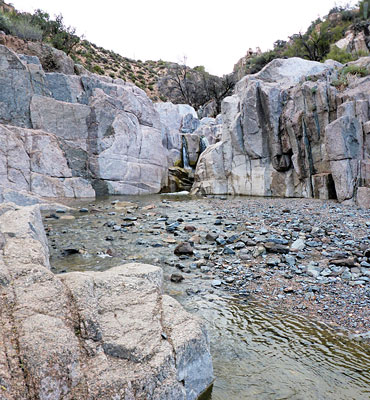
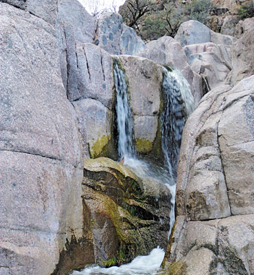
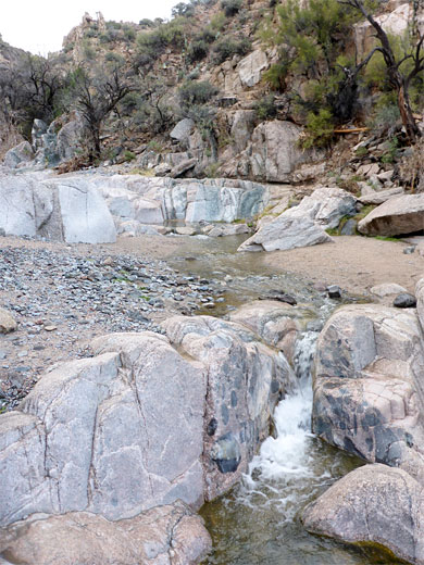
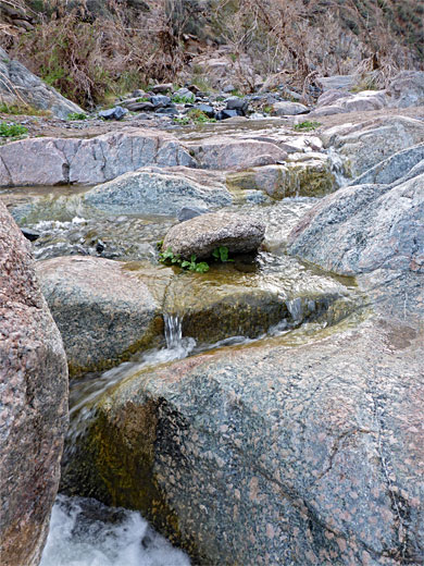
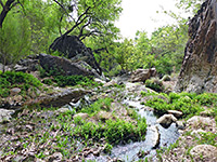
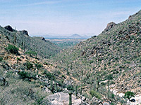
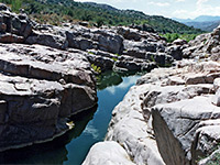
In the low hills northeast of Phoenix, Camp Creek is a relatively small drainage, a tributary of the Verde River, flowing only at some times of the year, and running mostly across sand or gravel but at one point cascading over a granite ledge creating a photogenic, stepped waterfall, around ten feet tall, lined by shapely, angular cliffs and jumbled boulders.
The falls are within the Tonto National Forest, and may be quickest reached by an easy, 1.4 mile hike, along the usually dry tributary of Blue Wash, starting from a signed parking place on the paved Cave Creek Road. Less than one mile north this passes another interesting location, the ancient pueblo at Sears-Kay Ruins; about three hours is enough to see both sites.
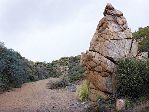
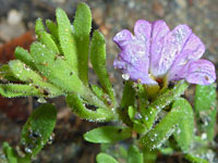
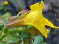
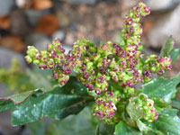
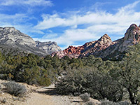
All the bedrock hereabouts is megacrystic granite, light grey to pinkish in color, visible as outcrops in various places along Camp Creek, sometimes forming nicely eroded formations including pinnacles and balanced boulders. In some places the rocks have a distinctly greenish tint. Even during dry periods when the waters of the creek move underground, the falls may still be flowing, and the generally moist conditions are good for wildflowers. The dry slopes above support many cacti including scattered saguaro.
The hike is quite popular, and the character of the area is improved following the decision, in 2005, following a wildfire, to ban access by ATVs, who formerly were able to drive up Camp Creek right to the base of the falls. Below the waterfall is (usually) a sizeable pool, not deep enough for swimming but fine for paddling and for cooling off on hot days.
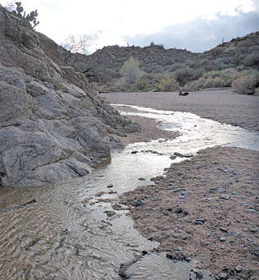
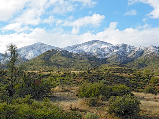
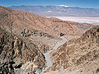
Camp Creek Falls can still be accessed on foot from downstream, a hike of 2.5 miles up Camp Creek from Bartlett Dam Road, though rather shorter is the approach from the west along Blue Wash, parking at a marked trailhead along Camp Creek Road, FR 24, 8 miles northeast of Carefree. From the road are good views of the Four Peaks, and other mountains to the north. The path starts through a gap in a fence, crossing undulating ground of ridges and gullies before descending into a little drainage which soon meets the larger canyon of Blue Wash - quite wide, with a coarse sandy floor, usually dry.
The creekbed winds through a few bends past some granite formations and meets Camp Creek, usually containing a shallow stream. The canyon here is also wide, with gently sloping sides, but narrows upstream and after 0.3 miles reaches the waterfall, in a narrow, sheer-walled section. Beyond, the stream remains enclosed a little further, up to a red rock corner, then becomes shallow once more. Great floods occur occasionally, as shown by debris high above the canyon floor. A little way further north the stream enters the private property of Sears-Kay Ranch.
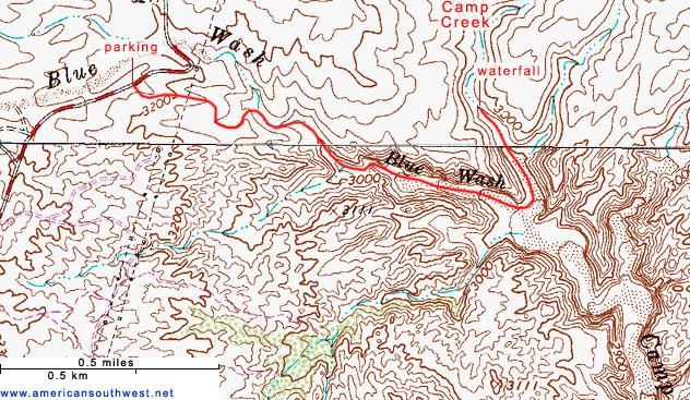
The falls are within the Tonto National Forest, and may be quickest reached by an easy, 1.4 mile hike, along the usually dry tributary of Blue Wash, starting from a signed parking place on the paved Cave Creek Road. Less than one mile north this passes another interesting location, the ancient pueblo at Sears-Kay Ruins; about three hours is enough to see both sites.
All the bedrock hereabouts is megacrystic granite, light grey to pinkish in color, visible as outcrops in various places along Camp Creek, sometimes forming nicely eroded formations including pinnacles and balanced boulders. In some places the rocks have a distinctly greenish tint. Even during dry periods when the waters of the creek move underground, the falls may still be flowing, and the generally moist conditions are good for wildflowers. The dry slopes above support many cacti including scattered saguaro.
The hike is quite popular, and the character of the area is improved following the decision, in 2005, following a wildfire, to ban access by ATVs, who formerly were able to drive up Camp Creek right to the base of the falls. Below the waterfall is (usually) a sizeable pool, not deep enough for swimming but fine for paddling and for cooling off on hot days.

Blue Wash
Camp Creek Falls can still be accessed on foot from downstream, a hike of 2.5 miles up Camp Creek from Bartlett Dam Road, though rather shorter is the approach from the west along Blue Wash, parking at a marked trailhead along Camp Creek Road, FR 24, 8 miles northeast of Carefree. From the road are good views of the Four Peaks, and other mountains to the north. The path starts through a gap in a fence, crossing undulating ground of ridges and gullies before descending into a little drainage which soon meets the larger canyon of Blue Wash - quite wide, with a coarse sandy floor, usually dry.
The Falls
The creekbed winds through a few bends past some granite formations and meets Camp Creek, usually containing a shallow stream. The canyon here is also wide, with gently sloping sides, but narrows upstream and after 0.3 miles reaches the waterfall, in a narrow, sheer-walled section. Beyond, the stream remains enclosed a little further, up to a red rock corner, then becomes shallow once more. Great floods occur occasionally, as shown by debris high above the canyon floor. A little way further north the stream enters the private property of Sears-Kay Ranch.
Topo Map of the Camp Creek Falls Trail
Camp Creek Falls Trail - Similar Hikes
All Contents © Copyright The American Southwest | Comments and Questions | Contribute | Affiliate Marketing Disclosure | Site Map