Highlights:
Two Salado Indian cliff dwellings, built in a ravine overlooking Theodore Roosevelt Lake, surrounded by flourishing Sonoran Desert vegetation. One is visited by a short, paved path, the other may only be seen on a ranger-guided tour
Nearby town:
Payson, 30 miles
Management:
Location:
Seasons:
All year, though the trail to the upper ruin is only open from November to April, as conditions are deemed too hot in summer
Rating (1-5):
★★★★★

Tonto NM is part of the Indian Lands itinerary
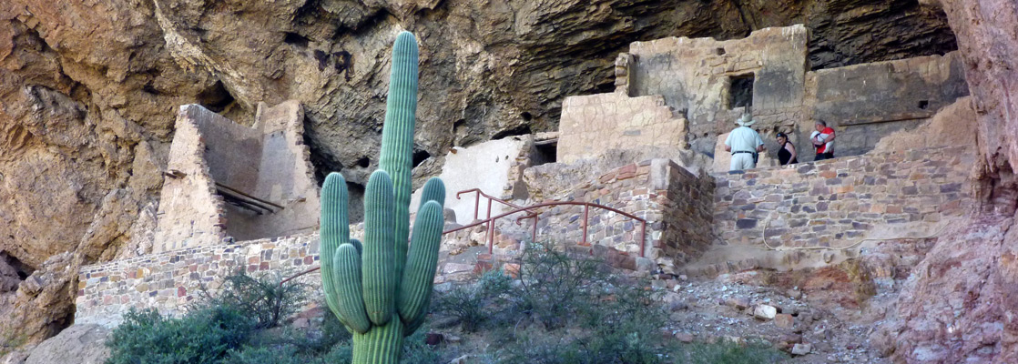
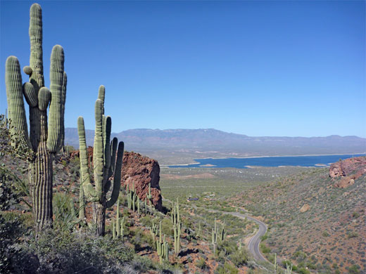
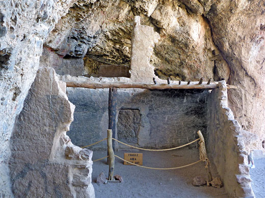
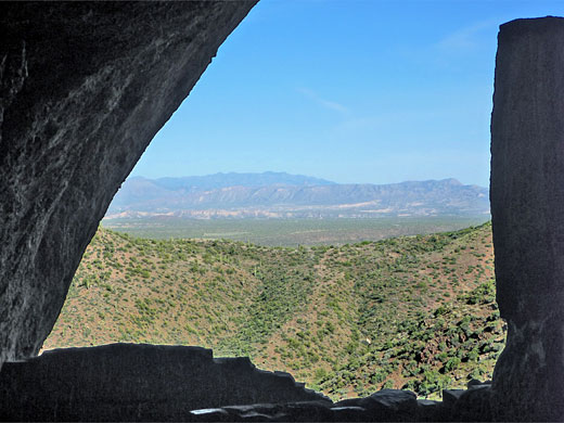
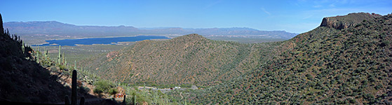
Tonto National Monument contains of the ruins of two cliff dwellings established by the Salado Indians around 1300 AD. The southeast-facing settlements were built quite high up a steep hillside within well-protected natural caves overlooking the Tonto Basin, which is now flooded forming Theodore Roosevelt Lake, though originally the Salt River flowed through the basin which was therefore well irrigated and fertile. As with many other ancient peoples of the Southwest, the Salado appear to have abandoned their villages suddenly, early in the fifteenth century, for reasons which are not known.
The national monument, established by President Roosevelt in December 1907, is located 0.8 miles from state route 188 (The Apache Trail) and the shore of Theodore Roosevelt Lake, in a generally rocky and quite empty area that has extensive and varied cacti. The nearest campground is on the far side of AZ 188, nearly opposite - managed by the USFS, this has many sites on flattish land within sight of the lake. Free primitive camping is possible a short distance southeast, along side tracks heading up into the hills. Entrance to the monument (2024) is $10 per person.
The national monument, established by President Roosevelt in December 1907, is located 0.8 miles from state route 188 (The Apache Trail) and the shore of Theodore Roosevelt Lake, in a generally rocky and quite empty area that has extensive and varied cacti. The nearest campground is on the far side of AZ 188, nearly opposite - managed by the USFS, this has many sites on flattish land within sight of the lake. Free primitive camping is possible a short distance southeast, along side tracks heading up into the hills. Entrance to the monument (2024) is $10 per person.
Tonto Table of Contents
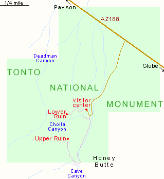
Map of Tonto National Monument
Photographs
15 views of Tonto National Monument.
Lower Ruin Trail
One of the two ancient dwellings (the Lower Ruin) is reached by a paved, half mile, self-guided trail which leads from the visitor center/museum quite steeply 350 feet up the side of a rocky hill, giving increasingly good views of Tonto Basin and Theodore Roosevelt Lake. The trail is closed to uphill travel at 4 pm, giving the last visitors one hour to make the trip, as the monument is closed every day at 5 pm. Along the way are notices about the native animals and plants - the area is especially abundant in cacti, the most visible species being saguaro, buckhorn cholla, teddy bear cholla, jumping cholla, Christmas cholla, Engelmann's hedgehog, tulip prickly pear and California barrel cactus. Cacti are also identified along a linked, 0.25 mile trail which provides an alternative route back to the parking area.
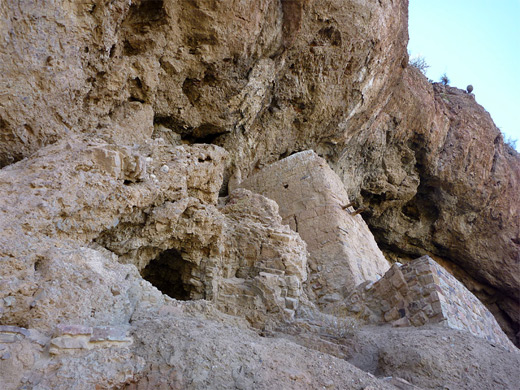
The Ruins at Tonto National Monument
| Tonto - one of the 20 least visited national monuments in the West |
Tonto - Nearby Places
- Superstition Mountains - fabled desert hills east of Phoenix
- Theodore Roosevelt Lake - desert reservoir just east of the national monument
Tonto - Similar Places
- Gila Cliff Dwellings National Monument, New Mexico - remote ruins in the Gila National Forest
- Montezuma Castle National Monument, Arizona - ancient dwelling built high in a sandstone cliff alcove
All Contents © Copyright The American Southwest | Comments and Questions | Contribute | Affiliate Marketing Disclosure | Site Map