Cactus Wren and Manville Trails, Saguaro National Park
Arizona > Saguaro National Park > West > Hiking > Cactus Wren and Manville Trails
Cactus Wren and Manville Trails
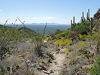
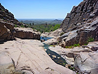
Loop over fairly level ground, including a few dry washes; all densely covered with large saguaro cacti and other Sonoran Desert plants, with long distance views towards distant mountains
Length: 4 miles
Elevation change: 200 feet
Difficulty: Easy
Type: Loop
Usage: Medium
Season: All year
Trailhead: Signal Hill picnic area
Rating (1-5): ★★★★★
Elevation change: 200 feet
Difficulty: Easy
Type: Loop
Usage: Medium
Season: All year
Trailhead: Signal Hill picnic area
Rating (1-5): ★★★★★

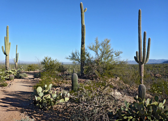
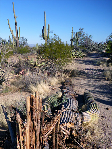
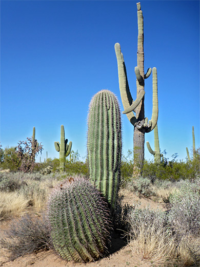
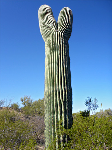
Starting at the Signal Hill picnic/parking area, the Cactus Wren and Manville trails cross nearly flat terrain in the northwest corner of the Tucson Mountain section of Saguaro National Park, all of which is very densely covered with the usual plants of the Sonoran Desert, including palo verde, desert ironwood, and innumerable tall, aged saguaro.
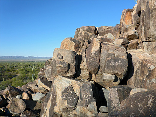
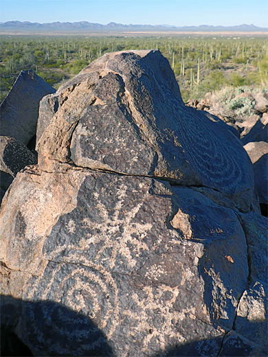
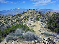
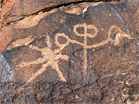
The two paths link again at the far end to form a four mile loop, also incorporating the hill itself, a minor summit formed of granodiorite boulders, covered with hundreds of Hohokam petroglyphs, up to 800 years old. After the hill, and a connected ridge, most of the loop crosses open plains, still with long-distance views, the only exception being the last part of the Manville Trail that runs along the floor of a dry, sandy wash beneath low banks.
The hike is also good for wildlife - snakes, lizards and birds, including the diminutive cactus wren after which the shorter (1.5 miles) of the two trails is named. Wildflowers are somewhat limited owing to the usually very dry environment. The trails are straight, wide, and the majority of the walking is across firm ground so the hike is easy and relatively quick.
Map of the west section of Saguaro National Park.
21 views along the Cactus Wren and Manville trails.
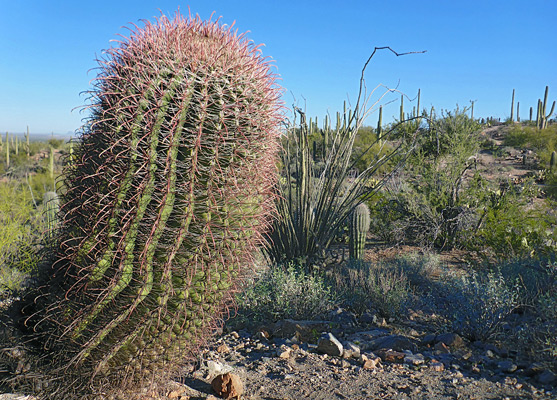
The trailhead is reached by gravel roads - Golden Gate Road, part of the main loop, and the short Signal Hill Road, ending at a dispersed parking area, a scenic location, slightly elevated. The path departs to the north, down into a little wash via a flight of stone steps then up the far side to the summit of the hill, close to many of the petroglyphs. The Cactus Wren Trail continues north, staying relatively high for a while, down slightly, along a ridge and down some more, then across a sandy wash, after which the remainder is quite flat. Cacti are abundant, especially jumping cholla, saguaro and the Arizona barrel cactus (ferocactus wislizeni), later becoming just a bit more spread out, the ground grassier, with mesquite and ironwood trees, as the path gradually comes close to a road and so experiences some traffic noise.
A junction is reached after one mile, with the Encinas Trail which provides a westwards shortcut to the Manville Trail, cutting off the northern part of the loop; the Cactus Wren Trail keeps heading northwestward, right to the corner of the park, at the Rudasill Road/Sandario Road intersection. The jumping cholla predominate along this latter section, plus the barrel cacti, several of which display cristate growth. Another junction, just before the end, marks the start of the Manville Trail which heads due south, parallel to Sandario Road. It crosses a wash, passes the Encinas junction, then traverses several minor washes and three slightly deeper ones to a final junction, an access point on Sandario Road, opposite the Manville Road intersection. A sign gives the remaining distance, to the Signal Hill picnic area, as 0.9 miles, most of which is along a streambed, over soft, coarse sand, round a few bends, beneath the hill and back to the trailhead.
The two paths link again at the far end to form a four mile loop, also incorporating the hill itself, a minor summit formed of granodiorite boulders, covered with hundreds of Hohokam petroglyphs, up to 800 years old. After the hill, and a connected ridge, most of the loop crosses open plains, still with long-distance views, the only exception being the last part of the Manville Trail that runs along the floor of a dry, sandy wash beneath low banks.
The hike is also good for wildlife - snakes, lizards and birds, including the diminutive cactus wren after which the shorter (1.5 miles) of the two trails is named. Wildflowers are somewhat limited owing to the usually very dry environment. The trails are straight, wide, and the majority of the walking is across firm ground so the hike is easy and relatively quick.
Location
Map of the west section of Saguaro National Park.
Photographs
21 views along the Cactus Wren and Manville trails.
Cactus Wren Trail
The trailhead is reached by gravel roads - Golden Gate Road, part of the main loop, and the short Signal Hill Road, ending at a dispersed parking area, a scenic location, slightly elevated. The path departs to the north, down into a little wash via a flight of stone steps then up the far side to the summit of the hill, close to many of the petroglyphs. The Cactus Wren Trail continues north, staying relatively high for a while, down slightly, along a ridge and down some more, then across a sandy wash, after which the remainder is quite flat. Cacti are abundant, especially jumping cholla, saguaro and the Arizona barrel cactus (ferocactus wislizeni), later becoming just a bit more spread out, the ground grassier, with mesquite and ironwood trees, as the path gradually comes close to a road and so experiences some traffic noise.
Manville Trail
A junction is reached after one mile, with the Encinas Trail which provides a westwards shortcut to the Manville Trail, cutting off the northern part of the loop; the Cactus Wren Trail keeps heading northwestward, right to the corner of the park, at the Rudasill Road/Sandario Road intersection. The jumping cholla predominate along this latter section, plus the barrel cacti, several of which display cristate growth. Another junction, just before the end, marks the start of the Manville Trail which heads due south, parallel to Sandario Road. It crosses a wash, passes the Encinas junction, then traverses several minor washes and three slightly deeper ones to a final junction, an access point on Sandario Road, opposite the Manville Road intersection. A sign gives the remaining distance, to the Signal Hill picnic area, as 0.9 miles, most of which is along a streambed, over soft, coarse sand, round a few bends, beneath the hill and back to the trailhead.

Cactus Wren and Manville Trails - Similar Hikes
All Contents © Copyright The American Southwest | Comments and Questions | Contribute | Affiliate Marketing Disclosure | Site Map