Goldmine, Dynamite and Moonlight Trails, San Tan Mountain Regional Park
Arizona > San Tan Mountain Regional Park > Goldmine, Dynamite and Moonlight Trails
Goldmine, Dynamite and Moonlight Trails
Varied loop across mountains, ravines and plains, also involving part of the San Tan Trail; good views in all directions, and plentiful cacti in some areas
Length: 7.5 miles (round trip)
Elevation change: 500 feet
Difficulty: Moderate
Type: Loop. Longer or shorter hikes possible
Usage: Medium
Season: Fall to spring
Trailhead: The main park entrance, along Phillips Road
Rating (1-5): ★★★★★
Elevation change: 500 feet
Difficulty: Moderate
Type: Loop. Longer or shorter hikes possible
Usage: Medium
Season: Fall to spring
Trailhead: The main park entrance, along Phillips Road
Rating (1-5): ★★★★★

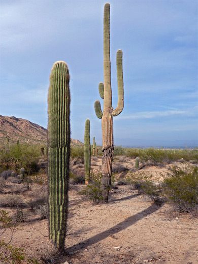
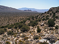
Loop hikes in San Tan Mountains Regional Park range from 1.6 miles to over 15 miles, since all the individual trails intersect, thus allowing a variety of route choices. For an intermediate length walk, one popular choice is along the paths in the northern half of the park, partly across flat, sandy, gravelly or earthen ground with scattered saguaro groves, and partly over the steep, lightly vegetated slopes of Goldmine Mountain, which give far reaching views in all directions.
The longest of three possible loops is 7.5 miles, beginning either at the northern trailhead off Wagon Wheel Road, or at the main entrance, at the end of Phillips Road (see map). From here, the anticlockwise route is along the Goldmine Trail across flat land and over a high ridge in the middle of Goldmine Mountain, then back south on the Dynamite Trail through the western foothills of the mountain and over saguaro flats via part of the San Tan Trail, before returning to the start along the Moonlight Trail, through more cactus country.
Most parts of the loop are fairly easy with the exception of the north side of Goldmine Mountain, where one short stretch is noted by the park as being hazardous and extremely steep, though this is a relative description and there are plenty of trails elsewhere in the state with similar sections that are not remarked upon.
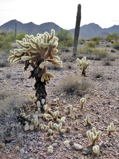
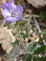
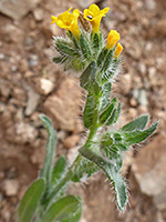
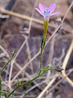
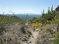
Away from the gravelly, saguaro areas, mostly along the San Tan and Moonlight trails, many regions of the park have surprisingly few cacti, only bushes and sparse grass, growing on soil, while parts of Goldmine Mountain are also rather barren, but there are still plenty of wildflowers in late spring early summer.
23 views along the trail.
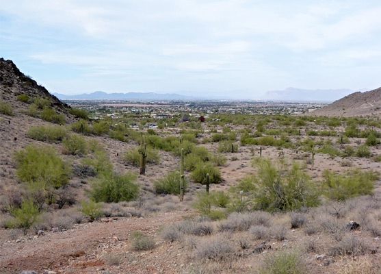
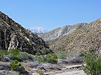
Starting at the main park entrance, the first part of the loop is either on the Goldmine Trail or the adjacent Littleleaf Trail (0.6 vs 0.7 miles); the latter is somewhat narrower and less used, crossing a few minor dry washes and soon meeting the other, wider path. Along the way are several notices about closed areas accessed by unmarked paths, features common to all other routes in the park. The Goldmine Trail climbs slightly, passes an intersection at the north end of the San Tan Trail then rises more steeply, curving up a narrowing valley to a saddle on a ridge along the eastern arm of Goldmine Mountain, the far side of which offers the first views northeastwards, across partly rural suburbs to the distant Superstition Mountains.
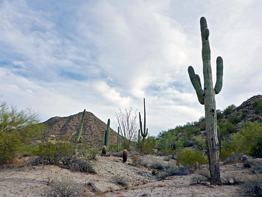
The next section is nearly flat, traversing beneath a peak to another saddle on the northern arm of the mountain, and even better views, to the northwest. After here is the steep section, down a rocky slope where the ground is covered by loose stones in places, but soon leveling out to a gravelly flat, where the trail passes a spur to the graves of two prospectors who searched for gold on the nearby mountain (Marion Kennedy died 1960; Mansel Carter died 1987) and continues a short distance to another intersection, shortly before the north end of the path at Wagon Wheel Road.
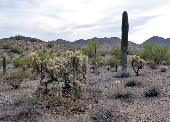
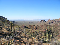
The junction near the graves is with the Dynamite Trail (2.4 miles), the next part of the loop; this rises slightly to a saddle from where land to the west first comes properly in sight, and ascends further, quite gently, to a better viewpoint, as the scenery improves, including little ravines and rocky knolls. There are two more saddles, one between a pair of boulder-covered cones, the other at the south edge of the mountain, accompanied by a bench, after which the path descends, curves in and out of a valley, and ends at a junction with the San Tan Trail.
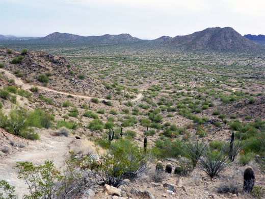
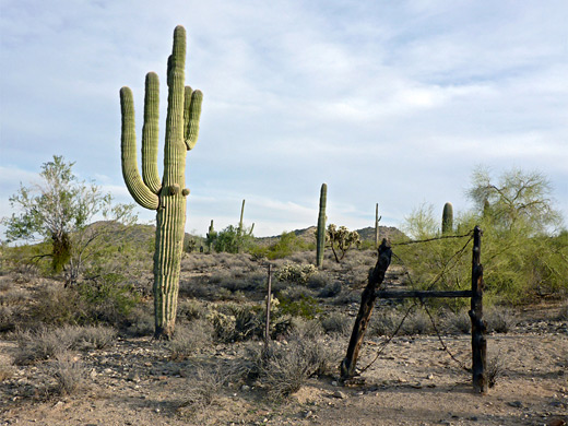
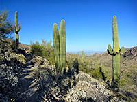
Turning right, the San Tan Trail traverses a nice area of light-colored sand and gravel with few bushes but plenty of tall saguaro, plus cholla and ferocacti; one of the most photogenic sections of the hike. Another junction is with a service road to the west, soon followed by another to the east, as the trail passes one small hill and enters a valley between two more, where it meets the Moonlight Trail to the east, the last segment of the loop. This skirts the edge of a hill, over a few small washes, initially still accompanied by large saguaro, then traverses flatter, more earthen land with bushes and palo verde trees, through a final junction with the short Stargazer Trail to the south, and back to the trailhead.
The longest of three possible loops is 7.5 miles, beginning either at the northern trailhead off Wagon Wheel Road, or at the main entrance, at the end of Phillips Road (see map). From here, the anticlockwise route is along the Goldmine Trail across flat land and over a high ridge in the middle of Goldmine Mountain, then back south on the Dynamite Trail through the western foothills of the mountain and over saguaro flats via part of the San Tan Trail, before returning to the start along the Moonlight Trail, through more cactus country.
Most parts of the loop are fairly easy with the exception of the north side of Goldmine Mountain, where one short stretch is noted by the park as being hazardous and extremely steep, though this is a relative description and there are plenty of trails elsewhere in the state with similar sections that are not remarked upon.
Away from the gravelly, saguaro areas, mostly along the San Tan and Moonlight trails, many regions of the park have surprisingly few cacti, only bushes and sparse grass, growing on soil, while parts of Goldmine Mountain are also rather barren, but there are still plenty of wildflowers in late spring early summer.
Photographs
23 views along the trail.
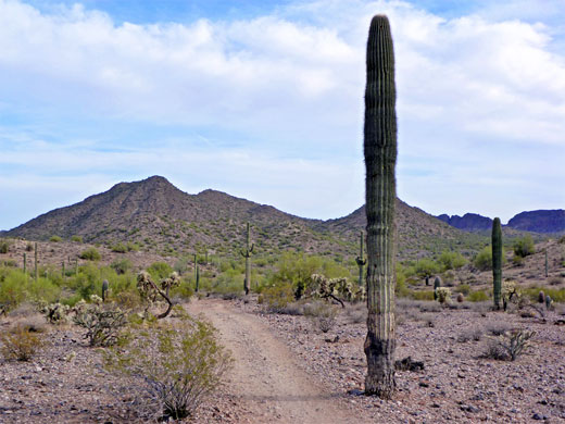
Goldmine Trail
Starting at the main park entrance, the first part of the loop is either on the Goldmine Trail or the adjacent Littleleaf Trail (0.6 vs 0.7 miles); the latter is somewhat narrower and less used, crossing a few minor dry washes and soon meeting the other, wider path. Along the way are several notices about closed areas accessed by unmarked paths, features common to all other routes in the park. The Goldmine Trail climbs slightly, passes an intersection at the north end of the San Tan Trail then rises more steeply, curving up a narrowing valley to a saddle on a ridge along the eastern arm of Goldmine Mountain, the far side of which offers the first views northeastwards, across partly rural suburbs to the distant Superstition Mountains.
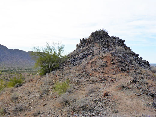
Goldmine Mountain
The next section is nearly flat, traversing beneath a peak to another saddle on the northern arm of the mountain, and even better views, to the northwest. After here is the steep section, down a rocky slope where the ground is covered by loose stones in places, but soon leveling out to a gravelly flat, where the trail passes a spur to the graves of two prospectors who searched for gold on the nearby mountain (Marion Kennedy died 1960; Mansel Carter died 1987) and continues a short distance to another intersection, shortly before the north end of the path at Wagon Wheel Road.
Dynamite Trail
The junction near the graves is with the Dynamite Trail (2.4 miles), the next part of the loop; this rises slightly to a saddle from where land to the west first comes properly in sight, and ascends further, quite gently, to a better viewpoint, as the scenery improves, including little ravines and rocky knolls. There are two more saddles, one between a pair of boulder-covered cones, the other at the south edge of the mountain, accompanied by a bench, after which the path descends, curves in and out of a valley, and ends at a junction with the San Tan Trail.
San Tan and Moonlight Trails
Turning right, the San Tan Trail traverses a nice area of light-colored sand and gravel with few bushes but plenty of tall saguaro, plus cholla and ferocacti; one of the most photogenic sections of the hike. Another junction is with a service road to the west, soon followed by another to the east, as the trail passes one small hill and enters a valley between two more, where it meets the Moonlight Trail to the east, the last segment of the loop. This skirts the edge of a hill, over a few small washes, initially still accompanied by large saguaro, then traverses flatter, more earthen land with bushes and palo verde trees, through a final junction with the short Stargazer Trail to the south, and back to the trailhead.
Goldmine Trail - Similar Hikes
All Contents © Copyright The American Southwest | Comments and Questions | Contribute | Affiliate Marketing Disclosure | Site Map