Highlights:
Over 10,000 acres of rocky hills and desert flats southeast of Phoenix, protected as a regional park, relatively unspoilt and lightly visited, with plenty of saguaro and other cacti. Crossed by 20 miles of intersecting, well maintained trails, accompanied by a good range of visitor facilities
Nearby town:
Queen Creek, 7 miles
Management:
Location:
Phillips Road, off Thompson Road (main entrance)
Seasons:
All year, though very hot in summer, when longer hikes are not recommended
Rating (1-5):
★★★★★

Featured Hotel
Best Western Legacy Inn
 Mid range hotel in Gilbert, with a countryside setting near Phoenix/Mesa Gateway Airport and the 202 freeway; 16 miles north of the regional park
Check Rates
Although located in Pinal County, along its northern edge, San Tan Mountain Regional Park is administered by neighboring Maricopa County; one of 12 such preserves, centered on hills, rivers or lakes in the Sonoran Desert surrounding Phoenix, others including Lake Pleasant and White Tank Mountain.
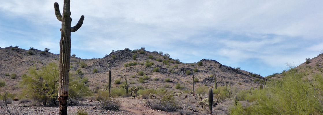
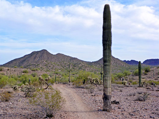
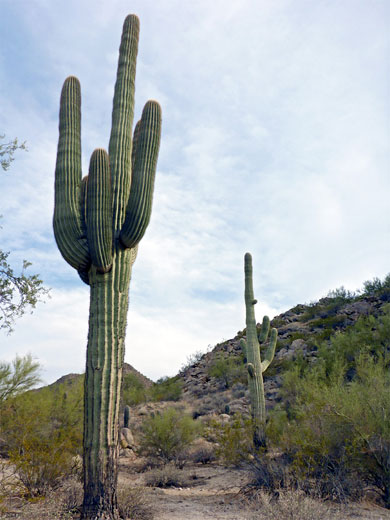
The San Tan Mountains are typical of the rugged ranges in this part of the desert, being rocky, steep-sided, split by ravines and densely covered by saguaro and other cacti, and while the majority of the highest elevation peaks are within the Gila River Indian Reservation and so generally off-limits for hiking, the eastern section is in the regional park, together with a lower, detached summit (Goldmine Mountain), and the flatter land in between. The park contains over 10,000 acres of unspoilt desert terrain, measuring over five miles north to south.
The San Tan Mountains are typical of the rugged ranges in this part of the desert, being rocky, steep-sided, split by ravines and densely covered by saguaro and other cacti, and while the majority of the highest elevation peaks are within the Gila River Indian Reservation and so generally off-limits for hiking, the eastern section is in the regional park, together with a lower, detached summit (Goldmine Mountain), and the flatter land in between. The park contains over 10,000 acres of unspoilt desert terrain, measuring over five miles north to south.
San Tan Mountain Table of Contents
- Map of the park
- Photographs
- Guided hikes
- Introduction
- The park; general information
- All trails of the San Tan Mountains
- Featured hike; Goldmine, Dynamite and Moonlight trails
- Nearby places
- Similar places
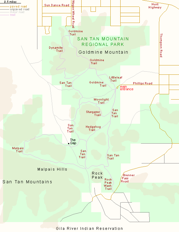
Map of San Tan Mountain Regional Park
Photographs
23 views of San Tan Mountain Regional Park.
Guided Sonoran Desert Hikes
Introduction
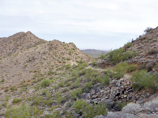
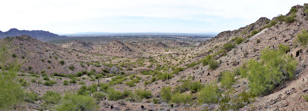
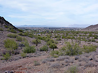
The scenery of San Tan Mountain is not much different to any other mountainous area in the Sonoran Desert, and the place is less spectacular than for example the Superstition Mountains to the north but the landscape is still very impressive, and can be seen close-up by over 20 miles of intersecting trails, which offer varied views, of the peaks, the nearby higher mountains, the cactus and creosote flats, desert plains to the east and the Phoenix suburbs to the north. Like all the regional parks the paths are well-maintained, signposted at every intersection and easy to follow, and the park has plenty of facilities including a visitor center, ranger station, horse staging area, nature trail and picnic area. There is at present no campground, though one might be added in the future - the park is relatively new, and some aspects are still being developed.
The Park
The regional park lies at the southeast edge of greater Phoenix, bordering Gilbert and Queen Creek. The main entrance is on the east side, along Phillips Road, off Thompson Road, and here are found all the facilities, including a large carpark. The entrance is open every day of the year, and admission (2023) is $7 per vehicle, or $2 for walk-ins. Two lesser-used approaches are from the north, along Wagon Wheel Road/Skyline Drive (the Goldmine trailhead), and in the south, along Brenner Pass Road, the Rock Peak Wash trailhead; all roads are paved, and entrance fees are due here as well. Elevations in the park range from 1,550 feet, along the northwest edge, to 2,495 feet, in the Malpais Hills, which form the eastern portion of the San Tan range and are characterized by a very steep north face, rising abruptly from a gravelly wash along the base. Other named features include Rock Peak, a detached, conical summit near the southern entrance, and The Gap, a pass through a narrow ridge.
Hiking in the San Tan Mountains
San Tan Mountain Regional Park is crossed by over 20 miles of intersecting trails, allowing many loop hikes, the shortest 1.6 miles (Littleleaf Trail and the south end of the Goldmine Trail). The most strenuous is the Goldmine Trail, as its central section involves an ascent and descent of steep, rocky slopes, in the middle of Goldmine Mountain. The remainder of the routes, although sometimes long, are generally easy, most either crossing flat land between the peaks, or following dry washes. All trails are multiple-use, open to cycles and horses, any many are wide, formerly vehicle tracks.
Trails are summarized below. Perhaps the best medium length hike, experiencing a variety of scenery and environments, is the 7.5 mile loop along the Goldmine, Dynamite, San Tan and Moonlight trails.
- Dynamite Trail, 2.4 miles - winding path through the western portion of Goldmine Mountain, mostly elevated and so providing good views
- Goldmine Trail, 2.5 miles - the most strenuous route, this links the Phillips Road and Wagon Wheel Road entrances, crossing a steep-sided ridge in the middle of Goldmine Mountain
- Hedgehog Trail, 1 mile - mostly level connector between two sections of the San Tan Trail
- Littleleaf Trail, 0.7 miles - east path through flat, bushy land near the main entrance; provides an alternative to the southernmost section of the Goldmine Trail
- Malpais Trail, 4.1 miles - the remotest and least used path in the park; a loop off the San Tan Trail. Half follows a gravelly wash at the foot of the steep slopes of the Malpais Hills, while the remainder is along shallow valleys between low ridges
- Moonlight Trail, 1.3 miles - easy route over flattish ground with many saguaro and palo verde. Links two points along the San Tan Trail
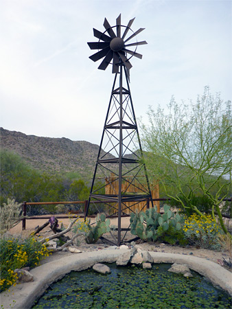
- Nature Trail, 0.3 miles - interpretive loop just north of the entrance station, passing a selection of Sonoran Desert plants, and also a pond beside a rusty windmill
- Rock Peak Wash Trail, 0.9 miles - links the Brenner Pass Road Trailhead with the south end of the San Tan Trail, via a sandy dry wash running between two hills
- San Tan Trail, 6.4 miles - long circuit over fairly level land in the middle of the park, forming an 8 mile loop with part of the Goldmine Trail.
- Stargazer Trail, 0.8 miles - easy, partly elevated path across sloping ground, linking the San Tan and Moonlight trails.
Featured Hike in the San Tan Mountains
Goldmine, Dynamite and Moonlight Trails
★★★★★
★★★★★
7.5 miles, 500 feet (loop)
Varied loop across mountains, ravines and plains, also involving part of the San Tan TrailSan Tan Mountains - Nearby Places
- Boyce Thompson Arboretum (39 miles) - 323 acre botanical gardens near Superior
- Casa Grande Ruins National Monument (21 miles) - four story, 14th century Indian ruins
San Tan Mountains - Similar Places
- South Mountain Park - the largest city park in the USA
- White Tank Mountain Regional Park - isolated, pristine mountain range west of Phoenix
All Contents © Copyright The American Southwest | Comments and Questions | Contribute | Affiliate Marketing Disclosure | Site Map