Highlights:
Well preserved ruins of a four floor, 14th century adobe building, set in desert surroundings in central Arizona
Nearby town:
Casa Grande, 22 miles
Management:
Location:
Seasons:
All year. This area is very hot in summer but a visit involves no hiking
Rating (1-5):
★★★★★
Weather:


Casa Grande Ruins NM is part of the Arizona Deserts itinerary
Featured Hotel
Holiday Inn Express Casa Grande
 15 miles from the Casa Grande; a 77 room/suite hotel offering free hot breakfast and an outdoor pool, beside I-10 at the Florence Boulevard exit
Check Rates
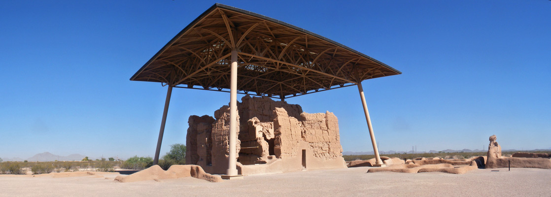
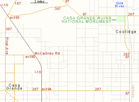
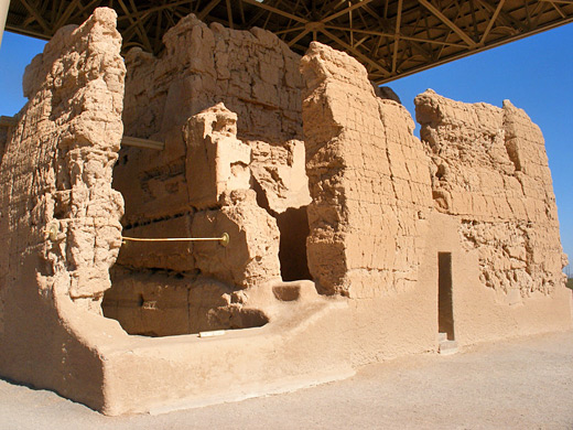
Casa Grande Ruins National Monument contains an imposing four-storey building dating from the late Hohokam period, probably 14th century and contemporary with other well preserved ruins in Arizona such as the Tonto and Montezuma Castle monuments. It is situated in the flat plain of central Arizona in between the Gila and Santa Cruz rivers, just north of Coolidge and about 15 miles from the larger town of Casa Grande.
The structure was once part of a collection of settlements scattered along the Gila River and linked by a network of irrigation canals. The area has a low elevation and hence is very hot - often over 110°F for several months in the summer. During spring, this part of Arizona is sometimes the hottest place in the whole USA, and even in winter, daytime temperatures can reach 80°F.
Unusually for an NPS unit, admission to Casa Grande Ruins National Monument is free. The site is open 362 days of the year; closed Thanksgiving, Christmas Day and Independence Day.
Casa Grande Ruins Table of Contents
Photographs
6 views of the Casa Grande Ruins.
The National Monument
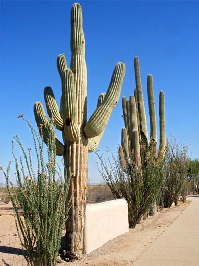
The approach to the Casa Grande Ruins from any direction is along straight roads across dusty farmland; Highway 87/287 runs past the entrance, 15 miles east of I-10. The monument is open from 9 am to 5 pm each day, and has a good visitor center with much information about the Hohokam people. Outside are a number of large specimens of desert plants, including the ubiquitous saguaro, and also a shady picnic area with an entertaining ground squirrel population. A door at the back of the visitor center leads to the Casa Grande itself, at the middle of a rectangular area that used to be a walled compound containing several other smaller buildings.
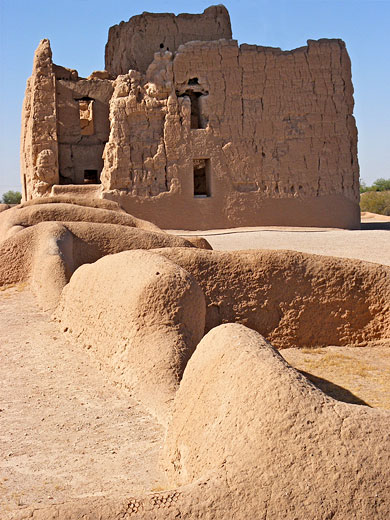
The Ruins
| Casa Grande Ruins - one of the 20 least visited national monuments in the West |
History of Casa Grande
It is believed that the Casa Grande functioned partly as an astronomical observatory since the four walls face the points of the compass, and some of the windows are aligned to the positions of the sun and moon at specific times. There are various smaller ruins in the complex, remains of a Hohokam farming village, and some are yet to be excavated. A second, similarly sized compound is located 850 feet northeast of the Casa Grande, though this is usually closed to the public. Nowadays, the roof and walls of the main building provide shelter for several species of small birds but the Hohokam themselves seem to have abandoned the complex around the 16th century, as part of a general decline in their civilisation. Apart from other Indian peoples and Spanish missionaries, the area was not revisited until the 1880s, when American settlers arrived and began to threaten the ruins by removing artefacts as souvenirs. In 1892, the Casa Grande became the first archaeological site in the USA to be protected as a national monument.
Casa Grande Ruins - Nearby Places
- The Apache Trail (42 miles) - dramatic, winding road from Apache Junction to Theodore Roosevelt Lake
- Picacho Peak State Park (28 miles) - volcanic mountain in the Sonoran Desert
- Sonoran Desert National Monument (50 miles) - large protected area of scenic desert
Casa Grande Ruins - Similar Places
- Aztec Ruins National Monument, New Mexico - large 12th century walled settlement
- Tuzigoot National Monument, Arizona - sizeable ruin atop a low hill with good views over the Verde River valley, southwest of Sedona
All Contents © Copyright The American Southwest | Comments and Questions | Contribute | Affiliate Marketing Disclosure | Site Map