The American Southwest
Home | Parks | Trails | Plants | Canyons
Maps | Landscapes | Site Map | Whats New? |
More...
Follow americansouthwest.net on Facebook
×
General Pages
Home
Parks
Trails
Plants
Slot Canyons
Maps
Landscapes
Itineraries
Site Map
What's New?
More pages...

States
Arizona
California
Colorado
Idaho
Nevada
New Mexico
Oregon
Texas
Utah
Wyoming


ARIZONA
CALIFORNIA
COLORADO
IDAHO
NEVADA
NEW MEXICO
OREGON
TEXAS
UTAH
WYOMING
TEXAS
MAPS | PARKS | TRAILS | HOTELS

Map of Big Bend Ranch State Park


Texas > Big Bend Ranch State Park > Map
Map of Big Bend Ranch State Park

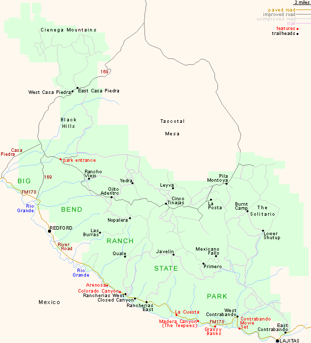
The east entrance to Big Bend Ranch State Park at Lajitas is 30 miles from nearby Big Bend National Park, and 95 miles south of Alpine via TX 118. The west entrance, 40 away along FM 170, is 5 miles from Presidio and 42 miles from Marfa via US 67.

Back to Top
Arizona | California | Colorado | Idaho | Nevada | New Mexico | Oregon | Texas | Utah | Wyoming | Slot Canyons | Travelogue | SOUTHWEST

All Contents © Copyright The American Southwest | Comments and Questions | Contribute | Affiliate Marketing Disclosure | Site Map