Highlights:
Canyon southwest of Lander, in the eastern foothills of the Wind River Mountains, where the Popo Agie River disappears into a limestone cave then re-emerges downstream; unusual geology and pleasant scenery
Nearby town:
Lander, 6 miles
Management:
Location:
42.747, -108.809 (the sinks)
Seasons:
All year
Rating (1-5):
★★★★★
Weather:


Featured Hotel
Holiday Inn Express Lander
 Modern hotel along US 287 on the west edge of Lander; guest rooms have fine views of the Wind River Range. Sinks Canyon is 6 miles west
Check Rates
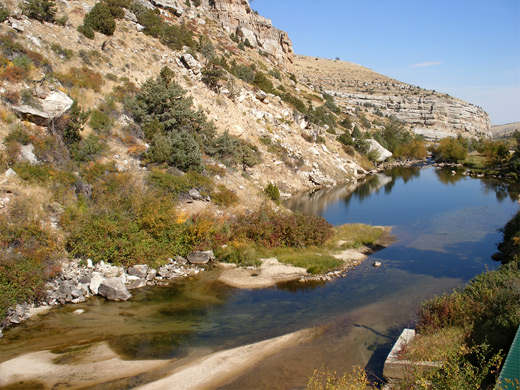
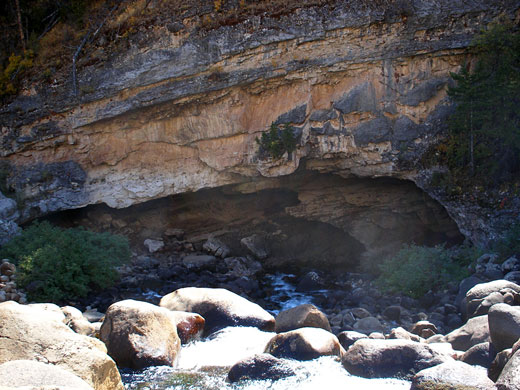
At the edge of the great plains of central Wyoming, Sinks Canyon State Park contains a short stretch of the Middle Fork of the Popo Agie River as it flows through a deep limestone canyon, near the town of Lander. The Popo Agie begins high in the Wind River Range and is unremarkable for most of its length but at one point near the mouth of the canyon its waters tumble down a steep bouldery slope into a sizeable cavern then disappear below ground, re-emerging a third of a mile downstream in a calm pool, home to a population of rainbow trout.
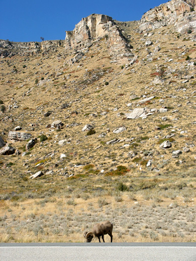
Named the sinks and the rise, these two features are linked by a pleasant trail alongside the usually dry section of river bed that continues above ground, and the park also has an informative visitor center, a fish feeding area and a campsite, while for the more adventurous, the vertical cliffs above the river are good for rock climbing. Wildlife in the area includes porcupines, deer, red squirrels, big horn sheep and golden eagles.
Named the sinks and the rise, these two features are linked by a pleasant trail alongside the usually dry section of river bed that continues above ground, and the park also has an informative visitor center, a fish feeding area and a campsite, while for the more adventurous, the vertical cliffs above the river are good for rock climbing. Wildlife in the area includes porcupines, deer, red squirrels, big horn sheep and golden eagles.
Sinks Canyon Table of Contents
Photographs
8 views of Sinks Canyon State Park
Video
The Sinks (mp4; 0:52 min).
The Rise
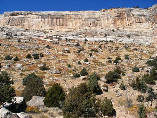
The approach to Sinks Canyon State Park is via Highway 131, along residential back streets of Lander then out into the countryside for a few miles, staying close to the river, which enters a canyon at the edge of the mountain foothills. The valley sides are soon quite steep, with sheer cliffs of Tensleep Sandstone at the top and rocky slopes below, covered (on the south-facing side) by grass, sagebrush, juniper and a few cacti, reflecting the generally arid environment and the relatively low elevation of 5,600 feet. The opposite slopes bear Douglas fir trees and a variety of larger shrubs, since the environment is cooler and more moist. The road soon enters the state park (which charges no access fee), and first passes the 30 site campground, set amidst wooded ground on the river banks. The rise is not far beyond, reached by a short path to a raised viewpoint directly above the trout-filled pool where the waters of the Popo Agie seep above ground and reform the river. Also at this location are a few information notices and some fish food dispensers, though the place is not nearly as interesting as the sinks, a short distance further up the canyon.
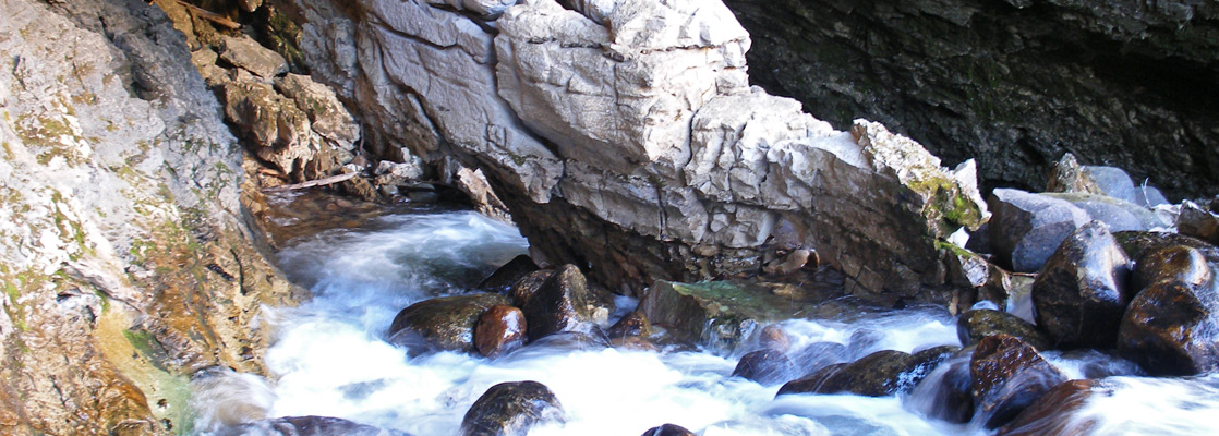
The Sinks
From the rise, visitors can either walk or drive the 1/3 mile to the sinks, next to which is a good visitor center that includes a comprehensive display of local rock types. Another short trail leads to the edge of the cave where the river sinks underground - it flows swiftly over a jumble of big boulders, curving back into the cavern opening and at one point passing along both sides of a little natural arch. At the base of the cave the waters sink out of sight into a network of small, unexplorable tunnels, remaining underground for over two hours before surfacing at the rise. Views from the end of the path are quite good, but for a close up look, if the water flow is not too great, the actual sinks can be seen by carefully crossing the river by stepping on the boulders, then descending the far side (see video). Another path visits the overflow channel - the 1/3 mile of dry, boulder-filled riverbed that is sometimes used in times of high run-off. All the sites can be seen in just an hour or so, but the park is an interesting destination with good facilities, easy access and no charge to enter.
Sinks Canyon - Nearby Places
- Boysen State Park (50 miles) - branched reservoir on the Wind River
- Independence Rock State Historic Site (105 miles) - granite outcrop with pioneer signatures
Sinks Canyon - Similar Places
- Bottomless Lakes State Park, New Mexico - deep, blue lakes - flooded sinkholes, near Roswell
All Contents © Copyright The American Southwest | Comments and Questions | Contribute | Affiliate Marketing Disclosure | Site Map