Highlights:
Remote, 100 mile mountain chain in west Wyoming, containing spectacular granite peaks, glaciers and basins; over 40 summits above 13,000 feet. Popular with backpackers and rock climbers
Management:
USFS, Wind River Indian Reservation
Location:
43.184, -109.654 (Gannett Peak - highest point)
Seasons:
Summer, fall
Rating (1-5):
★★★★★

Featured Hotel
Hampton Inn Pinedale
 Modern hotel with mountain views, at the center of Pinedale along US 191, near several restaurants. Free hot breakfast is provided. 15 miles from Elkhart Park
Check Rates
The Wind River Range extends for 100 miles across west Wyoming, merging in the north with the densely wooded hills and valleys east of Jackson Lake, and sloping down more abruptly to high desert plains in the south, at the edge of the Great Basin Divide. The Continental Divide runs all along the mountain crest, which includes the highest point in the state (13,804 foot Gannett Peak), just 234 feet above Grand Teton, central summit of the more well-known Teton Range.
While not quite equaling the Tetons in terms of steepness or ruggedness, the Wind River mountains are still very spectacular, containing hundreds of lakes, over one hundred glaciers (including the largest anywhere in the US Rocky Mountains) and vast areas of exposed granite wilderness well above the treeline. Unlike the Tetons, the foothills on both sides are quite extensive, so access to the high country is more difficult, and most of the area is out of reach of day hikes, even though the range is relatively narrow, about 25 miles across.
While not quite equaling the Tetons in terms of steepness or ruggedness, the Wind River mountains are still very spectacular, containing hundreds of lakes, over one hundred glaciers (including the largest anywhere in the US Rocky Mountains) and vast areas of exposed granite wilderness well above the treeline. Unlike the Tetons, the foothills on both sides are quite extensive, so access to the high country is more difficult, and most of the area is out of reach of day hikes, even though the range is relatively narrow, about 25 miles across.
Wind River Range Table of Contents
- Map of the Wind River Range
- Photographs
- Orientation
- Access
- Featured trails; Cirque of the Towers and Titcomb Basin
- Nearby places
- Similar places
Location
Map of the Wind River Range, showing the major trailheads.
Orientation
The highest summits of the Wind River Range form a well-defined crest, straight overall though curving round many cirques and basins, similar to the Uintas of northeast Utah. US 191 runs close to the west side of the range, the nearest major town being Pinedale, while US 26 and 287 follow a little further away on the east side, passing through Dubois towards the north end and Lander further south. The most spectacular section of the crest extends about 60 miles, from a little way beyond Gannett Peak in the north to Sweetwater Gap in the south. All of the mountains on the west side of the crest are within Bridger-Teton National Forest, while most of the east side is part of Shoshone National Forest, the exception being the central section which falls within the Wind River Indian Reservation, though is still open for exploration. The entire range is contained within the greater Yellowstone ecosystem, and is home to all the varied wildlife of this huge area, including wolves and (in the northern quarter), grizzly bears.
Access to the Wind River Range
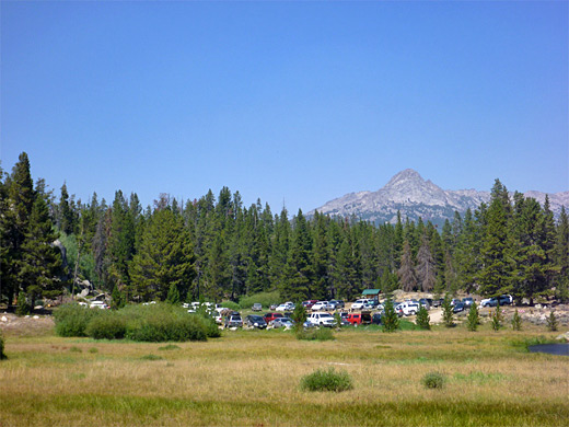
The highest, most glaciated and most remote section of the Wind River Range is in the north and center; peaks towards the south, while still very dramatic, are 1,000 feet or more lower in elevation, and require shorter hikes to reach. Major (paved or good quality gravel) roads into the mountains include (in the west) 352 and then FR10091 to the Green River Lakes, Fremont Lake Road to Elkhart Park (start point for hikes to Titcomb Basin), and Scab Creek Road, and in the east, Sinks Canyon Road/Louis Lake Road, Trout Creek Road to Moccasin Lake and Big Ridge Lane to Saint Lawrence Basin. The most popular trailhead, however, is probably Big Sandy, reached by a drive of at least 35 miles over unpaved tracks which become rather rough at the upper end, as from here a very scenic area known as Cirque of the Towers is within reach of a long day hike, 8.5 miles away and 1,700 feet up. This is the closest section of the mountain crest to a trailhead.
Trails of the Wind River Range
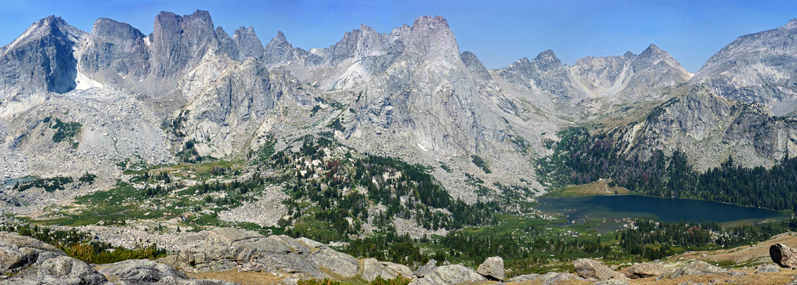
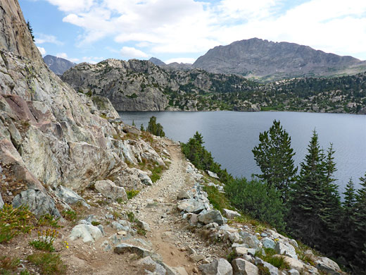
Cirque of the Towers
★★★★★
★★★★★
8.5 miles, 1700 feet
Spectacular glacial basin, surrounded on three sides by a curving line of 12,000 foot granite peaks. Reached by a long but not too difficult hike, mostly on the Big Sandy Trail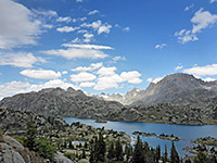
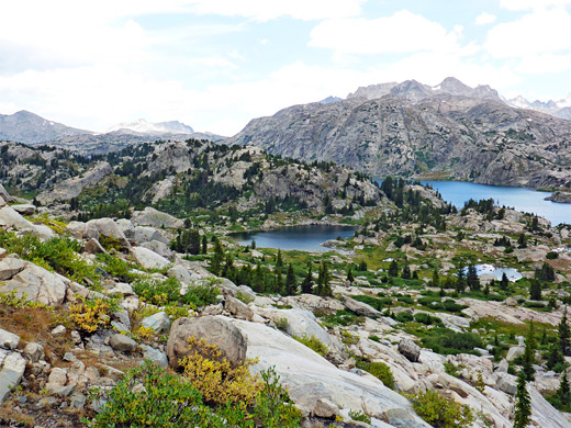
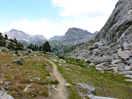
Titcomb Basin
★★★★★
★★★★★
12 miles, 1000 feet
Several beautiful lakes beneath stark, jagged peaks, reached by a long hike through forests, meadows and rocky terrainWind River Range - Nearby Places
- Grand Teton National Park - high, rugged, steep and spectacular mountain range
- Sinks Canyon State Park - short section of river that flows through a cave; in the eastern foothills of the Wind River Range
Wind River Range - Similar Places
- Rocky Mountain National Park - scenic and accessible section of the central Rockies in Colorado
- Uinta Mountains - high, sedimentary range in northeast Utah
All Contents © Copyright The American Southwest | Comments and Questions | Contribute | Affiliate Marketing Disclosure | Site Map