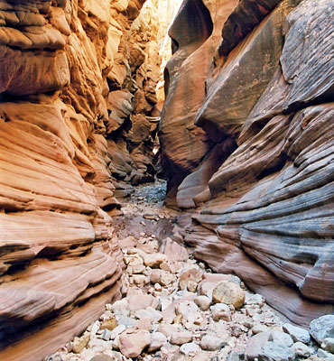
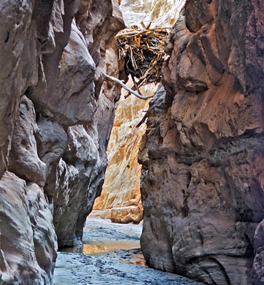
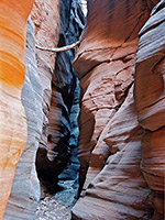
Slot canyons of the San Rafael Swell, Utah.
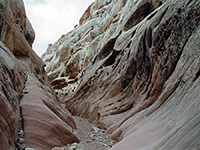
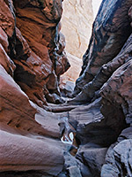
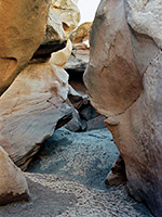
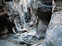
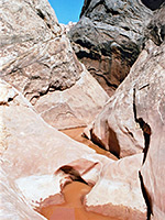
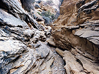
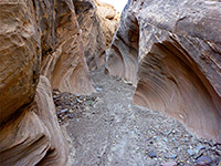
The northwest corner of the Colorado Plateau is a seldom explored wilderness area containing many narrow canyons amidst great expanses of colorful slickrock with arches and natural bridges, cliffs, ridges and mesas. This is the San Rafael Swell, a huge oval-shaped uplifted area bordered approximately by UT 24, US 6/191, UT 10 and the northern edge of Capitol Reef National Park, and bisected by I-70. Around the edges of the Swell is a ring of upturned eroded strata - the San Rafael Reef, where most of the slot canyons are located. The reef is steepest and widest on the east side, so here the canyons are deeper. The main area is from just northwest of the town of Green River, south alongside UT 24, past Goblin Valley State Park and further west to a particularly remote region known as the Moroni Slopes. There are over 30 canyons to explore along this part of the reef, and apart from a few near Goblin Valley (Bell/Little Wild Horse, Ding/Dang, Crack/Chute), all are remote, hidden and rarely visited. Some such as Quandary, Cable and Segers Hole require rappelling equipment and technical ability to overcome sheer drops and deep potholes.
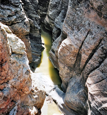
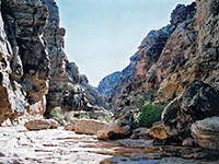
The central area is generally flat and barren - wide open plains with occasional buttes and ridges, but is crossed by two rivers forming deep canyons with branched tributaries. Both offer challenging narrows hiking; to the north, the San Rafael River flows into the Swell from Castle Dome and soon enters a deep layered canyon, seen most easily from the Wedge Overlook, a viewpoint that offers panoramic vistas of rocks and ravines - a kind of mini Canyonlands. Several miles downstream. the river enters a much narrower gorge with two extended sections, known as the Upper and Lower Black Boxes, that provide a hiking experience comparable to the Zion Narrows or the Paria River, and with similar fast flood dangers. South of I-70 is the lesser known Muddy Creek, which also has a deep dark section of over 10 miles ('The Chute'). As with the Black Boxes, hiking involves wading in the river most of the time and at least one overnight stay is required to see all of the canyon. The creek cuts through the San Rafael Reef near Hanksville and becomes the Dirty Devil River which joins Lake Powell at Hite.
Baptist Draw/Upper Chute Canyon
★★★★★
★★★★★
7 miles, 600 feet
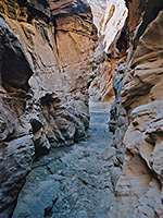
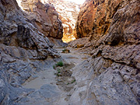
Long, deep and narrow slot canyons, perhaps the best in the Swell, through colorful, nicely eroded rocks; equal in beauty and extent to the Navajo canyons of PageBell Canyon
★★★★★
★★★★★
1.8 miles, 200 feet
Short ravine, not very narrow or enclosed, but bordered by nicely eroded rocks, with a great variety of textures and colors. Often hiked as part of a loop with adjacent Little Wild Horse Canyon.Cistern and Ramp Canyons
★★★★★
★★★★★
8.1 miles, 500 feet (loop)
Pair of deep canyons through the steeply-angled rocks at the southwest edge of the Swell, forming short narrows sections containing a few pools and chokestonesCrack Canyon
★★★★★
★★★★★
2.3 miles, 400 feet
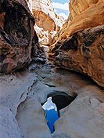
Three sections of angular narrows between more open sections, all likely to contain pools and mud. The surrounding rock is unusually varied in texture and color. Explorable as a short one-way hike or a longer loop through adjacent Chute CanyonCrawford Draw
★★★★★
★★★★★
1.5 miles, 200 feet
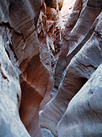
Upper tributary of Eardley Canyon, starting (via its own tributary, Reid Nelson Draw) with a photogenic section through fine stratified rock filled with long, semi-permanent pools, then a deeper stretch enclosed by spooky greyish rocksDing and Dang Canyons
★★★★★
★★★★★
6 miles, 500 feet (loop)
Two short ravines through the San Rafael Reef; quite narrow, though V-shaped and not enclosed, containing a selection of pools and chokestones. A good variety of rock textures en route.Devils Canyon
★★★★★
★★★★★
4.8 miles, 500 feet
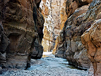
Deep canyon with a few slot sections and miles of medium-width passageways through dull-colored sandstone, joined many narrow, branched but fairly shallow tributariesEardley Canyon
★★★★★
★★★★★
5 miles, 800 feet
Spectacular, hidden ravine; an upper narrows section through inclined limestone of many thin layers, becoming much deeper downstreamFarnsworth Canyon
★★★★★
★★★★★
2.7 miles, 80 feet
Short, moderately narrow drainage through angled, thin-layered rocks. No obstructions, so easily explored; reached by a dirt track off the road to Goblin ValleyForgotten Canyon
★★★★★
★★★★★
1.8 miles, 300 feet
Short, moderately narrow but quite pretty slot towards the lower end of a much longer ravine, a tributary of Eagle Canyon on the west side of the SwellIron Wash, North Fork
★★★★★
★★★★★
10.5 miles, 600 feet
Remote, scenic, technical slot, the upper end of which can be seen without rappelling, though it still contains some deep potholes, and needs a long cross-country walk to reachLittle Wild Horse Canyon
★★★★★
★★★★★
1.8 miles, 400 feet
Most visited location in the Swell - a long, very narrow slot canyon through nicely colored rocks, easily accessed and not difficult to exploreMuddy Creek
★★★★★
★★★★★
9 miles, 450 feet
Deepest canyon in the Swell, containing a stream most of the year, flowing through 3 miles of narrows ('The Chute'), resembling some of the canyons in Zion National ParkMusic Canyon
★★★★★
★★★★★
4 miles, 1000 feet
East side tributary of Muddy Creek, deep and enclosed for just over a mile, and containing three sheer drops where ropes are neededThe central area is generally flat and barren - wide open plains with occasional buttes and ridges, but is crossed by two rivers forming deep canyons with branched tributaries. Both offer challenging narrows hiking; to the north, the San Rafael River flows into the Swell from Castle Dome and soon enters a deep layered canyon, seen most easily from the Wedge Overlook, a viewpoint that offers panoramic vistas of rocks and ravines - a kind of mini Canyonlands. Several miles downstream. the river enters a much narrower gorge with two extended sections, known as the Upper and Lower Black Boxes, that provide a hiking experience comparable to the Zion Narrows or the Paria River, and with similar fast flood dangers. South of I-70 is the lesser known Muddy Creek, which also has a deep dark section of over 10 miles ('The Chute'). As with the Black Boxes, hiking involves wading in the river most of the time and at least one overnight stay is required to see all of the canyon. The creek cuts through the San Rafael Reef near Hanksville and becomes the Dirty Devil River which joins Lake Powell at Hite.
Related Sections
- Goblin Valley State Park - thousands of strangely-shaped formations at the edge of the Reef
- The San Rafael Swell - general information, and map
All Contents © Copyright The American Southwest | Comments and Questions | Contribute | Affiliate Marketing Disclosure | Site Map