Highlights:
Vast area of the central Sierra Nevada, the majority hard-to-reach wilderness, containing canyons, lakes, waterfalls and scattered sequoia groves. Two accessible parts are the deep valley of the Kings River (centered on Cedar Grove), and Grant Grove, where many giant sequoia grow close to the highway
Nearby town:
Three Rivers, 41 miles
Management:
Location:
Seasons:
Kings Canyon - from mid April to November. Grant Grove - open all year, though subject to heavy winter snowfall
Rating (1-5):
★★★★★

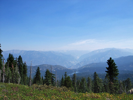
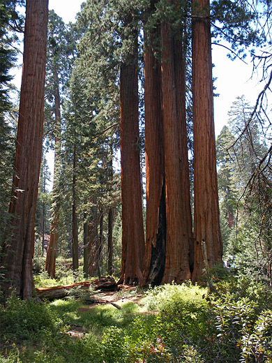
Kings Canyon National Park preserves a huge unspoilt and beautiful area of the central Sierra Nevada mountains, containing several deep glaciated canyons, countless lakes, pools, meadows and waterfalls, and over 20 peaks that exceed 13,000 feet. The park also shelters six groves of giant sequoia trees, found near the southern boundary which is shared with Sequoia National Park; the two are administered as one unit, and have similar scenery except that Sequoia has more of the huge trees.
Kings Canyon Table of Contents
- Maps
- Photographs
- Regions of the park; Kings Canyon and Grant Grove
- The canyon
- Highlights
- Hiking in Kings Canyon NP
- Tours of Kings Canyon
- Featured Kings Canyon trails
- Kings Canyon accommodation
- Nearby places
- Similar places
Maps
Kings Canyon and Sequoia National Parks, Cedar Grove, Grant Grove.
Photographs
Kings Canyon, Hotel Creek Trail, Roaring River Falls, Grant Grove, Big Stump Basin, Park Ridge, Dead Giant and Sunset Trails; All Kings Canyon photographs.
Kings Canyon - Regions
The main area of the national park, a scenic region of canyons and mountains, centered on Cedar Grove. Kings Canyon trails
The smaller, west section of the park, featuring giant sequoia trees. Contains a newtork of relatively easy trails, and plenty of visitor facilities
The Canyon
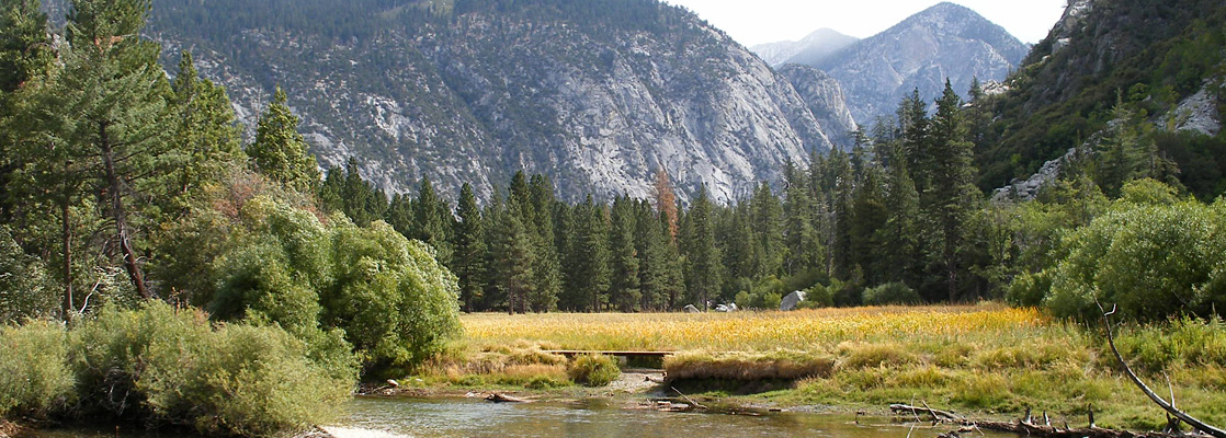
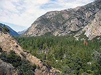
Kings Canyon is similar to Yosemite and Zion National Parks as the central attraction is a deep valley accessible from one end only, surrounded by huge areas of back-country that most people never visit. The canyon is not quite as immediately spectacular as these more famous destinations, but it is much less spoilt by development and very rewarding for the traveler who wants to do a little more than just drive along a road and stop at viewpoints. Vehicular access is even more limited than Yosemite as the dead-end canyon approach drive is the only road of any kind within the 462,000 acres of the park and so extended hiking is the only way to visit the wilderness areas.

Highlights of Kings Canyon
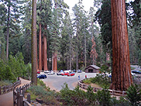
The centerpiece of the national park is Kings Canyon, formed by the South Fork of the Kings River - this is the deepest gorge in the US, although most lies outside the park to the west and forms the boundary between the Sequoia and Sierra National Forests. The steepest section has a drop of 8,000 feet, from Spanish Mountain at the north side of the canyon to the river, but there are no roads or even paths into this region. The lower, less steep western end may be reached by paved roads around Pine Flat Reservoir, 15 miles away in the western Sierra Nevada foothills, but most people come to visit the east section, accessed by the steep, winding and very scenic Highway 180. Facilities are concentrated at Cedar Grove, and include a visitor center, picnic areas, trailheads and several campgrounds. The giant sequoia are found in a smaller, detached, more easily reached section of the national park to the west (Grant Grove), bordering Sequoia National Park; besides the trees, the park road in this region also passes several viewpoints, three campgrounds and plenty more footpaths.
Hiking in Kings Canyon NP
The Pacific Crest Trail passes through the national park close to the eastern border, part of a continuous 2,640 mile footpath from Canada to Mexico, and the mountains are crossed by many other backcountry trails, which start from the main visitor center area at Cedar Grove, or outside the park - from the west in the Sierra National Forest and from Owens Valley in the east. For day hikes there are around 20 trails, centered on Grant Grove in the west section of the park and Cedar Grove/Kings River in the east.
Tours of Kings Canyon
Featured Kings Canyon Trails
Big Baldy
★★★★★
★★★★★
2.2 miles, 650 feet
The route to the granite summit of 8,209 foot Big Baldy is along a well marked trail through pine forest interspersed by open areas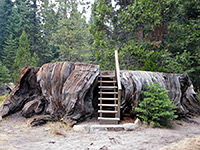
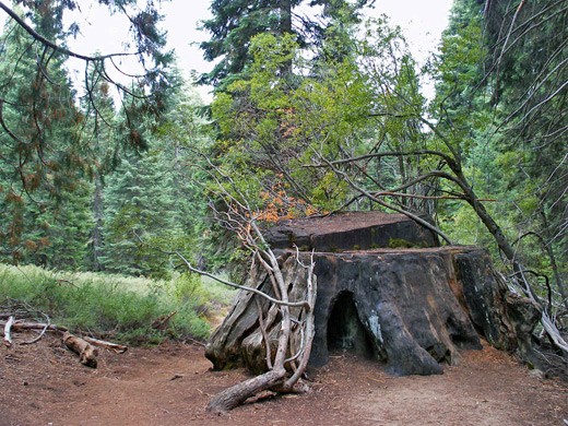
Big Stump
★★★★★
★★★★★
2 miles, 200 feet (loop)
This easy trail loops through a basin that was extensively logged in the 1880s but is now recovering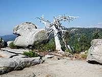
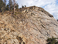
Buena Vista Peak
★★★★★
★★★★★
0.8 miles, 420 feet
This faint trail leads to a treeless, granite summit that has a 360 degree view over the surrounding forest, mountains and canyons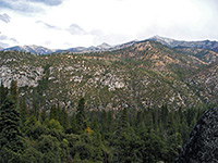
Don Cecil Trail
★★★★★
★★★★★
6 miles, 3300 feet
Long, steep route up the south side of Kings Canyon. Sheep Creek Cascade is reached after 1 mile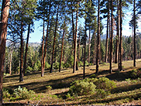
Hotel Creek/ Cedar Grove Overlook
★★★★★
★★★★★
3 miles, 1500 feet
Steep climb up the north side of Kings Canyon, through varied vegetation. A side trail leads to a promontory overlooking Cedar Grove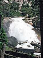
Mist Falls
★★★★★
★★★★★
4 miles, 800 feet
One of Kings Canyon's more spectacular cascades, Mist Falls are reached by a relatively easy trail that starts from the end of the park road and follows the flat valley floor eastwards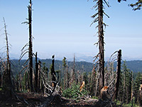
Park Ridge
★★★★★
★★★★★
2.3 miles, 200 feet
Fairly level path following a partly forested ridge that provides good views east and west, ending at a working fire lookout station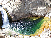
Roaring River Falls
★★★★★
★★★★★
0.2 miles, 40 feet
This easy, popular, paved path follows Roaring River, a south side tributary of the Kings River, to a 40 foot cascade at the edge of the valley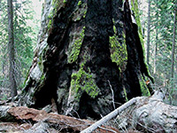
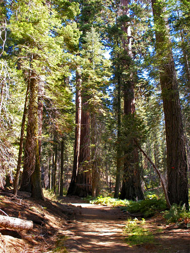
Sequoia Lake Overlook/Dead Giant
★★★★★
★★★★★
5 miles, 900 feet (loop)
Intersecting routes through the dense, little-visited forest west of Hwy 180, encountering many large sequoia, a secluded waterfall and a viewpoint of Sequoia Lake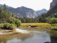
Kings Canyon Hotels
The main towns with hotels close to Kings Canyon National Park are Three Rivers (41 miles), Dinuba (61 miles), Visalia (72 miles) and Fresno (73 miles) - distances from the CA 180-245 road junction near Grant Grove.
Kings Canyon - Nearby Places
- Big Pine Lakes - beautiful glacial lakes just east of Kings Canyon, but 300 miles away by road
- Sequoia National Park - sequoia trees and granite mountains, bordering Kings Canyon NP to the south
Kings Canyon - Similar Places
- Rocky Mountain National Park - high mountains in north Colorado
- Yosemite National Park - mountains, lakes, meadows, forests and canyons
All Contents © Copyright The American Southwest | Comments and Questions | Contribute | Affiliate Marketing Disclosure | Site Map