Highlights:
Popular town beside the Colorado River, surrounded by spectacular red rock landscapes of canyons, cliffs, fins, pinnacles and arches, plus ancient ruins and rock art. World-famous center for all kinds of recreation including fishing, rafting, hiking, biking, off-roading and skiing
Nearby town:
Location:
Seasons:
All year
Rating (1-5):
★★★★★
Weather:


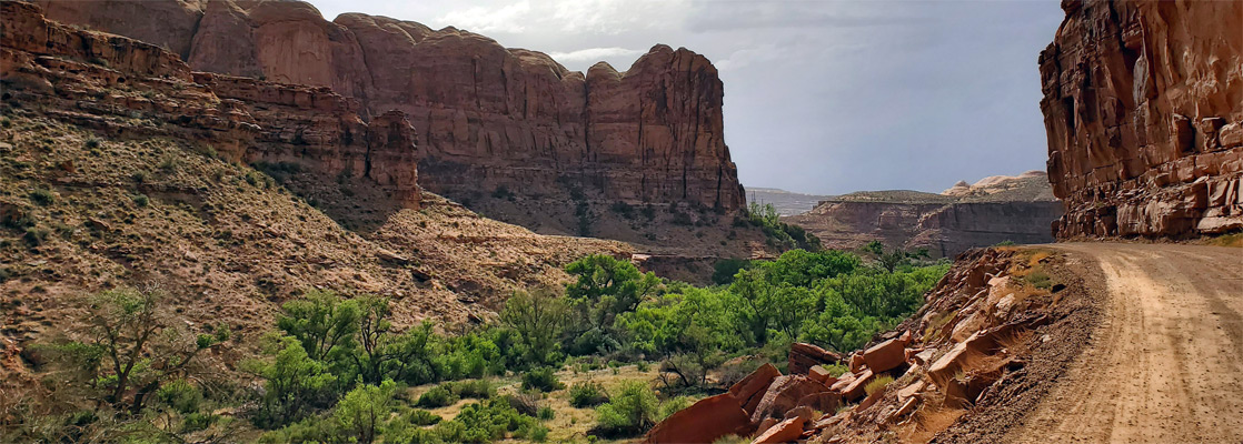
Potash Road
Paved, 15 mile road through the deepening canyon of the Colorado River west of Moab, passing many scenic locations
Paved, 15 mile road through the deepening canyon of the Colorado River west of Moab, passing many scenic locations
Featured Hotel
Fairfield Inn Moab
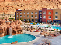 Along the northern approach to town (US 191), in a lightly developed area close to the Colorado River, beside the lower end of Courthouse Wash
Check Rates
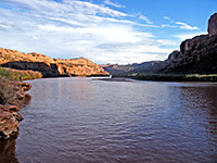
Moab is the biggest town in southeast Utah, though the population is relatively low, around 5,400, based mostly within 2 miles of the center; on the flat land of Spanish Valley just south of the Colorado River, framed by dramatic red cliffs on both sides. But in the warmer seasons the number of people may be two or three times as many, due to visitors, the majority here to see the two famous national parks nearby; Arches, the entrance to which is just 5 miles north of town, and Canyonlands, the Island in the Sky district being 30 a mile drive to the west. The less-visited Needles section is 70 miles away, still easily within reach of a day trip.
Outside the two well-known parks, the scenery is almost as spectacular, and many days can be spent exploring. Much of the land around Moab is a series of low sandstone plateaus, incised by branched, sheer-walled canyons, some containing permanent streams, and filled with eroded formations, including plenty more arches. Strata are from the Glen Canyon Group, most prominently Navajo sandstone, Entrada sandstone and Wingate sandstone. Rock art is abundant, and the whole region is crossed by many tracks and paths.
Outside the two well-known parks, the scenery is almost as spectacular, and many days can be spent exploring. Much of the land around Moab is a series of low sandstone plateaus, incised by branched, sheer-walled canyons, some containing permanent streams, and filled with eroded formations, including plenty more arches. Strata are from the Glen Canyon Group, most prominently Navajo sandstone, Entrada sandstone and Wingate sandstone. Rock art is abundant, and the whole region is crossed by many tracks and paths.
Moab Table of Contents
Location
Map of Moab, showing roads, trails, canyons, arches and rock art sites.
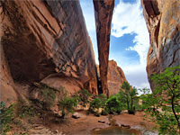
Photographs
Grandstaff Canyon, Hidden Valley.
Introduction
Moab is a major center for recreation, year-round, even in winter when the nearby La Sal Mountains offer skiing and other Alpine sports. Off-roading and mountain biking are popular all year, while the Colorado River hosts a full range of water-based activities. The town itself is unremarkable, but provides all necessary facilities, mostly along the main road, US 191 - there are several dozen hotels, a wide range of shops, a number of RV sites, and all kinds of rental and guiding businesses. Free camping opportunities have become somewhat limited in recent years, owing to the increasing visitor numbers; still permissible locations include along the south end of the La Sal Mountain Loop Road (Hwy 127) and in the open ground on the east side of the highway, a few miles north of the Colorado River.
Moab Tours
Explore the scenery by 4WD or rafting.
US 191 and the Colorado River divide the land around Moab into four equally-sized segments, north, east, south and west of town.
Moab - The North
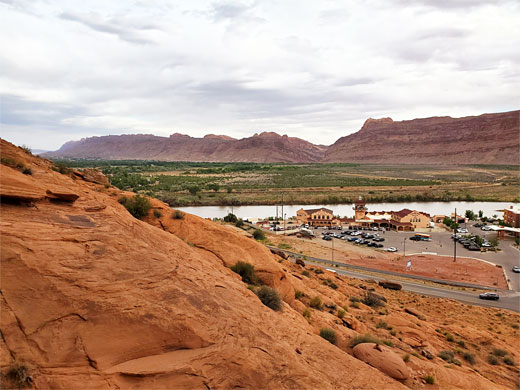
In the north, most of the land is contained within Arches National Park, the south edge of which borders the Colorado River; a line of sheer cliffs of Navajo and Kayenta sandstone without any overland access. West of the park, adjacent to US 191, is a belt of flattish land with some areas used for primitive camping, and a couple of other sites; the recently-created (2021) Utahraptor State Park, a quarry where Cretaceous-era dinosaur fossils have been extracted, and the Moab Isolation Center Ruins, location of a World War II camp where Japanese Americans were detained. At the southern tip of this region, beside the US 191 bridge over the Colorado, is one of the most accessible rock art panels around Moab, on a cliff above the lower end of Courthouse Wash.
Moab - The East
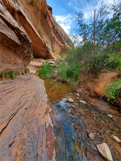
There is one main route east of Moab, scenic Hwy 128 that follows the south bank of the Colorado River and eventually meets Interstate 70 near the old railway settlement of Cisco. Along here are one trailhead, for the popular hike to Grandstaff Canyon and Morning Glory Arch, several riverside recreation sites and campgrounds, the photogenic formations of the Fisher Towers, and a number of other canyons including Professor Creek and Onion Creek. A side road leads to Castle Valley, a photogenic area lined by pinnacles and fins, home to a small settlement. The road continues to form the northern end of the La Sal Mountain Loop, the other side meeting US 191 a few miles south of Moab. Between the valley, the town and the mountains are two lengthy, branched canyons, Grandstaff and Mill Creek, both protected as wilderness study areas, and surrounded by vast areas of slickrock - this is the main location for off-roading and mountain biking.
Moab - The South
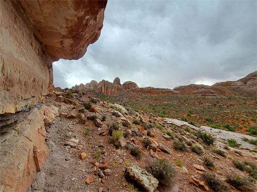
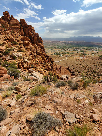
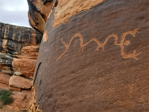
Southwest of Moab, 3 miles of the south bank of the Colorado River is followed by Kane Creek Road, past Moonflower Canyon, to the mouth of Kane Springs Canyon, a much bigger tributary, whereupon the road becomes unpaved and heads southwards, upstream along this canyon, deep into the backcountry, to more arches, rock formations, petroglyphs and viewpoints. Between here and US 191 is a big expanse of much jumbled rock, fins and canyons known as Behind the Rocks, also a wilderness study area, in which are yet more arches, though much is somewhat inaccessible; the only other main cross-country route, a 4WD track, is along Pritchett Canyon, which meets the Colorado just east of Kane Springs Canyon. Along the east edge of this region, reached by a popular trail from US 191, is Hidden Valley, a flat, elevated area with petroglyphs at its upper end.
Moab - The West
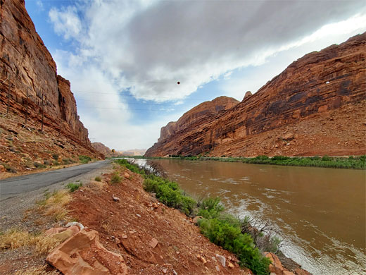
West of US 191 and north of the Colorado River are two paved routes. Potash Road, Hwy 279, is another scenic highway, along the north bank of the Colorado River, past arches, rock art sites, dinosaur tracks and rock-climbing locations, and meeting the Shafer Trail that climbs into Canyonlands National Park. Highway 313 is the main road to Canyonlands, leaving US 191 11 miles north of Moab and initially following a short ravine, Seven Mile Canyon, again with rock art panels, both on the cliffs facing the road and along the south fork of the canyon, explored by a trail. Lesser, unpaved roads lead to many other scenic places in the vicinity, both north and south of Highway 313, including the Gemini Bridges, the Secret Spire, Delta Pool, Determination Towers, Merrimac and Monitor Buttes, together with a number of other arches and petroglyph panels.
Hiking near Moab
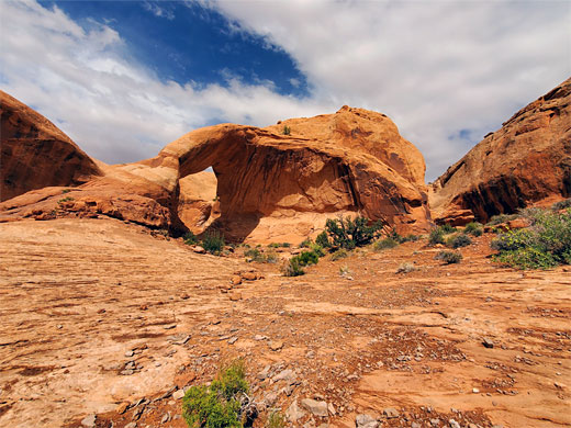
Grandstaff Canyon
★★★★★
★★★★★
2.6 miles, 300 feet
Popular route along a riparian ravine to a huge natural bridge, at the end of a narrow side canyon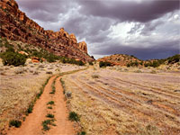
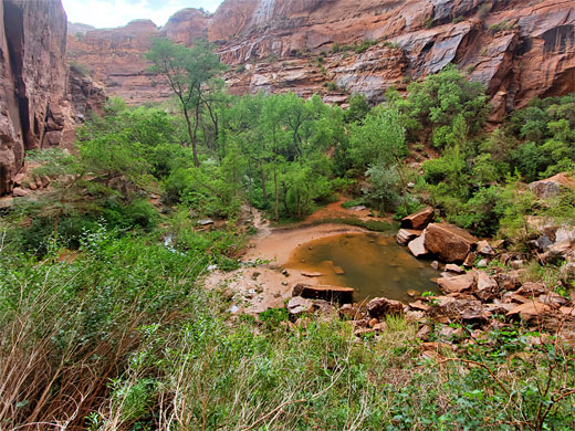
Hidden Valley
★★★★★
★★★★★
2.5 miles, 700 feet
Path up a steep slope with great views, then along a sheltered valley, to a petroglyph-covered cliff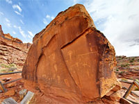
Kane Creek Road
★★★★★
★★★★★
Up to 0.4 miles
Scenic backroad alongside the Colorado River and up the side canyon of Kane Springs Creek, past petroglyphs and rock formations; various short hikes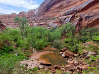
Moonflower Canyon
★★★★★
★★★★★
0.4 miles, 160 feet
Short Colorado River tributary along Kane Creek Road ending at a pool below towering cliffs. At the canyon mouth are several petroglyph panels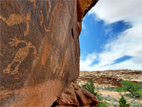
Sevenmile Canyon
★★★★★
★★★★★
2.6 miles, 100 feet
Rock art in the main and south forks of a red-walled canyon, along the road to Canyonlands NPMoab - Nearby Places
- Arches National Park (5 miles) - world-famous red rock arches
- La Sal Mountains (20 miles) - isolated range containing several peaks over 12,000 feet
Moab - Similar Places
- Mexican Hat, Utah - small village close to many spectacular landscapes
- St George, Utah - city near many major attractions including Zion and Snow Canyon
All Contents © Copyright The American Southwest | Comments and Questions | Contribute | Affiliate Marketing Disclosure | Site Map