Highlights:
Varied landscapes at the edge of the hills north of St George - white cliffs, red sandstone outcrops and black lava deposits, with Mojave Desert vegetation and wildlife. Also in the region are lava caves and extinct volcanoes. Crossed by 20 miles of intersecting trails
Nearby town:
St George, 8 miles
Management:
Location:
Seasons:
All year
Rating (1-5):
★★★★★
Weather:


Featured Hotel
Best Western Coral Hills
 Popular hotel with an elevated position on the north side of St George, 6 miles from Snow Canyon. Free hot breakfast and an outdoor pool
Check Rates
Snow Canyon is tucked away in the hills northwest of St George, close to the transition between the Color Country of southwestern Utah and the rather more barren Basin and Range landscape that persists all the way across Nevada.
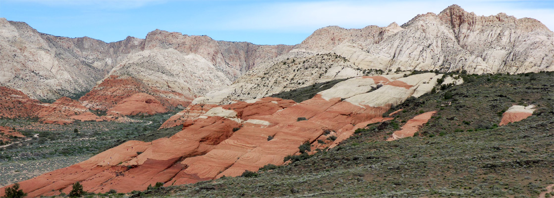
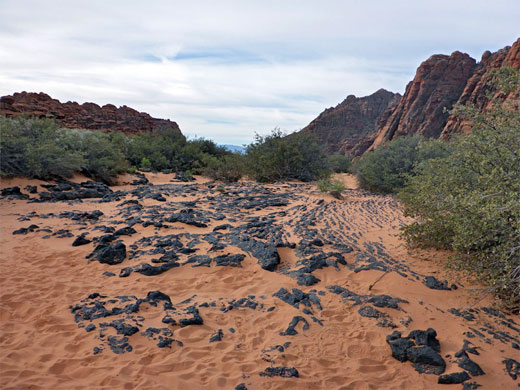
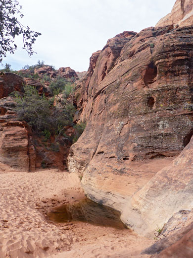
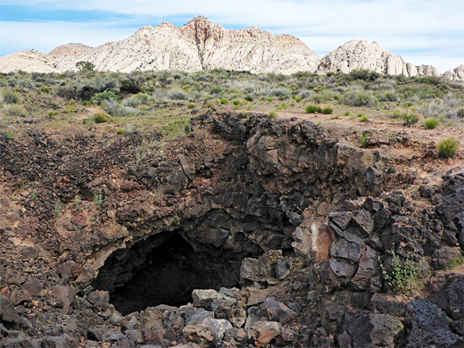
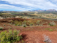
To one side of the canyon lie the Red Mountains, while a few miles away are the White Hills, and eroded sandstone rocks of both colors make up the cliffs at either side of the valley, while an even greater contrast is provided by a large mass of black lava, which originated from a cluster of volcanoes just beyond. The lava, plus associated cinder cones and caves are the main points of interest of what is a particularly colorful, scenic and little-visited location.
To one side of the canyon lie the Red Mountains, while a few miles away are the White Hills, and eroded sandstone rocks of both colors make up the cliffs at either side of the valley, while an even greater contrast is provided by a large mass of black lava, which originated from a cluster of volcanoes just beyond. The lava, plus associated cinder cones and caves are the main points of interest of what is a particularly colorful, scenic and little-visited location.
Snow Canyon Table of Contents
- Map of the state park
- Photographs
- Location
- Lava caves
- Scenery of Snow Canyon
- Hiking
- Nearby places
- Similar places
Map
Map of Snow Canyon State Park.
Location
Snow Canyon State Park is quite well hidden, which may be why visitation is relatively low. One road runs through the canyon, linking UT 18 with a lesser road (Center Street/Snow Canyon Parkway), from St George to the little towns of Ivins and Shivwits, location of a small Indian reservation. Extensive housing development is underway in this area, which has alternating patches of red earth and black lava - the buildings are part of the fast expanding suburbs of St George. There are few signposts to the park, but when found the entrance is reached just after the road passes a brand new luxurious estate, its houses extending right to the park boundary. One mile north of the far end of the scenic drive, along UT 18, are several extinct volcanoes - overlooking the east side of the highway on Lava Ridge, and it was eruptions from here, thousands of years ago, that sent molten rock through the valley leaving deposits hundreds of feet thick.
Lava Caves
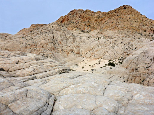
The best viewpoints are around the north end of Snow Canyon, near the junction of the park drive with UT 18, and the most popular trail begins near here. The 1.1 mile Lava Flow Trail crosses the twisted lava field and passes at least four lava caves, which were formed when the outer edges of a lava stream cooled and solidified while the main flow continued beneath, and later drained away. Some of these caverns are large, but all seem to extend for only a few hundred feet before becoming blocked. The rocks are sharp and jagged, passages are often narrow and there are some quite deep openings in the lava surface, so some care is necessary when exploring. Other trails lead to more lava outcrops, narrow canyons, sand dunes, pioneer signatures, arches and eroded rock formations.
Snow Canyon Scenery
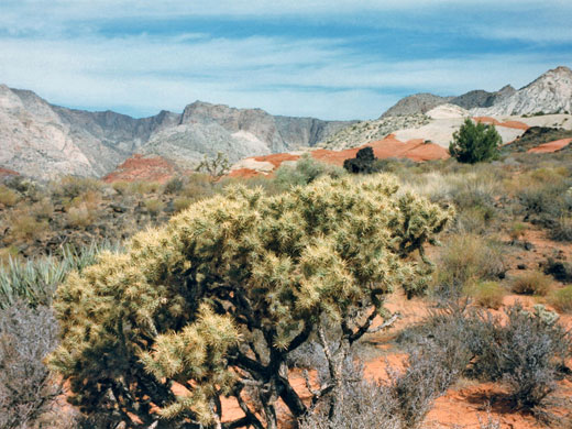
Occasional islands of layered red sandstone rocks rise above the black lava; these are easy to climb and provide excellent vantage points for photography. The canyon also has a selection of desert plants, which add another element to the medley of colors and forms, especially during the spring wildflower season. Sand dunes are scattered around the edges of the valley, and several locations on the enclosing cliffs have panels of ancient Indian petroglyphs.
Trails of Snow Canyon State Park
All Snow Canyon trails.
Featured Snow Canyon Trails
Cinder Cone Trail
★★★★★
★★★★★
1.1 miles, 380 feet
Short, steep path to a volcanic summit along Hwy 18; panoramic views in all directions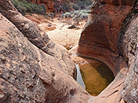
Three Ponds Trail
★★★★★
★★★★★
1.8 miles, 110 feet
Varied route through ravines and sandstone ridges, up a sandy drainage to very short slot canyon containing watery potholes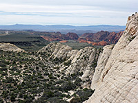
Whiterocks and Lava Flow Trails
★★★★★
★★★★★
3.9 miles, 650 feet (loop)
Sandy flats, red and white sandstone, lava caves and a high viewpointSnow Canyon - Nearby Places
- Beaver Dam Mountains Wilderness (25 miles) - rugged, colorful mountains in northwest Arizona
- Gunlock State Park (15 miles) - reservoir enclosed by red, sandy hills
- Sand Hollow State Park (24 miles) - red rocks, sand dunes and a reservoir
- Santa Clara River Reserve (4 miles) - riparian valley, desert hills and petroglyphs
Snow Canyon - Similar Places
- El Malpais National Monument, New Mexico - extensive lava flows through a wide sandstone valley
- Red Rock Canyon NCA, Nevada - white, grey and red rock formations surrounded by Mojave Desert plains
All Contents © Copyright The American Southwest | Comments and Questions | Contribute | Affiliate Marketing Disclosure | Site Map