Highlights:
Popular state park featuring a reservoir surrounded by red rocks, sand dunes and a volcanic mesa, within sight of high mountains in all directions. Camping, boating, off-roading and fishing are the main activities
Nearby town:
Hurricane, 8 miles
Management:
Location:
Seasons:
All year - this area is mild even in winter
Rating (1-5):
★★★★★
Weather:


Featured Hotel
Quality Inn Zion Park Area
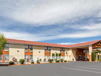 Affordable, centrally located Hurricane hotel, 8 miles from Sand Hollow, walking distance from shops, restaurants and a cinema. Hot breakfast is complimentary
Check Rates
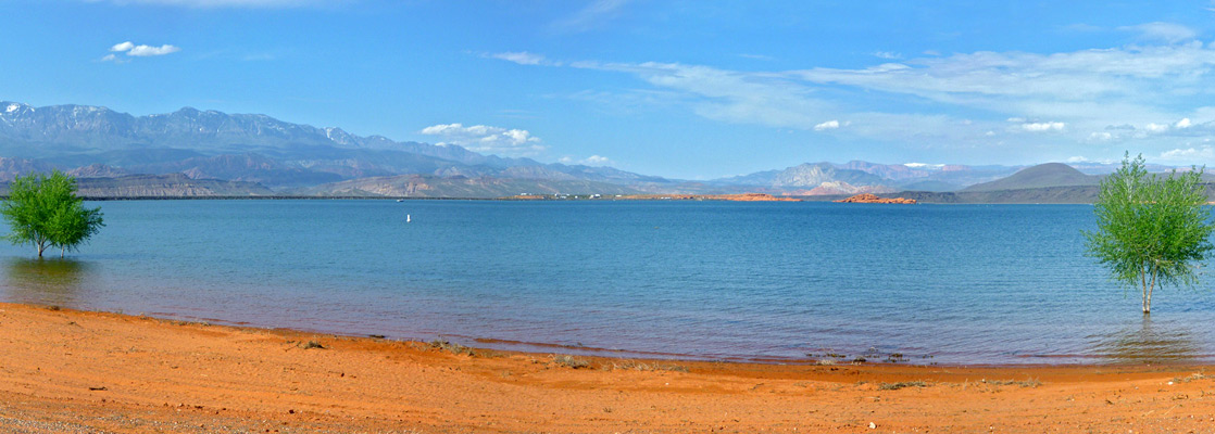
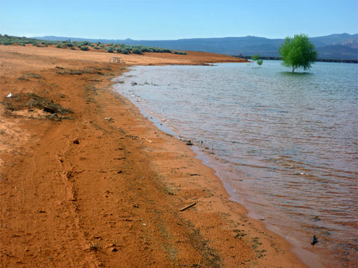
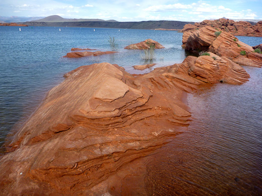
Sand Hollow is one of Utah's newest and most visited state parks, open 2003, and like many others is centered on an artificial lake, here occupying a sandy basin with desert surroundings, 15 miles (by road) from St George in the southwest corner of the state. In some respects the reservoir resembles a tiny version of Lake Powell, containing clear blue water, pleasantly warm most of the year, and lined in part by eroded red sandstone, and in other places by wide, sandy beaches, plus a causeway to the west and a black, volcanic mesa to the northeast.
In the distance, across the flat, open surroundings, are several mountain ranges including the steep-sided Pine Valley Mountains, the Hurricane Cliffs, and the White Cliffs of Zion National Park with the high country of the Kolob Terrace visible beyond, and so the scenery around the state park is quite impressive yet most visitors come here for the usual recreation activities, principally boating, swimming, fishing (for blue gill and bass), camping and ORV use, as the park also has an extensive area of orange-red dunes to the south (Sand Mountain).
In the distance, across the flat, open surroundings, are several mountain ranges including the steep-sided Pine Valley Mountains, the Hurricane Cliffs, and the White Cliffs of Zion National Park with the high country of the Kolob Terrace visible beyond, and so the scenery around the state park is quite impressive yet most visitors come here for the usual recreation activities, principally boating, swimming, fishing (for blue gill and bass), camping and ORV use, as the park also has an extensive area of orange-red dunes to the south (Sand Mountain).
Sand Hollow Table of Contents
- Map of the state park
- Photographs
- Access and facilities
- Shoreline of Sand Hollow Reservoir
- Tours of Sand Hollow, by ATV
- Nearby places
- Similar places
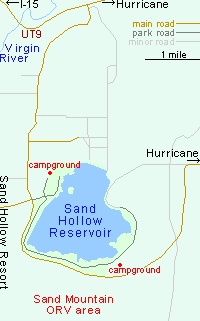
Map of Sand Hollow State Park
Photographs
8 views of Sand Hollow State Park.
State Park Access and Facilities
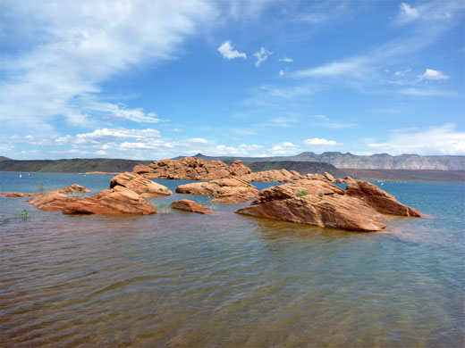
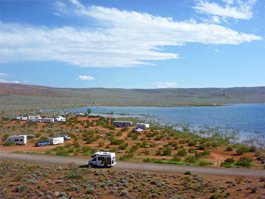
The main access to Sand Hollow State Park is via a wide, bendy route up the south side of the Virgin River valley from UT 9, passing a mixture of new housing estates and empty lands ripe for future development. A left turn after a few miles leads to the park, for which entry is relatively expensive at $20 per vehicle (2024), while a right turn enters Sand Hollow Resort (golf, residences and vacation rentals), and straight on is an alternative approach route from Hurricane. The entrance road ends at a large parking area, adjacent to a boat launch, a few narrow beaches and a viewpoint of the Island, a red Navajo sandstone outcrop 500 feet from the shore. Other, smaller semi-submerged red rocks are reachable by paddling, while the most popular waterfront area is a little way north, where a red ridge slopes down to the lake, forming rocky coves and small beaches. The nearby Westside Campground caters for tents or RVs, offering 59 full hookup sites.
Shoreline of Sand Hollow Reservoir
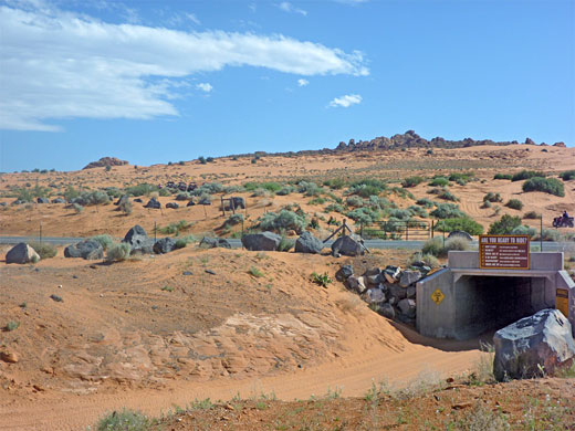
The majority of the shore is reachable by a side road that initially heads south parallel to the causeway then turns east past the gently sloping sandy shore, and curves back to the north where the edge of the lake is more overgrown, though still with small, private coves where it is possible to park or camp right beside the water. The road ends with a short unpaved section leading to another primitive camping area, set beneath the 200 foot high volcanic mesa. Also on the south side of the road is the ORV staging area, from where the vehicles cross under the adjacent highway via a tunnel and are free to explore 16,000 acres of sandy terrain beyond, rising to a highpoint of 4,182 feet at the summit of Sand Mountain.
Sand Hollow Tours
Explore the dunes by ATV.
Sand Hollow - Nearby Places
- Coral Pink Sand Dunes State Park (51 miles) - salmon-colored dunes beneath the Vermilion Cliffs
- Snow Canyon State Park (24 miles) - red rocks, white cliffs and black lava, north of St George
- Zion National Park (31 miles) - sheer cliffs and deep canyons
Sand Hollow - Similar Places
- Gunlock State Park (10 miles) - reservoir enclosed by red, sandy hills
- Lake Powell - spectacular reservoir at the center of red rock landscapes
All Contents © Copyright The American Southwest | Comments and Questions | Contribute | Affiliate Marketing Disclosure | Site Map