Cinder Cone Trail, Snow Canyon State Park
Utah > Snow Canyon State Park > Hiking > Cinder Cone Trail
Cinder Cone Trail
Short, steep path to a volcanic summit along Hwy 18; panoramic views in all directions. The trail crosses some piles of jagged lava then winds up the cinder-covered sides of the cone, ending with a short loop around the crater at the top
Length: 1.1 miles
Elevation change: 380 feet
Difficulty: Easy to moderate - short but steep, with some loose stones underfoot
Type: One way
Usage: Low to medium
Season: All year
Trailhead: Parking area along Hwy 18
Rating (1-5): ★★★★★
Elevation change: 380 feet
Difficulty: Easy to moderate - short but steep, with some loose stones underfoot
Type: One way
Usage: Low to medium
Season: All year
Trailhead: Parking area along Hwy 18
Rating (1-5): ★★★★★

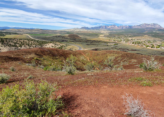
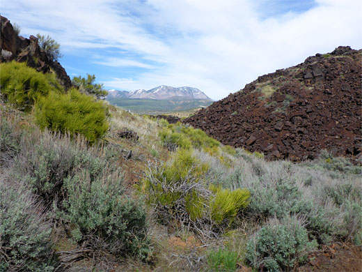
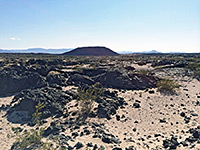
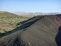
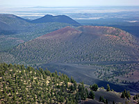
Cinder Cone, also known as Diamond Cinder Cone, is a circular volcanic summit, high point 4,575 feet, rising about 200 feet above the surrounding flat land in the northeast corner of Snow Canyon State Park, formed entirely of cinders, red or black, with lava mounds to one side. The lava extends northwards about a mile, incorporating a smaller peak, North Cinder Cone, just outside the park, close to the settlement of Diamond Valley.
Hwy 18 runs right past the main peak, and this area may be explored by the 1.8 mile Cinder Cone Trail, which passes through the lava deposits then winds up the south and west sides, ending with a 0.3 mile loop around the rim of the crater on top. At one time the whole hike was a loop, returning via a steeper path down the north face of the cone, but this was closed several years ago due to excessive erosion, though some people are ignoring this and creating new, unofficial routes down the slopes.
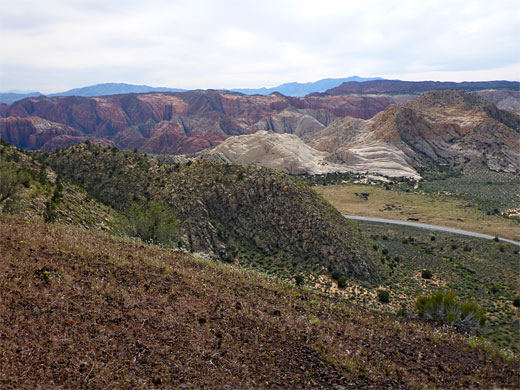
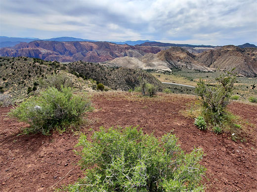
Overall, the hike, though short, is enjoyable and varied, different from others in the park, and just a little bit testing, being steep towards the end and over some surfaces covered with loose stones. The views change as the path curves around the summit, from the Pine Valley Mountains in the east to the red and white sandstone of Snow Canyon to the west. The immediate surroundings also change, from the lava, to stony, grassy slopes with scattered wildflowers, to bare ash on the summit. The round trip takes not much more than an hour.
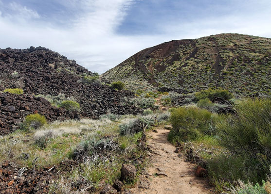
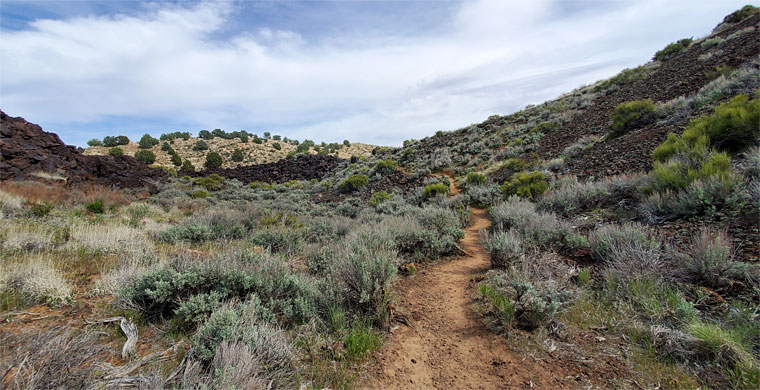
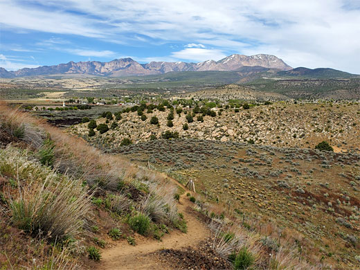
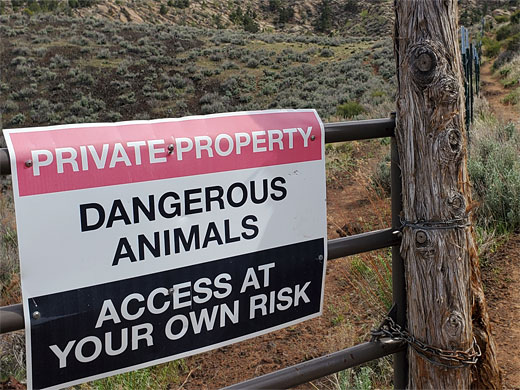
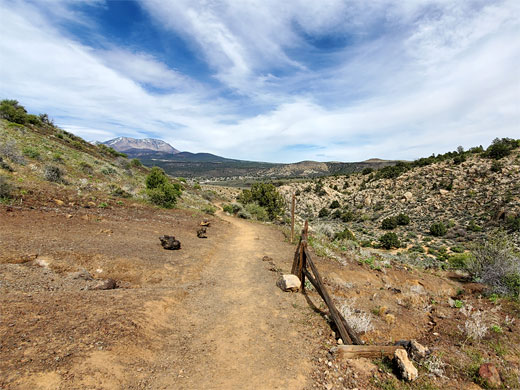
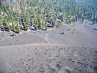
The Cinder Cone trailhead is along the highway; no entry fee is required. From the small roadside parking place, the path heads south, across jumbled piles of black lava, past a 'Trail Closed' notice, at the lower end of the former return path from the summit. The lava is completely unvegetated in some areas, in other places colonised with grasses and shrubs. The trail moves into less uneven terrain on the south side of the cone, alongside a fence for a while at the boundary of private land, almost level at this point, then begins to climb, initially up to a saddle linking with a boulder-covered sandstone ridge, which affords the first good views of the main area of the park off to the west.
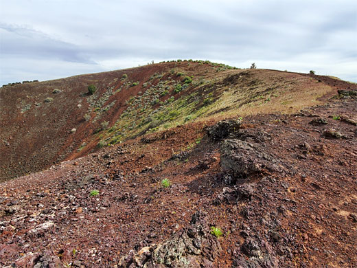
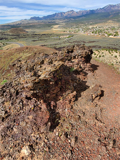
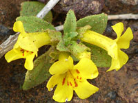
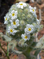
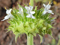
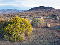
The last section is the steepest, up increasingly barren slopes, still scattered with small-flowered plants such as annual redspot monkey flower. The path reaches the summit at its highpoint then loops around the crater rim, descending by 100 feet to the low point on the far side. Another very short path leads down to the middle of the crater.
Hwy 18 runs right past the main peak, and this area may be explored by the 1.8 mile Cinder Cone Trail, which passes through the lava deposits then winds up the south and west sides, ending with a 0.3 mile loop around the rim of the crater on top. At one time the whole hike was a loop, returning via a steeper path down the north face of the cone, but this was closed several years ago due to excessive erosion, though some people are ignoring this and creating new, unofficial routes down the slopes.
Overall, the hike, though short, is enjoyable and varied, different from others in the park, and just a little bit testing, being steep towards the end and over some surfaces covered with loose stones. The views change as the path curves around the summit, from the Pine Valley Mountains in the east to the red and white sandstone of Snow Canyon to the west. The immediate surroundings also change, from the lava, to stony, grassy slopes with scattered wildflowers, to bare ash on the summit. The round trip takes not much more than an hour.
The Trail
The Cinder Cone trailhead is along the highway; no entry fee is required. From the small roadside parking place, the path heads south, across jumbled piles of black lava, past a 'Trail Closed' notice, at the lower end of the former return path from the summit. The lava is completely unvegetated in some areas, in other places colonised with grasses and shrubs. The trail moves into less uneven terrain on the south side of the cone, alongside a fence for a while at the boundary of private land, almost level at this point, then begins to climb, initially up to a saddle linking with a boulder-covered sandstone ridge, which affords the first good views of the main area of the park off to the west.
The Summit
The last section is the steepest, up increasingly barren slopes, still scattered with small-flowered plants such as annual redspot monkey flower. The path reaches the summit at its highpoint then loops around the crater rim, descending by 100 feet to the low point on the far side. Another very short path leads down to the middle of the crater.
Cinder Cone Trail - Similar Hikes
All Contents © Copyright The American Southwest | Comments and Questions | Contribute | Affiliate Marketing Disclosure | Site Map