The American Southwest
Home | Parks | Trails | Plants | Canyons
Maps | Landscapes | Site Map | Whats New? |
More...
Follow americansouthwest.net on Facebook
×
General Pages
Home
Parks
Trails
Plants
Slot Canyons
Maps
Landscapes
Itineraries
Site Map
What's New?
More pages...

States
Arizona
California
Colorado
Idaho
Nevada
New Mexico
Oregon
Texas
Utah
Wyoming


ARIZONA
CALIFORNIA
COLORADO
IDAHO
NEVADA
NEW MEXICO
OREGON
TEXAS
UTAH
WYOMING
UTAH
MAPS | PARKS | TRAILS | HOTELS

Map of Snow Canyon State Park


Utah > Snow Canyon State Park > Park Map
Map of Snow Canyon State Park


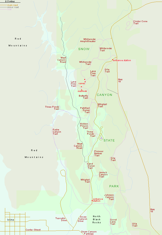
Hwy 18 from St George runs along the east edge of Snow Canyon State Park and passes two trailheads (Cinder Cone, Whiterocks), but most facilities are along the 4.5 mile scenic drive that follows the main valley, accessed from the west via Center Street through Ivins, and from the south along Snow Canyon Parkway.

Back to Top
Arizona | California | Colorado | Idaho | Nevada | New Mexico | Oregon | Texas | Utah | Wyoming | Slot Canyons | Travelogue | SOUTHWEST

All Contents © Copyright The American Southwest | Comments and Questions | Contribute | Affiliate Marketing Disclosure | Site Map