
Crater Mountain
Off-trail walk over open terrain, through black and red lava formations, to a flattish volcanic summit overlooking Owens Valley
Length: 1.8 miles
Elevation change: 1,130 feet
Difficulty: Easy to moderate
Type: One way, off-trail
Usage: Very low
Season: Spring to fall
Trailhead: Side track along McMurray Meadows Road, 4 miles from Big Pine
Rating (1-5): ★★★★★
Elevation change: 1,130 feet
Difficulty: Easy to moderate
Type: One way, off-trail
Usage: Very low
Season: Spring to fall
Trailhead: Side track along McMurray Meadows Road, 4 miles from Big Pine
Rating (1-5): ★★★★★

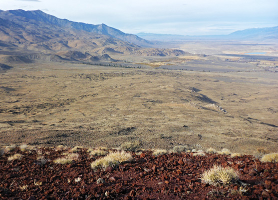
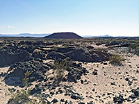
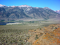
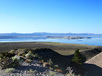
Crater Mountain is one of the more prominent components of the 190 square mile Big Pine Volcanic Field, in Owens Valley on the east side of the Sierra Nevada. The mountain is a volcanic cone, 6,110 feet high, rising up to 2,000 feet above the surroundings; approximately circular in outline with a flat summit, which affords spectacular views up and down the valley and across to the mountains on either side. The slopes are home to surprisingly varied vegetation, and are frequented by tule elk, amongst other creatures.
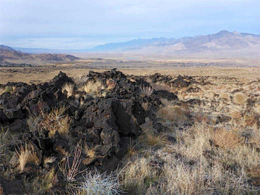
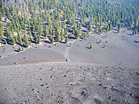
The lava field created by the cone extends 5 miles north to south and 3 miles west to east; its eastern edge is paralleled for several miles by US 395. There are no trails in this region, but the top of the mountain may be reached by a relatively easy cross-country walk of up to 1.8 miles, initially across grassy slopes with sagebrush and tumbleweed then through outcrops of black aa lava and finally through reddish ash deposits as the terrain steepens, approaching the summit. The peak and its lava are protected as the Crater Mountain Wilderness Study Area, 7,500 acres.
The crater, which can be seen for many miles along the valley, is quick to reach from Big Pine, by driving 2.6 miles along Glacier Lodge Road then turning left, continuing on McMurray Meadows Road, which is unpaved but has a firm, smooth surface, fine for all vehicles. This road climbs slowly over open ground past many good places for free camping. One suitable parking place is at the end of a little spur track beside a fenced enclosure; this after 1.2 miles, leaving a hike of 1.8 miles, though continuing further on the road, gradually closer to the peak, can reduce the hike to 1.2 miles.
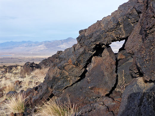
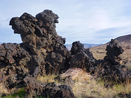
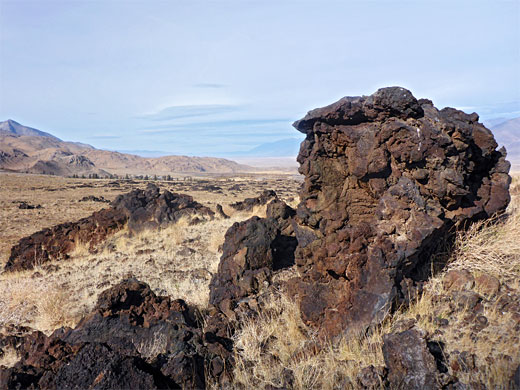
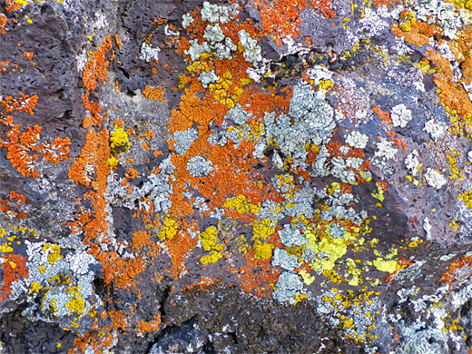
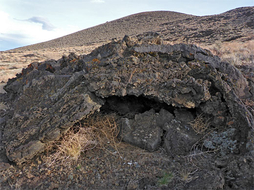
The suggested parking place is 900 feet from the edge of the lava field, separated by a band of sagebrush and other vegetation, on coarse, granitic soil. There is no set route, just a straight walk across the slopes, moving slightly to one side or the other to pass a few minor obstacles like gullies or lava piles. Most of the lava flow has very low relief, and is partly overgrown but in some places it forms bigger, more photogenic formations including pillars, ridges, collapsed tubes, tumuli (mounds), and tiny arches. The gradient increases gradually at first then more markedly as the peak approaches, and the vegetation becomes less. The rocks underfoot transition from black lava to red cinders close to the summit; there is one sizable red outcrop a little way west. The actual high point is marked with a pole and a USGS disc.
The lava field created by the cone extends 5 miles north to south and 3 miles west to east; its eastern edge is paralleled for several miles by US 395. There are no trails in this region, but the top of the mountain may be reached by a relatively easy cross-country walk of up to 1.8 miles, initially across grassy slopes with sagebrush and tumbleweed then through outcrops of black aa lava and finally through reddish ash deposits as the terrain steepens, approaching the summit. The peak and its lava are protected as the Crater Mountain Wilderness Study Area, 7,500 acres.

Crater Mountain Access
The crater, which can be seen for many miles along the valley, is quick to reach from Big Pine, by driving 2.6 miles along Glacier Lodge Road then turning left, continuing on McMurray Meadows Road, which is unpaved but has a firm, smooth surface, fine for all vehicles. This road climbs slowly over open ground past many good places for free camping. One suitable parking place is at the end of a little spur track beside a fenced enclosure; this after 1.2 miles, leaving a hike of 1.8 miles, though continuing further on the road, gradually closer to the peak, can reduce the hike to 1.2 miles.
The Hike
The suggested parking place is 900 feet from the edge of the lava field, separated by a band of sagebrush and other vegetation, on coarse, granitic soil. There is no set route, just a straight walk across the slopes, moving slightly to one side or the other to pass a few minor obstacles like gullies or lava piles. Most of the lava flow has very low relief, and is partly overgrown but in some places it forms bigger, more photogenic formations including pillars, ridges, collapsed tubes, tumuli (mounds), and tiny arches. The gradient increases gradually at first then more markedly as the peak approaches, and the vegetation becomes less. The rocks underfoot transition from black lava to red cinders close to the summit; there is one sizable red outcrop a little way west. The actual high point is marked with a pole and a USGS disc.
Crater Mountain - Similar Hikes
All Contents © Copyright The American Southwest | Comments and Questions | Contribute | Affiliate Marketing Disclosure | Site Map