

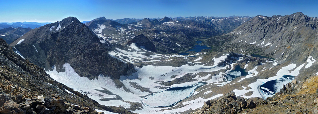
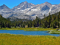
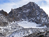
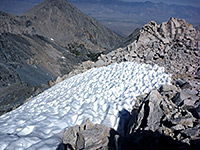
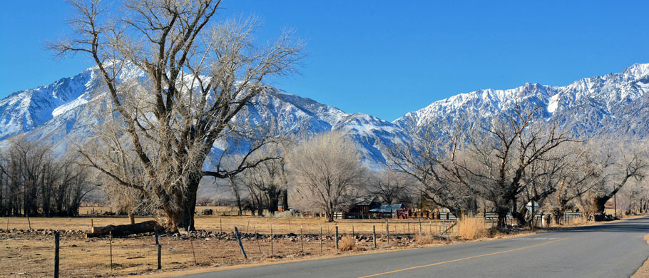
The eastern side of the Sierra Nevada borders the lightly populated Great Basin Desert and is rather less accessible than the west since the trans-mountain passes are closed by snow for up to six months of the year, and the southernmost 150 miles, south of the Tioga Pass, is not crossed by any road. US 395 runs all the way along the base of this part of the range, through Owens Valley and into the lesser hills around Mono Lake, giving spectacular views of the very steep, treeless slopes and snowy peaks high above; this scenery is in great contrast to the western foothills, which slope much more gradually, are thickly forested at lower elevations, and are bisected by many long, deep canyons.
The east-side steepness has one big advantage though, since the Sierra crest is within range of a day hike in many places, allowing relatively quick access to the beautiful Alpine granite wilderness above the treeline, a landscape that for the most part would require much longer, overnight hikes to reach if starting from the west. There are some exceptions, especially in the Tuolumne Meadows area of Yosemite National Park, but probably the best places are further south along the crest, most of which forms the eastern border of Kings Canyon and Sequoia national parks - see map.
Highlights:
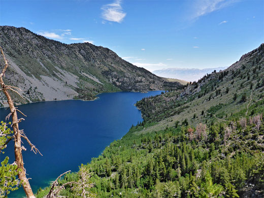
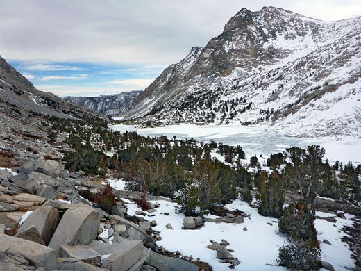
The more spectacular east side of the southern and central Sierra Nevada, where the mountains slope up very steeply to jagged granite peaks and beautiful Alpine lakes. Accessed by ten roads to high elevation trailheads; many hiking possibilities
Management:
USFS - part of the Inyo and Sierra national forests
Seasons:
Summer, early fall
Rating (1-5):
★★★★★

All roads are on Inyo National Forest land, and trails soon enter the John Muir Wilderness, many crossing into the national parks on the far side of the crest, and all are generally accessible a little earlier in the season than might be expected due to their location on the drier east face of the mountains, where snowfall is lighter.
Eastern Sierra Table of Contents
- Map of access roads to the Eastern Sierra
- Featured Eastern Sierra trails
- 1. Convict Lake Road
- 2. McGee Creek Road
- 3. Rock Creek Road
- 4. Pine Creek Road
- 5. Hwy 168
- 6. Glacier Lodge Road
- 7. North Creek Road
- 8. Onion Valley Road
- 9. Whitney Portal Road
- 10. Horseshoe Meadows Road
Map of Access Roads to the Eastern Sierra
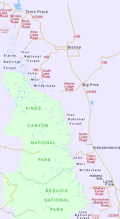
Detailed Map of the Eastern Sierra
Featured Eastern Sierra Trails
★★★★★ Big Pine Lakes and Palisade Glacier
★★★★★ Bishop Pass
★★★★★ Conness Lakes and Twenty Lakes Basin
★★★★★ Convict Lake Loop
★★★★★ Cottonwood Lakes
★★★★★ Crater Mountain
★★★★★ Hilton Creek Lakes
★★★★★ Kearsarge Pass, Mt Gould and the Golden Trout Lakes
★★★★★ Lake Dorothy and Mildred Lake
★★★★★ Little Lakes Valley
★★★★★ North Fork Lone Pine Creek
★★★★★ Piute Pass
★★★★★ Ruby Lake, Mono Pass and Mt Starr
★★★★★ Sabrina Lake Trail to Hungry Packer Lake
★★★★★ South Fork Big Pine Creek
The ten approach roads, and selected trails, are described below.
1. Convict Lake Road
The paved Convict Lake Road is only 2 miles long, following a creek uphill to a small but picturesque lake, a favored location for colorful aspen leaves in the fall. Beside the lake is a resort, campground and trailhead, for a 2.6 mile loop around the lake and one backcountry route, following a rugged valley to several high elevation lakes including Dorothy, Mildred, Genevieve and Edith.
Convict Lake Trails
Convict Lake Loop
★★★★★
★★★★★
2.6 miles, 80 feet
Easy circuit of Convict Lake, mostly a little way above the shoreline, through shady forest along the east shore, willow thickets to the south, and open slopes to the west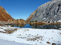
Lake Dorothy and Mildred Lake
★★★★★
★★★★★
5.8 miles, 2,700 feet
Two high elevation lakes - shallow Mildred Lake, at the head of a deep, rocky canyon, and the larger Lake Dorothy, over a ridge to the west2. McGee Creek Road
The 3.3 mile unpaved road alongside McGee Creek ends at a trailhead parking area, elevation 7,900 feet, on the floor of a deep valley, from where one trail continues upstream, climbing only gradually, to a junction after 4 miles. From here paths go northwest to Scheelore Mine and east to Steelhead Lake, while the main route leads to 11,895 foot McGee Pass, and on to various other destinations.
3. Rock Creek Road
Rock Creek Road leaves US 395 at Toms Place, following a stream through wooded surroundings past eight Inyo National Forest campgrounds and one lodge, ending a little way beyond Rock Creek Lake at 10,200 feet - the highest elevation of any of the eastern Sierra roads. The land remains fairly level for another couple of miles, along the floor of Little Lakes Valley, which contains a dozen small lakes, some within the forest, others above the treeline. Two main paths, starting at the Mosquito Flat trailhead at the far end of the road, are west above Ruby Lake to 12,000 foot Mono Pass then upper Mono Creek, and southeast past the Gem Lakes over Morgan Pass (11,130 feet), followed by a descent towards Pine Creek (this trail currently closed), a place also reached by the next access road south.
Rock Creek Trails
Hilton Creek Lakes
★★★★★
★★★★★
5 miles, 1,350 feet
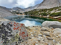
Trail up a slope and through fairly level woodland, then above the treeline to a spectacular group of lakes, close to the Sierra crest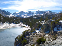
Little Lakes Valley
★★★★★
★★★★★
3.7 miles, 890 feet
Relatively easy and popular path up a scenic valley containing over a dozen small lakes, up to Morgan Pass, along a subsidiary ridge northeast of the Sierra crest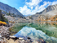
Ruby Lake, Mono Pass and Mt Starr
★★★★★
★★★★★
4.5 miles, 2,715 feet, to Mt Starr
Spectacular trail to Ruby Lake, lined by white granite slopes, then through increasingly stark surroundings to Mono Pass, from where the summit of Mt Starr may be reached by an off-trail scramble4. Pine Creek Road
The lesser used Pine Creek Road forks off US 395 ten miles north of Bishop in the middle of Round Valley and climbs fairly gently along a largely treeless canyon. Two trails start at roads end (site of a dormant tungsten mine), at 7,400 feet; one ascends the steep side valley of Morgan Creek, to Mono Pass and then Little Lakes Valley, the other passes a succession of pretty lakes including Pine, Upper Pine and Honeymoon, reaches the Sierra crest at 12,400 foot Italy Pass and continues to a junction with the Pacific Crest Trail (PCT) along Bear Creek. Another branch heads further south to Pine Creek Pass, which leads to French Canyon and, over a broad ridge, to Humphreys Basin. All the scenery hereabouts is particularly impressive.
5. Hwy 168
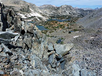
Hwy 168 is one of the busier routes into the eastern Sierra; a paved, 15 mile county road following Bishop Creek to Camp Sabrina, near Lake Sabrina. A slightly narrower route leads 7 miles to South Lake, and both have several trailheads, for hikes to various locations including the Treasure Lakes, 11,972 foot Bishop Pass above Palisade Basin (at the far north end of Kings Canyon National Park), and 11,423 foot Piute Pass above Humphrey Basin, within the Sierra National Forest.
Hwy 168 Trails
Bishop Pass Trail
★★★★★
★★★★★
6 miles, 2,150 feet, to the pass
Spectacular trail past six lakes and many Alpine meadows to an 11,972 foot mountain pass, continuing into Dusy Basin in Kings Canyon National Park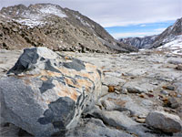
Piute Pass Trail
★★★★★
★★★★★
5.3 miles, 2,130 feet, to the pass
Varied route up granite slopes past two lakes (Loch Leven and Piute Lake) and many ponds to an 11,417 foot pass; continues into Humphreys Basin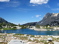
Sabrina Lake Trail
★★★★★
★★★★★
6.3 miles, 2,000 feet, to Hungry Packer Lake
Relatively easy route to a group of lakes, all different in character, along the upper reaches of the Middle Fork of Bishop Creek6. Glacier Lodge Road
Glacier Lodge offers rustic accommodations in log cabins, and is accessed by a ten mile road that climbs not too steeply alongside Big Pine Creek, through a valley that becomes wooded towards the upper end. Trails continue further into the mountains along the north and south forks of the creek, and the former is most spectacular, although not crossing the Sierra crest or linking with any extended cross-country routes, this passes the scenic Big Pine Lakes and the base of Palisade Glacier.
Glacier Lodge Trails
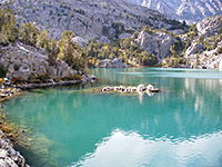
Big Pine Lakes and Palisade Glacier
★★★★★
★★★★★
11 miles, 3,400 feet (loop)
Loop past nine beautiful glacial lakes, just east of the Sierra crest, and a spur trail to the base of a glacier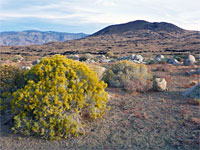
Crater Mountain
★★★★★
★★★★★
1.8 miles, 1,130 feet (loop)
Off-trail walk over open terrain, through black and red lava formations, to a flattish volcanic summit overlooking Owens Valley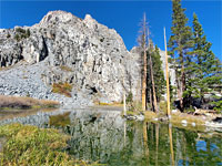
South Fork of Big Pine Creek
★★★★★
★★★★★
5 miles, 2,470 feet (loop)
Lightly-traveled route up a broad valley, initially ascending gently, then much more steeply, to Willow Lake and Brainerd Lake, giving spectacular views of the Palisade Crest7. North Creek Road
Two miles north of Independence along US 395, North Creek Road is one of the less traveled routes, and it climbs only a little way into the Sierra foothills, to a trailhead at 4,900 feet. One long distance trail starts here, climbing steadily beside North Fork Oak Creek to Baxter Pass at 12,300 feet, then meeting the PCT on the far side, within Kings Canyon National Park.
8. Onion Valley Road
Onion Valley is another busy Sierra trailhead; from the sizeable parking area (9,200 foot elevation), the main path encounters four pretty lakes while climbing to 11,760 foot Kearsarge Pass, before descending to the Kearsarge Lakes in Kings Canyon National Park, ending at a junction with the PCT. Besides the spectacular scenery, the trail is also popular for being part of the shortest cross-Sierra route; together with the linked Bubbs Creek Trail which leads follows a long ravine to the upper end of Kings Canyon Road, the full distance is just 18 miles (310 miles if driving). Onion Valley is reached by a 13 mile road that is steep and winding towards the upper end, climbing over 5,000 feet mostly across barren hillsides, starting in Independence on US 395.
Onion Valley Trails
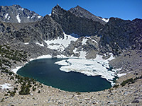
Kearsarge Pass, Mt Gould and the Golden Trout Lakes
★★★★★
★★★★★
8.5 miles, 3,800 feet (loop)
Spectacular loop hike, climbing steadily past four pretty lakes to 11,760 foot Kearsarge Pass, ascending further to the summit of Mt Gould then returning via an adjacent canyon9. Whitney Portal Road
Start point for hikes to California's highest peak is the Whitney Portal Road, beginning in the center of Lone Pine, soon passing the photogenic rocks of the Alabama Hills, and ending with a couple of wide switchbacks, leading to the wooded floor of the valley of Lone Pine Creek, elevation 8,300 feet. One dead-end trail goes south, to Meysan Lake, but almost all visitors take the main route, past three more lakes and very steeply up to the mountain crest at 13,650 feet. A spur path heads north to Mt Whitney summit, while the other trail continues to the PCT and Kern Canyon, within Sequoia National Park. The summit hike is 22 miles round trip, so possible to be completed in one long day, though camping for one night en route is a better option. The peak can also be reached by a shorter, primitive trail, the Mountineers Route, up the north fork of the creek, which along the way passes three scenic lakes (Lower Boy Scout, Upper Boy Scout and Iceberg), all good intermediate destinations.
Whitney Portal Trails
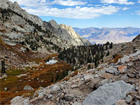
North Fork Lone Pine Creek
★★★★★
★★★★★
2.5 miles, 2,810 feet, to Clyde Meadow
Steep trail, branching off the main path from Whitney Portal, ascending a boulder-filled ravine, above the treeline, to Lower Boy Scout Lake and Clyde Meadow10. Horseshoe Meadows Road
Forking off near the start of the Whitney Portal Road, the paved Horseshoe Meadows Road traverses south a few miles before zig-zagging up the mountainside and into the upper valley of Cottonwood Creek, surrounded by scenery, while still pretty, that is generally more wooded and less rocky than the other routes to the north; south of here the peaks gradually lessen in height. The main hiking destinations are the Cottonwood Lakes and New Army Pass, at the south edge of the John Muir Wilderness; other locations include Horseshoe Meadows, Cottonwood Pass, Trail Pass and Mulkey Pass.
Horseshoe Meadows Trails
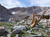
Cottonwood Lakes
★★★★★
★★★★★
5.7 miles, 1,500 feet
Group of lakes in a high basin just below the granite slopes of the Sierra crest, reached by a path alongside a wooded creek, through meadows and boggy areas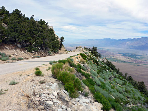
All Contents © Copyright The American Southwest | Comments and Questions | Contribute | Affiliate Marketing Disclosure | Site Map