Ruby Lake, Mono Pass and Mt Starr, Eastern Sierra
California > Eastern Sierra > Ruby Lake, Mono Pass and Mt Starr
Ruby Lake, Mono Pass and Mt Starr
Starting from Mosquito Flat along Rock Creek Road, a spectacular trail leads to Ruby Lake, lined by white granite slopes, then up through increasingly stark surroundings to 12,050 foot Mono Pass, from where the summit of Mt Starr may be reached by an off-trail scramble
Length: 2.2 miles to Ruby Lake, 3.9 miles to Mono Pass, 4.5 miles to Mt Starr
Elevation change: 1,000 feet, 1,930 feet, 2,715 feet
Difficulty: Moderate, moderate, strenuous
Type: One-way
Usage: Low
Season: Early summer to early fall
Trailhead: Mosquito Flat, at the end of Rock Creek Road
Rating (1-5): ★★★★★
Elevation change: 1,000 feet, 1,930 feet, 2,715 feet
Difficulty: Moderate, moderate, strenuous
Type: One-way
Usage: Low
Season: Early summer to early fall
Trailhead: Mosquito Flat, at the end of Rock Creek Road
Rating (1-5): ★★★★★

Mono Pass in the Inyo National Forest is one of the easiest-reached passes along the Sierra Nevada crest, since the trailhead, at Mosquito Flat along Rock Creek Road, has an already high elevation of 10,220 feet, and the mountain crest in this location curves eastwards a way, reducing the hiking distance to 3.9 miles, and the climb a relatively modest 1,930 feet; a steady assent, never too steep.
The hike is initially through sparse woodland, past a few ponds and little meadows then over open scree slopes, and into almost completely unvegetated terrain of light-colored granite around the pass, which should not be confused with another Mono Pass, 40 miles northwest along the boundary of Yosemite National Park.
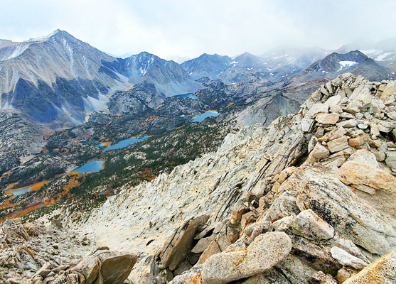
A short spur trail, half way to the pass, leads to the exceptionally beautiful Ruby Lake, while many other lakes can be seen further up the valley, these accessed via a separate hike. Just beyond Mono Pass is the small Summit Lake, after which the trail descends, leading to various remote locations in the John Muir Wilderness.
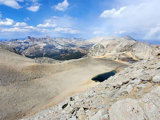
For a longer hike, a good target is the summit of Mount Starr, the 12,835 foot peak immediately east of Mono Pass, half a mile distant and 785 feet above; reached by a relatively straightforward ascent of a steep slope. Views from the summit are suitably spectacular, over a line of jagged peaks along the crest, many more lakes, and east across Owens Valley.
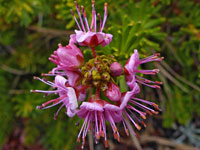
The lower portions of the Mono Pass hike encounter many wildflowers, and while in the upper reaches the plant life is much more limited, even around Mt Starr a few hardy tundra species can be found.
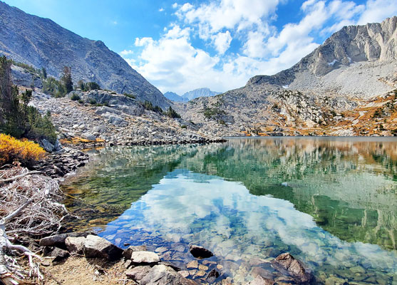
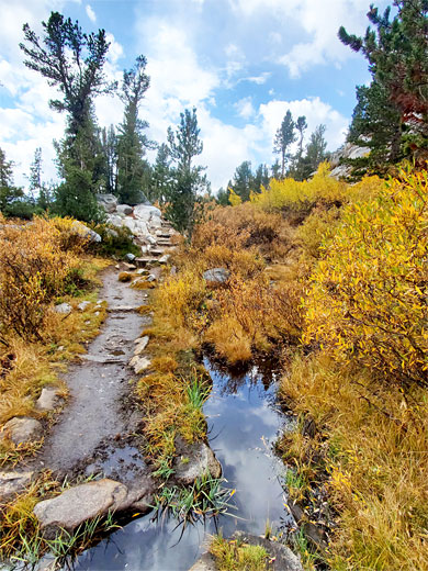
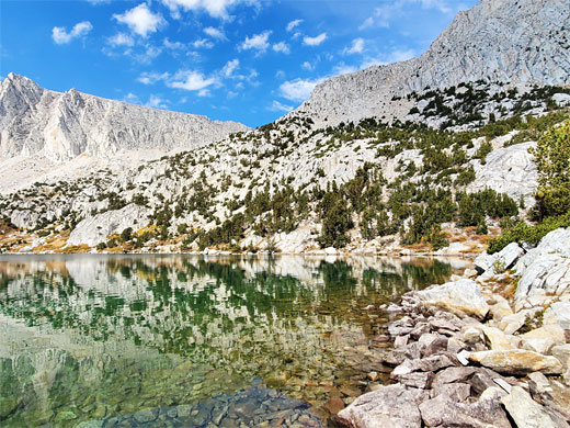
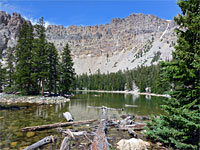
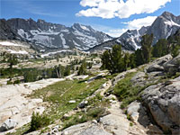
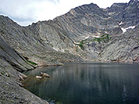
The hike to Ruby Lake, Mono Pass and Mt Starr begins at the end of Rock Creek Road, the gateway to Little Lakes Valley. The road terminates at a large parking area (still liable to fill up on popular days), lined by tall pines, from where a wide trail leaves to the south, into the woods, climbing slowly above the nearby stream, Rock Creek, and entering more open terrain, of small trees, grassy patches, large and small boulders. Turning right at a junction, left being the continuation along the valley floor, the Mono Pass route now climbs a little more noticeably and soon affords good views up and down the valley. Another intersection is reached, right being a little-used route back northwards, to Rock Creek Lake; the left fork is the main path, to the pass. This is quite straight for a while, passing a few little ponds then moves through a slightly steeper, rockier section and past a boggy area, home to a colony of the Sierra fringed gentian. Further on is a third intersection, beside a larger pond, with the 0.3 mile spur path to Ruby Lake, a very pretty place lined by whitish granite slopes and cliffs, below dramatic, angular peaks, along the mountain crest.
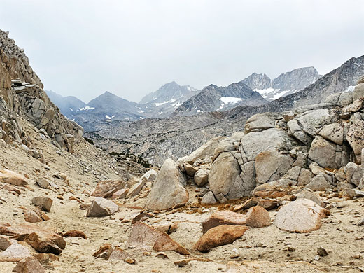
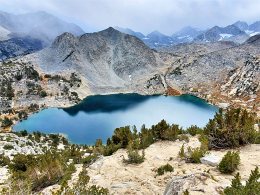
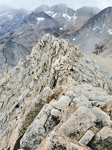
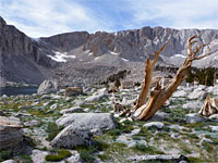
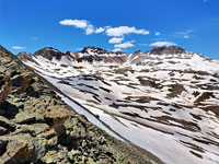
Back at the junction, the continuation route to Moro Pass climbs a partly wooded slope, now rising much more steeply, into treeless surroundings, switchbacking up gravelly granite hillside, sprinkled with tiny flowers. The trail reaches the base of the line of sheer cliffs and traverses westwards, giving more good views of Ruby lake, now 600 feet below with Little Lakes Valley beyond. The path around a corner, now heading due north, and the views change abruptly; ahead is a barren valley leading to the pass, the sides composed of pale brown granite. The trail crosses the slope on the east side of valley, past occasional tiny pine trees and more small wildflowers. The granite boulders become larger as the trail enters the last stage of the climb, past a few snowmelt ponds and onto the 12,050 foot pass, an elemental place of bare earth, rock and sky. The barrenness continues for 1.5 miles, to the shallow summit lake and over flattish land beyond, before starting a descent back towards wooded terrain at the upper end of the valley of Mono Creek.
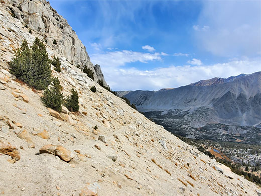
The elongated summit of Mt Starr rises 785 feet to the east of Mono Pass, and the easiest hiking route leaves the trail just beyond the high point, walking in a straight line directly up the slope, initially over earth, then small stones, with some loose patches, and eventually large boulders and outcrops of the granite bedrock, reaching the summit a climb taking around half an hour. The ridge has two distinct summits to the north and south, 800 feet apart, offering different though equally spectacular views.
The hike is initially through sparse woodland, past a few ponds and little meadows then over open scree slopes, and into almost completely unvegetated terrain of light-colored granite around the pass, which should not be confused with another Mono Pass, 40 miles northwest along the boundary of Yosemite National Park.
A short spur trail, half way to the pass, leads to the exceptionally beautiful Ruby Lake, while many other lakes can be seen further up the valley, these accessed via a separate hike. Just beyond Mono Pass is the small Summit Lake, after which the trail descends, leading to various remote locations in the John Muir Wilderness.
For a longer hike, a good target is the summit of Mount Starr, the 12,835 foot peak immediately east of Mono Pass, half a mile distant and 785 feet above; reached by a relatively straightforward ascent of a steep slope. Views from the summit are suitably spectacular, over a line of jagged peaks along the crest, many more lakes, and east across Owens Valley.
The lower portions of the Mono Pass hike encounter many wildflowers, and while in the upper reaches the plant life is much more limited, even around Mt Starr a few hardy tundra species can be found.
Ruby Lake
The hike to Ruby Lake, Mono Pass and Mt Starr begins at the end of Rock Creek Road, the gateway to Little Lakes Valley. The road terminates at a large parking area (still liable to fill up on popular days), lined by tall pines, from where a wide trail leaves to the south, into the woods, climbing slowly above the nearby stream, Rock Creek, and entering more open terrain, of small trees, grassy patches, large and small boulders. Turning right at a junction, left being the continuation along the valley floor, the Mono Pass route now climbs a little more noticeably and soon affords good views up and down the valley. Another intersection is reached, right being a little-used route back northwards, to Rock Creek Lake; the left fork is the main path, to the pass. This is quite straight for a while, passing a few little ponds then moves through a slightly steeper, rockier section and past a boggy area, home to a colony of the Sierra fringed gentian. Further on is a third intersection, beside a larger pond, with the 0.3 mile spur path to Ruby Lake, a very pretty place lined by whitish granite slopes and cliffs, below dramatic, angular peaks, along the mountain crest.
Mono Pass
Back at the junction, the continuation route to Moro Pass climbs a partly wooded slope, now rising much more steeply, into treeless surroundings, switchbacking up gravelly granite hillside, sprinkled with tiny flowers. The trail reaches the base of the line of sheer cliffs and traverses westwards, giving more good views of Ruby lake, now 600 feet below with Little Lakes Valley beyond. The path around a corner, now heading due north, and the views change abruptly; ahead is a barren valley leading to the pass, the sides composed of pale brown granite. The trail crosses the slope on the east side of valley, past occasional tiny pine trees and more small wildflowers. The granite boulders become larger as the trail enters the last stage of the climb, past a few snowmelt ponds and onto the 12,050 foot pass, an elemental place of bare earth, rock and sky. The barrenness continues for 1.5 miles, to the shallow summit lake and over flattish land beyond, before starting a descent back towards wooded terrain at the upper end of the valley of Mono Creek.
Mt Starr
The elongated summit of Mt Starr rises 785 feet to the east of Mono Pass, and the easiest hiking route leaves the trail just beyond the high point, walking in a straight line directly up the slope, initially over earth, then small stones, with some loose patches, and eventually large boulders and outcrops of the granite bedrock, reaching the summit a climb taking around half an hour. The ridge has two distinct summits to the north and south, 800 feet apart, offering different though equally spectacular views.
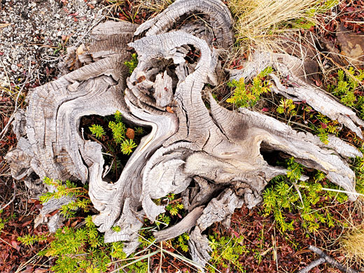
Wildflowers
More flowers; Ruby Lake, Mono Pass, Mt Starr
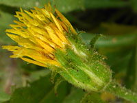 Whitney's goldenbush |
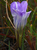 Sierra fringed gentian |
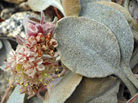 Granite buckwheat |
 Red mountain heather |
More flowers; Ruby Lake, Mono Pass, Mt Starr
Ruby Lake and Mono Pass - Similar Hikes
All Contents © Copyright The American Southwest | Comments and Questions | Contribute | Affiliate Marketing Disclosure | Site Map