Baker Lake Trail
Rarely-used route through damp woodland and floral meadows alongside a forceful creek, to a high elevation, cliff-lined lake, continuing up tundra slopes to an 11,294 foot pass below Pyramid Peak
Length: 5.2 miles to Baker Lake, 6.5 miles to the pass
Elevation change: 2,630 feet, 3,300 feet
Difficulty: Moderate to strenuous
Type: One-way, or part of a 12.5 mile loop back via Johnson Lake and the South Fork of Baker Creek
Usage: Low
Season: Summer and early fall
Trailhead: End of the unpaved Baker Creek Road
Rating (1-5): ★★★★★
Elevation change: 2,630 feet, 3,300 feet
Difficulty: Moderate to strenuous
Type: One-way, or part of a 12.5 mile loop back via Johnson Lake and the South Fork of Baker Creek
Usage: Low
Season: Summer and early fall
Trailhead: End of the unpaved Baker Creek Road
Rating (1-5): ★★★★★

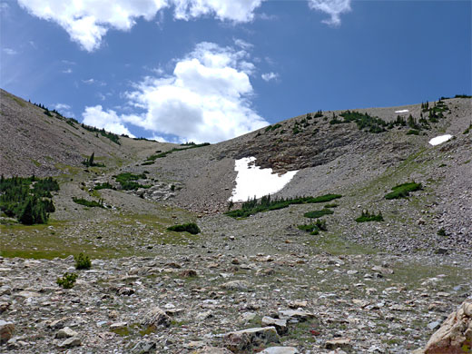
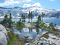
Away from the popular area north of Wheeler Peak at the end of scenic drive, trails in Great Basin National Park are rarely used, despite accessing equally spectacular scenery. One of the longer of such routes is the 5.2 mile Baker Lake Trail, which follows a forceful stream, Baker Creek, up a lengthy valley through forests of pine and aspen to the most beautiful of the small number of lakes in the park, set in a cliff-lined bowl below a curving ridge on the south side of 12,298 foot Baker Peak. A lesser path climbs further to a pass over the ridge, from where a 12.5 mile loop can be made by descending past another lake (Johnson) and later crossing a lower ridge and following the South Fork of Baker Creek back to the trailhead.
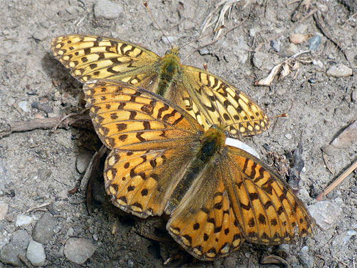
This description is to the pass, a 6.5 mile hike gaining 3,300 feet. The path is generally easy to follow, steep only briefly, when approaching the lake, otherwise rising fairly gently, but steadily. The journey to the lake is nearly all through woodland, mixed with small meadows, and the varied habitats, of riparian, wet and dry woods and the dry hillsides above the trees, give rise to a great variety of wildflowers, with many dozens of species blooming in late spring and summer. Above the lake, the path to the pass crosses rocky tundra, home to another set of species.
The hike, either to and from the pass or the full loop, takes seven hours or more and is usually accessible from May to November. Snow patches may persist all year in the highest elevations.
Overview map of Great Basin National Park, topographic map of the trail.
29 views along the trail.
Parking for the hike is at the end of the 3.5 mile (gravel) Baker Creek Road, branching south off the scenic drive near the Lehman Caves visitor center and en route passing one of the five park campgrounds. The surroundings of the parking lot are mostly treeless, with views back down the valley; the creek flows through a wooded corridor to one side, and the band of trees widens just upstream as the drainage splits into three - the Main and South Forks of Baker Creek, and Timber Creek, a large tributary to the south. The Baker Lake Trail follows the main fork.
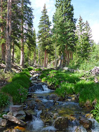
The trail enters pine woods, crosses a tributary stream and leads through a boggy, riparian area with many wildflowers, initially staying close to the creek then gradually moving away, with several switchbacks over the exposed, south-facing slopes above, though an earlier alignment, still fairly easily traversable if rather overgrown, stays close to the creek. The two paths rejoin in the middle of a darker, steeper and more enclosed patch of woodland, with fewer flowers, still close to the stream and about 50 feet above. The land flattens somewhat, the surroundings now moister, as a junction is reached, with a half mile connecting path to the South Fork of Baker Creek Trail, at which point a sign gives the remaining distance to Baker Lake (via the main route) as 4 miles.
The trees change to aspen as the path remains near the creek, traversing some small meadows before climbing higher again over dry slopes with manzanita and other shrubs. A big cliff comes into view to the south, part of a ridge extending from Pyramid Peak. After returning to the forest, at least four small tributary streams are crossed, as the trail winds through a patch of moist pine woods followed by a drier section where flowers include spotted coralroot orchid, and then another tributary, now very close to the main stream. The first more extensive open, grassy section starts just beyond another distance sign, the lake now 2.7 miles away.
The North Fork of Baker Creek joins, contributing about half the water flow, and after here are more wet meadows where the path runs above, later coming back to the creek several times before switchbacking back north to drier ground. At one point the trail runs along a stony ridge which gives good views of the nearby rocky peaks then, after a longish straight, returns once more to the stream, now much smaller, lined with the bright purple flowers of Parry's primrose.
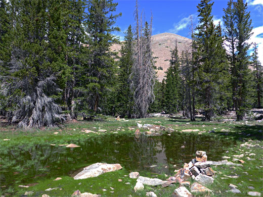
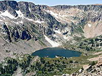
The land becomes quite open, rising to a little basin, and the trail is nearly level for a while before the steepest section, through dry pine woods well away from the stream; rising 500 feet over the next mile. Then the trees gradually thin out, the gradient lessens and the ground is covered by many white boulders, which extend to Baker Lake, elevation 10,620 feet, ringed by unvegetated granite cliffs on three sides; a very peaceful and beautiful location. Many tiny flowers of Nevada bitterroot decorate the mud flats along the edge.
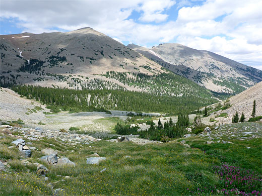
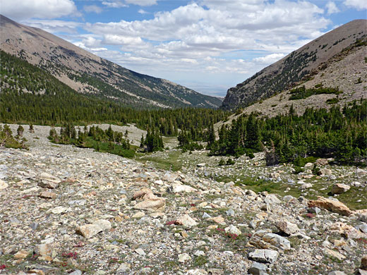
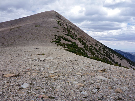
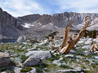
The continuation path forks southwards just before the lake, entering sparse, level woodland below a big slope of scree and rock. It passes a pretty pond, climbs a dry gully to a wildflower meadow with streams and seeps, then rises again to a tundra plateau with a larger stream on the far side, flowing down a shallow ravine that provides a course for the trail. After the last patch of stunted trees the slopes are covered only by short grass and small wildflowers; the faint path ascends alongside the stream, which one point forms a nice cascade over rock ledges. The creek eventually dries up and the final part of the climb is over a featureless stony slope leading to the pass, on the far side of which the land is much steeper, dropping down 550 feet to Johnson Lake. In the other directions the ground slopes up smoothly, to Pyramid Peak (11,926 feet) in the northeast and a lower ridge to the southwest.
This description is to the pass, a 6.5 mile hike gaining 3,300 feet. The path is generally easy to follow, steep only briefly, when approaching the lake, otherwise rising fairly gently, but steadily. The journey to the lake is nearly all through woodland, mixed with small meadows, and the varied habitats, of riparian, wet and dry woods and the dry hillsides above the trees, give rise to a great variety of wildflowers, with many dozens of species blooming in late spring and summer. Above the lake, the path to the pass crosses rocky tundra, home to another set of species.
The hike, either to and from the pass or the full loop, takes seven hours or more and is usually accessible from May to November. Snow patches may persist all year in the highest elevations.
Maps
Overview map of Great Basin National Park, topographic map of the trail.
Photographs
29 views along the trail.
Baker Lake Trailhead
Parking for the hike is at the end of the 3.5 mile (gravel) Baker Creek Road, branching south off the scenic drive near the Lehman Caves visitor center and en route passing one of the five park campgrounds. The surroundings of the parking lot are mostly treeless, with views back down the valley; the creek flows through a wooded corridor to one side, and the band of trees widens just upstream as the drainage splits into three - the Main and South Forks of Baker Creek, and Timber Creek, a large tributary to the south. The Baker Lake Trail follows the main fork.
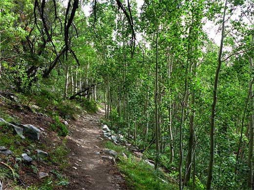
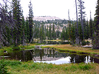
Start of the Trail
The trail enters pine woods, crosses a tributary stream and leads through a boggy, riparian area with many wildflowers, initially staying close to the creek then gradually moving away, with several switchbacks over the exposed, south-facing slopes above, though an earlier alignment, still fairly easily traversable if rather overgrown, stays close to the creek. The two paths rejoin in the middle of a darker, steeper and more enclosed patch of woodland, with fewer flowers, still close to the stream and about 50 feet above. The land flattens somewhat, the surroundings now moister, as a junction is reached, with a half mile connecting path to the South Fork of Baker Creek Trail, at which point a sign gives the remaining distance to Baker Lake (via the main route) as 4 miles.
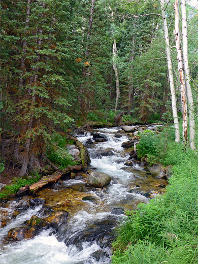
Streams
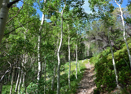
The trees change to aspen as the path remains near the creek, traversing some small meadows before climbing higher again over dry slopes with manzanita and other shrubs. A big cliff comes into view to the south, part of a ridge extending from Pyramid Peak. After returning to the forest, at least four small tributary streams are crossed, as the trail winds through a patch of moist pine woods followed by a drier section where flowers include spotted coralroot orchid, and then another tributary, now very close to the main stream. The first more extensive open, grassy section starts just beyond another distance sign, the lake now 2.7 miles away.
North Fork Junction
The North Fork of Baker Creek joins, contributing about half the water flow, and after here are more wet meadows where the path runs above, later coming back to the creek several times before switchbacking back north to drier ground. At one point the trail runs along a stony ridge which gives good views of the nearby rocky peaks then, after a longish straight, returns once more to the stream, now much smaller, lined with the bright purple flowers of Parry's primrose.
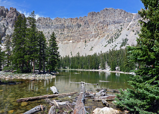
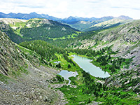
Baker Lake
The land becomes quite open, rising to a little basin, and the trail is nearly level for a while before the steepest section, through dry pine woods well away from the stream; rising 500 feet over the next mile. Then the trees gradually thin out, the gradient lessens and the ground is covered by many white boulders, which extend to Baker Lake, elevation 10,620 feet, ringed by unvegetated granite cliffs on three sides; a very peaceful and beautiful location. Many tiny flowers of Nevada bitterroot decorate the mud flats along the edge.
Trail to the Pass
The continuation path forks southwards just before the lake, entering sparse, level woodland below a big slope of scree and rock. It passes a pretty pond, climbs a dry gully to a wildflower meadow with streams and seeps, then rises again to a tundra plateau with a larger stream on the far side, flowing down a shallow ravine that provides a course for the trail. After the last patch of stunted trees the slopes are covered only by short grass and small wildflowers; the faint path ascends alongside the stream, which one point forms a nice cascade over rock ledges. The creek eventually dries up and the final part of the climb is over a featureless stony slope leading to the pass, on the far side of which the land is much steeper, dropping down 550 feet to Johnson Lake. In the other directions the ground slopes up smoothly, to Pyramid Peak (11,926 feet) in the northeast and a lower ridge to the southwest.
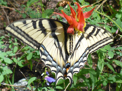
Baker Lake Wildflowers
More flowers along the trail
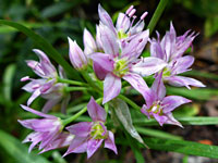 Twincrest onion |
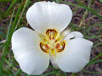 Sego lily |
 Spotted coralroot |
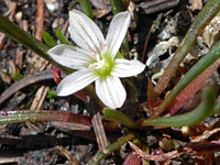 Nevada bitterroot |
More flowers along the trail
Baker Lake Trail - Similar Hikes
All Contents © Copyright The American Southwest | Comments and Questions | Contribute | Affiliate Marketing Disclosure | Site Map