Piute Pass Trail, Eastern Sierra
Varied route through a sparsely wooded valley then up granite slopes past two lakes (Loch Leven and Piute Lake) and many ponds to an 11,417 foot pass, for views across Humphreys Basin and many distant peaks
Length: 5.3 miles to the pass; continuation hikes possible
Elevation change: 2,130 feet
Difficulty: Moderate; never particularly steep
Type: One-way
Usage: Low to medium
Season: Early summer to early fall
Trailhead: Parking area near North Lake
Rating (1-5): ★★★★★
Elevation change: 2,130 feet
Difficulty: Moderate; never particularly steep
Type: One-way
Usage: Low to medium
Season: Early summer to early fall
Trailhead: Parking area near North Lake
Rating (1-5): ★★★★★

Hwy 168 to Lake Sabrina sees a lot of traffic, but far fewer people take the short, partly unpaved side road that forks off one mile before the lake, crosses a low divide and ends at a campsite just beyond North Lake (9,260 feet), a small body of water along the North Fork of Bishop Creek. Two trails start here, one south to the Lamarck Lakes, the other, the main route, west, along the broad, U-shaped valley of the creek, past two large lakes (Leven and Piute) and many ponds, to 11,417 foot Piute Pass on the Sierra Crest, beyond which are many more lakes in Humphreys Basin, just north of Kings Canyon National Park. All land hereabouts is part of the John Muir Wilderness, which begins a short distance beyond the campsite, and is also within the Inyo National Forest.
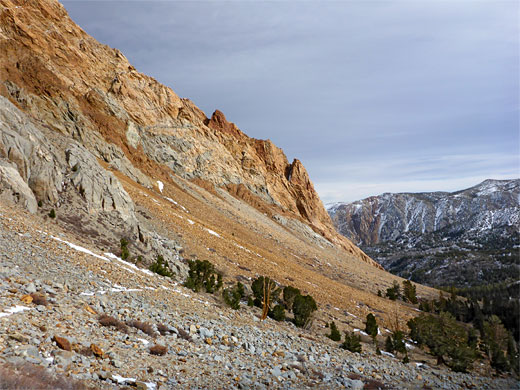
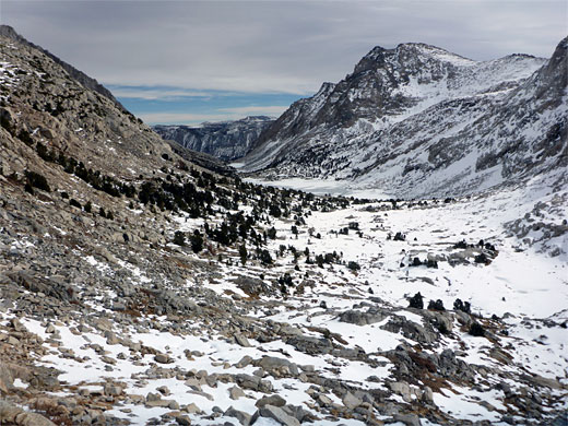
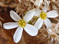
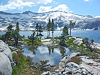
Scenery along the 5.3 mile Piute Pass Trail is a typical but spectacular mix of sparse woodland, granite outcrops, scree slopes, wet meadows and lakes, flanked by dramatic slopes on both sides - the jagged, brownish Piute Crags and the slopes of Mount Emerson to the north, and the steeper cliffs of Mount Thoreau to the south, while once at the pass, innumerable other summits come into view, around the vast expanse of Humphreys Basin, a popular backpacking area.
The round trip walk to the pass is an ideal day hike, taking five hours or more, and is usually passable well into October, though the best time is the during the peak wildflower season, in July and August. No permit is needed, for day hikes, and parking is free. The North Lake Campground has 11 sites, for tents only, nicely shaded beneath Jeffrey and lodgepole pines. The campground is usually open from early June to the end of September. North Lake is 28 miles from Bishop.
49 views along the Piute Pass Trail
Piute Pass Trail topo map. Overview map of the Eastern Sierra
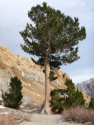
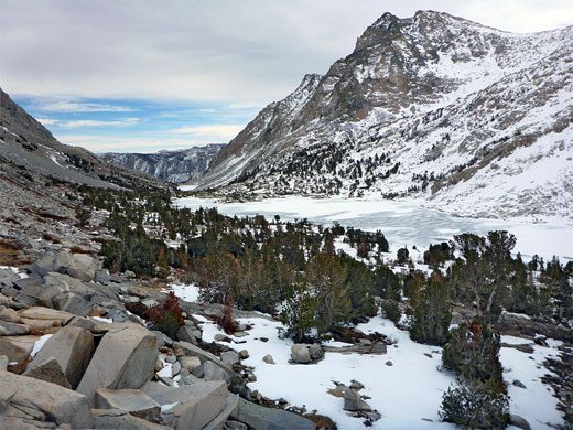
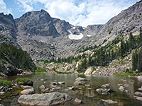
North Lake Road, a partially one lane route with passing places, starts off paved then changes to smooth dirt as it ascends the north side of the Bishop Creek valley, crosses a saddle and drops down to the lake, continuing half a mile beyond to the campground and trailhead, though hiker parking is beside the lake, along its north side. The walk then starts off along the road, through pine and aspen woodland, past the campsite and onto the path, which soon passes a wooden sign marking the edge of the John Muir Wilderness. Trees persist for a while, mainly lodgepole pine, growing in fairly dry terrain, the ground covered by leaf litter and scattered blocks of red and grey lava. The Piute Pass Trail stays close to the stream, Bishop Creek, later crossing two times in quick succession via log bridges then soon after moving away to the north, out of the trees and on to a good viewpoint, looking up and down the valley.
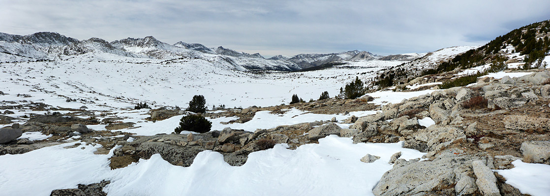
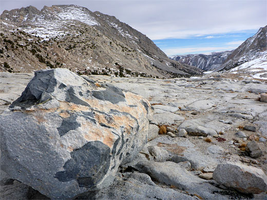
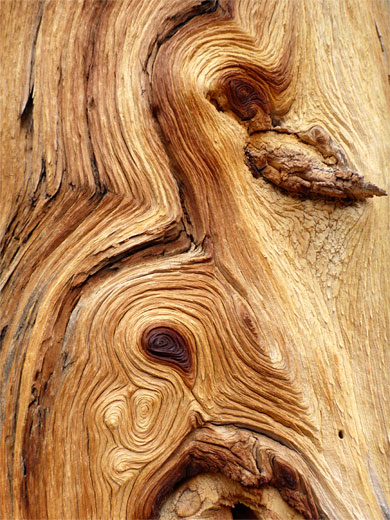
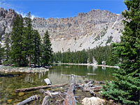
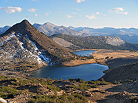
The Piute Pass Trail zig-zags up the scree slope at the foot of the Piute Crags, turns southwest and follows below a line of low granite cliffs, briefly level, before climbing a granite chute and rising some more to the first lake, Loch Leven, at 10,748 feet. Many ancient tree stumps are scattered amongst the boulders at its east end, their rich color enhanced by many years of weathering. The path runs right along the north shore of the lake, on granite benches, and stays close to the stream beyond, flowing through a succession of large and small ponds, gaining height only gradually. The route later climbs just a bit more steeply over open granite slopes to the final, larger lake, Piute, all the while encountering similar scenery, as is the case for the final half mile to Puite Pass, crossing gently rising slickrock dotted with stunted trees.
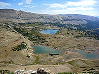
Piute Pass is a wide, flat area without a specific high point; the land slopes up gradually to the north and south and is similarly gentle to the west, descending 200 feet to Summit Lake, at the head of Puite Creek. One path goes to Summit Lake and down the valley beyond, while another traverses southwestwards to Muriel Lake. The terrain does soon become more sleep to the south, rising to a line of summits including Muriel Peak, but stays open and fairly flat for some distance in the other direction, across the main part of Humphreys Basin.
Scenery along the 5.3 mile Piute Pass Trail is a typical but spectacular mix of sparse woodland, granite outcrops, scree slopes, wet meadows and lakes, flanked by dramatic slopes on both sides - the jagged, brownish Piute Crags and the slopes of Mount Emerson to the north, and the steeper cliffs of Mount Thoreau to the south, while once at the pass, innumerable other summits come into view, around the vast expanse of Humphreys Basin, a popular backpacking area.
The round trip walk to the pass is an ideal day hike, taking five hours or more, and is usually passable well into October, though the best time is the during the peak wildflower season, in July and August. No permit is needed, for day hikes, and parking is free. The North Lake Campground has 11 sites, for tents only, nicely shaded beneath Jeffrey and lodgepole pines. The campground is usually open from early June to the end of September. North Lake is 28 miles from Bishop.
Photographs
49 views along the Piute Pass Trail
Maps
Piute Pass Trail topo map. Overview map of the Eastern Sierra
Path from North Lake
North Lake Road, a partially one lane route with passing places, starts off paved then changes to smooth dirt as it ascends the north side of the Bishop Creek valley, crosses a saddle and drops down to the lake, continuing half a mile beyond to the campground and trailhead, though hiker parking is beside the lake, along its north side. The walk then starts off along the road, through pine and aspen woodland, past the campsite and onto the path, which soon passes a wooden sign marking the edge of the John Muir Wilderness. Trees persist for a while, mainly lodgepole pine, growing in fairly dry terrain, the ground covered by leaf litter and scattered blocks of red and grey lava. The Piute Pass Trail stays close to the stream, Bishop Creek, later crossing two times in quick succession via log bridges then soon after moving away to the north, out of the trees and on to a good viewpoint, looking up and down the valley.
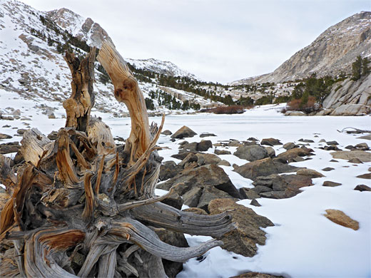
Loch Leven and Piute Lake
The Piute Pass Trail zig-zags up the scree slope at the foot of the Piute Crags, turns southwest and follows below a line of low granite cliffs, briefly level, before climbing a granite chute and rising some more to the first lake, Loch Leven, at 10,748 feet. Many ancient tree stumps are scattered amongst the boulders at its east end, their rich color enhanced by many years of weathering. The path runs right along the north shore of the lake, on granite benches, and stays close to the stream beyond, flowing through a succession of large and small ponds, gaining height only gradually. The route later climbs just a bit more steeply over open granite slopes to the final, larger lake, Piute, all the while encountering similar scenery, as is the case for the final half mile to Puite Pass, crossing gently rising slickrock dotted with stunted trees.
Piute Pass
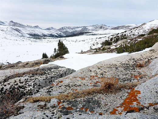
Piute Pass is a wide, flat area without a specific high point; the land slopes up gradually to the north and south and is similarly gentle to the west, descending 200 feet to Summit Lake, at the head of Puite Creek. One path goes to Summit Lake and down the valley beyond, while another traverses southwestwards to Muriel Lake. The terrain does soon become more sleep to the south, rising to a line of summits including Muriel Peak, but stays open and fairly flat for some distance in the other direction, across the main part of Humphreys Basin.
Piute Pass Trail - Similar Hikes
All Contents © Copyright The American Southwest | Comments and Questions | Contribute | Affiliate Marketing Disclosure | Site Map