Convict Lake Loop
Easy circuit of Convict Lake, mostly a little way above the shoreline, through shady forest along the southeast shore and open slopes to the northwest. A good location for colorful aspen leaves in the fall
Length: 2.6 miles
Elevation change: 80 feet
Difficulty: Easy
Type: Loop
Usage: Medium to high
Season: Spring to fall
Trailhead: End of the road to Convict Lake
Rating (1-5): ★★★★★
Elevation change: 80 feet
Difficulty: Easy
Type: Loop
Usage: Medium to high
Season: Spring to fall
Trailhead: End of the road to Convict Lake
Rating (1-5): ★★★★★

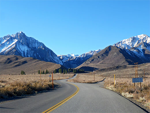
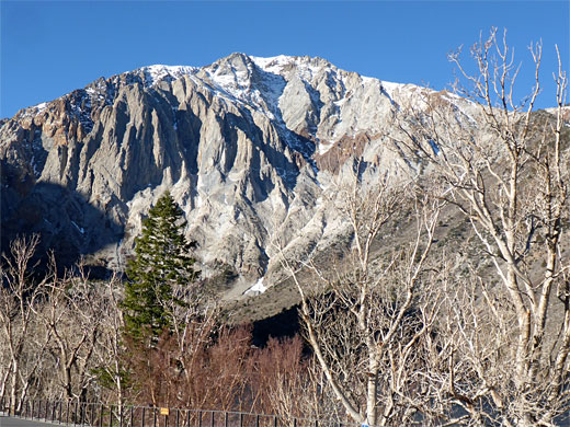
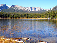
Unlike most lakes in the Eastern Sierra, which have high elevation and require several miles of hiking to reach, Convict Lake is easily accessed, by a 2 mile paved road off US 395 - the lake, elevation 7,580 feet, sits at the lower end of a lengthy, V-shaped ravine containing a sizable stream, Convict Creek, and is a popular destination most of the year, especially in the fall on account of the rich colors of the aspen trees which line part of the shore. The lake has formed behind a moraine dam, left by retreating glaciers.
Near the lake are a resort, including a well reviewed restaurant, a USFS campground, and a trailhead/parking place, right at the end of the road. From here begins a 2.6 mile loop trail all around the shore and, at the far end, a lengthy route up the canyon into the back country, to other lakes including Dorothy, Mildred, Genevieve and Edith.
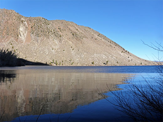
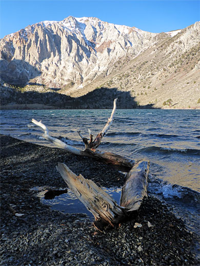
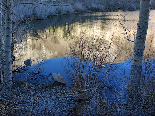
The Convict Lake Loop trail is easy and fairly level, generally staying a little way above the water, through patches of pine and aspen along the shadier southeast shore, and across mostly open terrain to the northwest, which receives full sun most of the day. The trail affords good views of the surrounding reddish mountains as well as the lake, and because of the variety of habitats encounters a good amount of wildflowers in the summer. Sunny days emphasize the natural turquoise-blue color of the waters, which harbor several species of fish, including rainbow trout and brown trout, and is a popular angling destination.
Convict Lake was known to the local Paiute Indians as Lake Wit-sa-nap, receiving its present name after events of 17th September 1871, when it provided a brief refuge for a group of escaped convicts from Carson City. Local lawmakers caught up with the fugitives, prompting a firefight, after which most of the convicts and some of the posse were killed; all the remaining escapees were captured, and later lynched. Another infamous incident occurred on 19th February 1990, when several teenagers on a day-trip from a nearby detention center fell through thin ice, after walking a quarter of a mile from the lakeshore, prompting a rescue mission involving over 50 people from various local organizations. Despite their best efforts, seven people drowned - three teens, two of the counselors and two of the first responders.
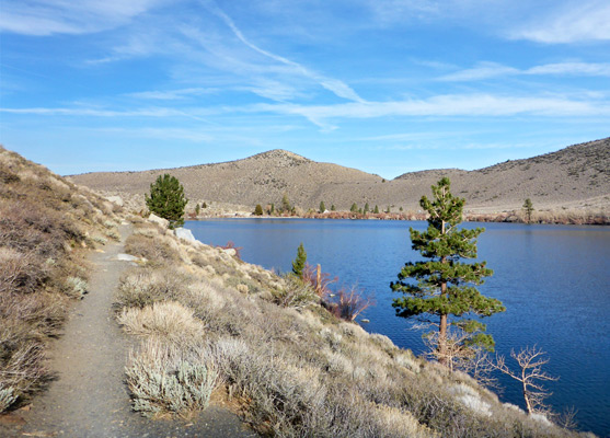
The approach road passes several parking places, and then a larger lot at the north edge of the lake, before ending a little way along the east shore. From here, the loop trail, for which counter-clockwise is the recommended direction, leads across open sagebrush slopes, rising slightly, passing a few 'Lake Access' signs where little paths descend to the water's edge, then entering pinewoods. At one point it passes below a streaked rock outcrop covered with colorful lichens, soon after which the trees change to aspen, and the trail descends to the flat boggy land at the far end of the lake, kept moist by several branches of the two entry streams.
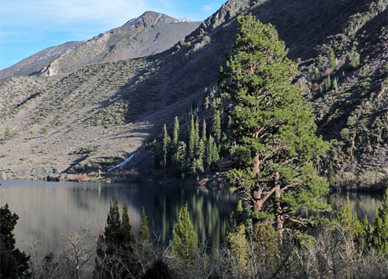
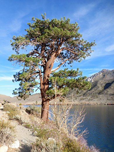
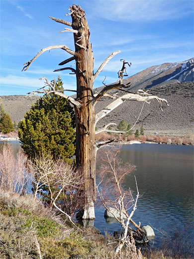
The trail continues, via a few boardwalks, past a junction with a stock bypass trail to another intersection, where the path upcanyon branches off, the first destination being Mildred Lake, 3.3 miles. The loop path now traverses the northwest side of the lake, the ground lightly covered by sagebrush and other shrubs, with just a few large, isolated pines and some standing dead trunks. The final section is bushier, as the path descends to the shoreline, past a boat ramp and meeting a road, which runs along half of a mile of the shore, past several parking places.
Near the lake are a resort, including a well reviewed restaurant, a USFS campground, and a trailhead/parking place, right at the end of the road. From here begins a 2.6 mile loop trail all around the shore and, at the far end, a lengthy route up the canyon into the back country, to other lakes including Dorothy, Mildred, Genevieve and Edith.
The Convict Lake Loop trail is easy and fairly level, generally staying a little way above the water, through patches of pine and aspen along the shadier southeast shore, and across mostly open terrain to the northwest, which receives full sun most of the day. The trail affords good views of the surrounding reddish mountains as well as the lake, and because of the variety of habitats encounters a good amount of wildflowers in the summer. Sunny days emphasize the natural turquoise-blue color of the waters, which harbor several species of fish, including rainbow trout and brown trout, and is a popular angling destination.
History of Convict Lake
Convict Lake was known to the local Paiute Indians as Lake Wit-sa-nap, receiving its present name after events of 17th September 1871, when it provided a brief refuge for a group of escaped convicts from Carson City. Local lawmakers caught up with the fugitives, prompting a firefight, after which most of the convicts and some of the posse were killed; all the remaining escapees were captured, and later lynched. Another infamous incident occurred on 19th February 1990, when several teenagers on a day-trip from a nearby detention center fell through thin ice, after walking a quarter of a mile from the lakeshore, prompting a rescue mission involving over 50 people from various local organizations. Despite their best efforts, seven people drowned - three teens, two of the counselors and two of the first responders.
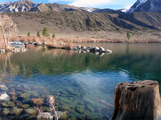
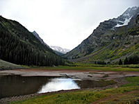
Convict Lake Southeast Shore
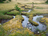
The approach road passes several parking places, and then a larger lot at the north edge of the lake, before ending a little way along the east shore. From here, the loop trail, for which counter-clockwise is the recommended direction, leads across open sagebrush slopes, rising slightly, passing a few 'Lake Access' signs where little paths descend to the water's edge, then entering pinewoods. At one point it passes below a streaked rock outcrop covered with colorful lichens, soon after which the trees change to aspen, and the trail descends to the flat boggy land at the far end of the lake, kept moist by several branches of the two entry streams.
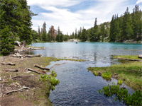
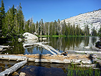
Convict Lake Northwest Shore
The trail continues, via a few boardwalks, past a junction with a stock bypass trail to another intersection, where the path upcanyon branches off, the first destination being Mildred Lake, 3.3 miles. The loop path now traverses the northwest side of the lake, the ground lightly covered by sagebrush and other shrubs, with just a few large, isolated pines and some standing dead trunks. The final section is bushier, as the path descends to the shoreline, past a boat ramp and meeting a road, which runs along half of a mile of the shore, past several parking places.
Convict Lake Wildflower
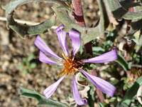 Hoary tansy aster |
Convict Lake Loop - Similar Hikes
All Contents © Copyright The American Southwest | Comments and Questions | Contribute | Affiliate Marketing Disclosure | Site Map