Crater Lake Trail
Shortest path into the Maroon Bells-Snowmass Wilderness, starting beside reflective Maroon Lake and soon reaching Crater Lake after climbing through fir, spruce and aspen forest
Length: 1.8 miles to Crater Lake
Elevation change: 550 feet
Difficulty: Easy
Type: One way. Trail splits near the lake, leading to West Maroon Pass and Buckskin Pass, both much more strenuous hikes
Usage: High
Season: Late spring, summer and fall
Trailhead: End of road FR 125
Rating (1-5): ★★★★★
Elevation change: 550 feet
Difficulty: Easy
Type: One way. Trail splits near the lake, leading to West Maroon Pass and Buckskin Pass, both much more strenuous hikes
Usage: High
Season: Late spring, summer and fall
Trailhead: End of road FR 125
Rating (1-5): ★★★★★

The 1.8 mile path (TR 1975) to Crater Lake and other places beyond leaves the Maroon Lake scenic loop at the far end of the lake and soon crosses the boundary of the Maroon Bells-Snowmass Wilderness. It heads up the densely wooded slope on the north side of the canyon, through a mixture of fir, spruce and aspen. The uphill gradient is consistently steep for the first mile, and the route is mostly quite enclosed, with only limited views of the surrounding mountains.
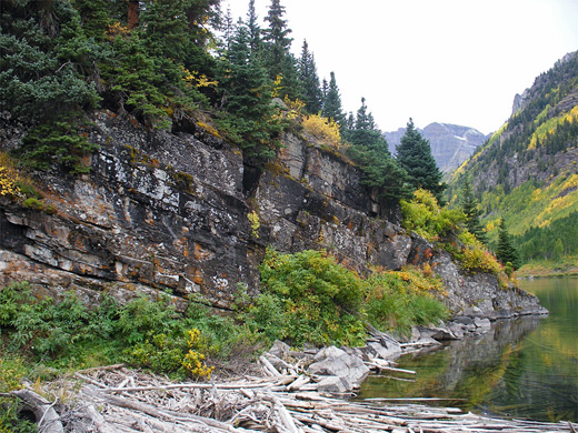
A few gaps in the forest allow sight of the valley floor and West Maroon Creek, which is fast flowing, tumbling over cascades and pools. After the steep section, the trail reaches a treeless boulder field formed by a rockfall long ago, part of a big slide that dammed the valley and formed Crater Lake. The rocks underfoot are loose and uneven so more care is needed on this section.
Crater Lake Trail topographic map
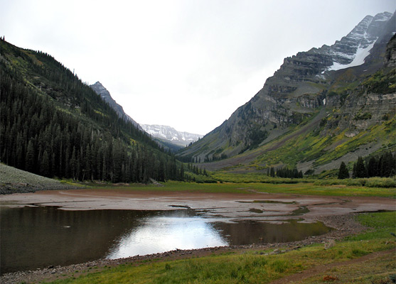
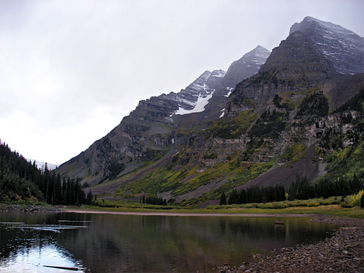
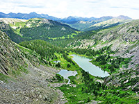
The trees return on the far side of the boulders, and the path soon arrives at a signposted junction, 1.6 miles from the starting point and 500 feet higher in elevation. The left path (TR 1970) descends a little, passing several primitive campsites and emerging into a short grass meadow at the edge of Crater Lake, which is quite shallow, especially in late summer when its south end dries up, exposing mudflats. Upstream, the U-shaped canyon has generally fewer trees, and remains fairly level for several miles, until a long climb at the far end, up to 12,500 foot West Maroon Pass. This trail passes right beneath the steep east face of the Maroon Bells (still 3,000 feet below the summits, however), and has good views, though these don't change too much along the way. Most people just go as far as the lake then head back to the trailhead - a 3.6 mile round trip taking from 1.5 hours.
Back at the junction near Crater Lake, the right fork (the continuation of TR 1975 - the Maroon/Snowmass Trail) is a more rewarding choice for an extended day hike, as it climbs steadily, steeper than before, and so soon provides rather more expansive views. At first this path is still through the forest, initially spruce & fir, then young aspen where the route crosses several open, bouldery areas, course of some of the frequent avalanches that affect the hillsides in winter and spring. After more conifer forest, the trail approaches the edge of a ravine (Minnehaha Gulch), and the trees fade away to allow views down into the steep, jagged-walled canyon below, and the forceful stream flowing through it. Higher up, the gulch becomes temporarily flatter and less rocky, and the waters meander across several small meadows.
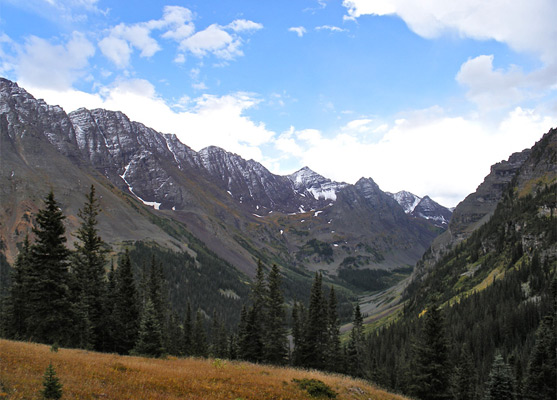
The path climbs some more and reaches a grassy hillside devoid of trees, affording the best views so far - of West Maroon Creek valley, the high mountains to the south centered on Pyramid Peak, the Maroon Bells, and the longer red ridge to the north ('Sleeping Sexton'). The elevation is now 11,000 feet. Past here, other short open areas alternate with patches of woodland until the path finally climbs above the treeline near the upper end of the ravine, and on up to a junction at 11,780 feet, below a ridge separating two steep-sided glacial bowls. The left branch ascends to Buckskin Pass (12,462 feet) and leads to other sites further into the mountains, while the right path peaks at 12,600 foot Willow Pass then traverses rocky tundra for several miles before descending the valley of East Snowmass Creek towards Snowmass Village.
A few gaps in the forest allow sight of the valley floor and West Maroon Creek, which is fast flowing, tumbling over cascades and pools. After the steep section, the trail reaches a treeless boulder field formed by a rockfall long ago, part of a big slide that dammed the valley and formed Crater Lake. The rocks underfoot are loose and uneven so more care is needed on this section.
Map
Crater Lake Trail topographic map
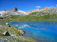
Crater Lake
The trees return on the far side of the boulders, and the path soon arrives at a signposted junction, 1.6 miles from the starting point and 500 feet higher in elevation. The left path (TR 1970) descends a little, passing several primitive campsites and emerging into a short grass meadow at the edge of Crater Lake, which is quite shallow, especially in late summer when its south end dries up, exposing mudflats. Upstream, the U-shaped canyon has generally fewer trees, and remains fairly level for several miles, until a long climb at the far end, up to 12,500 foot West Maroon Pass. This trail passes right beneath the steep east face of the Maroon Bells (still 3,000 feet below the summits, however), and has good views, though these don't change too much along the way. Most people just go as far as the lake then head back to the trailhead - a 3.6 mile round trip taking from 1.5 hours.
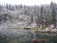
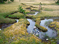
Minnehaha Gulch
Back at the junction near Crater Lake, the right fork (the continuation of TR 1975 - the Maroon/Snowmass Trail) is a more rewarding choice for an extended day hike, as it climbs steadily, steeper than before, and so soon provides rather more expansive views. At first this path is still through the forest, initially spruce & fir, then young aspen where the route crosses several open, bouldery areas, course of some of the frequent avalanches that affect the hillsides in winter and spring. After more conifer forest, the trail approaches the edge of a ravine (Minnehaha Gulch), and the trees fade away to allow views down into the steep, jagged-walled canyon below, and the forceful stream flowing through it. Higher up, the gulch becomes temporarily flatter and less rocky, and the waters meander across several small meadows.
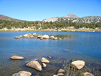
Buckskin Pass
The path climbs some more and reaches a grassy hillside devoid of trees, affording the best views so far - of West Maroon Creek valley, the high mountains to the south centered on Pyramid Peak, the Maroon Bells, and the longer red ridge to the north ('Sleeping Sexton'). The elevation is now 11,000 feet. Past here, other short open areas alternate with patches of woodland until the path finally climbs above the treeline near the upper end of the ravine, and on up to a junction at 11,780 feet, below a ridge separating two steep-sided glacial bowls. The left branch ascends to Buckskin Pass (12,462 feet) and leads to other sites further into the mountains, while the right path peaks at 12,600 foot Willow Pass then traverses rocky tundra for several miles before descending the valley of East Snowmass Creek towards Snowmass Village.
Crater Lake Trail - Similar Hikes
All Contents © Copyright The American Southwest | Comments and Questions | Contribute | Affiliate Marketing Disclosure | Site Map