Highlights:
Three mile section of the Santa Clara River, bordered to the east by a high escarpment lined with many petroglyphs, and to the west by extensive, low hills and branched ravines. Explorable by a network of trails, most open to hiking, cycling and horse riding
Nearby town:
St George, 8 miles
Management:
Location:
37.162, -111.706 (Anasazi Valley trailhead)
Seasons:
All year
Rating (1-5):
★★★★★

Featured Hotel
Best Western Coral Hills
 Popular hotel with an elevated position on the north side of St George, 6 miles from Santa Clara River Reserve. Free hot breakfast and an outdoor pool
Check Rates
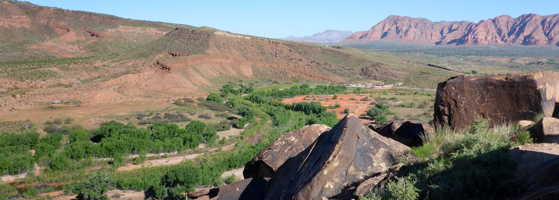
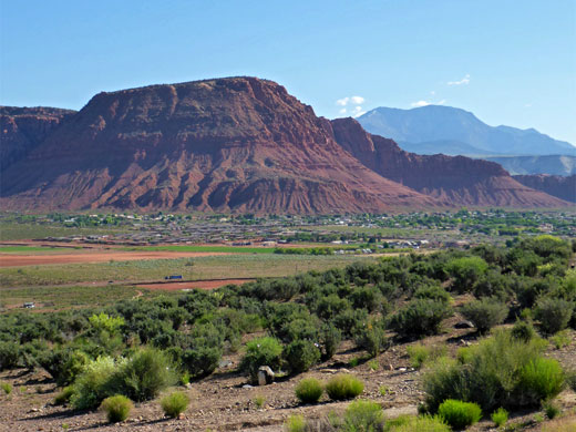
In the far southwest corner of Utah at the edge of the Mojave Desert, the BLM-controled Santa Clara River Reserve is a little known region of red and white hills, crossed by a 3 mile stretch of the river, flowing through a generally wide valley with a flat, overgrown floor, and steep or gentle slopes on either side. The area is bordered to the west by the foothills of the Beaver Dam Mountains and to the northwest by part of the Shivwits Paiute Indian reservation, while the eastern boundary lies close to Old Hwy 91, between Santa Clara and Shivwits.
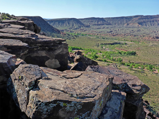
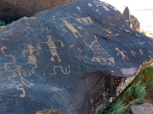
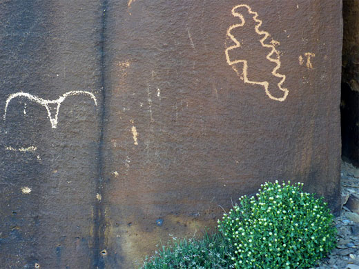
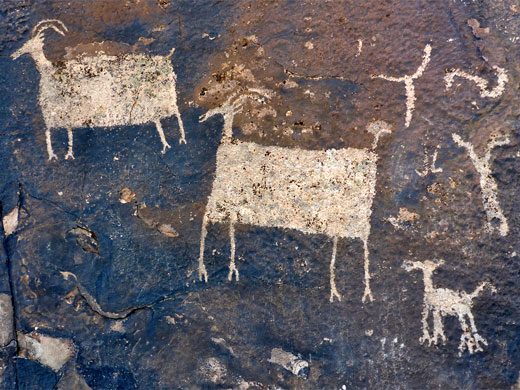
Besides the fine views of the surrounding red rock hills, including Red Mountain and the lower end of Snow Canyon State Park, the reserve is most famous for its numerous ancient petroglyphs, which occur in a band along the rim of a steep slope overlooking the east side of the river, an escarpment at the edge of a small plateau named Land Hill. The designs are varied, crisp, well preserved and easy to find, etched on large, reddish-brown rocks of the Moenkopi Formation, and they may be seen by a one-way hike of between one and two miles, starting from any of three trailheads.
Another path follows the river, while more trails cross the undulating, low relief hills and branched ravines to the south and west - routes which are mostly used by mountain bikers, since away from the petroglyphs and the river corridor there is not too much of interest to see, although the one significant tributary of the river, Wittwer Canyon, does upstream lead to a pretty pair of narrow ravines containing springs and permanent streams. These narrows are within the adjacent Indian reservation though can most readily be reached through the river reserve.
Santa Clara River Table of Contents
Photographs
General views, Wittwer Canyon, wildflowers.
Santa Clara River Trailheads
The reserve has three main access points. The northernmost is the Anasazi Valley Trailhead, at the end of a 0.3 mile gravel track that forks west off Hwy 91, a little way beyond the western edge of Santa Clara. A path heads south from here to the petroglyph site and continues to the main trailhead, Tukupetsi, reached by a similarly short track off Hwy 91, leaving a few hundred feet northwest of the Jacob Hamblin Home. The less-used Cove Wash Trailhead is on the south side of the reserve, at the end of a one mile track off Gates Lane, which meets the highway immediately east of the Hamblin Home. Cove Wash runs through the center of the main mountain biking area, with about a dozen intersecting routes nearby, merging with other, undesignated tracks that access areas further west. The two northern trailheads are more used by hikers. There are several other, minor access points, some also close to the highway.
Petroglyphs - the Tempi'po'op Trail
The easiest access to the Santa Clara River petroglyphs is from the Anasazi Valley trailhead, on the north side of the reserve, set amidst largely undeveloped surroundings close to the river, which at this point is privately owned. Parking is free, and notices give information about the various trails in the reserve. Upstream, the river is enclosed by low, sandy slopes, but to the south the ground rises to form a substantial escarpment, on the east side, up to 300 feet above the river. East of here, the land slopes down very gradually towards the highway. The top of the high ground is formed of an even layer of erosion-resistant conglomerate (the Shinarump member of the Chinle Formation), lying on top of the upper red member of the Moenkopi Formation, which is exposed most extensively on the cliffs bordering the east side of the river.
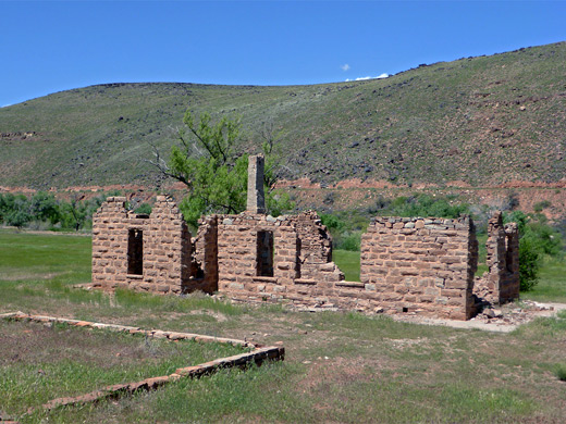
The path (the Tempi'po'op Trail) heads south, taking an excessively zig-zagging course up the sparsely vegetated slope, where the winding mariposa lily is perhaps the most eye-catching wildflower species. A short side-loop after 0.7 miles explores the partly reconstructed remains of a prehistoric farmstead, consisting of low walls and enclosures, built around 1,000 years ago. The petroglyphs start not far beyond, and extend for several hundred feet, generally just below the plateau edge, on boulders - sometimes they are small isolated figures, in other places they occur in large groups, and are found either on the side of the rocks or more usually on the top. Below the plateau, the land falls away steeply to the willow- and grass-filled river corridor, with dry-looking, stony hills beyond, the closer of which are still red, while those further away are white or pinkish, formed of the underlining Shnabkaib member of the Moenkopi Formation. The main trail ends at the petroglyphs, though a somewhat narrower route continues south along the rim, later passing a few smaller groups of the rock art, and reaches the Tukupetsi trailhead in another 2 miles.
Santa Clara River - Hiking
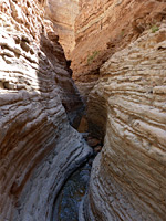
Wittwer Canyon
★★★★★
★★★★★
7.6 miles, 300 feet (round trip)
Small stream flowing through a narrow canyon, containing springs and enclosed channelsSanta Clara River - Nearby Places
- Buckskin Hollow (13 miles) - short drainage through very colorful rocks
- Gunlock State Park (10 miles) - reservoir enclosed by red, sandy hills
- Snow Canyon State Park (4 miles) - white cliffs, red sandstone and black lava
Santa Clara River - Similar Places
- Basin and Range National Monument, Nevada - rock art in the Great Basin Desert
- Red Cliffs Recreation Area, Utah - red rocks around a permanent stream
All Contents © Copyright The American Southwest | Comments and Questions | Contribute | Affiliate Marketing Disclosure | Site Map