Grandstaff Canyon to Morning Glory Arch
Popular route along a riparian, tree-lined, red rock ravine to a huge natural bridge, at the end of a short, narrow side canyon. The trail crosses the stream several times, rises to a sandy bluff then drops down to the arch
Length: 2.6 miles
Elevation change: 300 feet
Difficulty: Moderate
Type: One-way
Usage: High
Season: All year
Trailhead: Parking area along Hwy 128, 5 miles from Moab
Rating (1-5): ★★★★★
Elevation change: 300 feet
Difficulty: Moderate
Type: One-way
Usage: High
Season: All year
Trailhead: Parking area along Hwy 128, 5 miles from Moab
Rating (1-5): ★★★★★

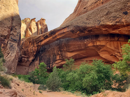
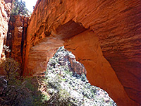
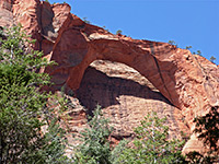
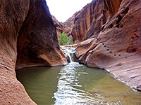
The 2.6 mile trail up Grandstaff Canyon to Morning Glory Arch is probably the most popular near Moab outside of those in Arches National Park, perhaps seeing several hundred people on busy days. The fairly level path follows the bushy floor of a partly shaded, riparian canyon containing a permanent stream, crossing the waters several times, then climbing over some sandy benches and dropping down to the upper end of a short side canyon, framed by a huge natural arch in the Navajo sandstone. The feature is sometimes described as a natural bridge, but is a true arch, formed by wind and rain erosion rather than by running water.
The arch is 243 feet across, apparently the sixth largest in the country, and is a popular location for rappelling; hikers approach via a track off Sand Flats Road on the plateau above the canyon, firstly descending between two fins to a secluded chamber, followed by a free-hanging rappel of around 110 feet down to the canyon floor.
Grandstaff Canyon was until 2017 known as Negro Bill Canyon; both new and old names reference William (Bill) Grandstaff, a mixed-race rancher and prospector who settled in Moab in 1877 and kept a herd of cattle in the canyon, taking advantage of the year-round water supply. Bill departed in the area in haste in 1881, after being accused of selling liquor to the local native tribes, after which he moved to Colorado and died there in 1901 aged about 60, in Glenwood Springs.
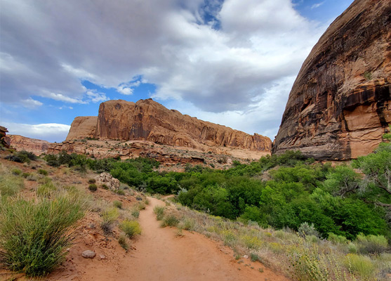
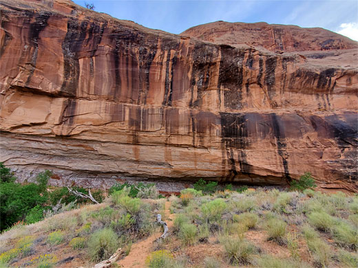
The Grandstaff Canyon trailhead is 3 miles along Hwy 128, at the mouth of the canyon, where the stream meets the Colorado River in a thicket of bushes and reeds. The designated parking lot accommodates around 30 vehicles, so is often full, but there are plenty more spaces nearby, on verges, and in a lengthy pull out at the entrance to Grandstaff Campground, just upstream alongside the river. The surrounding cliffs are 400 feet tall, mostly composed of Navajo sandstone, with a narrow layer of the Kayenta Formation at the base.
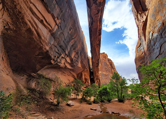
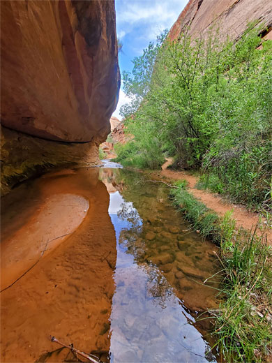
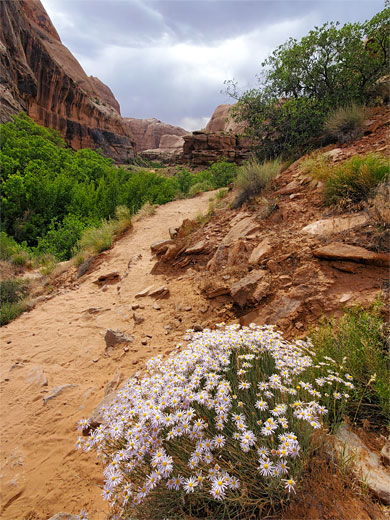
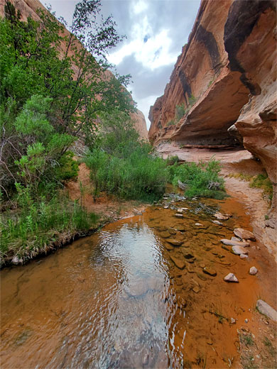
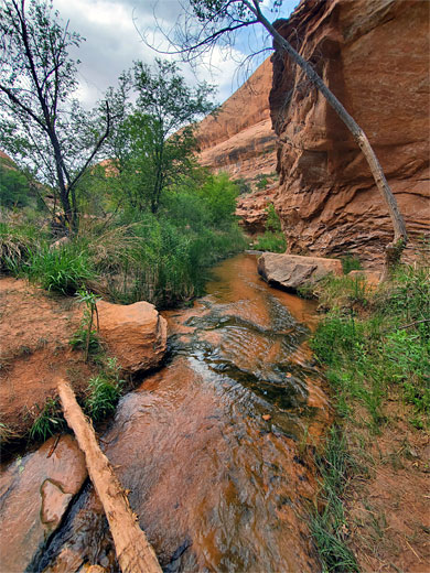
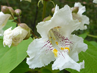
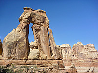
The wide and well-used path starts off on the east side of the small, gently flowing creek, traverses a brief rocky area then descends to the stream, running through quite dense vegetation; the canyon is home to a good range of wildflowers, bushes and trees, including cottonwoods, pinyon pine and desert willow. The trail crosses the creek a few times and stays mostly within sight of the waters, as they flow over little cascades and through some long, shallow pools. One section is semi-enclosed, with a straight, sheer cliff on the far side and a line of trees on the other. A wider, photogenic cascade is reached after one mile, as the path crosses from east to west, and there is another scenic section just beyond with a slightly overhanging cliff, shortly before the junction with a side canyon to the south, as the main drainage bends to the east. The trail climbs away from the creek, crossing an exposed, sandy bench, followed by two more stream crossings, up to another junction, with the side ravine containing the arch.
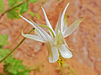
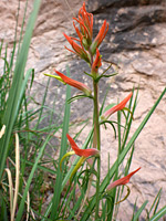
The last segment is along this canyon, climbing again along a bench, rocky in places and quite high above the stream, which flows through a corridor of greenery down to the west. The path drops down through a patch of trees and enters the shady, enclosed chamber beneath the arch, containing a tiny stream that flows along a straight crack in the rock, originating from a small hole right at the base of the cliffs. Just above is a single patch of Mancos columbine, an uncommon wildflower endemic to the Colorado Plateau.
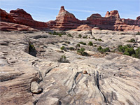
Lesser trails continue further up the main canyon, on one or both sides, initially over wide benches, until the drainage narrows and becomes rather shallow, after 1.5 miles. The streambed can be followed for several more miles; it eventually splits into several little tributaries, below Porcupine Rim, the great divide above Castle Valley.
The arch is 243 feet across, apparently the sixth largest in the country, and is a popular location for rappelling; hikers approach via a track off Sand Flats Road on the plateau above the canyon, firstly descending between two fins to a secluded chamber, followed by a free-hanging rappel of around 110 feet down to the canyon floor.
Grandstaff Canyon was until 2017 known as Negro Bill Canyon; both new and old names reference William (Bill) Grandstaff, a mixed-race rancher and prospector who settled in Moab in 1877 and kept a herd of cattle in the canyon, taking advantage of the year-round water supply. Bill departed in the area in haste in 1881, after being accused of selling liquor to the local native tribes, after which he moved to Colorado and died there in 1901 aged about 60, in Glenwood Springs.
Grandstaff Canyon Trailhead
The Grandstaff Canyon trailhead is 3 miles along Hwy 128, at the mouth of the canyon, where the stream meets the Colorado River in a thicket of bushes and reeds. The designated parking lot accommodates around 30 vehicles, so is often full, but there are plenty more spaces nearby, on verges, and in a lengthy pull out at the entrance to Grandstaff Campground, just upstream alongside the river. The surrounding cliffs are 400 feet tall, mostly composed of Navajo sandstone, with a narrow layer of the Kayenta Formation at the base.
The Canyon
The wide and well-used path starts off on the east side of the small, gently flowing creek, traverses a brief rocky area then descends to the stream, running through quite dense vegetation; the canyon is home to a good range of wildflowers, bushes and trees, including cottonwoods, pinyon pine and desert willow. The trail crosses the creek a few times and stays mostly within sight of the waters, as they flow over little cascades and through some long, shallow pools. One section is semi-enclosed, with a straight, sheer cliff on the far side and a line of trees on the other. A wider, photogenic cascade is reached after one mile, as the path crosses from east to west, and there is another scenic section just beyond with a slightly overhanging cliff, shortly before the junction with a side canyon to the south, as the main drainage bends to the east. The trail climbs away from the creek, crossing an exposed, sandy bench, followed by two more stream crossings, up to another junction, with the side ravine containing the arch.
The Arch
The last segment is along this canyon, climbing again along a bench, rocky in places and quite high above the stream, which flows through a corridor of greenery down to the west. The path drops down through a patch of trees and enters the shady, enclosed chamber beneath the arch, containing a tiny stream that flows along a straight crack in the rock, originating from a small hole right at the base of the cliffs. Just above is a single patch of Mancos columbine, an uncommon wildflower endemic to the Colorado Plateau.
The Upper Canyon
Lesser trails continue further up the main canyon, on one or both sides, initially over wide benches, until the drainage narrows and becomes rather shallow, after 1.5 miles. The streambed can be followed for several more miles; it eventually splits into several little tributaries, below Porcupine Rim, the great divide above Castle Valley.
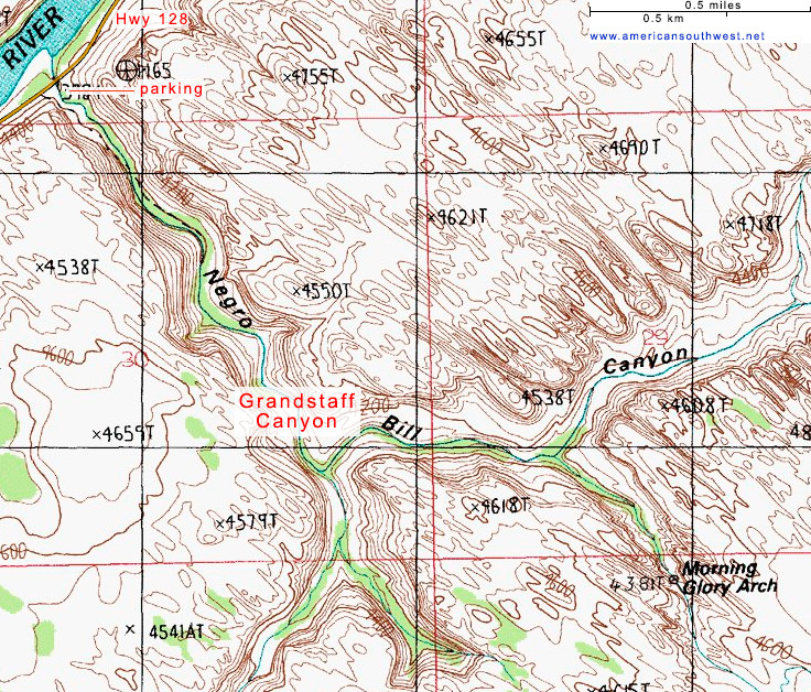
Topographic Map of the Grandstaff Canyon Trail
Grandstaff Canyon - Similar Hikes
All Contents © Copyright The American Southwest | Comments and Questions | Contribute | Affiliate Marketing Disclosure | Site Map