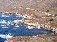
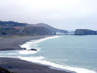
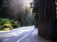
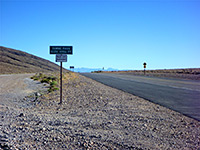
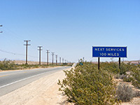
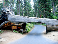
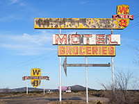
Other scenic roads in the state are concentrated in the mountains or the southwest deserts; examples of the former include US 395 along the eastern Sierra - near such varied places as Mono Lake, Hot Creek and Mammoth Lakes, the 72 mile ring road around Lake Tahoe, any of the half dozen trans-Sierra passes, the northern 100 miles of Interstate 5 past the Cascade Range, and of course most of the roads in the famous mountain-based national parks of Yosemite, Kings Canyon, Sequoia and Lassen Volcanic. In the southwest there are many long, straight, little used roads through amazing, hypnotic desert scenery; some examples are Route 66, Hwy 62 east of Joshua Tree NP, CA 127 between Baker and the south end of Death Valley, various roads through the Mojave National Preserve and the north-south route US 95 near the Colorado River. There are also many spectacular stretches of highway within Joshua Tree and Death Valley national parks.
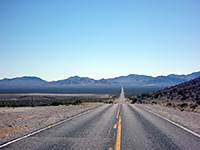
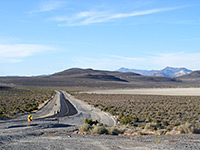
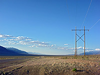
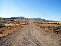
Most roads in Nevada run either north-south, along the many parallel valleys of the Great Basin Desert, or east-west, across the valleys and the narrow mountain ranges in between, and one such road is similar to any other, but some recognized scenic drives are NV 376/305 between Tonopah and Battle Mountain, NV 375, the Extraterrestrial Highway, US 93 from Caliente to Ely, NV 445 to Pyramid Lake and the Black Rock Desert, and US 50, the loneliest road in America. Two good shorter routes, both close to Las Vegas, are the drive through Valley of Fire State Park, and NV 447 (Northshore Road) along the western shores of Lake Mead.
- US 89 in the Paria River region
- The short section of UT 261 up Cedar Mesa, and nearby Muley Point
- I-80 across the Great Salt Lake Desert
- US 1912 between Vernal and Flaming Gorge Reservoir
- Potash Road near Moab
- Alpine Loop
- Mount Nebo Scenic Byway
Arizona has similarly varied mixture of scenery to Utah; routes cross low deserts, thick forests, grassy plateaus and high mountains. Some of the best roads are the following:
- AZ 281 through Organ Pipe Cactus National Monument, past many huge cacti and other Sonoran Desert plants; also the Puerto Blanco and Ajo Mountain drives
- UT 95 past Kofa NWR, one of the longest straight roads in the Southwest (47 miles, including the stretch on the north side of Quartzsite)
- Route 66, from Topock to Kingman, and Kingman to Williams - long sections of the famous old road, through lonely land of the Black Mountains, the Hualapai Reservation and the Colorado Plateau
- South Rim Drive at the Grand Canyon - a 36 mile route past many fine viewpoints
- SR 67 (North Rim Parkway) and Cape Royale Road, partly across the forested Kaibab Plateau to less-visited Grand Canyon viewpoints on the North Rim
- The 35 mile road through Wupatki and Sunset Crater national monuments
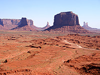
- US 191 through Monument Valley, and the linked Valley Drive within the Navajo Tribal Park
- US 191, the Coronado Trail, across Sulphur Springs Valley and the White Mountains
- Apache Trail, a partly unpaved route winding through the cactus-covered slopes of the Superstition Mountains east of Phoenix
- The Catalina Highway to the summit of Mount Lemmon, near Tucson
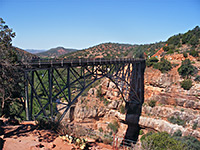
- US 89A, Oak Creek Canyon and Sedona
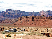
- US 89A across Marble Gorge near Lees Ferry and along the base of the Vermilion Cliffs
- Peach Springs Canyon, an unpaved road, rough towards the end, that follows a tributary all the way to the shores of the Colorado River deep within the Grand Canyon
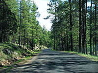
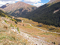
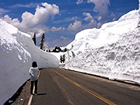
With a few exceptions like the rim drive in Colorado National Monument, Harpers Corner Road in Dinosaur National Monument and the road to Mesa Verde National Park, the Rocky Mountains are the setting for most scenic routes in Colorado, ranging from the loop through the San Juan Mountains in the southwest to Trail Ridge Road through Rocky Mountain National Park in the northeast. A selection of other notable roads are to the summit of Pikes Peak, US 24 across Independence Pass and on to Aspen, US 50 alongside Black Canyon of the Gunnison, Curecanti Reservoir and Monarch Pass, and much of Interstate 80, 150 miles of which are through the mountains.
The best parts of Wyoming are also in the Rockies, in the west, especially US 191 through Grant Teton and Yellowstone national parks, and the four connecting routes to this region from the east (US 189 to Pinedale, US 287 to Dubois, US 14 to Cody and US 212 from Billings, MT). Teton Park Drive is a noted scenic drive through the middle of Grand Teton National Park.
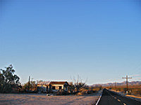
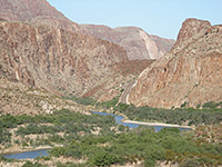
West Texas resembles much of New Mexico, being flat, largely treeless and relatively little habited, but the scenery improves towards the Big Bend region, especially along some of the roads. Best of all is the River Road, west of Big Bend National Park, through the untouched Chihuahuan Desert landscapes of Big Bend Ranch State Park.
View all photographs of scenic drives.
All Contents © Copyright The American Southwest | Comments and Questions | Contribute | Affiliate Marketing Disclosure | Site Map