Highlights:
Scenic drive from Santa Fe to Roswell, avoiding the main highways - a 252 journey along quiet back roads, partly unpaved (NM 3, NM 247, NM 246 and CRE 010)
Management:
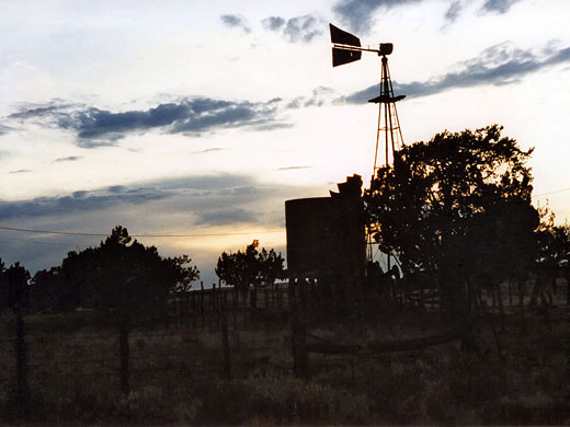
Most of the land en route is privately owned, part of large cattle ranches
Location:
Seasons:
All year
Rating (1-5):
★★★★★

South of I-40 and east of I-25, New Mexico is mainly flat and empty. Occasional mountain ranges rise above the endless acres of prairie, but these are widely spaced, often visible an hours drive away across the flatness, and are only found towards the west.
Driving across this barren expanse is still a worthwhile and rewarding experience; try for instance the journey from Santa Fe to Roswell - this is 213 miles along US 285, the comparatively well-travelled direct route, or 252 miles along forgotten side roads with virtually no traffic - state routes 3, 247 and 246, and farm road CRE 010.
Driving across this barren expanse is still a worthwhile and rewarding experience; try for instance the journey from Santa Fe to Roswell - this is 213 miles along US 285, the comparatively well-travelled direct route, or 252 miles along forgotten side roads with virtually no traffic - state routes 3, 247 and 246, and farm road CRE 010.
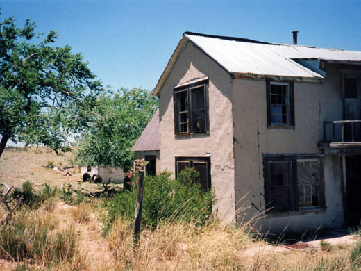
An Abandoned House - description of a mysterious derelict homestead along road CRE 010, one of thousands of such empty dwellings in New Mexico
Santa Fe to Roswell Table of Contents
Encino
At first, NM 3 is unexpectedly narrow and winding, following the Pecos River valley south from junction 323 of I-25 (43 miles from Santa Fe), through sleepy farming villages with small fields and patches of woodland. Past Villanueva, the road climbs up and across a low plateau, the trees fade away and quite suddenly the land opens out, and rolling grass- and scrub-covered hills extend to the far horizon. After a 30 minute drive further the unchanging scenery is interrupted by interstate 40, then there is nothing of note for 26 miles until Encino, a tiny windswept town built as a halt along a branch line of the Atchison, Topeka and Santa Fe railway.
Santa Fe Tours
Learn about the architecture, history and culture of Santa Fe.
Camping
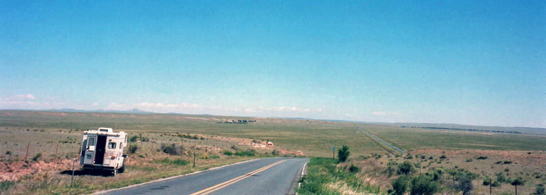
Route 3 continues due south across country now flat and quite featureless, although still appealing in its own way. Unlike much of the desert in Arizona or Utah, the land is privately owned, used mainly for ranching and fenced off either side of the road. Camping is no problem, though - just pull over on to the wide grass verge. No more than 6 other vehicles passed between Encino and Duran in the summer's evening I spent on the roadside.
Road CRE 010
Civilisation returns for a while for the 19 mile stretch of US 54 heading southwest - part of the main road to El Paso. A turn southeast at Corona, another unmemorable town of a few hundred people and a pleasant drive along Gallo Canyon, a shallow cacti-filled valley, leads to a junction with farm road CRE 010 - unpaved and unfenced, this heads due south for another 33 miles and crosses an interesting landscape with sweeping desert vistas, clusters of colorful cacti and a few melancholy abandoned homesteads. These old dwellings can be fascinating to explore, but often a little sad - see here for an example.
Roswell
Travel to Roswell is completed by a 1 hour drive east on NM 246; this road is bendy, quite hilly and still without any villages; only a few well separated ranches interrupt the scrub-covered plains. The land is not much different beyond Roswell, just a little flatter and less scenic, with more signs of industry and settlement.
All Contents © Copyright The American Southwest | Comments and Questions | Contribute | Affiliate Marketing Disclosure | Site Map