Highlights:
The most scenic and varied part of the Mojave Desert, containing sand dunes, Joshua trees, cacti, volcanic features, isolated mountains and old mines. Popular for hiking, 4WD exploration and (free) primitive camping. A small but varied selection of trails, and scenic drives
Nearby town:
Needles, 87 miles (from Kelso)
Management:
Location:
35.011, -115.654 (Kelso)
Seasons:
All year, but less busy during the long hot months of summer
Rating (1-5):
★★★★★

Mojave National Preserve is part of the California Deserts itinerary
Mojave - Roads and Sites
Places to see along the main roads through the national preserve, including Shadow Valley, Cima, Kelso, Ivanpah, Black Canyon and Granite Pass
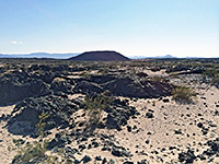
The Mojave Desert may have a reputation as being a hot, rattlesnake-infested sandy wasteland, but it contains numerous particular places of interest, and the vast open spaces have a special, stark beauty of their own, which has to be experienced in person to be fully appreciated. Despite the apparent emptiness, quite a lot of the land is put to use; there are four huge military bases, up to 50 miles in extent, and scattered but extensive habitation in the area west of Barstow. What remains is not just sand dunes and inhospitable mountains, but also ghost towns, volcanic craters and lava, historic sites and buildings, various other unusual geological features and even a diverse range of wildlife.
The Mojave often seems timeless, unending and indestructible, but some parts are threatened by a variety of developments including expansion of the army reservations, mining, land-fill rubbish dumps and new housing construction. The most unspoilt and unpopulated region is the East Mojave, and a large expanse between I-40 and I-15 containing much scenic and unusual terrain has been protected for many years as a National Scenic Area.
The land was redesignated a National Preserve following the California Desert Protection Act of 1994, a move which in theory affords the land greater protection, but has met with mixed responses owing to the possible detrimental effects of the likely increase in visitation and publicity, though the preserve remains lightly traveled compared to the nearby Death Valley and Joshua Tree national parks. More of the desert was protected in 2016 by creation of Mojave Trails National Monument, which links Joshua Tree with the national preserve.
Mojave Table of Contents
Location
Map of Mojave National Preserve.
Photographs
Roads and landscapes, cacti and yucca, all Mojave photographs.
Locations in the National Preserve
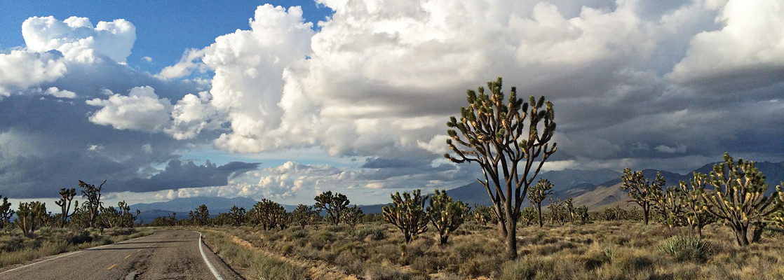
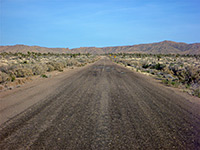
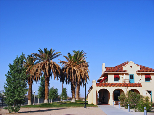
Various types of roads cross the 1.6 million acres of the Mojave National Preserve; many are unpaved and lead to old settlements, springs, water wells and dozens of mines, some still in use but most long disused. Main (paved) routes into the area from the north leave from three I-15 exits; the Kelbaker, Cima and Morning Star Mine roads, the latter two of which converge at Cima, from which a good quality road continues to an intersection with Kelbaker Road at Kelso, then proceeds further south and eventually meets I-40 at the southern edge of the preserve. All routes pass many points of interest, and the journey from I-15 along any of the three makes a great drive of 2 hours or so. The route initially on Morning Star Mine Road also forms part of the shortest drive from Las Vegas to Palm Springs. The main visitor center for the preserve is at Kelso, occupying an old railway depot, but the greatest concentration of facilities (campgrounds and trails) are in the Hole-in-the-Wall region further east, reached by a paved road from the south or good quality unpaved routes from the north. For hiking, there are few maintained trails though opportunities for cross-country exploration are almost limitless.
Featured Mojave Trails
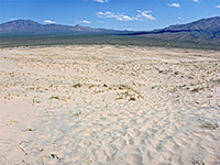
Kelso Dunes
★★★★★
★★★★★
1.5 miles, 470 feet
Well-used route to the high point of a prominent group of sand dunes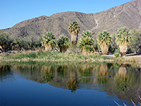
Lake Tuendae
★★★★★
★★★★★
0.25 miles, level
Very short walk around a palm tree-lined artificial lake, at the remote settlement of Zzyzx
Lava Tube
★★★★★
★★★★★
0.3 miles, 70 feet
Short lava cave, illuminated at intervals by small gaps in the ceiling, the light made more evident by dust in the air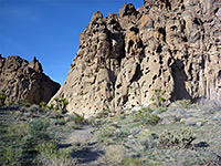
Rings Trail
★★★★★
★★★★★
1.4 miles, 700 feet (loop)
Hike along a short slot canyon through grey volcanic rocks, assisted by ringbolts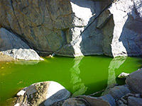
Rock Spring Loop
★★★★★
★★★★★
1 miles, 120 feet (loop)
Short loop past some seasonal pools in a boulder-filled granite ravine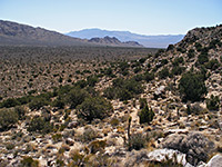
Teutonia Peak
★★★★★
★★★★★
2 miles, 700 feet
The trail to Teutonia Peak passes a Joshua tree forest and an old silver mine then climbs a narrow ridge to a granitic summit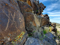
Willow Wash Petroglyphs
★★★★★
★★★★★
0.2 miles, level
Small group of petroglyphs along an ancient travel route across the Mojave Desert; reached by a very short hike from Kelbaker RoadMojave Desert Tours
Guided tours of the desert, from Las Vegas.
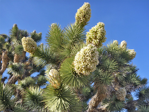
Mojave Wildflowers
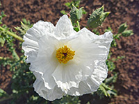
Photographs and descriptions of flowering plants found in the national preserve
Mojave - Nearby Places
- Calico Ghost Town (90 miles from Kelso) - partially restored silver mining town near Barstow
- Route 66 (33 miles from Kelso) - long section of the old highway through the desert
Mojave - Similar Places
- Kofa National Wildlife Refuge, Arizona - wide plains and isolated mountains
- Sonoran Desert National Monument, Arizona - expanse of the desert southwest of Phoenix
All Contents © Copyright The American Southwest | Comments and Questions | Contribute | Affiliate Marketing Disclosure | Site Map