Kelso Dunes Trail, Mojave National Preserve
California > Mojave National Preserve > Hiking > Kelso Dunes Trail
Kelso Dunes Trail
Well-used route to the high point of a prominent group of sand dunes, the most accessible of several dune fields in the preserve. Initially across sparsely vegetated terrain with bushes and wildflowers, then pure sand
Length: 1.5 miles
Elevation change: 470 feet
Difficulty: Easy to moderate
Type: One way
Usage: Medium
Season: Fall, winter and spring are best; very hot in summer
Trailhead: West end of a side track, off Kelbaker Road
Rating (1-5): ★★★★★
Elevation change: 470 feet
Difficulty: Easy to moderate
Type: One way
Usage: Medium
Season: Fall, winter and spring are best; very hot in summer
Trailhead: West end of a side track, off Kelbaker Road
Rating (1-5): ★★★★★

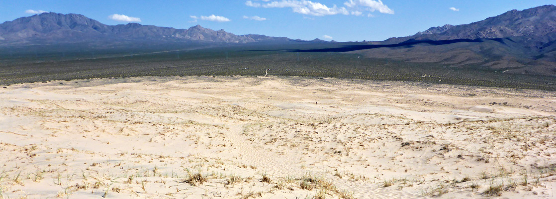
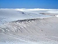
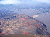
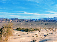
The Kelso Dunes cover 45 square miles of the desert in the southwestern corner of Mojave National Preserve, bordering an even larger (and flatter) sandy area, Devils Playground; both extend northwestwards from a pass between the Providence and Granite mountains, two comparatively high ranges which disrupt the prevailing winds and so cause deposition of the aeolian sand, though the dunes seem not to be growing at present.
Most of the sands are far from any road and so are rarely explored (since ATVs are not allowed) but the tallest dune, 3,115 feet, lies close to the southern edge, and may be reached by a 1.5 mile trail starting along a side road that forks off Kelbaker Road.
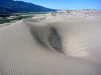
Because of the ease of access and the far-reaching views the Kelso Dunes is one of the most popular sites in the national preserve, receiving dozens of visitors each day during the temperate seasons of spring and fall; the place is best avoided in summer, however, when temperatures can top 110°F. The route into the dunes starts as a well-defined path through bushes and scattered wildflowers, then splits into several routes as the gradient increases and the vegetation fades away - across most of the dunes the surface is pure sand, colored light orange/brown, appearing slightly pinkish in places, and formed of feldspar and quartz, probably originating in the San Bernardino Mountains 70 miles southwest. The dunes are also notable for the singing, or booming sound, which may be produced during windy spells, or by people running down the steep slopes, this being the best way to descend after reaching the summit.
Map of Mojave National Preserve.
The 3 mile side road to the Kelso Dunes trailhead is partially paved, though bumpy and pockmarked, so 30 mph is a typical speed. The road continues a short distance to a primitive campsite then narrows, now for 4WD only, heading for a remote area along the western edge of the dunes.
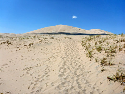
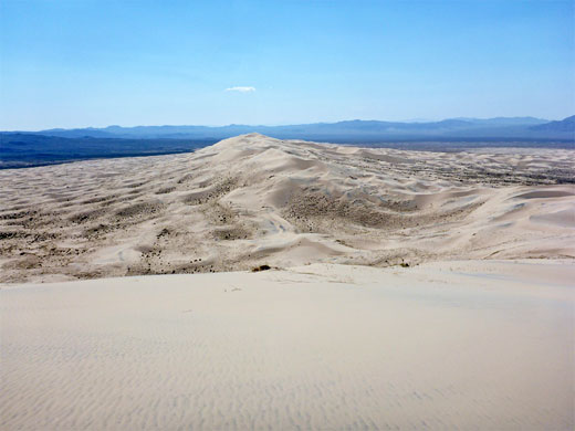
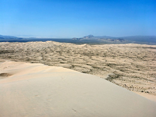
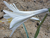
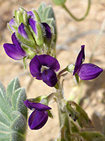
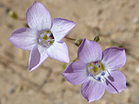
The obvious trail leads northwest from the parking area and is flat for the first quarter of a mile, crossing sparsely grassy terrain with plentiful wildflowers in spring, most noticeable being the desert lily, though the majority of species are small, including astragalus, gilia, chaenactis and desert dandelion. The vegetation lessens as the land rises at the edge of the dunes, the last remnants being a few bushes and clumps of coarse, tufted grass, then the gradient steepens further as the path, sometimes splitting into two or more, rises to a narrow ridge, which is followed 200 feet west to the top of the tallest dune, the destination for most hikers. Some people walk along a lengthier though slightly lower ridge to the east. The sand is soft but the walk as a whole is not too strenuous, and away from the path the dune surfaces are relatively firm, hardened by wind and sun. From the summit of the dunes, an often very windy location, the panoramic view encompasses a vast area of the desert, across plains towards barren mountains in most directions.
Most of the sands are far from any road and so are rarely explored (since ATVs are not allowed) but the tallest dune, 3,115 feet, lies close to the southern edge, and may be reached by a 1.5 mile trail starting along a side road that forks off Kelbaker Road.
Because of the ease of access and the far-reaching views the Kelso Dunes is one of the most popular sites in the national preserve, receiving dozens of visitors each day during the temperate seasons of spring and fall; the place is best avoided in summer, however, when temperatures can top 110°F. The route into the dunes starts as a well-defined path through bushes and scattered wildflowers, then splits into several routes as the gradient increases and the vegetation fades away - across most of the dunes the surface is pure sand, colored light orange/brown, appearing slightly pinkish in places, and formed of feldspar and quartz, probably originating in the San Bernardino Mountains 70 miles southwest. The dunes are also notable for the singing, or booming sound, which may be produced during windy spells, or by people running down the steep slopes, this being the best way to descend after reaching the summit.
Location
Map of Mojave National Preserve.
Kelso Dunes Trailhead
The 3 mile side road to the Kelso Dunes trailhead is partially paved, though bumpy and pockmarked, so 30 mph is a typical speed. The road continues a short distance to a primitive campsite then narrows, now for 4WD only, heading for a remote area along the western edge of the dunes.
Kelso Dunes Trail
The obvious trail leads northwest from the parking area and is flat for the first quarter of a mile, crossing sparsely grassy terrain with plentiful wildflowers in spring, most noticeable being the desert lily, though the majority of species are small, including astragalus, gilia, chaenactis and desert dandelion. The vegetation lessens as the land rises at the edge of the dunes, the last remnants being a few bushes and clumps of coarse, tufted grass, then the gradient steepens further as the path, sometimes splitting into two or more, rises to a narrow ridge, which is followed 200 feet west to the top of the tallest dune, the destination for most hikers. Some people walk along a lengthier though slightly lower ridge to the east. The sand is soft but the walk as a whole is not too strenuous, and away from the path the dune surfaces are relatively firm, hardened by wind and sun. From the summit of the dunes, an often very windy location, the panoramic view encompasses a vast area of the desert, across plains towards barren mountains in most directions.

Kelso Dunes Trail - Similar Hikes
All Contents © Copyright The American Southwest | Comments and Questions | Contribute | Affiliate Marketing Disclosure | Site Map