Sand Ramp Trail, Great Sand Dunes National Park
Colorado > Great Sand Dunes National Park and Preserve > Hiking > Sand Ramp Trail
Sand Ramp Trail
Long, lightly traveled path that heads north from the park campground, past an elevated overlook, and continues close to the edge of the forest at the foot of the Sangre de Cristo Mountains. The dunes can be explored by off trail hiking; one option, for a loop, is to leave the path after 2 or 3 miles and walk west, across Medano Creek, returning beside or through the dunes
Length: 11 miles, or less, or a loop of 4 miles or more
Elevation change: up to 400 feet
Difficulty: Easy to moderate
Type: One way or partial off-trail loop
Usage: Medium to the dunes overlook, low thereafter
Season: Spring, summer, fall
Trailhead: Loop 2 of the campground
Rating (1-5): ★★★★★
Elevation change: up to 400 feet
Difficulty: Easy to moderate
Type: One way or partial off-trail loop
Usage: Medium to the dunes overlook, low thereafter
Season: Spring, summer, fall
Trailhead: Loop 2 of the campground
Rating (1-5): ★★★★★

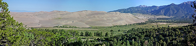
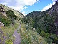
Most hiking in Great Sand Dunes National Park takes place on the dunes, starting from the main parking area just north of the visitor center. Very few people visit the high elevation backcountry, where several remote trails lead to lakes and summits, and there are only two maintained, easily-accessed trails lower down; the Mosca Pass Trail to a low gap in the mountain crest, and the Sand Ramp Trail, which heads north from the park campground over fairly level ground, staying just inside the lower edge of the forest for while then moving mostly over open flats covered by grass or sand, about half a mile from Medano Creek and the dunes. After about 4 miles it crosses the creek and veers west, traveling along the north edge of the sands, and ends in a flat, open area beside Sand Creek, another seasonal drainage.
The full 11 mile distance is hiked very infrequently, in part since the first few miles are paralleled by the Medano Pass Road, and also since the immediate surroundings, at least at the beginning, are not so interesting. It does however give access to several primitive camping locations and other backcountry sites up in the mountains, and the first half mile links with a short spur (the Dunes Overlook Trail) to a viewpoint of the sands. One option for a more varied, though are still relatively short hike, is to walk the first mile of the Sand Ramp Trail, take a short connecting path towards Medano Creek, follow this upstream a way and return by climbing up into the dunes and following ridges and basins back south.
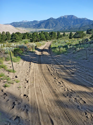
The Sand Ramp trailhead, which is not obviously signposted, is located within Pinyon Flats Campground, right at the north end of the park road. The path begins from a small parking area along the upper section of Loop B, which has space for only five vehicles. Overflow or large vehicle parking is available at the campground entrance, a quarter of a mile away. The camp is usually full each night in summer in which case the alternatives are a private site just outside the national park entrance, or a larger, much less used facility at San Luis State Park, 11 miles west; there are no good free primitive sites nearby.
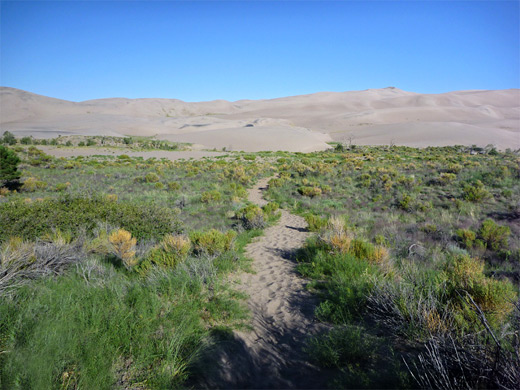
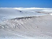
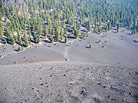
The Sand Ramp Trail is, as its name suggests, sandy at first, as it crosses open, bushy ground either side of a small ravine, then enters a patch of woodland where a spur forks off uphill (east) to the Buck Creek primitive campsite. Another junction is reached soon after, a half mile from the start, with the 0.5 mile Dunes Overlook Trail. This leads up a treeless valley, veers left up a ridge, winds through a couple of switchbacks and ends at an overlook where the views are somewhat tree-lined and limited; the best perspective is northwards. The main path detours uphill a little, into thicker, cooler forest of tall pines, crosses several more drainages (usually dry), and descends back towards the dunes, down to an intersection with the Medano Pass Road, beside a small parking area that marks the end of the 2WD-accessible section. Beyond, soft sand makes the route 4WD only. The Sand Ramp Trail leaves the road again, keeping to the edge of the forest then gradually moving away, instead crossing open land to the west, some parts of which also have soft sand and so the walking becomes quite tiring. The larger drainages of Castle Creek and Horse Canyon Creek are crossed after 2.3 and 3.0 miles respectively, and then Medano Creek itself at the 4 mile point, whereupon the trail turns west, heading towards generally sandier terrain.
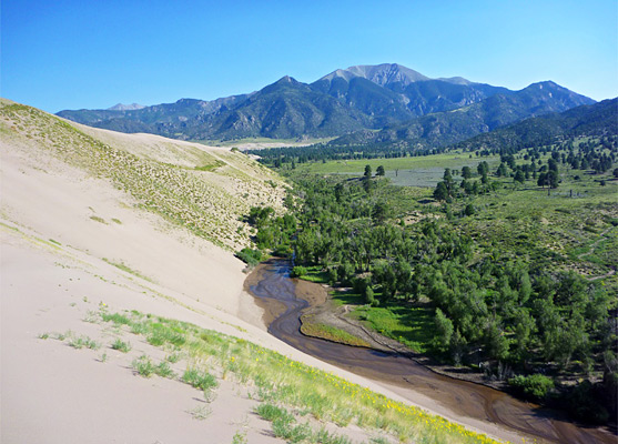
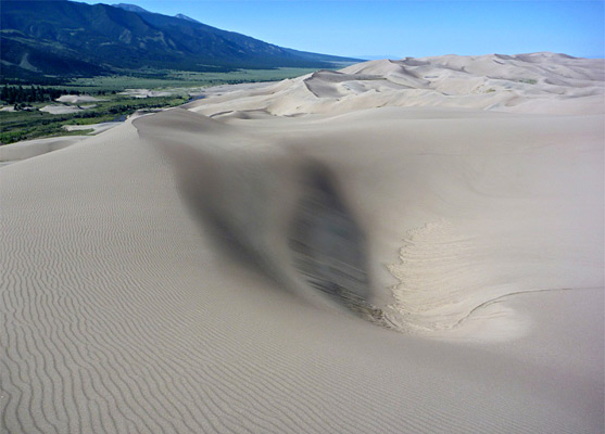
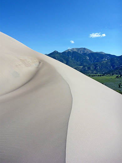
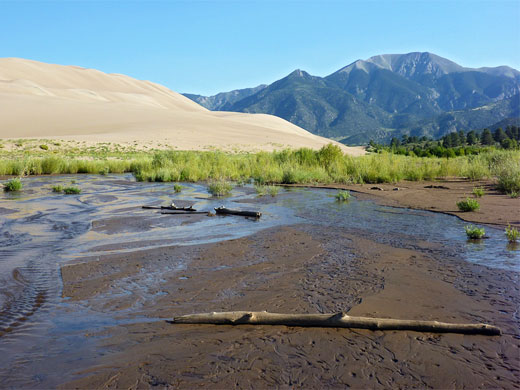
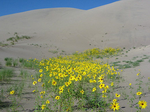
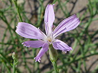
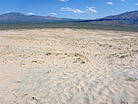
For a loop hike, one suitable place to leave the Sand Ramp Trail is at the road junction after one mile. From here a short connecting path (the Sand Pit Trail) leads northwest over low, grassy dunes to another parking area beside Medano Creek, a section which usually flows all year, unlike the stretch closer to the visitor center that dries up in summer. It is easy to walk upstream through or beside the very shallow waters, which are bordered by sparse vegetation on the east side and pure sand slopes to the west. After 2 miles, the creek turns away from the dunes, heading northeastwards towards the mountains, and views to the north open out somewhat, encompassing the north edge of the sands as they curve round to the west. This is a possible turn around point, in which case the return can be along the creek, the road, the Sand Ramp Trail, or the dunes themselves, here enjoyable without the hundreds of people that often congregate around the main entry point to the south. Once making the initial, arduous climb of 200 to 300 feet, hiking across the dunes is relatively easy, along ridges and through basins, these often filled with bright clusters of wildflowers. The two most common species found in the sands are colored yellow (helianthus petiolaris, prairie sunflower) and pink (lygodesmia juncea, rush skeletonplant).
The full 11 mile distance is hiked very infrequently, in part since the first few miles are paralleled by the Medano Pass Road, and also since the immediate surroundings, at least at the beginning, are not so interesting. It does however give access to several primitive camping locations and other backcountry sites up in the mountains, and the first half mile links with a short spur (the Dunes Overlook Trail) to a viewpoint of the sands. One option for a more varied, though are still relatively short hike, is to walk the first mile of the Sand Ramp Trail, take a short connecting path towards Medano Creek, follow this upstream a way and return by climbing up into the dunes and following ridges and basins back south.
Trailhead
The Sand Ramp trailhead, which is not obviously signposted, is located within Pinyon Flats Campground, right at the north end of the park road. The path begins from a small parking area along the upper section of Loop B, which has space for only five vehicles. Overflow or large vehicle parking is available at the campground entrance, a quarter of a mile away. The camp is usually full each night in summer in which case the alternatives are a private site just outside the national park entrance, or a larger, much less used facility at San Luis State Park, 11 miles west; there are no good free primitive sites nearby.
Sand Ramp Trail
The Sand Ramp Trail is, as its name suggests, sandy at first, as it crosses open, bushy ground either side of a small ravine, then enters a patch of woodland where a spur forks off uphill (east) to the Buck Creek primitive campsite. Another junction is reached soon after, a half mile from the start, with the 0.5 mile Dunes Overlook Trail. This leads up a treeless valley, veers left up a ridge, winds through a couple of switchbacks and ends at an overlook where the views are somewhat tree-lined and limited; the best perspective is northwards. The main path detours uphill a little, into thicker, cooler forest of tall pines, crosses several more drainages (usually dry), and descends back towards the dunes, down to an intersection with the Medano Pass Road, beside a small parking area that marks the end of the 2WD-accessible section. Beyond, soft sand makes the route 4WD only. The Sand Ramp Trail leaves the road again, keeping to the edge of the forest then gradually moving away, instead crossing open land to the west, some parts of which also have soft sand and so the walking becomes quite tiring. The larger drainages of Castle Creek and Horse Canyon Creek are crossed after 2.3 and 3.0 miles respectively, and then Medano Creek itself at the 4 mile point, whereupon the trail turns west, heading towards generally sandier terrain.
Loop Trail
For a loop hike, one suitable place to leave the Sand Ramp Trail is at the road junction after one mile. From here a short connecting path (the Sand Pit Trail) leads northwest over low, grassy dunes to another parking area beside Medano Creek, a section which usually flows all year, unlike the stretch closer to the visitor center that dries up in summer. It is easy to walk upstream through or beside the very shallow waters, which are bordered by sparse vegetation on the east side and pure sand slopes to the west. After 2 miles, the creek turns away from the dunes, heading northeastwards towards the mountains, and views to the north open out somewhat, encompassing the north edge of the sands as they curve round to the west. This is a possible turn around point, in which case the return can be along the creek, the road, the Sand Ramp Trail, or the dunes themselves, here enjoyable without the hundreds of people that often congregate around the main entry point to the south. Once making the initial, arduous climb of 200 to 300 feet, hiking across the dunes is relatively easy, along ridges and through basins, these often filled with bright clusters of wildflowers. The two most common species found in the sands are colored yellow (helianthus petiolaris, prairie sunflower) and pink (lygodesmia juncea, rush skeletonplant).

Sand Ramp Trail and Medano Creek - Similar Hikes
All Contents © Copyright The American Southwest | Comments and Questions | Contribute | Affiliate Marketing Disclosure | Site Map