Trails of Great Sand Dunes National Park
Colorado > Great Sand Dunes National Park and Preserve > Hiking
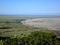 Length 0.8 miles (1.3 km) Elevation change 300 feet (91 meters) Difficulty Easy Type One way Usage Medium Season All year Trailhead Pinyon Flats Campground Rating (1-5) ★★★★★ This short trail is a spur that forks off near the beginning of the Sand Ramp Trail, just north of the crossing of Buck Creek, and climbs a little way up a lightly wooded ridge to an overlook of Medano Creek and the sand dunes. |
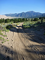
| Medano Lake Trail Length 3.8 miles (6.1 km) Elevation change 1920 feet (585 meters) Difficulty Strenuous Type One way Usage Very low Season Summer, early fall Trailhead Along Medano Pass Road (4WD) Rating (1-5) ★★★★★ A 4WD vehicle is needed to reach the start point for the Medano Lake Trail, high up in the Sangre de Cristo mountains. The path follows a forested valley to a pretty lake at 11,518 feet, just beyond the timberline, surrounded on three sides by steep slopes of rock and scree. The summit of adjacent Mount Herard can be reached by an off-trail scramble, gaining another 1,832 feet. |
 Length 0.5 miles (.8 km) Elevation change 50 feet (15 meters); (loop) Difficulty Easy Type Loop Usage Medium Season Spring, summer, fall Trailhead Near the visitor center Rating (1-5) ★★★★★ This short loop climbs a little way up the wooded hills on the east side of the dunes, passing the site of a late 1800s homestead, and reaching a high point that gives good views of the sands below. The start is along the lower end of the Mosca Pass Trail. |
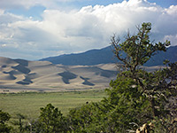
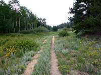
| Mosca Pass Trail Length 3.5 miles (5.6 km) Elevation change 1520 feet (463 meters) Difficulty Moderate Type One way Usage Low Season Spring, summer, fall Trailhead Near the visitor center Rating (1-5) ★★★★★ The trail to 9,737 foot Mosca Pass climbs steadily but not too steeply up a wooded valley, staying close to a small creek most of the way. The path starts along the short Montville Nature Trail. The trail is best for wildflowers rather than scenery as apart from short stretches near the start, the views are quite restricted. Trees fade away at the top but even here there is no grand panorama, as gently sloping hillsides hide the wider landscape. |
| Music Pass Trail Length 3.5 miles (5.6 km) Elevation change 2130 feet (649 meters) Difficulty Strenuous Type One way Usage Low Season Summer, early fall Trailhead Along FR 119, 10.7 miles from Hwy 69 Rating (1-5) ★★★★★ The most remote hiking destination in the national park is Music Pass in the northeast corner; a saddle in a long narrow ridge extending north from Snowslide Mountain, bordered to the west by a deep valley holding the upper end of Sand Creek. From here, continuation trails lead to the Upper and Lower Sand Creek lakes and to the top of another summit, 13,522 foot Milwaukee Peak (additional distances 3, 3.5 and 8 miles respectively). The 3.5 mile hike to the pass can be shortened to one mile for people with 4WD vehicles. |
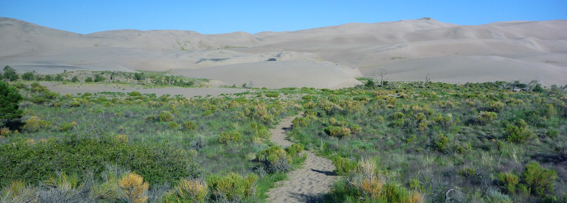
 Length 11 miles (17.7 km) Elevation change 400 feet (122 meters); (loop) Difficulty Easy to moderate Type One way Usage Medium to the overlook, low thereafter Season Spring, summer, fall Trailhead Loop 2 of the campground Rating (1-5) ★★★★★ Most people just walk one mile along the Sand Ramp Trail, as far as an overlook of the dunes, a little way up in the Sangre de Cristo foothills, but the path continues ten miles further. The trail stays a little way from the edge of the sands, continuing north then later west, where it does return to the dunes, and ends at a wooded area beside another large drainage (Sand Creek). There are several primitive campsites en route. One option, for a loop hike, is to leave the path after 2 or 3 miles and walk west, across Medano Pass Road and Medano Creek, returning beside or through the dunes. |
All Contents © Copyright The American Southwest | Comments and Questions | Contribute | Affiliate Marketing Disclosure | Site Map