Lake Tuendae Trail, Mojave National Preserve
California > Mojave National Preserve > Hiking > Lake Tuendae Trail
Lake Tuendae Trail
Very short loop around a palm tree-lined pond at the tiny settlement of Zzyzx, once a health spa, now a study center for California State University. Good views of the Soda Mountains to the west and the salt flats of Soda Lake in the east
Length: 0.25 miles (loop)
Elevation change: Level
Difficulty: Easy
Type: Loop
Usage: Medium
Season: All year
Trailhead: 5 miles along Zzyzx Road
Rating (1-5): ★★★★★
Elevation change: Level
Difficulty: Easy
Type: Loop
Usage: Medium
Season: All year
Trailhead: 5 miles along Zzyzx Road
Rating (1-5): ★★★★★

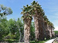
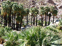
Zzyzx was named in 1944 by evangelist and minister Curtis Springer, who established a health spa at this remote desert location, at the foot of the Soda Mountains, now right at the western edge of Mojave National Preserve. The spa made use of water from a year-round spring, which is surrounded by flourishing groves of California fan palm trees; the site was previously known as Soda Spring, as it lies at the edge of the vast, usually dry bed of Soda Lake, which extends over ten miles north and south.
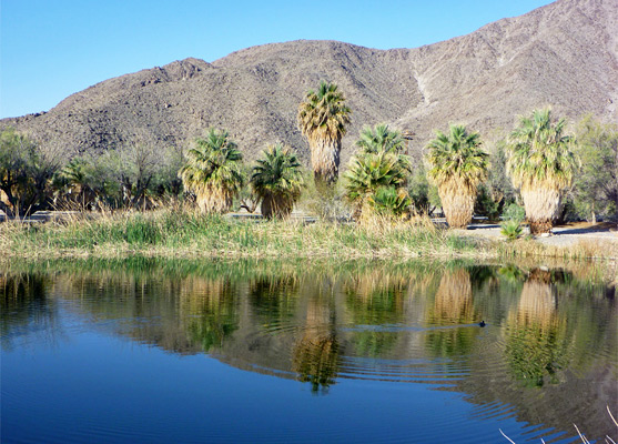
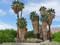
The buildings at the spring are now used by California State University as a desert study center, but the public are allowed to visit one section, an artificial pond named Lake Tuendae. A quarter-mile trail runs round the lake, accompanied by notices about the area's historic past. The immediate surroundings are not particularly exciting, a mix of concrete remains, unkempt palm trees and dusty tracks, but the lake itself is pretty, while the surrounding barren mountains and the great salt flats have a stark beauty, so the place is certainly worth a quick visit. Access is easy, along a 5 mile, mostly paved road from I-15 exit 239, 6 miles south of Baker.
Map of Mojave National Preserve.
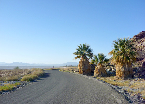
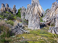
From the interstate, Zzyzx Road descends a bushy hillside to the western edge of the dry lake - there are good views here, towards a line of distant, hazy hills to the east. The road becomes quite winding, following the very edge of the lake bed, which extends right to the mountain foothills. A few isolated palm trees appear, growing on the west side of the road, then several bigger groves, all rather overgrown and unattended, as the Zzyzx complex approaches. Visitors drive no further than a parking lot just before the settlement, though the route continues south another 1.5 miles and meets the cross country, 4WD Mojave Road.
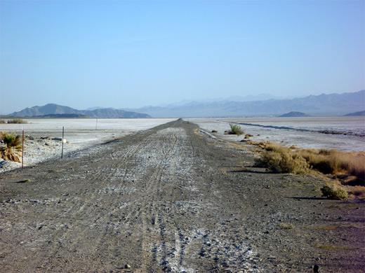
The entrance road bends east towards the cluster of buildings, used all year by the university. A trail runs around the perimeter of the rectangular Lake Tuendae, on the north side of the buildings, lined by regularly spaced palm trees and centered on a fountain, no longer in operation. The lake was once a key part of the health spa but is now used only as a habitat for the endangered Mojave tui chub fish. The trail also has views over the salt flats of Soda Lake, and of the course of an old railroad bed, cutting dead straight across the flats; this is part of the long-disused Tonopah-Tidewater railway, a 200 mile line between Ludlow, CA and Tonopah, NV.
The buildings at the spring are now used by California State University as a desert study center, but the public are allowed to visit one section, an artificial pond named Lake Tuendae. A quarter-mile trail runs round the lake, accompanied by notices about the area's historic past. The immediate surroundings are not particularly exciting, a mix of concrete remains, unkempt palm trees and dusty tracks, but the lake itself is pretty, while the surrounding barren mountains and the great salt flats have a stark beauty, so the place is certainly worth a quick visit. Access is easy, along a 5 mile, mostly paved road from I-15 exit 239, 6 miles south of Baker.

Location
Map of Mojave National Preserve.
Lake Tuendae Trail
From the interstate, Zzyzx Road descends a bushy hillside to the western edge of the dry lake - there are good views here, towards a line of distant, hazy hills to the east. The road becomes quite winding, following the very edge of the lake bed, which extends right to the mountain foothills. A few isolated palm trees appear, growing on the west side of the road, then several bigger groves, all rather overgrown and unattended, as the Zzyzx complex approaches. Visitors drive no further than a parking lot just before the settlement, though the route continues south another 1.5 miles and meets the cross country, 4WD Mojave Road.
Zzyzx
The entrance road bends east towards the cluster of buildings, used all year by the university. A trail runs around the perimeter of the rectangular Lake Tuendae, on the north side of the buildings, lined by regularly spaced palm trees and centered on a fountain, no longer in operation. The lake was once a key part of the health spa but is now used only as a habitat for the endangered Mojave tui chub fish. The trail also has views over the salt flats of Soda Lake, and of the course of an old railroad bed, cutting dead straight across the flats; this is part of the long-disused Tonopah-Tidewater railway, a 200 mile line between Ludlow, CA and Tonopah, NV.
Lake Tuendae Trail - Similar Hikes
All Contents © Copyright The American Southwest | Comments and Questions | Contribute | Affiliate Marketing Disclosure | Site Map