US 50
America's loneliest road, traversing the middle of Nevada across the center of the Great Basin Desert, passing only four major towns (Fallon, Austin, Eureka and Ely)
Length: 395 miles
Junctions: US 50 enters Nevada from the west at Stateline, Lake Tahoe, and passes into Utah near Great Basin National Park, where the route is shared with US 6
Junctions: US 50 enters Nevada from the west at Stateline, Lake Tahoe, and passes into Utah near Great Basin National Park, where the route is shared with US 6

US 50 crosses Nevada from east to west, beginning at Lake Tahoe and passing into Utah 395 miles later near Great Basin National Park. It continues in sections, sometimes merging with interstate highways, all the way across America to Ocean City on the Atlantic coast, but its nickname of the 'Loneliest Road in America' is most appropriate for the Nevada section - the road is very little traveled, and passes through sparsely settled land.
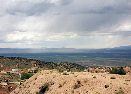
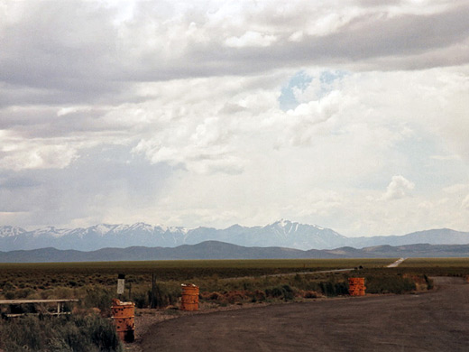
The westernmost 60 miles of highway 50, east from Carson City, are relatively well-used, and the surroundings agriculturalized; real emptiness begins soon after Fallon, a lively town with several brightly-lit casinos, at least one of which offers free overnight RV parking. Thereafter the road passes through only three towns of any significance - Austin, Eureka and Ely, separated by 111, 70 and 77 miles respectively. From Fallon, US 50 passes through extensive salt flats with areas of sand dunes for much of the next 50 miles east, until the approach of the Clan Alpine Mountains, the first of many north-aligned ranges between here and the Utah border. Eleven times the road climbs into the hills, winds through a few miles of rocky canyons then descends into the wide desert basin beyond - usually as the road reaches the top of one ridge, the route ahead is visible for many miles until the next summit.
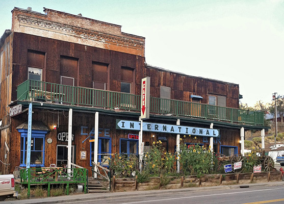
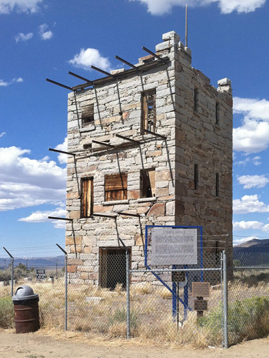
The road passes no place of special interest but there are large areas of Toiyabe National Forest land with camping and hiking opportunities, old copper and silver mines, occasional abandoned towns, petroglyphs and other historical sites. The last mountains before the Utah border are the Snake Range, where US 50 crosses just north of Great Basin National Park, the only NPS province wholly in Nevada.
The main towns with hotels along highway us 50 in Nevada are, from west to east, Carson City, Fallon, Eureka and Ely.
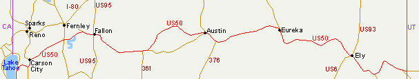
Map of US 50 in Nevada
Towns
The westernmost 60 miles of highway 50, east from Carson City, are relatively well-used, and the surroundings agriculturalized; real emptiness begins soon after Fallon, a lively town with several brightly-lit casinos, at least one of which offers free overnight RV parking. Thereafter the road passes through only three towns of any significance - Austin, Eureka and Ely, separated by 111, 70 and 77 miles respectively. From Fallon, US 50 passes through extensive salt flats with areas of sand dunes for much of the next 50 miles east, until the approach of the Clan Alpine Mountains, the first of many north-aligned ranges between here and the Utah border. Eleven times the road climbs into the hills, winds through a few miles of rocky canyons then descends into the wide desert basin beyond - usually as the road reaches the top of one ridge, the route ahead is visible for many miles until the next summit.
Scenery
The road passes no place of special interest but there are large areas of Toiyabe National Forest land with camping and hiking opportunities, old copper and silver mines, occasional abandoned towns, petroglyphs and other historical sites. The last mountains before the Utah border are the Snake Range, where US 50 crosses just north of Great Basin National Park, the only NPS province wholly in Nevada.
Hotels
The main towns with hotels along highway us 50 in Nevada are, from west to east, Carson City, Fallon, Eureka and Ely.
All Contents © Copyright The American Southwest | Comments and Questions | Contribute | Affiliate Marketing Disclosure | Site Map