Highlights:
Long stretches of the famous old road, through small towns and across open countryside, with many evocative old buildings and other reminders of the route's busier times. Most is close to I-40 or I-25, running west-east across the state
Nearby town:
Management:
Passes through a variety of land - BLM, state, private and Indian Reservation
Location:
Seasons:
All year
Rating (1-5):
★★★★★

Route 66 is part of the Indian Lands and New Mexico Highlights itineraries
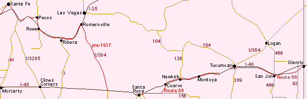
There is quite a lot of original Route 66 in New Mexico though most is right next to its replacement (I-40/I-25) - either the frontage road or a parallel road just a mile or so from the interstate - so the surviving route is not quite as atmospheric as the long stretches in neighbouring Arizona which cross remote, undeveloped land, far from any busy highways. Most of the old road was constructed in the 1920s and crossed New Mexico west-east through Gallup, Grants, Albuquerque, Santa Rosa and Tucumcari, with a diversion through Santa Fe and the northern mountains, replaced in 1937 by a more direct route due east and west from Albuquerque, where I-40 runs today.
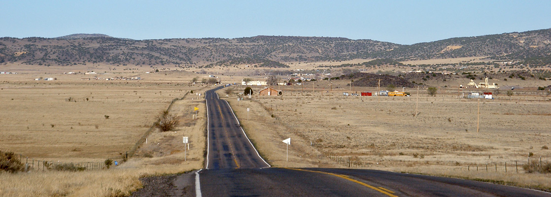
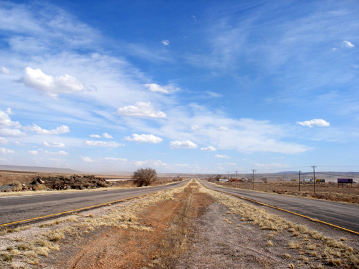
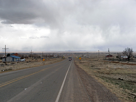
Apart from various shorter stretches between several towns on the flat, grassy plains of the east, principally Santa Rosa to Cuervo and Tucumcari to Glenrio on the Texas state line, the most significant section is from Lupton on the Arizona border to Moriarty (via Los Lunas), a near-complete drive of around 230 miles. This makes for an interesting day-long excursion, along generally quiet roads with many reminders of the recent history of this region.
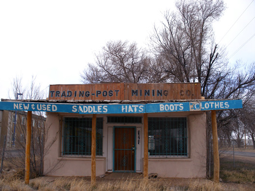
Some of the road is through Indian reservations, and all is scenic, passing along valleys, beneath hills, close to patches of lava and visiting many small towns and villages, containing a great selection of abandoned, disused and still-surviving buildings and businesses from the Route 66 heyday.
Apart from various shorter stretches between several towns on the flat, grassy plains of the east, principally Santa Rosa to Cuervo and Tucumcari to Glenrio on the Texas state line, the most significant section is from Lupton on the Arizona border to Moriarty (via Los Lunas), a near-complete drive of around 230 miles. This makes for an interesting day-long excursion, along generally quiet roads with many reminders of the recent history of this region.
Some of the road is through Indian reservations, and all is scenic, passing along valleys, beneath hills, close to patches of lava and visiting many small towns and villages, containing a great selection of abandoned, disused and still-surviving buildings and businesses from the Route 66 heyday.
Route 66 Table of Contents
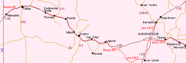
Gallup
The first appearance of Route 66 after the Arizona border is as NM 118 through the small town of Manuelito, crossing I-40 several times and entering Gallup, a major trading town for the Navajo and Zuni tribes. The route forms the main street through town and is lined by a fine collection of old buildings and craft shops. East of Gallup the old road forms the northern I-40 frontage as far as exit 36. There is then a gap of 11 miles, so continuing east requires traveling on I-40 for a few junctions, across the continental divide, though an older (unpaved) alignment of Route 66 exits a little way north, next to the ATSF railway. The paved section of the original road may be rejoined at exit 47 near Thoreau, beyond which it crosses generally empty prairie land through several small towns for an uninterrupted 65 miles to Laguna, one of several historic Indian pueblo villages in this part of the state.
Prewitt - Milan
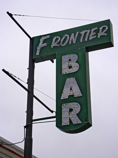
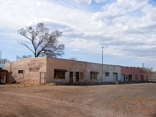
Particularly evocative is the section of Route 66 between Prewitt and Milan, now part of NM 122. The road is wide but little used, a reminder of busier days now forever past. Abandoned bars, motels (one with a parking lot full of classic cars) and empty gas stations are scattered at intervals, with faded decor typical of the 60s and 70s. The railway runs alongside to the north; this too has more tracks than seems necessary, and is becoming partially overgrown. The surrounding land is not particularly scenic, but seems somehow appropriate; distant low hills, greyish in color, in keeping with the drab abandoned buildings. There are several lava flows in the region, associated with the much larger deposits of the nearby El Malpais National Monument south of Grants.
Grants - Albuquerque
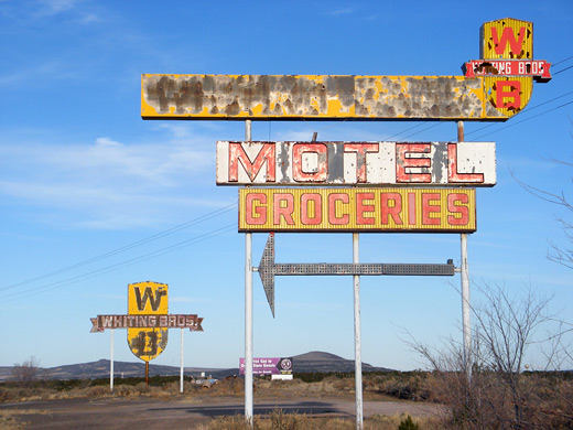
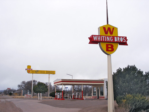
Beyond Grants, Route 66 (as NM 117) moves away from I-40 for a few miles, becomes the southern frontage road between exits 89 and 96, then crosses back to the north side towards the village of San Fidel. Along this stretch is the remains of the Whiting Brothers gas station and motel - several faded signs in distinctive yellow and red colors, next to a few ruined buildings. Whiting Brothers outlets were once a familiar landmark across western USA, until the construction of the interstates when the businesses began to close. The only site still in operation is further east along Route 66 in New Mexico, in Moriarty. Old Route 66 continues eastwards over flat empty lands into the Laguna Reservation and through several other small towns (Cubero, Budville, Paraje), eventually moving to the south side of I-40 just past exit 117 (Mesita). The road next meets Hwy 6 from Los Lunas, a section of Route 66 prior to the 1937 realignment - the more recent course can be followed for just a short distance more, until it disappears beneath the interstate; to resume the journey requires driving along I-40 for 23 miles between exits 126 and 149, to the west edge of Albuquerque. Hwy 6 to Los Lunas parallels a railway for most of its length, across largely undeveloped countryside, passing no ruins or interesting buildings, just rolling fields and faraway hills.
Albuquerque - Moriarty
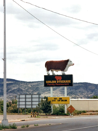
In Albuquerque, Route 66 is now Central Avenue, a wide and busy road that still has many well preserved old buildings, concentrated in the historic downtown area close to the Rio Grande. In the east, the road becomes Hwy 333, exiting the city just south of I-40, as both routes climb into the foothills of the Sandia Mountains, running through a small canyon. For a short while the surroundings are rural and quite scenic, part of the Cibola National Forest; the highway ascends gradually to a high point near Tijeras. On the far side of the pass, Route 66 is wider and straighter, lined by scattered but near-continuous development for the 20 miles to Moriarty. Most construction is recent and there isn't much evidence of the past apart from the occasional ruined building. Moriarty has the best sites hereabouts, including old bars, gift shops and hotels, such as Sunset Motel, in business for over 60 years. The only surviving Whiting Brothers gas station is on the east side of town, near I-40 exit 197, where Route 66 ends. The next significant section is in Santa Rosa, 78 miles away.
Route 66 in East New Mexico
Santa Rosa and Tucumcari
The I-40 junctions east of Moriarty have some traces of Route 66, including exit 265 where the pre-1937 alignment (now US 84) joins from the north, but the next extended stretch begins on the west side of Santa Rosa at exit 273 - through town, out into the countryside along NM 156 then northeastwards along a rather rough, unpaved track, towards another interstate exit (291). Frontage roads continue on one or other side of I-40 for most of the way to Tucumcari, the only gap being between junctions 321 and 329; from here, Route 66 becomes Tucumcari Boulevard through the city center and then the southern frontage road as far as San Jon. The final (unpaved) 17 mile stretch to Glenrio on the Texas border moves away from the interstate, across farmland then leads along the shallow valley of Trujillo Creek, next to the course of an old railway.
All Contents © Copyright The American Southwest | Comments and Questions | Contribute | Affiliate Marketing Disclosure | Site Map