Utah National Parks and Natural Landscapes
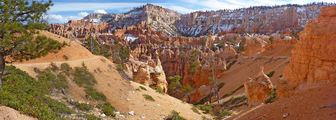

Table of Contents for Utah
- National Park Service units in Utah
- Other major scenic places in Utah
- Miscellaneous Utah landscapes
- Hiking in Utah
- Slot canyons in Utah
- Hotels in Utah
- Utah driving itineraries
- Plants of Utah; cacti and wildflowers
- Other Utah resources
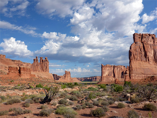
| ★★★★★ ARCHES National Park - world famous red rock arches, and many other eroded formations, surrounded by sandy, desert plains, a few miles north of Moab |
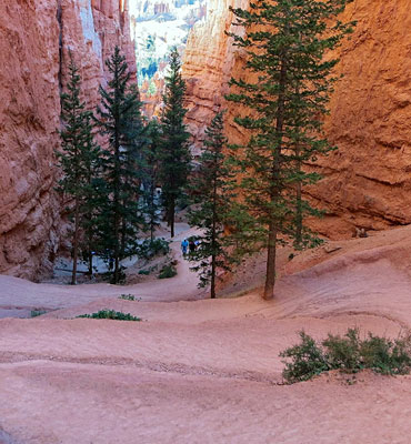
| ★★★★★ BRYCE CANYON National Park - delicately sculptured pinnacles of orange, pink and white sandstone, one of the highlights of the Southwest |
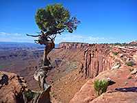
| ★★★★★ CANYONLANDS National Park - vast area of remote and spectacular canyon country, entered on the confluence of the Green and Colorado rivers |
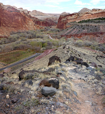
| ★★★★★ CAPITOL REEF National Park - slickrock, steep cliffs and narrow canyons; sandstone of many colors and forms |
| ★★★★★ CEDAR BREAKS National Monument - high, eroded cliff face, eroded to expose colorful rocks, hoodoos and ridges |
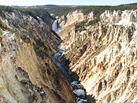
| ★★★★★ DINOSAUR National Monument - many fossilized bones and remote canyons |
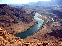
| ★★★★★ GLEN CANYON National Recreation Area - spectacular desert region with red rock canyons, centered around Lake Powell |
| ★★★★★ GOLDEN SPIKE National Historical Site - replica steam trains and old railroad grades, in desolate, uninhabited terrain |
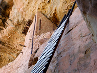
| ★★★★★ HOVENWEEP National Monument - ancient ruins in remote country close to the Colorado border |
| ★★★★★ NATURAL BRIDGES National Monument - three large natural bridges in canyon country |
| ★★★★★ TIMPANOGOS CAVE National Monument - central attraction of Timpanogos Mountains |
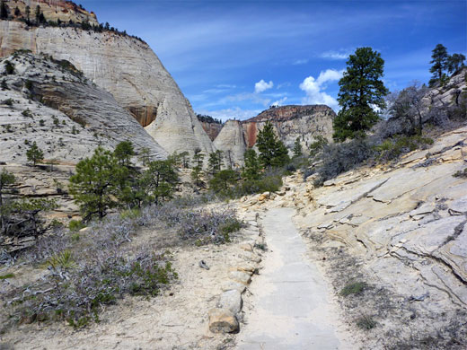
| ★★★★★ ZION National Park - huge sandstone cliffs and sheer, narrow canyons formed by the Virgin River and its tributaries; perhaps the most spectacular scenery in Utah |
| ★★★★★ ANTELOPE ISLAND State Park - stark, mountainous island in the Great Salt Lake |
| ★★★★★ BEARS EARS National Monument - large area of canyon and mountain wilderness east of the Colorado River, including thousands of ancient sites |
| ★★★★★ CEDAR MESA and GRAND GULCH - hundreds of Anasazi ruins in the southeast |
| ★★★★★ DEAD HORSE POINT State Park - high promontory overlooking Colorado River canyons |
| ★★★★★ FLAMING GORGE National Recreation Area - dramatic red cliffs above a large artificial lake |
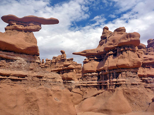
| ★★★★★ GOBLIN VALLEY State Park - thousands of strangely-shaped formations |
| ★★★★★ GRAND STAIRCASE-ESCALANTE National Monument - great expanse of scenic wilderness, with narrow canyons and countless rock formations |
| ★★★★★ KODACHROME BASIN State Park - eroded cliffs and narrow spires |
| ★★★★★ MOAB - popular town surrounded by spectacular red rock landscapes |
| ★★★★★ MONUMENT VALLEY - world-famous red rock buttes and mesas |
| ★★★★★ MOUNT TIMPANOGOS Region - scenic area of the Wasatch Mountains |
| ★★★★★ RED CANYON - eroded formations near Bryce Canyon |
| ★★★★★ SNOW CANYON State Park - red rocks, white cliffs and black lava |
| ★★★★★ UINTA MOUNTAINS - high, sedimentary range in the northeast; many lakes and Alpine basins |
| ★★★★★ Anasazi State Park - museum and a small excavated pueblo |
| ★★★★★ Bear Lake - deep blue lake on the Utah-Idaho border |
| ★★★★★ Buckskin Hollow - short drainage through amazingly colorful rocks; in Red Cliffs National Conservation Area, north of St George |
| ★★★★★ Canyon Rims Recreation Area - vast wilderness east of Canyonlands |
| ★★★★★ Cisco - abandoned railroad town close to Interstate 70 |
| ★★★★★ Coral Pink Sand Dunes State Park - miles of colorful shifting sands |
| ★★★★★ Dark Canyon - wild, lengthy, branched canyon complex with difficult access |
| ★★★★★ Dixie National Forest - large areas of scenic land in the southwest |
| ★★★★★ Escalante Petrified Forest State Park - petrified wood and a reservoir |
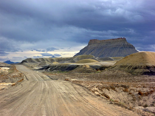
| ★★★★★ Factory Butte - isolated peak surrounded by desert lands and eroded sandstone formations |
| ★★★★★ Fantasy Canyon - strangely eroded rocks in the Uinta Basin of the northeast |
| ★★★★★ Fisher Towers - unusual red cliffs and hoodoos, in the Colorado River valley east of Moab |
| ★★★★★ Goosenecks State Park - entrenched meanders of the San Juan River |
| ★★★★★ Grafton - historic Mormon settlement with peaceful surroundings beside the Virgin River |
| ★★★★★ Great Chamber - huge, south-facing alcove near Kanab |
| ★★★★★ Gunlock State Park - small reservoir lined by sandy hills and red rock formations |
| ★★★★★ Henry Mountains - forested peaks surrounded by red rock desert |
| ★★★★★ Kanab - popular town close to national parks, surrounded by spectacular Grand Staircase scenery |
| ★★★★★ La Sal Mountains - isolated range east of Moab, with summits over 12,000 feet |
| ★★★★★ Little Egypt - red sandstone formations near the Henry Mountains |
| ★★★★★ Little Sahara Recreation Area - extensive sand dunes in a remote corner of Utah |
| ★★★★★ Mexican Hat - small settlement at the centre of some dramatic landscapes |
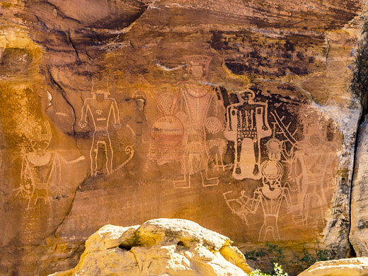
| ★★★★★ McConkie Ranch Petroglyphs - petroglyphs and pictographs, extending nearly a mile across a line of sandstone cliffs |
| ★★★★★ Montezuma Canyon - ruins, rock art and red rock scenery |
| ★★★★★ Nebo Loop Scenic Byway - winding road through the southern Wasatch Mountains |
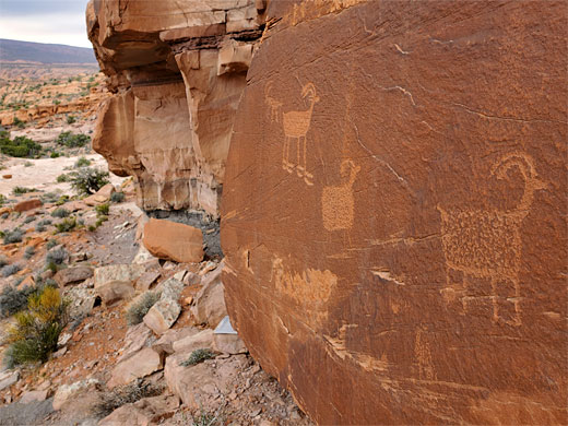
| ★★★★★ Nine Mile Canyon - ancient rock art in a remote part of central Utah |
| ★★★★★ Paria Rimrocks - colorful strata and strangely shaped rocks |
| ★★★★★ Parowan Gap - petroglyphs and fossilized prints, at the edge of the Colorado Plateau |
| ★★★★★ Potash Road - scenic byway beside the Colorado River, west of Moab |
| ★★★★★ Red Cliffs Recreation Area - colorful cliffs north of St George, split by the narrow canyon of Quail Creek |
| ★★★★★ Salt Lake Desert - endless stretches of white desert |
| ★★★★★ San Rafael Swell - geologically unusual, little known part of central Utah |
| ★★★★★ Sand Hollow State Park - popular, recently created park featuring red rocks, sand dunes and a reservoir |
| ★★★★★ Santa Clara River Reserve - a riparian canyon, desert hills, branched ravines and petroglyphs |
| ★★★★★ Sego Canyon - canyon through the Book Cliffs, containing rock art and an old townsite |
| ★★★★★ Valley of the Gods - small scale version of Monument Valley |
| ★★★★★ Wasatch Mountain State Park - Utah's most popular state park; many kinds of recreation, in wooded, hilly surroundings |
| ★★★★★ Yant Flat Cliffs - swirling, patterned sandstone in a variety of colors, on the southern slopes of the Pine Valley Mountains |
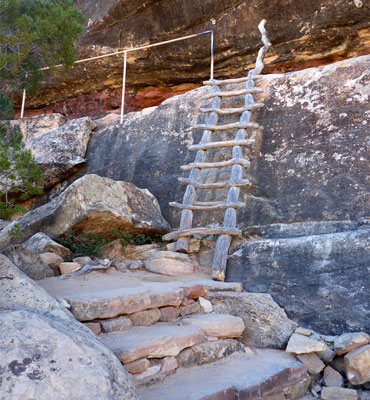
Utah offers perhaps the best, most varied hiking of any state, from the many maintained paths in the national parks and state parks, the less-traveled trails in the national forets, to countless cross-country routes in canyons and wilderness areas.
Utah trail listings are divided into four regions:
North (12 trails), including Dinosaur National Monument and the Uinta Mountains
South Central (75 trails), including Bryce Canyon, Capitol Reef and Grand Staircase-Escalante
Southeast (89 trails), including Arches, Canyonlands, Cedar Mesa, Lake Powell and the San Rafael Swell
Southwest (48 trails), including Snow Canyon State Park and Zion National Park
The most popular hiking areas in Utah include Arches, Bryce Canyon, Canyonlands, Capitol Reef and Zion.
Utah Trail Search
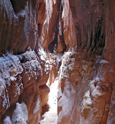
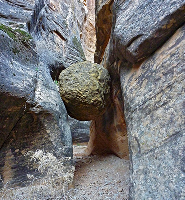
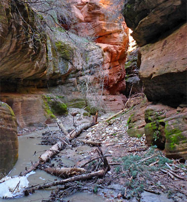
Utah contains the majority of the Southwest's slot canyons; narrow ravines through richly colored sandstone, sometimes containing flowing water, often with boulders and chokestones that provide challenges while exploring. The most famous canyons include Buckskin Gulch, Peekaboo Canyon and the Zion Narrows.
Utah Slot Canyon Listings
Capitol Reef National Park
Escalante River
North Lake Powell
Paria River
San Rafael Swell
Zion National Park
Utah Slot Canyon Listings
Capitol Reef National Park
Escalante River
North Lake Powell
Paria River
San Rafael Swell
Zion National Park

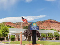
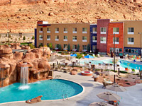

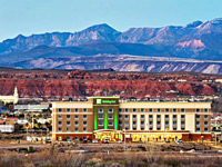
Choose from over 330 Utah hotels in 65 towns and cities, including national park hotels, interstate hotels
Locations include: Bryce Canyon, Cedar City, Green River, Kanab, Layton, Logan, Moab, Ogden, Provo, Richfield, Salt Lake City, Sandy, Springdale, St George, Vernal
Locations include: Bryce Canyon, Cedar City, Green River, Kanab, Layton, Logan, Moab, Ogden, Provo, Richfield, Salt Lake City, Sandy, Springdale, St George, Vernal
Utah Travel Itineraries
 |
 |
 |
 |
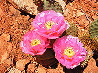
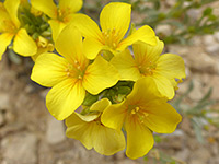
Plants of Utah
 |
 |
Other Utah Resources
Driving Distances - mileages between selected places in Utah
Introduction - summary of Utah's scenic areas
Utah Maps - state map and national park maps
Weather - forecasts for Utah cities and parks
Utah Photographs - indexed by location
Panoramic Photographs - wide landscape photos ogf Utah
Videos of Utah - mp4 videos
| Photograph Search - |
All Contents © Copyright The American Southwest | Comments and Questions | Contribute | Affiliate Marketing Disclosure | Site Map