Highlights:
Great expanse of scenic wilderness, with arches, cliffs, many narrow canyons and countless rock formations, based around two major rivers (Paria and Escalante) and their tributaries. Also contains most of the Grand Staircase, a series of differently colored sandstone escarpments
Nearby towns:
Management:
Location:
37.770, -111.601 (Escalante)
Seasons:
All year, but low elevation areas are rather hot in summer, and access roads are often impassable during wet weather
Rating (1-5):
★★★★★
Weather:


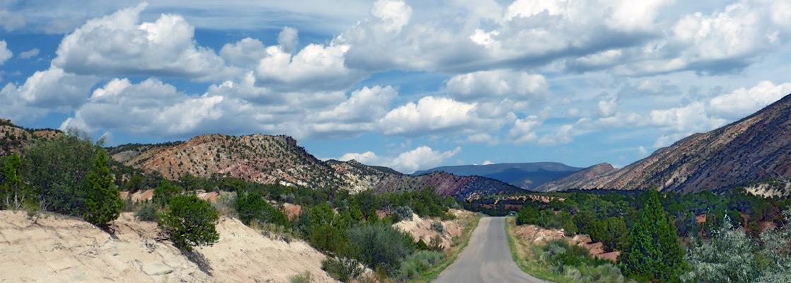
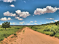
Escalante is a small town at the center of south Utah, surrounded by some of the most rugged yet beautiful country in the state. The areas to the south and east were amongst the last places in America to be explored and mapped, and have long been popular with adventurous explorers and back-country enthusiasts because of the countless spectacular canyons, badlands, cliffs, hoodoos, arches and other red rock formations, and the peace and solitude provided by the region.
The land is lightly regulated; there is very little development, no entrance fee, few facilities, and free primitive camping is allowed almost anywhere. A small number of places have a maintained path, or a recognized trailhead, but for the most part, exploration is off trail, cross-country.
The area has been protected since September 1996 after the establishment of the Grand Staircase-Escalante National Monument (administered by the BLM rather than the NPS), which covers 1.7 million mostly roadless acres, bordered approximately by Capitol Reef National Park to the northeast, Glen Canyon National Recreation Area to the southeast, road UT 12 to the north, Paunsaugunt Plateau to the west and road US 89 to the south (see map).
Grand Staircase-Escalante Table of Contents
- Map of the national monument
- Introduction
- The East - the Escalante River
- Escalante locations
- Escalante trails
- Escalante tours
- Escalante canyons
- The West - the Paria River
- Paria locations
- Paria rock formations
- Paria canyons
Location
Overview map of Grand Staircase-Escalante National Monument
Introduction
The principal attractions within the preserve are based around tributaries of the two major river systems - the Paria in the west and the Escalante in the east, around which are a series of escarpments of differently colored sandstone strata - the Grand Staircase - which extend to neighboring areas like Bryce Canyon, Cedar Breaks and the Vermilion Cliffs. The creation of the national monument was met with a mixed response, since the added protection and restrictions on further industrial development of the area were counterbalanced by the increase in visitation, with consequent problems of pollution and spoiling of the environment. Partly because of these issues, the monument was, in December 2017, split into three separate preserves, the Grand Staircase, Kaiparowits and Escalante Canyons units, totaling about 60 percent of the original area, however this was reversed in 2021.
Grand Staircase - The East - the Escalante River
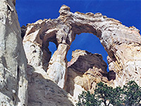
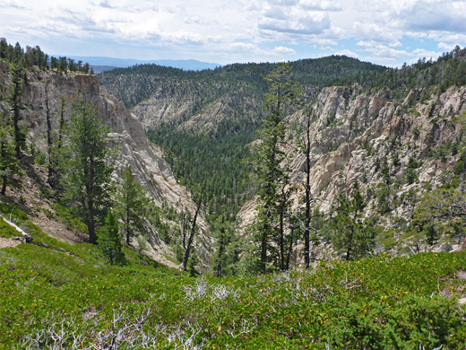
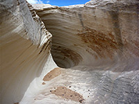
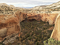
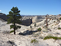
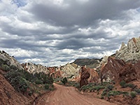
The largest canyon system in the Grand Staircase-Escalante National Monument is formed by the Escalante River. This, the last in all America to be discovered and mapped, runs through the small town of Escalante and then down a long canyon towards Lake Powell, en route joined by dozens of side-canyons, many of which are quite narrow and fascinating to explore. This region also has numerous natural bridges and arches, plateaus and ridges, but there are only two maintained access routes - the Burr Trail and the Hole-in-the-Rock road, and quite lengthy hiking is necessary to reach most of the interesting places. One alternative is sightseeing by boat from the lake, as the lower reaches of the Escalante River are flooded.
Escalante Locations
Mostly paved backcountry road that leads east from Boulder into Capitol Reef National Park, where it meets the Notom-Bullfrog Road. Gives access to many canyons
Scenic, unpaved road between Escalante and Boulder that climbs high up the southern slopes of Boulder Mountain, round the upper ends of several deep canyons
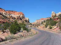
Two small towns in the northeast, linked by scenic route 12, described by some as the most beautiful paved road in Utah
The main access to the western Escalante River and its numerous tributary canyons; an unpaved, 55 mile route that is usually fine for all vehicles apart from the last few miles, which lead to a viewpoint above Lake Powell
Escalante Trails
Boulder Mail Trail
★★★★★
★★★★★
14.5 miles, 1,140 feet
Historic, cross-country route between Boulder and Escalante, over three major drainages (Sand Creek, Death Hollow, Mamie Creek) and expansive slickrock benches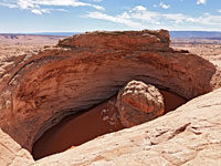
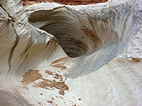
Cosmic Ashtray
★★★★★
★★★★★
4.6 miles, 200 feet
Cross-country route to a huge, sand-filled crater, ringed by partly overhanging cliffs, with a rock pillar at the center; created by wind erosion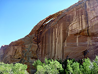
Escalante River Trail
★★★★★
★★★★★
2.5 miles, 100 feet
Varied trail along the wide Escalante River canyon west of UT 12, passing two arches, some Anasazi ruins, a petroglyph panel and a narrow tributary ravine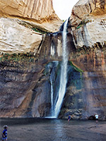
Lower Calf Creek Falls
★★★★★
★★★★★
2.75 miles, 200 feet
Popular path that follows a sheer-walled riparian canyon, either close to the stream or across more arid land above, to a dramatic waterfall in a sheltered alcove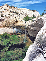
Upper Calf Creek Falls
★★★★★
★★★★★
1.1 miles, 560 feet
88 foot waterfall close to UT 12, reached by a steep descent down a white slickrock slopeEscalante Canyons
Big Horn Canyon
★★★★★
★★★★★
3.8 miles, 700 feet
Medium depth drainage that has several stretches of shallow narrows in its east (main) fork, and a short but deeper, more colorful and photogenic slot in the west fork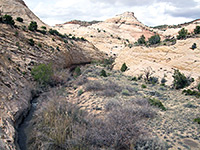
Boulder Creek
★★★★★
★★★★★
1.5 miles, 400 feet
Short, cross country hike down a rocky ravine into the middle part of Boulder Creek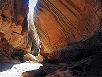
Brimstone Gulch
★★★★★
★★★★★
2.9 miles, 350 feet
Extremely dark and enclosed slot that eventually becomes too narrow to explore at ground level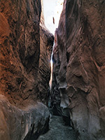
Coyote Gulch, Dry Fork
★★★★★
★★★★★
1.1 miles, 200 feet
Long drainage containing 0.7 miles of moderately deep and narrow passageways near its upper end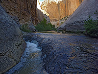
Death Hollow
★★★★★
★★★★★
2 miles, 600 feet
Off trail hike into the lower end of Death Hollow, a deep canyon through sheer Navajo sandstone cliffs, containing a permanent stream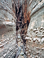
Egypt 3
★★★★★
★★★★★
2.7 miles, 400 feet
Excellent narrows in three distinct sections; a long succession of interlinked potholes, followed by extremely narrow passageways through strangely textured rocks, and finally a lower technical section with drop-off and pool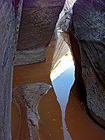
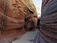
Escalante River Slot Canyon
★★★★★
★★★★★
1.4 miles, 500 feet
Minor tributary ravine on the south side of the Escalante River, quite easily accessible from Hwy 12; forms a nice short slot, with shallow pools and twisting passages through dark-colored sandstone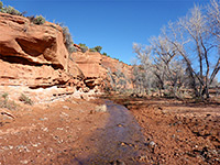
The Gulch
★★★★★
★★★★★
10 miles, 650 feet (loop)
Major Escalante River tributary containing a permanent stream, and joined by several side-canyons that form short slots; accessed from the Burr Trail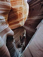
Harris Wash
★★★★★
★★★★★
5.3 miles, 300 feet
Long, deep and relatively wide drainage providing an obstruction-free hiking route to the Escalante River. Four tributaries forms slots, most unusual (and shortest) being stripy Zebra Slot and enclosed Tunnel Slot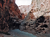
Little Death Hollow
★★★★★
★★★★★
8 miles, 600 feet
Remote, east-side Escalante tributary that after a long open section, eventually forms a fine slot canyon, with over 2 miles of narrow, twisting passageways through colorful Wingate sandstone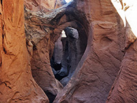
Peekaboo Gulch
★★★★★
★★★★★
1.1 miles, 180 feet
Minor tributary of Dry Fork of Coyote Gulch forming a short slot at its southern end, containing sharp fins, interlinked potholes several small arches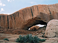
Phipps Wash
★★★★★
★★★★★
5 miles, 800 feet
Large sandstone arch, reached by hiking across sand and slickrock then down the deepening drainage of Phipps Wash, which eventually meets the Escalante River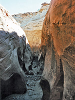
Red Breaks
★★★★★
★★★★★
3 miles, 500 feet
Extensive, branched, north-side tributary of Harris Wash in a rarely visited area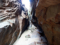
Spencer Canyon
★★★★★
★★★★★
4 miles, 550 feet
Short, branched, south side tributary of the Escalante River; longest fork is straight and vertical-walled, with a tight, dark slot in the upper end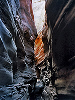
Spooky Gulch
★★★★★
★★★★★
1.2 miles, 220 feet
Short, narrow, claustrophobic slot canyon, a tributary of Dry Fork of Coyote GulchGrand Staircase - The West - the Paria River
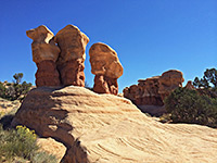
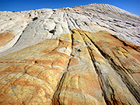
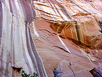
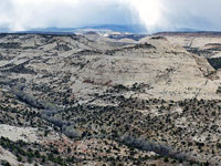
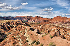
The western section of the national monument contains most of the Grand Staircase, a series of uplifted sandstone cliffs stretching in order of increasing age between Bryce Canyon and the Grand Canyon. Cutting through the cliffs is one of the two major canyon systems; that formed by the Paria River and its many tributaries. The main access to the upper reaches of the river is by the 50-mile Cottonwood Canyon Road running between Cannonville and US 89; this is a bumpy gravel track that is often impassable after rains due to the clayish soils. The most visited section of the river is towards the south, either side of the Hwy 89 crossing, where popular places include the Paria Rimrocks and the Paria townsite, while just outside the national monument are the Paria River narrows, the Buckskin Gulch slot canyon and the eroded features of Coyote Buttes and the Wave.
Paria Locations
Lengthy unpaved road through the national monument, also a useful short-cut between UT 12 (near Kodachrome Basin State Park) and US 89 close to the Paria River ranger station.
Fantastic rock formations near the Paria River; colorful strata, hoodoos and strangely shaped rocks, in many shades of red and white
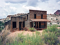
Side roads of US 89, including Johnson Canyon Road, Paria River Valley Road and the Paria ghost town/movie set
Paria Rock Formations
Nautilus Rock
★★★★★
★★★★★
1.1 miles, 130 feet
Shell-shaped outcrop of Page sandstone, split by a curving, wave-like gully, lined by thin, delicate fins and ridges; a very photogenic location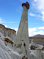
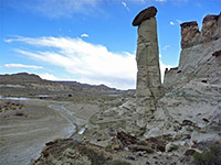
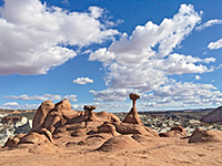
Wahweaap Hoodoos
★★★★★
★★★★★
4.6 miles, 300 feet
Photogenic group of pinnacles and balanced rocks surrounded by undulating mounds and cliffs of white entrada sandstone. Hike also passes a few short slot canyons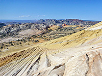
Yellow Rock
★★★★★
★★★★★
1 miles, 780 feet
Smooth-sided dome of swirling, multicolored Navajo sandstone, reached by a short but steep trail; many photogenic patterns and texturesParia Canyons
Booker Canyon
★★★★★
★★★★★
3 miles, 600 feet
Short but pretty narrows in a remote, little-visited region; a tight, V-shaped slot that gives way to a deeper canyon through photogenic, angled, thin-layered rocks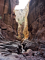
Bull Valley Gorge
★★★★★
★★★★★
2 miles, 500 feet
Good, deep narrows through colorful, thin-layered sandstone, containing long muddy pools and several dryfalls, hence quite testing to explore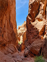
Catstair Canyon
★★★★★
★★★★★
1 mile, 210 feet
Short, red rock canyon through the Cockscomb, alongside US 89; narrows, dryfalls, and a stack of 1950s cars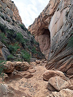
Cottonwood Wash Narrows
★★★★★
★★★★★
3.2 miles, 300 feet
Short enclosed section of canyon running parallel to Cottonwood Canyon Road, through the angled strata of the Coxcomb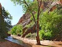
Hackberry Canyon
★★★★★
★★★★★
2 miles, 120 feet
The lower end of Hackberry Canyon forms a deep gorge through light-colored Navajo sandstone, while a shallow creek flows through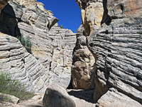
Lick Wash
★★★★★
★★★★★
0.9 miles, 120 feet
Brief narrows section enclosed by unusual thin-layered, cross-bedded sandstone; not especially colorful but interesting nonetheless, and quite photogenic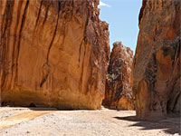
Paria Box
★★★★★
★★★★★
1.8 miles, 400 feet
Short enclosed section of the Paria River, with cliffs up to 300 feet tall; viewed along an easy trail that ends at an elevated viewpoint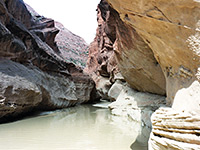
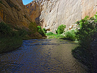
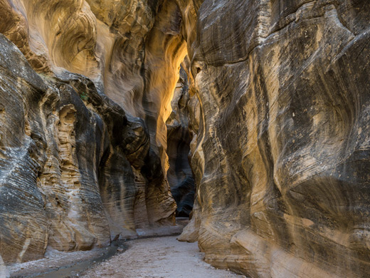
Paria River
★★★★★
★★★★★
7 miles, 300 feet
Rival of the Zion Narrows to be the best narrow, water-filled canyon in the Southwest - a usually shallow river flowing through miles of enclosed passageways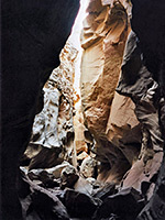
Round Valley Draw
★★★★★
★★★★★
2.8 miles, 350 feet
Deep, dark canyon through dull-colored sandstone, thin-layered in some places and nicely eroded. The narrows extend for about a mile, then the gorge gradually opens out and pine trees grow beside the streambed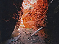
Starlight Canyon
★★★★★
★★★★★
5.8 miles, 500 feet
Short slot canyon in a remote location. Tributary of the Paria River, wide for most of its length, that forms a pretty, enclosed passageway containing a small stream, flowing through pools and cascades
Upper Sand Creek
★★★★★
★★★★★
3 miles, 550 feet
Remote, trailless, overgrown drainage, winding beneath tall pines and sandstone cliffs, part of the Box-Death Hollow Wilderness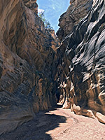
Willis Creek
★★★★★
★★★★★
0.9 miles, 150 feet
Permanent stream flowing through some beautiful narrow sections, between curvy, nicely eroded walls streaked with desert varnish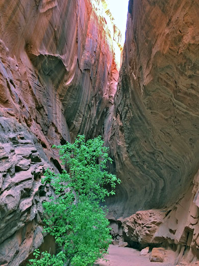
All Contents © Copyright The American Southwest | Comments and Questions | Contribute | Affiliate Marketing Disclosure | Site Map