Cottonwood Canyon Road, Grand Staircase-Escalante National Monument
Utah > Grand Staircase-Escalante National Monument > Cottonwood Canyon Road
Highlights:
Lengthy unpaved road through the western reaches of Grand Staircase-Escalante National Monument, passing close to several narrow canyons and the triple span of Grosvenor Arch. Much is along the Coxcomb, a series of valleys formed by upturned rock layers. The road provides a useful short-cut between UT 12 (near Kodachrome Basin State Park) and US 89 close to the Paria River ranger station

The surrounding land has much of interest to explore, including slot canyons, arches, springs and endless colorful, eroded rocky scenery. The description below is from south to north; US 89 to UT 12.
Cottonwood Canyon Road Table of Contents
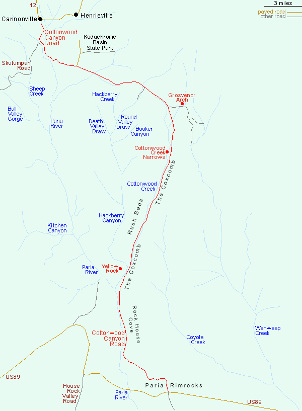
Cottonwood Canyon
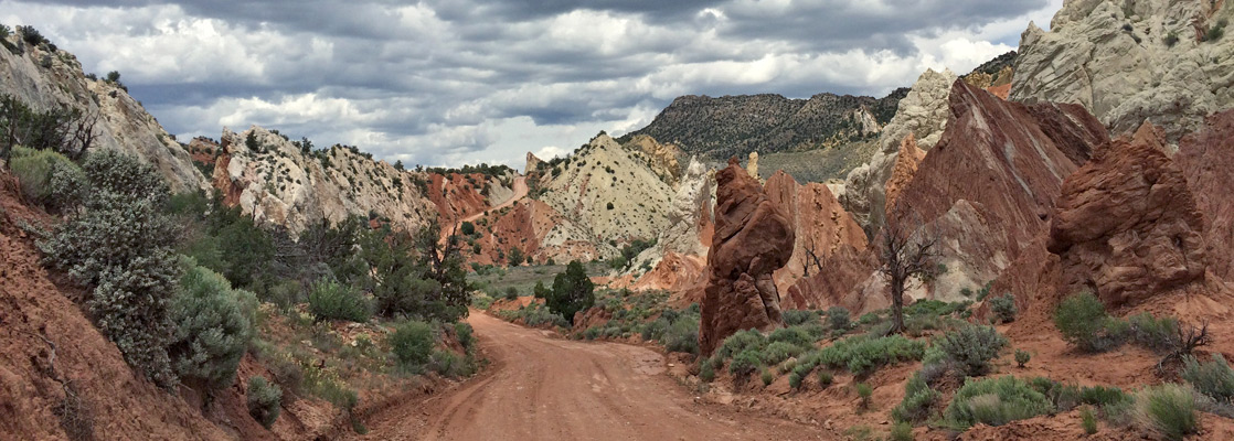
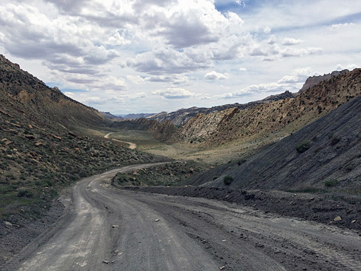
Once through a short band of hills, part of the Paria Rimrocks, the surface of the southernmost few miles of Cottonwood Canyon Road is liable to be ridged and bumpy as the road crosses wide open, rather desolate and empty terrain with undulating badlands, grey to brown in color with no covering vegetation - layers of the Tropic Shale formation that border much of US 89 between here and Lake Powell. The track eventually drops down into the Paria River Valley, running across a wide flat area that is occasionally flooded, then along beneath crumbling cliffs at the east side of a low canyon that begins a little way upstream. The Paria soon turns away northwest at the junction with Cottonwood Creek; road then follows creek for the next 10 miles, along a very straight canyon bordered by the upturned strata of the Coxcomb - an elongated series of ridges running along the valley, created by erosion of upwardly-pointing folded rock layers. This is bordered on the east side by an equally straight depression, Cad's Crotch, extending for about 12 miles. The rocks at either side of the Coxcomb have strange faded whitish-grey colors; steep, tilted cliffs again with almost no trees or bushes. There is a general air of remoteness, only slightly spoilt by rather conspicuous telephone wires that run alongside the course of the creek, which is dry for some of the year.


Hiking along Cottonwood Canyon
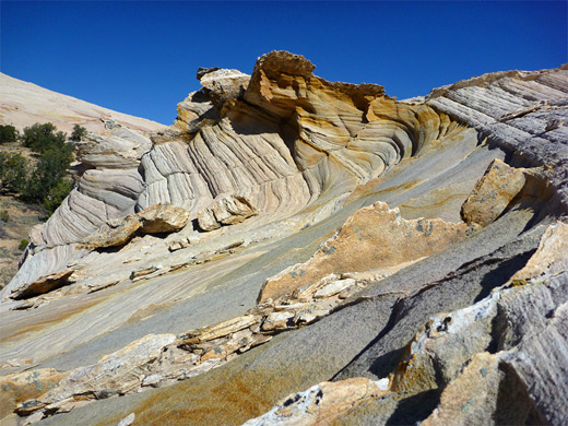
There are several hikes along the Cottonwood Creek section of the road; the southernmost is at the Paria confluence, from where a route follows the river throuh a short, enclosed canyon (Paria Box), returning across higher ground to the north. Two miles further north, reached by a short but steep hike, is Yellow Rock, a smooth dome of swirling, multicolored Navajo sandstone, which is to the north bordered by Hackberry Canyon, a major tributary. The lower 2 miles is most enclosed and spectacular, but the drainage can be followed for many more miles upstream, North of here, after a longer straight stretch along the main valley, the creek takes an abrupt turn west and thereafter flows through a much narrower canyon; the road continues north between ridges of the Coxcomb. One mile beyond it passes through a particularly dramatic section with many steep, jagged pinnacles in shades from red to white, and from this location begins the hike into the Cottonwood Wash Narrows.

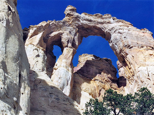
Grosvenor Arch
30 miles from US 89 and 17 miles from Cannonville is the turn off to Grosvenor Arch, the most accessible and spectacular natural feature along the Cottonwood Canyon Road. This is a large double arch at the end of an isolated ridge of yellowish-white Henrieville sandstone, and is one of the most photographed places in the national monument. The main road then bends westwards and crosses up and down several steep ridges en route to Kodachrome Basin State Park; the surface is paved from here to Cannonville. There are several side tracks en route including a short spur to Round Valley Draw (and the more remote Booker Canyon), and the Skutumpah Road, which crosses a large area of wooded hills and valleys back south to US 89 and Johnson Canyon. Along this road are the intriguing slot canyons of Willis Creek, Lick Wash and Bull Valley Gorge.

All Contents © Copyright The American Southwest | Comments and Questions | Contribute | Affiliate Marketing Disclosure | Site Map