Hole-in-the-Rock Road, Grand Staircase-Escalante National Monument
Utah > Grand Staircase-Escalante National Monument > Hole-in-the-Rock Road
Highlights:
The main access to the western Escalante River and its numerous tributary canyons; an unpaved, 55 mile route that is usually passable by regular vehicles apart from the last few miles, which lead to a viewpoint above Lake Powell

The lower 300 feet are now submerged below the cold waters of Lake Powell but the route to this point survives as the Hole-in-the-Rock Road, and today this provides easy access to the Escalante River and its western tributaries, the most visited area of Grand Staircase-Escalante National Monument, though after the 2016 area reduction all of the road falls outside the boundaries. The southernmost few miles are within Glen Canyon NRA.
Hole-in-the-Rock Road Table of Contents
- Photographs
- Map of Hole-in-the-Rock Road
- The road
- Hole-in-the-Rock northern trailheads
- Hole-in-the-Rock southern trailheads
- Devils Garden; arches and hoodoos
- Dance Hall Rock; undulating sandstone
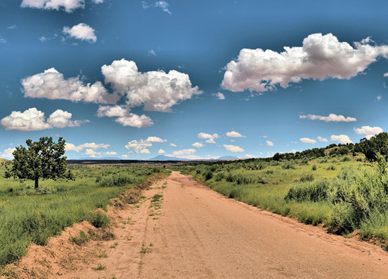
Photographs
20 views along the Hole-in-the-Rock Road.

The Road
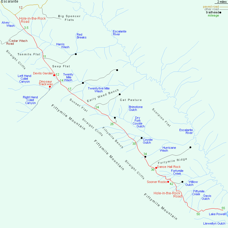
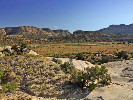
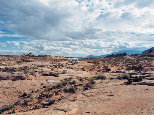
The unpaved Hole-in-the-Rock starts 4.5 miles east of Escalante on UT 12 and reaches the edge of Glen Canyon after 55.5 miles. The first 15 miles, as far as the Garfield/Kane county line, are almost as good as a regular highway, then the surface deteriorates somewhat and is often severely graded but is fine for normal cars until at least mile 38. After here are six steep dry wash crossings, tributaries of Fortymile and Fiftymile Creeks, that may pose a problem, but still the surface should usually be passable until 5 miles from the southern end; the last section, after the Davis Gulch crossing, is very rough and for high clearance, 4WD vehicles only. The scenery along most of the journey is little changing and not too spectacular as to the west stretch the high, layered 50 mile long Straight Cliffs while the land on the other side is mostly a flat, grassy plain - the many fantastic canyons are hidden from view, reached only by various side roads that lead east towards the Escalante River. Towards the end though, the terrain is more undulating and dramatic as the cliffs become closer to the river, the side canyons are more numerous and extend further west, and the grassy plateau is gradually replaced by vast areas of slickrock domes, which are best viewed from an overlook just before Davis Gulch. At mile 46, the road enters Glen Canyon National Recreation Area.


Hole-in-the-Rock Trailheads - North
All major trailheads and canyons along the Hole-in-the-Rock road are signposted, and the upper section is well-traveled during the summer months. The main side tracks are to the east, with just a few exceptions including the first, Cedar Wash Road (after 3.5 miles), which crosses Alvey Wash and climbs gently towards the Straight Cliffs, passing two arches, Cedar Wash Arch and Covered Wagon Natural Bridge. The second (mile 11) is the six mile route to the Harris Wash trailhead, used either for long hikes far down the wash, or shorter walks to the north-side tributaries of Red Breaks, Zebra Canyon and Tunnel Slot. Next, mile 14, is another westerly route, following the upper reaches of Twentymile Wash and later one of its two tributaries, Right Hand Collet Canyon. Near the junction with Left Hand Collet Canyon is a short spur to the trailhead for the quarter mile path to the 20 Mile Dinosaur Trackway, a group of around 250 shallow prints, mostly made by sauropods, 160 million years ago. The prints are spread out across a low bench and can be quite difficult to spot. At mile 17, a ten mile track heads east across Twentyfive Mile Wash to the Egypt Bench trailhead, for hikes to the Egypt slot canyons, and locations on the far side of the Escalante River including Choprock Canyon and the Golden Cathedral (in Neon Canyon). The next track, mile 24, is to Early Weed Bench, a less used trailhead, which gives access to the lower reaches of Twentyfive Mile Wash. Two miles south is a short track to perhaps the most used trailhead, Dry Fork of Coyote Gulch (mile 26), near which are the three intriguing, and contrasting, canyons of Peekaboo, Spooky and Brimstone gulches.
Hole-in-the-Rock Trailheads - South
Another short track (mile 30) leads to Red Well, next to Big Hollow Wash, start point for a hike down the main fork of Coyote Gulch. The Hurricane Wash trailhead, mile 34, is right along the main road, while shortly beyond, a good quality, 7 mile track crosses Fortymile Ridge to another Coyote Gulch access point, near its downstream end. A worthwhile side trip hereabouts is the one mile hike over gently sloping, sandy plains to Sunset Arch, a narrow span formed of dark-colored Entrada sandstone; start is 4 miles down the road. The southernmost trailhead, 42 miles, is at the end of another short track, across Sooner Bench, for hikes to Willow Gulch and Broken Bow Arch. Also of interest in the vicinity, and easily accessed from the main road, are two south-side tributaries of Fortymile Gulch - Carcass Wash and Sooner Wash; they both form shallow narrows, both east and west of the road, and can be used to reach the gulch. Sooner Wash is the more interesting of the two. South of Willow Gulch the Hole-in-the-Rock Road crosses Fiftymile Creek and then Davis Gulch, both inviting to explore. The latter crossing is also the start point for off-trail hikes to Llewellyn Gulch.
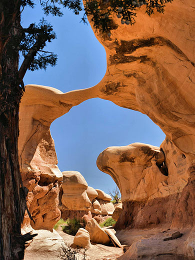
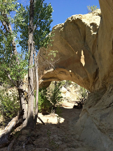
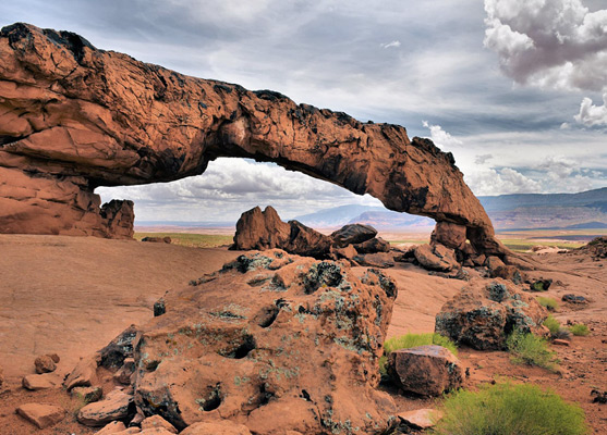
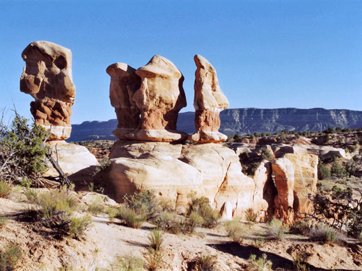
Devils Garden
Apart from the grey cliffs that border the road - the second of the four main steps of the Grand Staircase, there are only two other specific places of interest along the route. First is Devils Garden, 12 miles from UT 12. Not to be confused with the other formation of that name in Arches National Park, this is a collection of large eroded rocks, quite similar to Goblin Valley with fewer formations on a bigger scale. There is a picnic area, a short loop path and two interesting arches (Metate and Mano) a little way to the south.

Dance Hall Rock
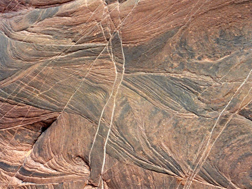
The second roadside location is Dance Hall Rock, 24 miles further, by which point traffic on the road is much less - the Hurricane Wash/Coyote Gulch trailhead at mile 34 marks the end of the most frequently travelled section. The rock is a large mound of Navajo sandstone at the edge of quite an impressive outcrop formed of several hundred feet of undulating, striated slickrock with cliffs, ravines, water pockets and eroded, sheer-sided cavities, some containing lone cottonwood trees - a nice place to explore for an hour or so. Several large overhangs provided good sheltered campsites for the original Hole-in-the-Rock expedition, who rested here while preparing for the route ahead, which became much harder from here southwards.
All Contents © Copyright The American Southwest | Comments and Questions | Contribute | Affiliate Marketing Disclosure | Site Map