Highlights:
Small village along US 163 with only basic facilities, but near many spectacular landscapes, including the Goosenecks of the San Juan River, Valley of the Gods, Monument Valley, Muley Point and Cedar Mesa
Nearby town:
Kayenta (AZ), 43 miles
Management:
Most of the surroundings are BLM land; south of the river is the Navajo Reservation
Location:
Seasons:
All year
Rating (1-5):
★★★★★

Mexican Hat is part of the Grand Circle and Indian Lands itineraries.
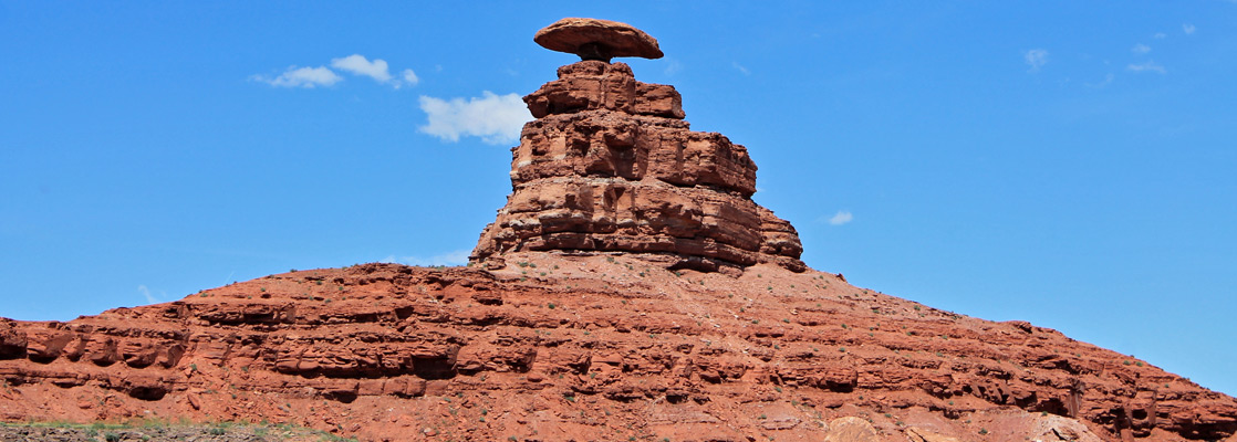
After passing the eroded mesas of Monument Valley, highway US 163 crosses 20 miles of rather flat landscape past scattered Navajo houses to Mexican Hat, a small settlement named after a curious formation nearby consisting of a large flat rock 60 feet in diameter perched precariously on a much smaller base at the top of a small hill.
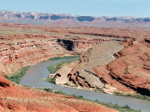
The village itself is small, home to fewer than one hundred people and offering few facilities, but the surrounding scenery is exceptional and not often visited, featuring 1,200 foot sandstone cliffs at the edge of Cedar Mesa, deep, layered canyons of the San Juan River, vast sandy desert plains, and a wide valley studded with isolated red rock buttes and mesas.
The village itself is small, home to fewer than one hundred people and offering few facilities, but the surrounding scenery is exceptional and not often visited, featuring 1,200 foot sandstone cliffs at the edge of Cedar Mesa, deep, layered canyons of the San Juan River, vast sandy desert plains, and a wide valley studded with isolated red rock buttes and mesas.
Mexican Hat Table of Contents
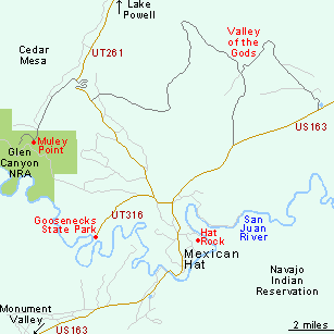
Map of Mexican Hat
Photographs
Mexican Hat and surroundings, Goosenecks State Park.
Sites
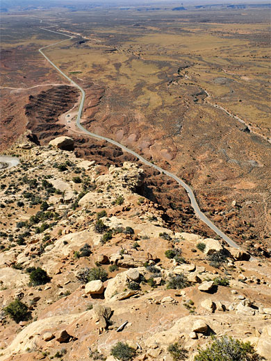
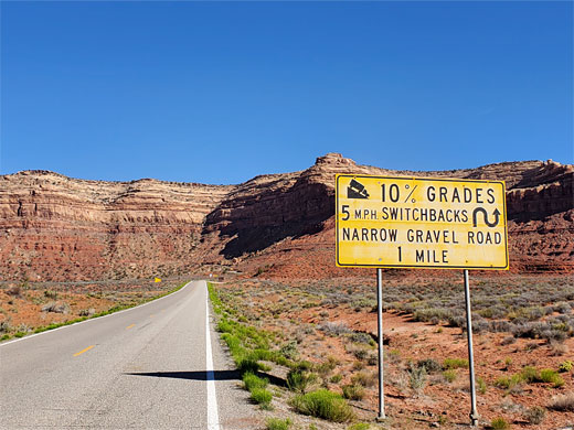
The three main sites of interest near Mexican Hat are the overlook at Muley Point, the entrenched river meanders at Goosenecks State Park and the red sandstone formations of Valley of the Gods.
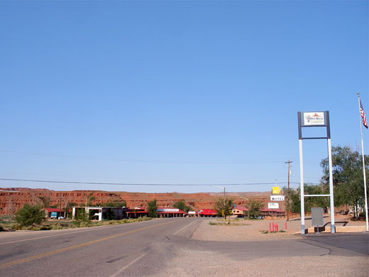
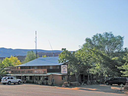
Facilities at Mexican Hat
Highway 163 is the only road through Mexican Hat, passing all the limited facilities which comprise a gas station, gift shop, campground, several restaurants, and four motels, one of which (San Juan Inn) sits right beside the river, next to the road bridge across into the Navajo Indian Reservation. The nearest chain hotels are in Kayenta (43 miles west) or Blanding (50 miles east). Besides providing a base to explore the surrounding scenery, the town is also popular as the start (or end) point for rafting trips along the San Juan River - these usually run between Bluff and Mexican Hat, or from Mexican Hat downstream to the upper end of Lake Powell, exiting via the Piute Farms Road near Monument Valley.
Camping near Mexican Hat
The Hat Rock after which the town was named can be reached by a short track leading from US 163 to the San Juan River, and with moderate effort it is possible to climb to the top, to a summit that affords good views of the surrounding red and grey rocks, many of which have been twisted into strange convoluted forms. Near the end of the track there is an excellent (free) place for camping, with views of the Hat and the river. The greenery along the water's edge contrasts vividly with the swirling reds and grays of the canyon walls. There are many other good free camping places nearby - at Goosenecks Overlook, along the road through Valley of the Gods, or at Muley Point - unlike south of the river, as here begins the vast Navajo Reservation, where camping is in general only permitted in official sites.
All Contents © Copyright The American Southwest | Comments and Questions | Contribute | Affiliate Marketing Disclosure | Site Map