Highlights:
The most famous national parks in the Southwest, in north Arizona and south Utah: Zion, Bryce Canyon, Capitol Reef, Arches, Canyonlands and the Grand Canyon, plus Lake Powell and Monument Valley on the Navajo Indian Reservation. Other places visited en route include Kodachrome Basin, Goblin Valley and the Hoover Dam. Focus of this tour is on sightseeing and short trails, as to hike these areas in depth would need many weeks!
Type:
Loop, beginning at Las Vegas
Length:
1,500 miles, 2,400 km
Duration:
11 days minimum; 15 days or more with optional side trips
Seasons:
Spring and fall are best; summers are hot, and some places are rather busy
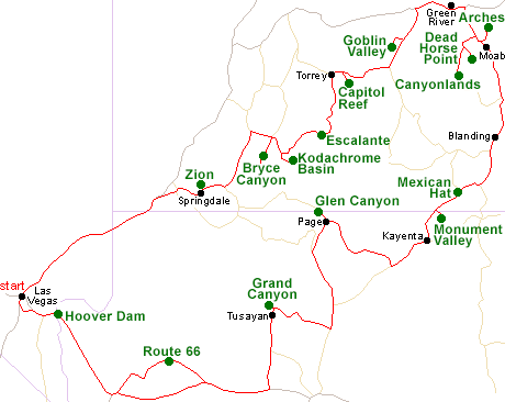
Map of the Grand Circle Itinerary
Please refer to the disclosure notice for information about the affiliate (commissionable) links on this page.
Day 1 - Las Vegas to Zion National Park, 165 miles
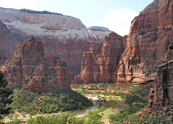
Starting in Las Vegas, an easy 3 hour drive along I-15 through the Mohave Desert then scenic Highway 9 reaches the little town of Springdale by the Virgin River, gateway to Zion National Park. The rest of the day is spent exploring Zion Canyon, which has plenty of roadside overlooks and a good variety of trails to choose from.
Optional extra day: longer hikes in Zion
Day 2 - Zion National Park to Bryce Canyon, 120 miles
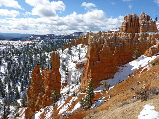
There is time in the morning to see a little more of Zion NP, such as Checkerboard Mesa, east of the Mt Carmel tunnel, before heading further east to the beautiful orange-pink sandstone pinnacles of Bryce Canyon, and taking the 15 mile scenic drive through the park to the southernmost overlook at Yovimpa Point. A hike along one of the shorter trails such as Queens Garden gives a close-up view of the famous formations.
Day 3 - Bryce Canyon to Torrey, 130 miles
Continuing east on one of Utah's most scenic byways (Hwy 9), the next stop is at Kodachrome Basin State Park, which features multicolored rocks and unusual sand spires, followed by the slickrock canyons of Escalante, where popular trails include Lower Calf Creek Falls. After here the road climbs through the cool pine forests of Boulder Mountain and descends to Torrey.
Optional extra day: explore more of the Escalante canyons
Day 4 - Torrey to Green River, 145 miles
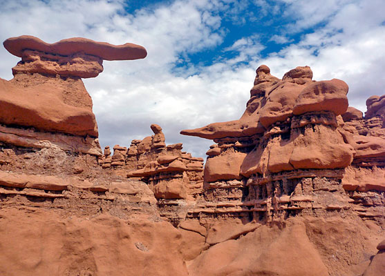
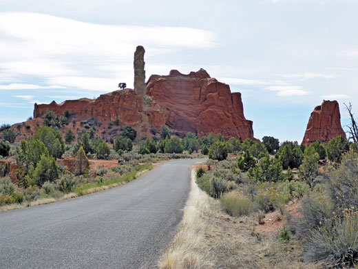
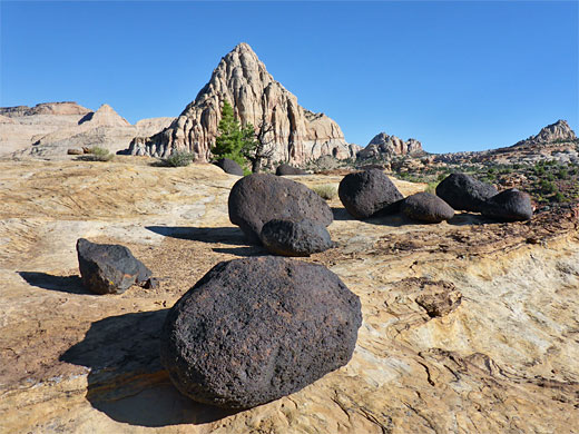
A few miles from Torrey, UT 9 crosses a great ridge of colorful, upturned sandstone, contained within Capitol Reef National Park; the scenery can best be seen along a 7 mile scenic drive and several trails. The desert lands further east conceal many other scenic landscapes including Goblin Valley. The night is spent at Green River along I-70; attractions in town include the John Wesley Powell Museum, which has many exhibits about the pioneer history of this area.
Day 5 - Green River to Moab, 80 miles
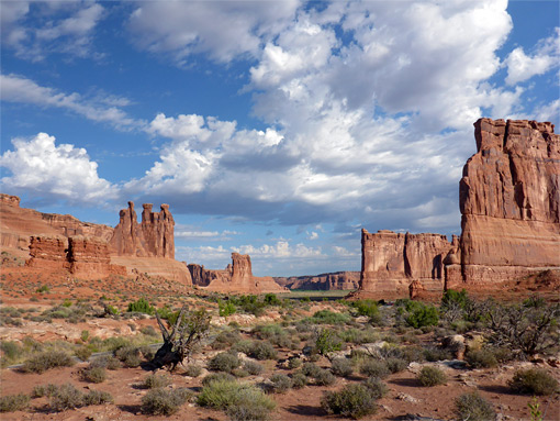
An hour's drive south of Green River, US 191 reaches Arches National Park, one of the highlights of the Southwest, where there is more than enough to see for a full day. From here it is a very short drive across the Colorado River to Moab. A scenic side trip follows the river westwards a few miles along Potash Road.
Day 6 - Moab to Blanding, 160 miles
Canyonlands is the other national park near Moab, and the Island in the Sky District is less then an hour away; here are many spectacular overlooks, of a vast region of ravines and mesas, plus a selection of trails. En route, Dead Horse Point State Park has more of the same scenery. The day is completed by driving south along US 191 to Blanding.
Optional extra day: Needles District of Canyonlands National Park
Day 7 - Blanding to Kayenta, 120 miles
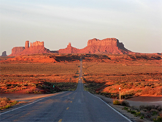
South of Blanding are several small but scenic sites around Mexican Hat including Goosenecks State Park and Valley of the Gods, before the highway crosses the San Juan River, enters the Navajo Indian Reservation and reaches Monument Valley, the epitome of a red rock Western landscape, seen best along the 17 mile Valley Drive in the Navajo Tribal Park. Lodging is in Kayenta, half an hour south.
Optional extra day: the stream-cut arches of Natural Bridges National Monument and/or the cliff dwellings of Cedar Mesa
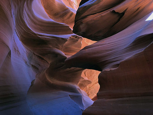
Day 8 - Kayenta to Page, 120 miles
Next stop is Wahweap in Glen Canyon NRA; more red rock scenery, with the added attraction of the warm waters of Lake Powell. As an alternative to water-based activities, popular sites nearby include Antelope Canyon, Water Holes Canyon and Horseshoe Bend on the Colorado River. The night is spent in Page, near Glen Canyon Dam.
Day 9 - Page to Tusayan (Grand Canyon), 145 miles
The drive from Page to the Grand Canyon passes sandy desert lands for most of the way, starting to climb into wooded terrain once past Cameron and the Little Colorado River Gorge. An enjoyable diversion, taking a couple of hours, is to Lees Ferry, a tiny settlement on the Colorado River near much interesting scenery. The nearest chain lodging to Grand Canyon National Park is at Tusayan, 3 miles from the south entrance.
Day 10 - Grand Canyon, 50 miles
A full day is spent at the South Rim of the Grand Canyon, enough to see all major roadside overlooks, and for a hike part way down into the canyon; Bright Angel and South Kaibab are the two most popular trails.
Day 11 - Tusayan to Las Vegas, 265 miles
The long drive from the Grand Canyon back to Las Vegas could be enlivened by a detour along old Route 66, through Peach Springs and the Hualapai Indian Reservation. The highway crosses into Nevada via a new bridge over the Colorado River, just downstream of the Hoover Dam, which may be viewed from the top, or toured inside.
All Contents © Copyright The American Southwest | Comments and Questions | Contribute | Affiliate Marketing Disclosure | Site Map