Highlights:
By far the most visited section of the Grand Canyon, offering many trails and overlooks, and all necessary facilities including hotels, shops, shuttlebuses and a historic railway
Seasons:
Open all year, though subject to frequent snowfall during the winter

South Rim of the Grand Canyon is part of the Colorado River, Grand Circle and Grand Canyon itineraries
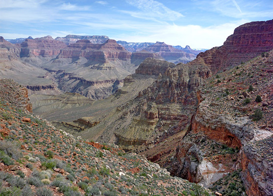
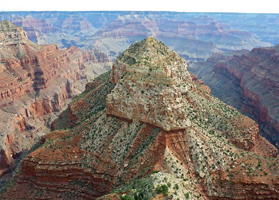
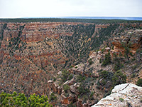
South Rim - Viewpoints
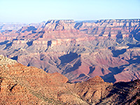
25 canyon overlooks, from Piute Point to Comanche Point north of Desert View - beside the road or reachable by hiking, either very short, level paths or cross-country routes of up to 4 miles
For most people, a visit to the Grand Canyon is to the south rim rather than the remote north rim, approaching either along US 180 from Flagstaff and the south or AZ 64 from Williams and the west. Both routes cross the largely flat Coconino Plateau which is characterized by typical mountain scenery of broad meadows and pine forests, giving no hint of the great abyss over the horizon.
The busy village of Tusayan is located two miles south of the park boundary; it has an airport, shops, hotels, an IMAX cinema and a large, cheapish RV site. Basic, primitive camping is allowed free in the neighboring Kaibab National Forest - closest location to town is along FR 302, on the southeast side of Tusayan, where overnight stays are permitted once a quarter of a mile from the highway. Another suitable track is FR 328, just north of the village.
The busy village of Tusayan is located two miles south of the park boundary; it has an airport, shops, hotels, an IMAX cinema and a large, cheapish RV site. Basic, primitive camping is allowed free in the neighboring Kaibab National Forest - closest location to town is along FR 302, on the southeast side of Tusayan, where overnight stays are permitted once a quarter of a mile from the highway. Another suitable track is FR 328, just north of the village.
South Rim Table of Contents
- Maps
- Photographs
- South Rim viewpoints
- Approach to the vanyon
- Grand Canyon tours
- Grand Canyon Village; many visitor facilities
- The western rim
- The eastern rim
- Grand Canyon Wilderness
- South Rim Trails
Maps
South Rim trails and viewpoints, Grand Canyon Village.
Photographs
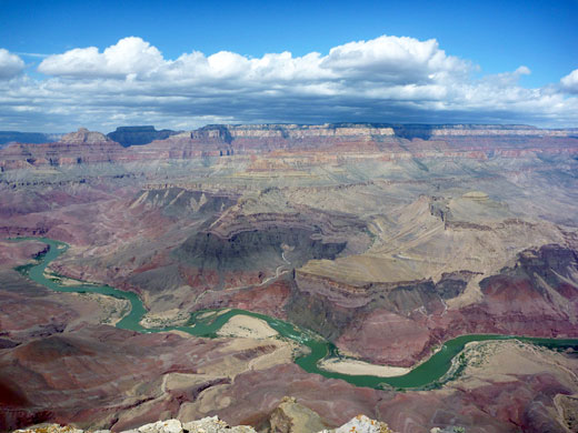
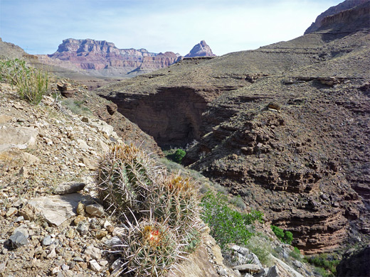
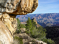
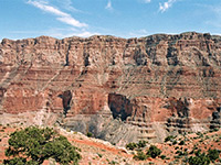
General South Rim views
Trail photos: Bright Angel, Cedar Mountain, Comanche Point, Grandview, Hermit, New Hance, Tanner.
Approach to the Canyon
Tusayan is the location for the proposed car-park that may one day mark the limit of approach to the canyon for private vehicles, when visitors will be transported further by either an electric bus system or a light railway. Once past the town and past the national park entrance station, the canyon is hidden from view by a gradual incline until only a few yards away. The road divides just before the edge - to the west is the main visitor area and various viewpoints quite close together while to the east, AZ 64 continues through the pine forest alongside the canyon rim for 30 miles with fewer viewpoints further apart, before leaving the park, descending back into desert lands of the Navajo Indian Reservation and joining US 89 at Cameron.
South Rim Grand Canyon Viewpoints - 20 overlooks along the canyon edge.
Grand Canyon Tours
Grand Canyon Village
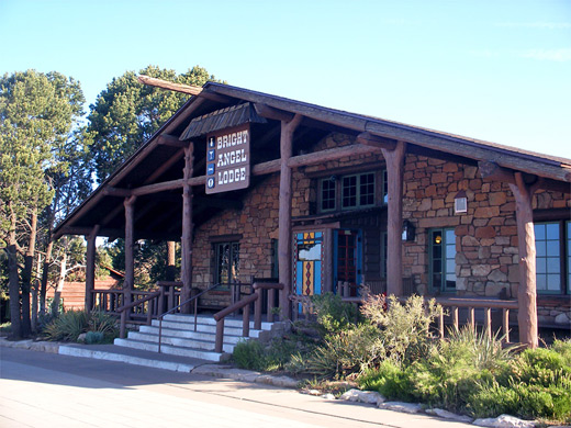
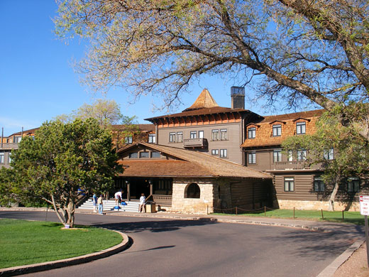
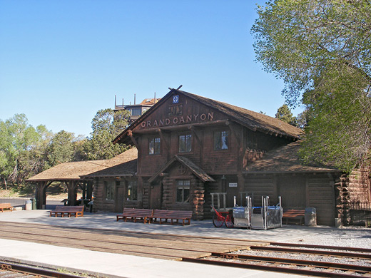
The usual place to see the canyon for the first time is either at Mather Point or Yavapai Point to the west; the latter has more parking and slightly better views. Around the next bend there is the equivalent of a small town, spread out over several miles of the forest, with a hospital, railway station (terminus of old-style steam rides from Williams, complete with staff in period costume), shops, restaurants, six lodges, a trailer village and a campground. The village also contains several historic sites such as hotels and artists' studios built early this century.
The Western Rim
The scenic drive (Hermit Road, formerly the West Rim Drive) continues several miles further but it becomes narrow and has limited parking so entry is closed to private vehicles during the day in peak season and free shuttle buses are provided instead. Another half dozen viewpoints may be visited, including Pima Point & Hopi Point, and all are linked by a rim trail making it possible to walk between selected points before resuming the shuttle, which is rather slow and bumpy, taking about 70 minutes (excluding stops) for the round trip. The road ends at the most westerly viewpoint of Hermits Rest where several trails descend into the canyon including to Dripping Spring and Hermit Creek, while for the more adventurous, starting at Grand Canyon Village is a rough track leading south into the forest that soon turns west and passes various other remote viewpoints and trailheads, eventually entering the backcountry of the Havasupai Indian Reservation. The most popular hiking path into the canyon is the Bright Angel Trail, beginning near the railway station. All the other south rim routes are rather more strenuous and much less-frequented - see the South Rim hiking index.
The Eastern Rim
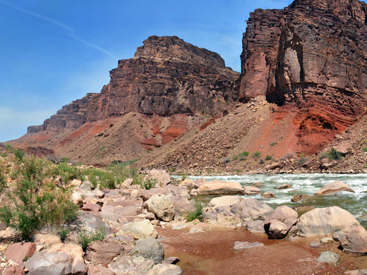
The Desert View Drive (AZ 64; also known as the East Rim Drive) passes through thick ponderosa pine forest with only occasional glimpses of the canyon, though the rim is never very far away. Stopping places include Yaki Point after 1 mile; this is near the South Kaibab trailhead and is a popular place for sunset watching, and the aptly named Grandview Point after 12 miles. Yaki Point has recently been closed to all private vehicles to help reduce overcrowding and now access is by shuttle bus or on foot. The final viewpoint along the drive (Desert View) is one of the best in the whole park - from a high promontory just before the east entrance station, a huge area of the Grand Canyon stretches out below; the main ravine to the north and west, the Little Colorado Gorge in the east - a very steep and narrow side canyon cutting into a flat plateau, and the colorful Painted Desert in the northeast. This one of the few south rim overlooks from which the Colorado itself can be glimpsed; the contrast between the greenery alongside the river and the stark reddish rocks is quite striking. But nine miles of the river are in full view from remote Comanche Point, reached by a 6 mile hike. There is another cluster of buildings at Desert View including the last gas station for a while and The Watchtower, a 20 meter high stone tower built in 1932 which is just visible from Cape Royal on the north rim, 9 miles away. Nearby, on the south side of the road, the Tusayan Ruins & Museum has the remains of a 12th century Anasazi settlement containing circular kivas and square houses, though the site is not particularly impressive as the remaining walls are only one foot high.
Grand Canyon Wilderness
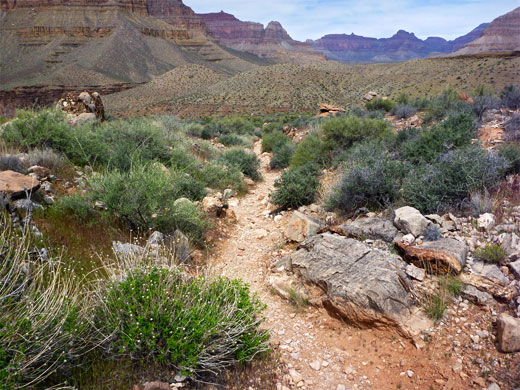
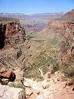
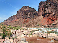
Perhaps more than any other national park in America, the Grand Canyon contains a huge variety of spectacular but largely hidden and inaccessible places - waterfalls, deep pools, narrow ravines, and oases - that cannot be reached by the casual tourist. Many of the wonderful side-canyons, with their associated photogenic features require a day or more traveling on foot from the canyon rim or complicated journeys involving boat trips down the Colorado to reach them. It is perhaps comforting to think that no matter how crowded and over-developed the South Rim overlooks become, most of the canyon will remain empty and essentially unvisited.
South Rim Trails
All maintained trails on the south rim of the Grand Canyon, from short paths along the rim to strenuous routes to the Colorado.
Fatured South Rim Trails
Bright Angel Trail
★★★★★
★★★★★
9.5 miles, 4550 feet
Popular and spectacular route to Havasupai Gardens, the Tonto Bench and the Colorado River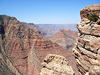
Cedar Mountain Trail
★★★★★
★★★★★
1.7 miles, 630 feet
Little traveled path giving views of Desert View from the canyon rim, before heading east towards a flat-topped butte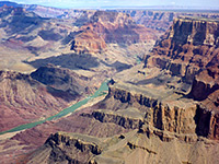
Comanche Point
★★★★★
★★★★★
6.2 miles, 670 feet
Remote, rarely traveled trail to a trailless overlook on the east side of the Grand Canyon, in the middle of the Palisades of the Desert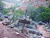
Dripping Spring Trail
★★★★★
★★★★★
3.1 miles, 1400 feet
Quite popular path descending steeply into upper Hermit Creek, then following a side drainage to a small spring
Grandview Trail
★★★★★
★★★★★
3 miles, 2600 feet
Unmaintained path that descends a steep ridge to Horseshoe Mesa, site of some old copper mines and primitive camping areas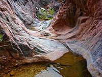
Hance Creek
★★★★★
★★★★★
8.5 miles, 4860 feet
Off-trail route to the Colorado River down a narrow, twisting canyon containing a permanent stream. Accessed by the Grandview Trail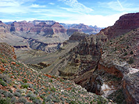
Hermit Trail
★★★★★
★★★★★
9 miles, 4340 feet
Excellent rim to river path with varied scenery, from cliff-bound Hermit Basin, all along Hermit Creek to Hermit Rapids on the Colorado River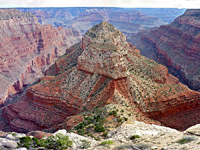
Mimbreno, Mescalero, Jicarilla and Piute Points
★★★★★
★★★★★
15 miles, 400 feet (loop)
Off-trail loop hike across the forested rim west of Hermits Rest to four remote promontories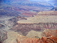
New Hance Trail
★★★★★
★★★★★
8 miles, 4530 feet
Spectacular, unmaintained rim to river path that follows Red Canyon to Hance Rapids; perhaps the most difficult South Rim trail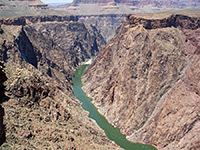
Plateau Point Trail
★★★★★
★★★★★
1.5 miles, 80 feet
Spur off the Bright Angel Trail, to a viewpoint of the inner canyon gorge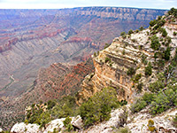
Shoshone Point Trail
★★★★★
★★★★★
1 miles, 0 feet
Stoll through airy ponderosa pine woodland to a rarely seen viewpoint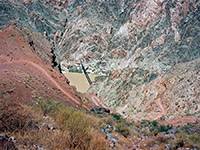
South Kaibab Trail
★★★★★
★★★★★
6.5 miles, 4820 feet
Shorter of the two maintained rim to river routes, running for most of the way along a narrow ridge, giving excellent views
Tanner Trail
★★★★★
★★★★★
9 miles, 4600 feet
Long route that descends to the Colorado River, joining it opposite Unkar Creek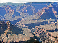
Yuma Point
★★★★★
★★★★★
6 miles, 1,500 feet
Remote viewpoint west of Hermit's Rest, reached by a rather difficult hike of which the last 2 miles is off-trail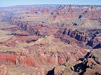
Zuni Point
★★★★★
★★★★★
0.5 miles, 20 feet
Quick, cross-country hike to a named overlook, overlooking Papago Creek and Red CanyonAll Contents © Copyright The American Southwest | Comments and Questions | Contribute | Affiliate Marketing Disclosure | Site Map