Tanner Trail, Grand Canyon National Park
Arizona > Grand Canyon National Park > South Rim > Hiking > Tanner Trail
Tanner Trail
Long route, very steep at the start, that descends from the South Rim to the Colorado River, joining it opposite Unkar Creek
Length: 9 miles
Elevation change: 4,600 feet
Difficulty: Steep, strenuous and lacking any water sources, though the path is in good condition and easy to follow
Type: One way; intersects the Escalante and Beamer trails
Usage: Low
Season: Accessible all year; partly snow-covered in winter and very hot in summer, especially the lower few miles
Trailhead: Along the short side road to Lipan Point, 1.7 miles west of Desert View
Rating (1-5): ★★★★★

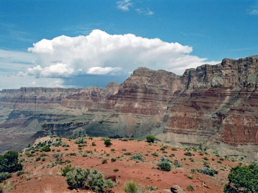
Lipan Point (7,400 feet) is the second viewpoint west of Desert View and overlooks 10 miles of the Grand Canyon, including Seventyfive Mile Creek and Tanner Canyon. It is also the starting point for the Tanner Trail, an 8 mile route that descends 4,600 feet to the Colorado River, and intersects two backcountry trails that run alongside - the Escalante Route westwards and the Beamer Trail north. The hike is recommended for the more experienced canyoneer as there is no water and little shade along the path, though the trail is in good condition and relatively easy to follow.
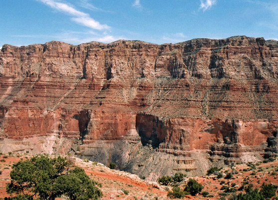
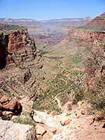
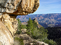
The small trailhead is set a little way back from the rim, on the right side of the entrance road, marked by an information board with map, from which a quite narrow path winds through the juniper bushes over a short plateau then drops very steeply down a narrow, shady ravine - an upper branch of Tanner Canyon. The surroundings are overgrown by trees and bushes, and the trail gets very little sunlight, as it descends sharply either via a series of short switchbacks or just directly down the slope. The path has boulders, loose stones and roots, and the route needs some care. It offers distant views of buttes and the Colorado river corridor but there is not much to see in the immediate vicinity for over a mile, until the end of the steepest section, when the trail flattens out and passes the head of Seventyfive Mile Creek on the left - this is another narrow canyon with sheer drop offs at the edge. To the right, the land falls away at the head of the less steep Tanner Canyon. The rocks hereabouts are Esplanade Sandstone, with the earlier sheer parts descending through the Kaibab Limestone, Toroweap Formation and Coconino Sandstone layers.
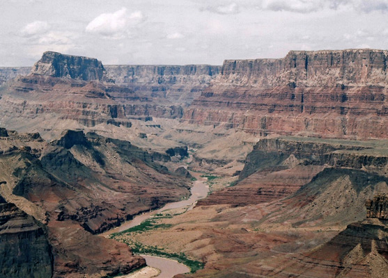
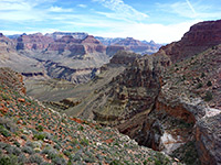
The trail continues along a narrowish ridge, away from the steep, wooded cliffs and into more desert like surroundings with cacti and yucca, as the views become more expensive, and is almost level for a while as it curves past the east side of Escalante Butte, round the head of a side valley then along the east side of Cardenas Butte. Next it climbs a little before dropping down to another ridge with even better views of the river and the inner canyon gorge. The main path continues to the right but a short spur leads to a viewpoint at the edge of a plateau from which several miles of the Colorado are visible, including the Tanner Canyon Rapids and the more distant Lava Canyon Rapids. This point is about half way from rim to river, in both distance and elevation, and is a good target for an easy day hike.
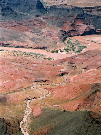
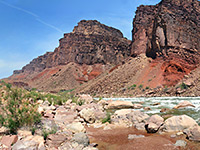
The route to the river continues by descending steeply through the Redwall limestone to the floor of a gently sloping ravine, along this and another ridge, then finally down the last 1,000 feet to the river, at this point bordered by a large area of sand dunes and beaches, good for camping. The land along the second half of the trail is quite open, mostly arid, reddish slopes, rather unlike the more familiar and rugged Grand Canyon landscape further west.
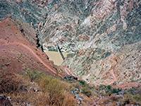
Start of the Tanner Trail
The small trailhead is set a little way back from the rim, on the right side of the entrance road, marked by an information board with map, from which a quite narrow path winds through the juniper bushes over a short plateau then drops very steeply down a narrow, shady ravine - an upper branch of Tanner Canyon. The surroundings are overgrown by trees and bushes, and the trail gets very little sunlight, as it descends sharply either via a series of short switchbacks or just directly down the slope. The path has boulders, loose stones and roots, and the route needs some care. It offers distant views of buttes and the Colorado river corridor but there is not much to see in the immediate vicinity for over a mile, until the end of the steepest section, when the trail flattens out and passes the head of Seventyfive Mile Creek on the left - this is another narrow canyon with sheer drop offs at the edge. To the right, the land falls away at the head of the less steep Tanner Canyon. The rocks hereabouts are Esplanade Sandstone, with the earlier sheer parts descending through the Kaibab Limestone, Toroweap Formation and Coconino Sandstone layers.
Middle Section
The trail continues along a narrowish ridge, away from the steep, wooded cliffs and into more desert like surroundings with cacti and yucca, as the views become more expensive, and is almost level for a while as it curves past the east side of Escalante Butte, round the head of a side valley then along the east side of Cardenas Butte. Next it climbs a little before dropping down to another ridge with even better views of the river and the inner canyon gorge. The main path continues to the right but a short spur leads to a viewpoint at the edge of a plateau from which several miles of the Colorado are visible, including the Tanner Canyon Rapids and the more distant Lava Canyon Rapids. This point is about half way from rim to river, in both distance and elevation, and is a good target for an easy day hike.
Route to the River
The route to the river continues by descending steeply through the Redwall limestone to the floor of a gently sloping ravine, along this and another ridge, then finally down the last 1,000 feet to the river, at this point bordered by a large area of sand dunes and beaches, good for camping. The land along the second half of the trail is quite open, mostly arid, reddish slopes, rather unlike the more familiar and rugged Grand Canyon landscape further west.
Tanner Trail - Similar Hikes
All Contents © Copyright The American Southwest | Comments and Questions | Contribute | Affiliate Marketing Disclosure | Site Map