Highlights:
Management:
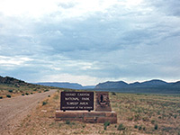
Location:
36.000,-112.121 (South Rim entrance)
Seasons:
Open all year, except for the North Rim which is closed by snow from November to May
Rating (1-5):
★★★★★
Weather

South Rim and North Rim
Featured Hotel
Holiday Inn Express Grand Canyon
 Most popular of the hotels near the South Rim, located just two miles from the southern entrance station, in Tusayan, within walking distance of all facilities
Check Rates
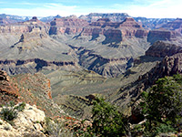
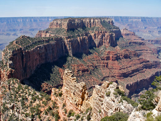
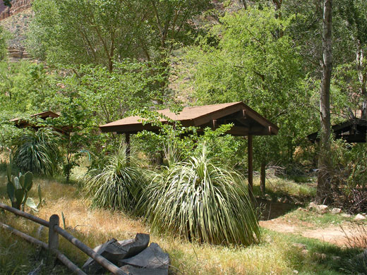
The South Rim of Arizona's Grand Canyon is expensive and overcrowded, and there is usually a shortage of parking and accommodation, but that of course doesn't matter as the canyon is the most famous natural attraction in the USA and possibly in the world. No-one forgets their first sight of the Grand Canyon and it will never fail to impress or offer something new, no matter how often it is visited.
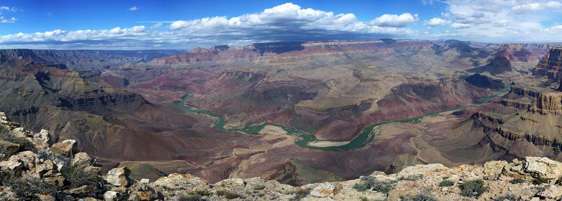
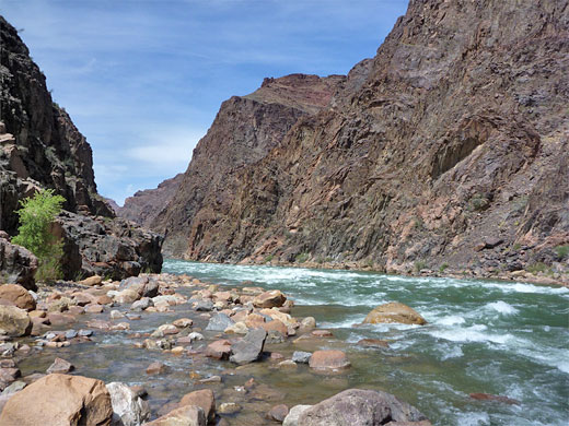
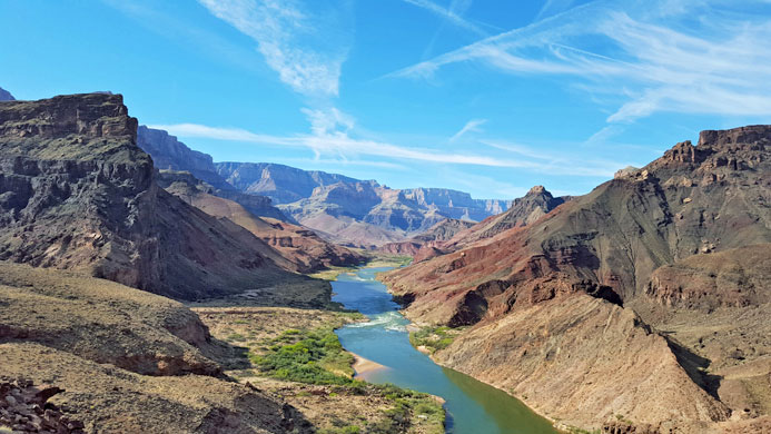
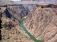
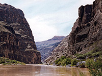
The great gorge, formed over many millions of years by the Colorado River, is 277 miles long, well over 5,000 feet deep for most of its length, and includes hundreds of tributaries. Grand Canyon National Park was established in 1919, and after several expansions, currently encompasses almost 2 million square miles of northern Arizona, with elevations ranging from 1,200 feet at the west edge, close to Lake Mead, to 9,165 feet on the Kaibab Plateau.
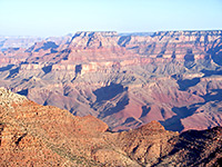
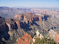
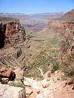
Ninety percent of tourists see only the south rim of the Grand Canyon, since it is easily accessible and the main road (AZ 64) parallels the canyon edge for some distance (see map) - here there is every conceivable facility, many superb overlooks and a choice of hiking trails. The north rim, 215 miles away by road, is much more remote and high enough in elevation to be closed during the winter months by snow, but fewer people mean more peace and tranquility, and the views are just as good. The only other part of the Grand Canyon that may be approached via paved roads is Havasu Canyon, contained within the Havasupai Indian Reservation to the west, although a day's hiking is necessary to descend from the rim.
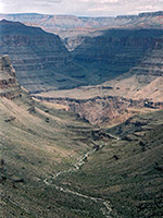
Still further west, a few unpaved roads of reasonable quality run through land of the Hualapai Indian Reservation including one down Peach Springs Canyon that leads all the way to the Colorado, giving access to many isolated side canyons as well as the river itself. On the other side of the Grand Canyon, the particularly remote Tuweep area to the northwest can be reached by several dirt tracks of over 60 miles starting from US 89 in Utah and offers some spectacular viewpoints, but most of the countless square miles of the canyon and its branched tributaries are completely inaccessible by road.
The great gorge, formed over many millions of years by the Colorado River, is 277 miles long, well over 5,000 feet deep for most of its length, and includes hundreds of tributaries. Grand Canyon National Park was established in 1919, and after several expansions, currently encompasses almost 2 million square miles of northern Arizona, with elevations ranging from 1,200 feet at the west edge, close to Lake Mead, to 9,165 feet on the Kaibab Plateau.
Ninety percent of tourists see only the south rim of the Grand Canyon, since it is easily accessible and the main road (AZ 64) parallels the canyon edge for some distance (see map) - here there is every conceivable facility, many superb overlooks and a choice of hiking trails. The north rim, 215 miles away by road, is much more remote and high enough in elevation to be closed during the winter months by snow, but fewer people mean more peace and tranquility, and the views are just as good. The only other part of the Grand Canyon that may be approached via paved roads is Havasu Canyon, contained within the Havasupai Indian Reservation to the west, although a day's hiking is necessary to descend from the rim.
Still further west, a few unpaved roads of reasonable quality run through land of the Hualapai Indian Reservation including one down Peach Springs Canyon that leads all the way to the Colorado, giving access to many isolated side canyons as well as the river itself. On the other side of the Grand Canyon, the particularly remote Tuweep area to the northwest can be reached by several dirt tracks of over 60 miles starting from US 89 in Utah and offers some spectacular viewpoints, but most of the countless square miles of the canyon and its branched tributaries are completely inaccessible by road.
Grand Canyon Table of Contents
Grand Canyon Tours
Grand Canyon General Information
- Park Maps: Grand Canyon Overview Map,
North Rim and South Rim Detail Map,
Grand Canyon Village Map, Hualapai and Havasu canyons
- Grand Canyon Weather: climate summary
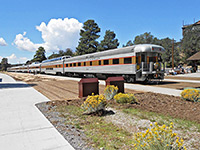
- Other details: camping, Grand Canyon Railway, hiking precautions, mule trips
- Grand Canyon photographs
- Grand Canyon videos: Bright Angel Trail, Hance Rapids, Hermit Trail
- Grand Canyon Wildflowers: flowering plants in the national park
Grand Canyon Regions
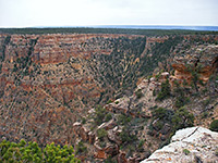
South Rim - by far the most visted area of the national park
20 canyon overlooks, from Yuma Point to Comanche Point north of Desert View - beside the road or reachable by hiking
All maintained trails on the south rim of the Grand Canyon, from short paths along the rim to strenuous routes to the Colorado
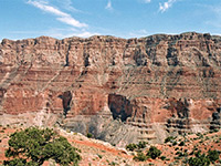
North Rim - higher elevation overlooks, much less visited, closed because of snow in winter and early spring
Ten canyon overlooks, from Widforss Point in the west to Point Imperial in the east
Details of all paths and trails on the north rim of the Grand Canyon, most to overlooks along the rim
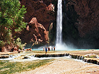
Outside the national park, this is a scenic region west of the main South Rim area, centered around Supai, Havasu Canyon, Mooney Falls and Havasu Falls
Large area of rugged canyons in the southwest, including Grand Canyon West, Peach Springs Canyon and Grand Canyon Skywalk; also not part of the national park
Wild, remote area in the northwest corner of the national park, reached by a long drive across uninhabited land
Grand Canyon Hiking
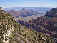
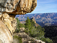
As others have said, sometimes the scale and extent of the Grand Canyon is disconcerting - the great gorge is too vast to take in at first sight, but a hike down beneath the south rim gives a more intimate and manageable perspective. The two main trails to the Colorado River are the Bright Angel and the South Kaibab; this latter connects with the North Kaibab route which follows Bright Angel Canyon to the north rim. There are also many longer (unmaintained) paths suitable for experienced hikers, leading both to the river and along the canyon, such as the difficult New Hance Trail, the mostly level Widforss Trail on the north rim and very steep Lava Falls Trail near Tuweep. For inexperienced hikers, even a short walk along the level and partly paved Rim Trail (which parallels the south edge of the canyon for 13 miles) is enough to escape the all crowds at the major viewpoints.
Grand Canyon Hiking Map
The best general map for hiking in the Grand Canyon is the double-sided 1:73,530 scale topographic map from National Geographic/Trails Illustrated, which covers the canyon from its northern point at Lees Ferry (Marble Canyon), as far west as Mohawk Canyon in the Hualapai Reservation.
Buy from amazon.com
Affiliate disclosure
Featured Grand Canyon Trails
See also a list of the top 20 trails in the national park
South Rim
Bright Angel Trail
★★★★★
★★★★★
9.5 miles, 4550 feet
Popular and spectacular route to Havasupai Gardens, the Tonto Bench and the Colorado River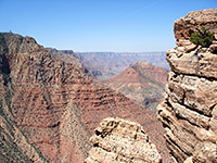
Cedar Mountain Trail
★★★★★
★★★★★
1.7 miles, 630 feet
Little traveled path giving views of Desert View from the canyon rim, before heading east towards a flat-topped butte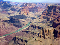
Comanche Point
★★★★★
★★★★★
6.2 miles, 670 feet
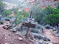
Remote, rarely traveled trail to a trailless overlook on the east side of the Grand Canyon, in the middle of the Palisades of the DesertDripping Spring Trail
★★★★★
★★★★★
3.1 miles, 1400 feet
Quite popular path descending steeply into upper Hermit Creek, then following a side drainage to a small spring
Grandview Trail
★★★★★
★★★★★
3 miles, 2600 feet
Unmaintained path that descends a steep ridge to Horseshoe Mesa, site of some old copper mines and primitive camping areas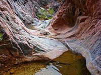
Hance Creek
★★★★★
★★★★★
8.5 miles, 4860 feet
Off-trail route to the Colorado River down a narrow, twisting canyon containing a permanent stream. Accessed by the Grandview Trail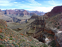
Hermit Trail
★★★★★
★★★★★
9 miles, 4340 feet
Excellent rim to river path with varied scenery, from cliff-bound Hermit Basin, all along Hermit Creek to Hermit Rapids on the Colorado River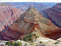
Mimbreno, Mescalero, Jicarilla and Piute Points
★★★★★
★★★★★
15 miles, 400 feet (loop)
Off-trail loop hike across the forested rim west of Hermits Rest to four remote promontories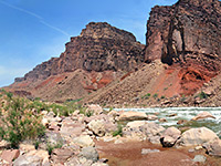
New Hance Trail
★★★★★
★★★★★
8 miles, 4530 feet
Spectacular, unmaintained rim to river path that follows Red Canyon to Hance Rapids; perhaps the most difficult South Rim trail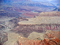
Plateau Point Trail
★★★★★
★★★★★
1.5 miles, 80 feet
Spur off the Bright Angel Trail, to a viewpoint of the inner canyon gorge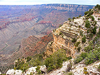
Shoshone Point Trail
★★★★★
★★★★★
1 miles, 0 feet
Stoll through airy ponderosa pine woodland to a rarely seen viewpoint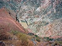
South Kaibab Trail
★★★★★
★★★★★
6.5 miles, 4820 feet
Shorter of the two maintained rim to river routes, running for most of the way along a narrow ridge, giving excellent views
Tanner Trail
★★★★★
★★★★★
9 miles, 4600 feet
Long route that descends to the Colorado River, joining it opposite Unkar Creek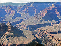
Yuma Point
★★★★★
★★★★★
6 miles, 1,500 feet
Remote viewpoint west of Hermit's Rest, reached by a rather difficult hike of which the last 2 miles is off-trail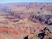
Zuni Point
★★★★★
★★★★★
0.5 miles, 20 feet
Quick, cross-country hike to a named overlook, overlooking Papago Creek and Red CanyonNorth Rim
Atoko Point
★★★★★
★★★★★
1.4 miles, 220 feet
Off-trail walk through thin woodland close to the rim of a little-visited part of the Grand Canyon, ending at a narrow promontory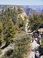
Bright Angel Point Trail
★★★★★
★★★★★
0.4 miles, 100 feet
Starting beside the historic Bright Angel Lodge, a paved trail descends a short distance to the southern tip of a narrow promontory for excellent views over the Grand Canyon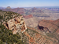
Cape Final Trail
★★★★★
★★★★★
2 miles, 150 feet
A long disused vehicle track provides an easy route across the edge of the Walhalla Plateau to the easternmost viewpoint on the North Rim, which overlooks a vast area of lesser-known formations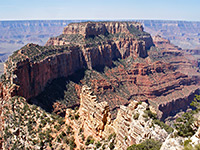
Cape Royal Trail
★★★★★
★★★★★
0.3 miles, 40 feet
Competing with Cape Final to be the best North Rim viewpoint, Cape Royal is reached by an easy, paved, wheelchair-accessible footpath starting right at the end of the paved side road across the Walhalla Plateau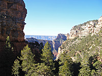
Cliff Spring Trail
★★★★★
★★★★★
0.5 miles, 150 feet
Short hike past an Anasazi ruin and along the side of a deepening canyon to an elongated dripping spring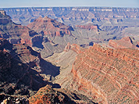
Honan Point
★★★★★
★★★★★
2 miles, 350 feet
Easiest reached of five named promontories at the edge of the Walhalla Plateau, reached by a cross-country, off trail hike mostly through open woodland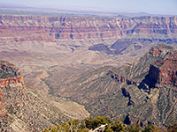
Naji Point
★★★★★
★★★★★
1.4 miles, 250 feet
Trailless viewpoint, quite easily accessed by walking through the thick pine/fir forest for about 40 minute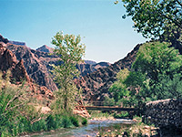
North Kaibab Trail
★★★★★
★★★★★
14 miles, 5780 feet
Well used route down Bright Angel Canyon to Phantom Ranch and the Colorado River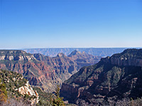
Uncle Jim Trail
★★★★★
★★★★★
5 miles, 100 feet
Trail across the plateau to a viewpoint on the rim that overlooks Roaring Springs Canyon, some of Bright Angel Canyon and the upper part of the North Kaibab Trail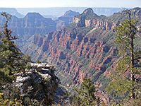
Widforss Trail
★★★★★
★★★★★
5 miles, 400 feet
Tranquil route along the rim of a side ravine then through thick forest to a remote viewpoint of the main canyonHavasupai Indian Reservation
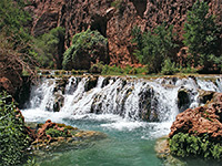
Havasu Canyon
★★★★★
★★★★★
10.5 miles, 3600 feet
Famous trail descending Hualapai and Havasu Canyons to the Colorado River, past Supai villageHualapai Indian Reservation
Bridge Canyon
★★★★★
★★★★★
5 miles, 800 feet
Very remote route, partly along a disused vehicle track, down a wide valley and up a ridge into a Grand Canyon tributary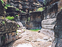
Hindu Canyon
★★★★★
★★★★★
6 miles, 1200 feet
A wide, shallow, grassy drainage that eventually forms a short slot, through thin-layered, light-colored rocks stained black in places - an unusual and scenic narrows section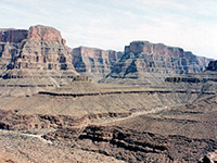
Milkweed Canyon
★★★★★
★★★★★
8.5 miles, 1000 feet
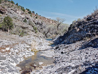
Several short sections of limestone narrows, containing flooded potholes, and later a permanent stream with rather deeper poolsMarble Canyon Area
Cathedral Wash
★★★★★
★★★★★
1.5 miles, 300 feet
Short, curving tributary; photogenic passageways through potmarked, multilayered rocks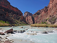
Salt Trail
★★★★★
★★★★★
3 miles, 2740 feet
Spectacular route to the lower end of the Little Colorado River, containing turquoise water, flowing beneath high red cliffs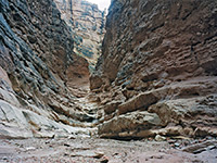
Jackass Creek
★★★★★
★★★★★
2.4 miles, 800 feet
Canyon with two main forks, both quite narrow in places and containing shallow pools after rains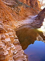
Tanner Wash
★★★★★
★★★★★
4.4 miles, 700 feet
Long canyon, deepening via unusual staircase-like passages through thin-layered sandstone, followed by a 50 foot dryfall and a much wider lower gorgeTuweep
Lava Falls Trail
★★★★★
★★★★★
1.5 miles, 2540 feet
Very steep descent down loose scree and lava blocks, to Lava Rapids on the Colorado RiverAll Contents © Copyright The American Southwest | Comments and Questions | Contribute | Affiliate Marketing Disclosure | Site Map