American Southwest
Home | Categories | National Parks | Hotels | Site Map | Photographs | QTVR | Whats New? | More...
ARIZONA
Index | Introduction | Photographs | QTVR | Driving Distances | Map | Weather | Hotels


Desert View, Grand Canyon National Park
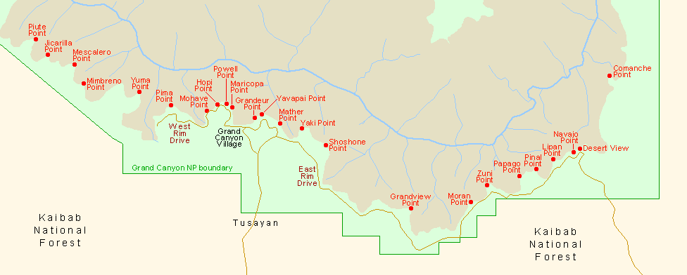
Sites in Arizona

NPS - Landscapes
Canyon de Chelly
Chiricahua
Grand Canyon
Lake Mead
Organ Pipe
Petrified Forest
Saguaro
Sunset Crater

NPS - Historic Sites
Casa Grande Ruins
Coronado
Montezuma Castle
Pipe Spring
Tonto
Tumacacori
Tuzigoot
Walnut Canyon
Wupatki

Other Places
Apache Trail
Ironwood Forest NM
Meteor Crater
Route 66
Sedona
Sonoran Desert NM
Tonto NF
Vermilion Cliffs NM

Arizona Site Map

Site Search

Grand Canyon National Park > The South Rim > Viewpoints > Desert View


Looking northwest from Desert View
Four miles from the national park boundary, Desert View offers the first glimpse of the Grand Canyon for visitors arriving from the east, and presents a spectacle rather different to most overlooks as one third of the panorama is of the flat plains of the Painted Desert, on the east side of the Colorado as it bends round to the north. The park road cannot follow the rim any further east as the ground falls away steeply towards Cedar Canyon, a tributary of the Little Colorado River, so the many other viewpoints are all found to the west.

The facilities at Desert View include a gas station, bookstore, shop, restaurant, campground, ranger station, acres of parking and the historic watchtower, built in 1932 right on the cliff edge and visible for many miles across this part of the canyon. One trail starts nearby - a long backcountry route that crosses the Painted Desert and reaches Cape Solitude after 16 miles, directly above the Little Colorado River confluence.

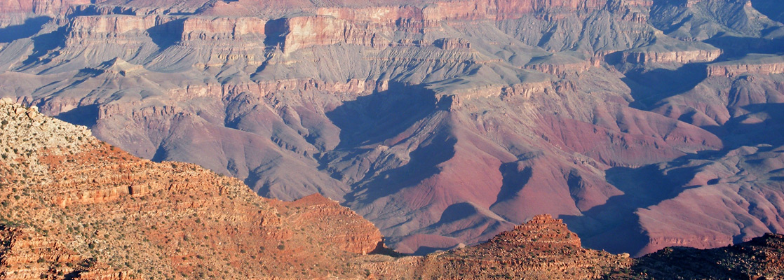
Views at Desert View encompass many miles of the canyon, countless peaks and tributary ravines from Shoshone Point in the west as far north as Temple & Chuar Buttes (location of an aircraft crash in 1956), then above and beyond to the distant Vermilion & Echo Cliffs that enclose the start of the Grand Canyon at Lees Ferry. Several miles of the river can be seen, around the Tanner Creek rapids, which can be reached by the Tanner Trail starting from Lipan Point. The best time for photography at Desert View is in early morning, when the sun first illuminates the cliffs opposite, on the north rim below Cape Royal.

Next Points
West: Navajo Point
East: Comanche Point - which could be reached by a 10 mile, cross-country hike starting from Desert View


Back to Top

All contents © copyright John Crossley | Comments and questions
Arizona California Colorado Nevada New Mexico Texas Utah Wyoming Slot Canyons Travelogue