American Southwest
Home | Categories | National Parks | Hotels | Site Map | Photographs | QTVR | Whats New? | More...
ARIZONA
Index | Introduction | Photographs | QTVR | Driving Distances | Map | Weather | Hotels


Yaki Point, Grand Canyon National Park
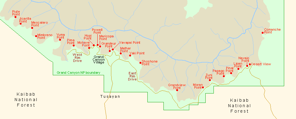
Sites in Arizona

NPS - Landscapes
Canyon de Chelly
Chiricahua
Grand Canyon
Lake Mead
Organ Pipe
Petrified Forest
Saguaro
Sunset Crater

NPS - Historic Sites
Casa Grande Ruins
Coronado
Montezuma Castle
Pipe Spring
Tonto
Tumacacori
Tuzigoot
Walnut Canyon
Wupatki

Other Places
Apache Trail
Ironwood Forest NM
Meteor Crater
Route 66
Sedona
Sonoran Desert NM
Tonto NF
Vermilion Cliffs NM

Arizona Site Map

Follow americansouthwest.net on Facebook
Site Search

Photograph Search


Grand Canyon National Park > South Rim > Viewpoints > Yaki Point


View east of Yaki Point, looking towards Clear Creek
Overlooks along Grand Canyon's East Rim Drive are much less visited than those to the west with the exception of Yaki Point, at the end of a 1.5 mile side road that starts 2 miles east of the US 180 road junction, near the national park entrance. Several years ago, the small parking area by the rim was deemed to small to cope with the increased volume of traffic, so entry to all private vehicles was stopped and now access is either on foot - by parking on the main road at a nearby picnic area - or by shuttlebus. Yaki is the easternmost stop on the Kaibab Trail Route that also serves Pipe Creek Vista and the Canyon View Information Plaza at Mather Point. The restriction also applies to the South Kaibab Trailhead, located half way along the side road.

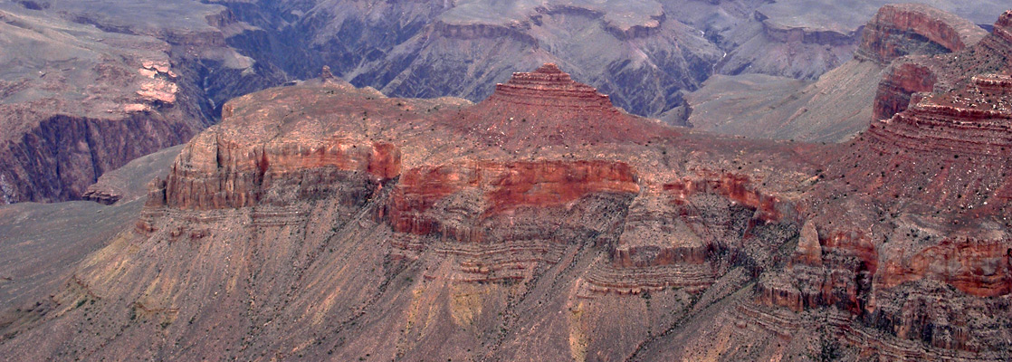
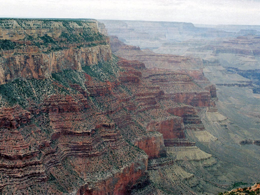
The views at Yaki Point are rather different to the popular triumvirate of Grandeur/Yavapai/Mather points, all of which occupy the same promontory so look out over similar features. The westwards vista encompasses the end of the Bright Angel Trail, a section of the Tonto Trail and a fine view of much of the South Kaibab Trail as it descends along Cedar Ridge and O'Neill Butte. The view to the east includes Cremation Creek, running beneath another long red ridge centered on Newton Butte, and beyond (on the North Rim), the long drainage of Clear Creek enclosed by many high buttes and mesas.

Next Points
West: Mather Point
East: Shoshone Point

Cliffs to the west

Burnt trees


Back to Top

All contents © copyright John Crossley | Comments and questions
Arizona California Colorado Nevada New Mexico Texas Utah Wyoming Slot Canyons Travelogue