Highlights:
The southeastern section of Canyonlands National Park - relatively low elevation land of red rock ravines, ridges and plateaus, bordered to the west by the Colorado River. Crossed by over a dozen trails, mostly following canyons, to springs, arches, pinnacles and rock art sites
Location:
38.168, -109.760 (Needles visitor center)
Seasons:
All year, though very hot during summer

The Needles is part of the Colorado River itinerary
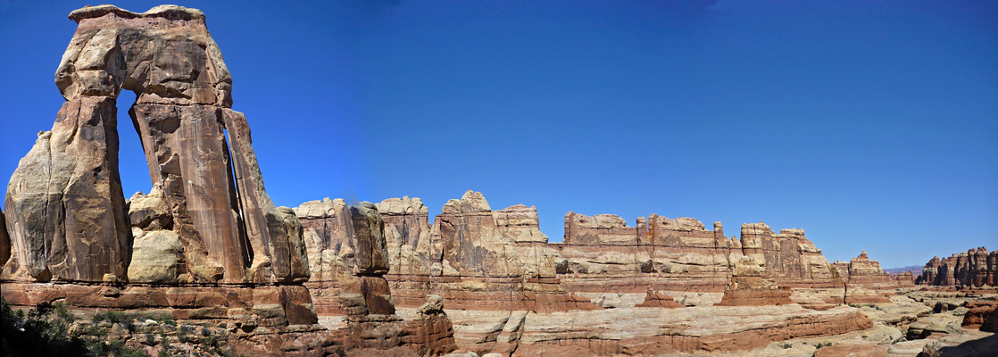
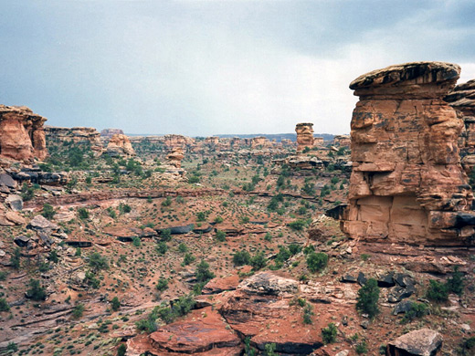
The Needles section of Canyonlands National Park is just 15 miles south of the Island in the Sky, but 137 miles distant by road. It is so named because of the massive red and white eroded sandstone pillars that extend southwards for many miles, forming a jumbled and hostile landscape, but the area also has many arches, domes, narrow canyons and signs of ancient Indian life such as ruins and rock-carvings.
The district is a lot lower in elevation than the Island, and its river canyons are less steep but more branched, so there are greater opportunities for extended hiking, backpacking and 4WD exploration. Many of the paths and tracks intersect, allowing for a variety of loop hikes, from hours to days. This section of the park has a scenic campground and a visitor center, though few other facilities.
The district is a lot lower in elevation than the Island, and its river canyons are less steep but more branched, so there are greater opportunities for extended hiking, backpacking and 4WD exploration. Many of the paths and tracks intersect, allowing for a variety of loop hikes, from hours to days. This section of the park has a scenic campground and a visitor center, though few other facilities.
The Needles Table of Contents
Photographs
General views, Chesler Park and the Joint Trail, Elephant Canyon and Druid Arch, Elephant Hill to Red Lake Canyon.
Approach Road
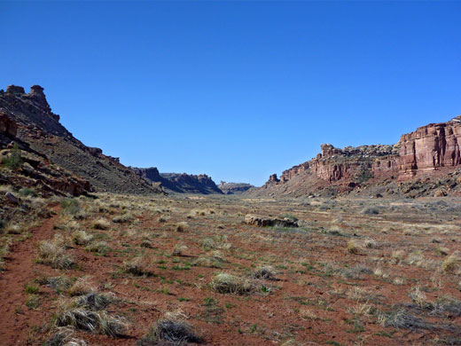
The road to the Needles starts from US 191 14 miles north of Monticello, runs across open grassy land for a while then descends gradually along Indian Creek Canyon, which is at first narrow, twisting and overgrown but soon widens to be several miles across, accommodating flat meadows either side of the creek where many cattle graze. Cliffs along the upper part of this canyon are a renowned rock climbing location, and also of interest are the petroglyphs of Newspaper Rock State Historical Monument. The road crosses the creek just once, 6 miles before the park boundary, from where a rough track heads south, though an unlocked gate towards Davis and Lavender canyons. Just the far side of the gate is a good area for (free) camping, mostly out of sight of the road and high enough for nice views over the bushy valley of Indian Creek, the high red cliffs at either side, and the distinctive spires of North and South Sixshooter peaks. Three miles west, another track forks off the highway northwards to Lockhart Canyon and eventually all the way to Moab. A short distance along here is a more official primitive campsite, useful since the only campground within the park (at Squaw Flat) is often fully booked in summer.
Canyonlands Tours
See the park by airplane or 4WD vehicle.
The Needles Scenic Drive
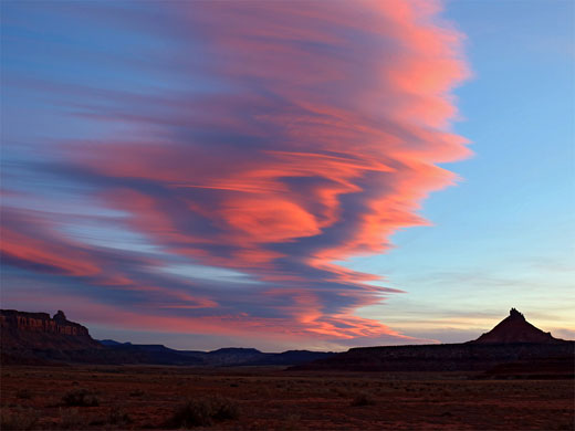
The Needles rocks are first glimpsed in the distance as the road crosses the park boundary, just after which is a turn off for the Needles Outpost, a private facility offering gas, groceries, books & maps, gifts, a restaurant and a campsite. The NPS visitor center is just beyond, next to the start of a 4WD track leading to the rim of the Colorado River canyon. There is no single major viewpoint in the Needles section, and many of the features of interest - arches, ancient ruins, river overlooks, rock formations - can only be reached by trails, either on foot or by 4WD vehicle, although there are numerous roadside viewpoints and four easy, self-guiding footpaths (Roadside Ruin, Cave Spring, Pothole Point and Slickrock Foot Trail - see hiking index). The main road ends amongst a jumble of small ravines and pinnacles at Big Spring Canyon Overlook from which a 5 mile trail leads to an overlook of the confluence of the Green and Colorado rivers. Apart from this, the park road offers extended views of distant cliffs and canyons, and of the Needles themselves, which look particularly foreboding in gloomy light during the frequent thunderstorms that affect this area in summer, rolling in from the Abajo and La Sal mountains.
Squaw Flat Campsite
Primitive camping is allowed in various places in the Needles section, although there is only one developed site, at Squaw Flat, reached by a paved side road. Drinking water is available here during peak season, something not usual for NPS campgrounds in the Southwest. The site has excellent views of the Needles formations just a mile away, and it is set amongst other large colorful rocks which are fun to climb. Places are limited to about 24 so it is best to arrive early during popular times, and/or book in advance.
The Needles Backcountry
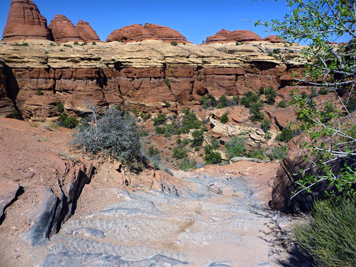
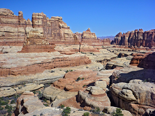
One famous 4WD route through the Needles is Elephant Hill Trail, one of the most testing roads in Utah, which leads to a collection of parallel, vertical-walled valleys formed by rock faulting, known as the Grabens, then eventually into Beef Basin and the Manti-La Sal National Forest, south of the park. The trail is reached by a good quality dirt road from Squaw Flat, and both this and the campsite are the starting point for the various trails into the Needles backcountry, centered around Chesler Park. The area has quite a complex network of interconnecting paths, mostly along canyons and/or across slickrock benches.
Canyon Rims
Another paved road outside the park boundary passes across flat terrain at the top of the cliffs to the north of the main access road, to the edge of Horsehead Rock. From here the Colorado River canyon and the Needles can be viewed in the distance. Both the approach roads pass through the Canyon Rims Recreation Area, which covers an area of wilderness even larger than Canyonlands National Park and includes many more inaccessible buttes and canyons, formed by tributaries of the Colorado.
Trails in the Needles District
Needles trails - descriptions of all paths.
Featured Needles Hikes
Cave Spring Trail
★★★★★
★★★★★
0.6 miles, 60 feet (loop)
Short but varied loop past pictographs, a spring and an old cowboy camp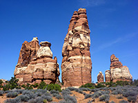
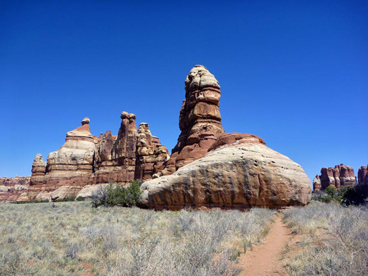
Chesler Park Trail
★★★★★
★★★★★
3 miles, 1,200 feet (overall)
This path passes varied terrain, across Elephant Canyon to the edge of Chesler Park. One of several other routes radiating from the park is the Joint Trail, which winds southwards through cool, narrow passages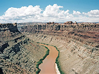
Confluence Overlook Trail
★★★★★
★★★★★
5.5 miles, 200 feet
This excellent hike crosses several shallow canyons then traverses more open country, ending at a viewpoint of the junction of the Green and Colorado Rivers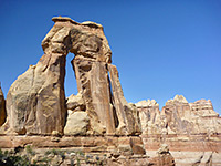
Druid Arch Trail
★★★★★
★★★★★
5.4 miles, 650 feet
The double span of Druid Arch is a popular hiking destination, and is reached by the southernmost trail in the Needles, starting like several others from Elephant Hill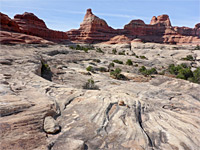
Lost Canyon and Squaw Canyon
★★★★★
★★★★★
8.7 miles, 400 feet (loop)
Two deep tributaries of Salt Creek, enclosed by red and white cliffs and benches, explored by a loop hike that includes part of the Peekaboo Trail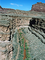
Lower Big Spring Canyon
★★★★★
★★★★★
5 miles, 500 feet
Cross country route down a scenic canyon to a viewpoint of the Colorado River - initially along the streambed, then on a bench on the south side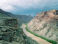
Lower Elephant Canyon
★★★★★
★★★★★
5 miles, 800 feet
Narrow, deepening canyon that provides a route to the Colorado River; hike is along the Confluence Trail for a mile, then down the streambed, and finally across sloping terrain to a viewpoint high above the river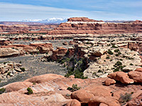
Peekaboo Trail
★★★★★
★★★★★
5 miles, 270 feet
Path over grassy flats, branched canyons and high sandstone ledges, ending beside a pictograph panel above Salt Creek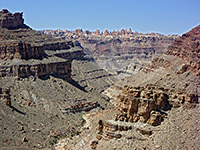
Red Lake Canyon Trail
★★★★★
★★★★★
9.5 miles, 1600 feet
The only direct route to the Colorado River in the Needles is along Lower Red Lake Canyon, 2 miles south of the confluence with the Green River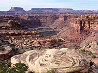
Slickrock Foot Trail
★★★★★
★★★★★
2.4 miles (loop), 80 feet
Popular, mostly level route across a sandstone plateau between Big and Little Spring Canyons, with four short spurs to overlooksAll Contents © Copyright The American Southwest | Comments and Questions | Contribute | Affiliate Marketing Disclosure | Site Map