Highlights:
The northern, higher elevation section of Canyonlands National Park - a broad plateau, narrowing towards the south, with commanding views across many miles of red rock canyons. There are several overlooks, either beside the road or along short paths, and a good selection of hiking trails, some across the mesa top, others descending towards the Green and Colorado rivers
Location:
38.459, -109.820 (Island in the Sky visitor center)
Seasons:
All year, though affected by snow during the winter

Island in the Sky is part of the Colorado River and Grand Circle itineraries
Island in the Sky, also known as Between the Rivers, is the most visited and easily reached area of Canyonlands, being close to the town of Moab and Arches National Park. It is the highest section of the national park, at an average elevation of 6,100 feet, and the access road passes many breathtaking viewpoints of the deep twisting canyons at either side, plus a dozen short paths and longer trails, some across the plateau and a few descending towards the rivers.
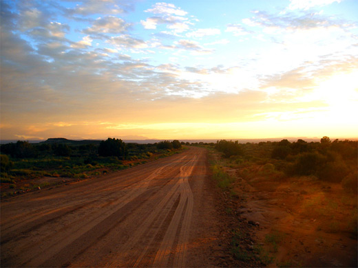
The approach is via UT 313, forking off US 191 eleven miles north of Moab and entering the park after crossing 18 miles of BLM-managed land - the road runs along a narrowing ravine (Sevenmile Canyon), climbs the steep cliffs on the south side then ascends more gently over uneven, partly wooded ground to the flat grasslands in the center of the plateau.
The approach is via UT 313, forking off US 191 eleven miles north of Moab and entering the park after crossing 18 miles of BLM-managed land - the road runs along a narrowing ravine (Sevenmile Canyon), climbs the steep cliffs on the south side then ascends more gently over uneven, partly wooded ground to the flat grasslands in the center of the plateau.
Island in the Sky Table of Contents
- Map of the Island in the Sky
- Photographs
- Camping
- The scenic drive
- Tours of the Island in the Sky
- Grand View Point, at the end of the drive
- The White Rim
- Island in the Sky hiking
Map
Island in the Sky map, showing roads, trails and natural features.
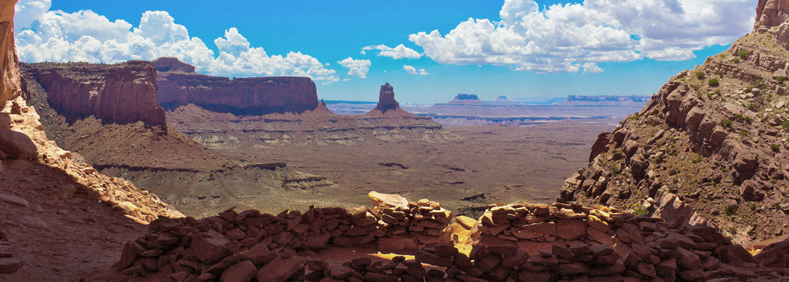
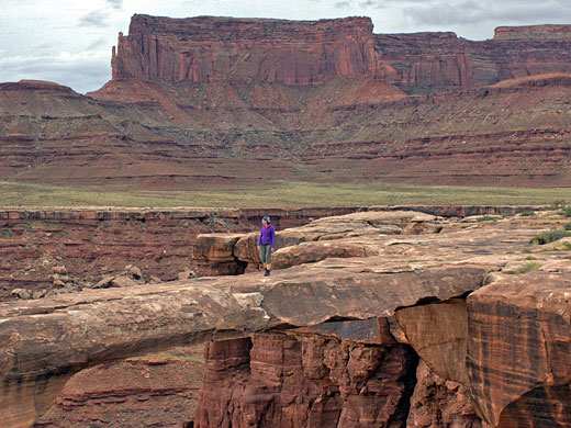
Photographs
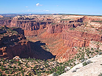
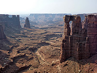
General views of the Island in the Sky.
Camping
There are various unpaved side tracks en route along which primitive camping used to be permitted but in recent years the BLM have posted No Camping notices at all points, instead requiring people to pay $15 to use a basic site (Horsethief Campground) on a small hill beside the highway, 5 miles from the park. The only exception seems to be the Mineral Bottom Road, a mile further north, as this has no such notice. Just before the park boundary, a turn-off leads to Dead Horse State Park, which was established some time before Canyonlands National Park and offers an alternative viewpoint of the canyons to the northeast. More developed camping is available either at the state park or at Willow Flat Campground in the national park.
Island in the Sky Scenic Drive
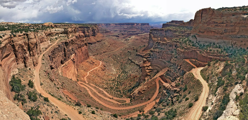
The flat land at the top of the Island in the Sky mesa becomes narrower towards the south as the river confluence approaches. After the visitor center and entrance station (fees $30 per vehicle in 2024 - good for all areas of the park), the first viewpoint is over Shafer Canyon to the east, a steep drainage containing a rough 4WD track that descends to the Colorado, becomes paved at the mining settlement of Potash and joins US 191 just north of Moab. To the west, the land drops away at the head of another canyon (Taylor), leaving quite a narrow strip of land in between (The Neck), but the plateau widens for the next few miles as the road crosses a flat meadow known as Grays Pasture, the original name for this whole area. The next canyon on the east (Trail) causes the plateau to split into two forks, as does the scenic drive. The west road leads past the main campground and an overlook of the Green River, both at Willow Flat, then descends gradually to the end of the mesa at Upheaval Dome. Also near the road junction are two short trails - to Mesa Arch, a graceful span of Navajo sandstone framing distant canyons to the northeast, and to some Anasazi granaries on Aztec Butte - plus one longer route (Wilhite) that descends to the White Rim and the Green River.

Island in the Sky Tours
View the scenery by 4WD or helicopter!
Grand View Point
The remaining 5 miles of the main road cross a rather narrower plateau, past several overlooks, including Buck Canyon, Candlestick Tower, Murphy Point (at the end of a 1.7 mile trail), Gooseberry Canyon and the Orange Cliffs. The park road ends at Grand View Point, which offers magnificent vistas across the Colorado canyons and the spires of Monument Basin, to the distant La Sal Mountains in the east and the Needles area to the south. A further one mile, 20 minute walk southwards along the Grand View Trail leads to the very end point of the Island in the Sky plateau, where the cliffs drop away in all directions, and the canyons of both rivers can be seen. The actual confluence point is hidden, but can be reached by a long trail starting in the Needles section of the park.

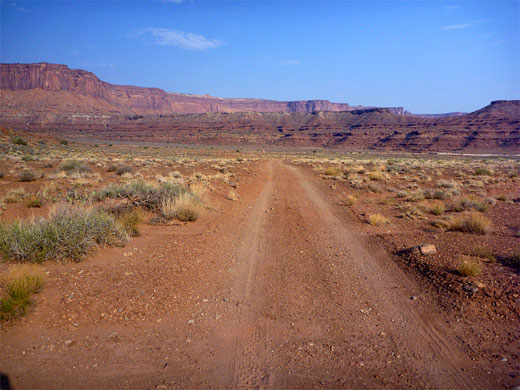
The White Rim
The White Rim is a wide flat plateau halfway in height between the Island in the Sky and the Green/Colorado rivers, formed by a layer of white sandstone much more resistant to erosion than the strata above or below. A 100 mile track built by uranium prospectors after World War 2 winds along the edge of the rim; driving the full distance is said to take 2 days and a few parts require 4WD even though much is level and quite easy to navigate. A reservations system operates to regulate the limited number of primitive camp sites en route. This was the road featured at the end of the film Thelma and Louise, when the heroines drove over the edge, apparently thinking that they had found the Grand Canyon. Vehicle access is by the Shafer Trail in the east and Mineral Bottom Road in the west, while connecting paths are the Lathrop Trail, Gooseberry Trail, Murphy Trail, Wilhite Trail and Upheaval Canyon Trail. Some of the many features along the way are (east to west) Musselman Canyon, Musselman Arch, Lathrop Canyon, Buck Canyon, Gooseberry Canyon, Junction Butte, Murphy Hogback, Soda Springs Basin, Holeman Spring Basin, Potato Bottom Basin, Bighorn Mesa, Upheaval Bottom and Horsethief Point. The best viewpoint of the rim, and of Monument Basin, is by the short White Rim Overlook Trail.
Hiking in the Island of the Sky
Island in the Sky trails - descriptions of all paths.
Featured Island in the Sky Hikes
Gooseberry Trail and Monument Basin
★★★★★
★★★★★
4 miles, 1480 feet
Steep path down to the White Rim, followed by an off-trail hike to Monument Basin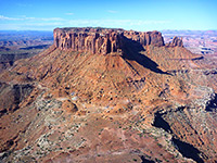
Grand View Trail
★★★★★
★★★★★
1 miles, level
Walk to the southernmost tip of the plateau, which offers a 270° panorama over the White Rim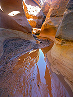
Holeman Slot
★★★★★
★★★★★
5.5 miles, 1600 feet
Short narrows; a tributary of the Green River that forms 600 feet of pretty, light-colored, medium depth passageways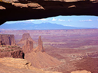
Mesa Arch Trail
★★★★★
★★★★★
0.6 miles, level
A short, easy route through pine-juniper woodland to a sandstone arch, perched on the east rim of the plateau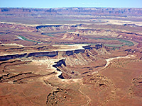
Murphy Point Trail
★★★★★
★★★★★
1.7 miles, level
Little visited viewpoint to the west, reached by an old vehicle track, now for foot travel only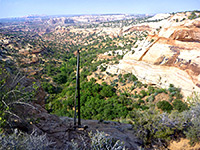
Neck Spring Trail
★★★★★
★★★★★
5 miles, 260 feet
Loop trail around canyon tributaries, also passing Cabin Spring and various old cattle ranching relics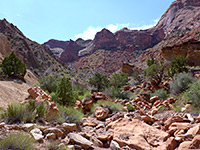
Syncline Loop Trail
★★★★★
★★★★★
8 miles, 1460 feet (loop)
Strenuous circuit of the two valleys either side of Upheaval Dome; an optional 2 mile extension leads to the dome itself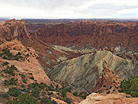
Upheaval Dome Overlook Trail
★★★★★
★★★★★
1 miles, 200 feet
Easy trail leads to two viewpoints along the rim of an unusual metamorphic crater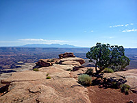
White Rim Overlook Trail
★★★★★
★★★★★
0.9 miles, 140 feet
Good, elevated views of the White Rim, Monument Basin and Gooseberry Canyon.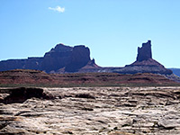
All Contents © Copyright The American Southwest | Comments and Questions | Contribute | Affiliate Marketing Disclosure | Site Map